Awards
Exemplary Ecosystem Initiatives — 2011
Washington: State Route 410 Nile Valley Landslide – Emergency Response, Reconstruction, and Restoration

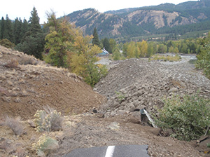
Figure 1. Road damage, including uplifted and covered segments, caused by landslide
Source: Washington Department of Transportation

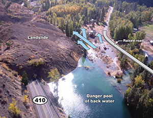
Figure 2. Aerial photograph showing landslide mass covering the road and damming the river. Access road shown on the right side of photograph was temporarily raised and was usable again as an emergency access route within three days.
Source: Washington Department of Transportation
In October 2009, a landslide damaged a one-half mile section of State Route 410 (SR 410) in the Nile Valley, leaving close to 10 million cubic yards of debris on the roadway. The landslide buried portions of the route and elevated others. Large amounts of debris also entered the nearby Naches River, altering its course.
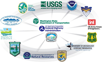
The Washington State Department of Transportation (WSDOT) engaged other agencies and developed an immediate response plan regarding traffic control, public safety, health, and public notices of current and future environmental impacts. WSDOT partnered with Yakima County to reach out to other Federal, State, and local agencies for support. The Federal Highway Administration (FHWA) responded by supplying emergency funds to WSDOT. The efforts of these agencies, along with those of 15 others, constructed a temporary, re-aligned roadway within eight weeks of the natural disaster. The Naches River was re-channelized in an effort to mitigate harm to private property, lower flood flows, and preserve aquatic habitats.
The quick response and collaboration among the agencies involved ensured the continuation of travel along SR 410. This vital transportation corridor through the Nile Valley remained active, supporting the movement of goods and services and connections to the Cascade Mountain Range and Mount Rainier National Park. As the Nile Valley is a remote area in Washington, keeping this corridor open was crucial in limiting the disruption to the community.
Improvements to the Naches River, while working to address human concerns such as property damage, water quality, and future flood risks, also addressed environmental impacts of the landslide on the surrounding watershed. WSDOT and its partners developed 14 acres of new river channel and seven acres for riparian buffers. Fish rescue efforts transported more than 500 Chinook, Coho, and steelhead from isolated pools to unaffected upstream habitats. Additional habitat restoration efforts included a native planting initiative, acquisition of 30 acres for future ecosystems support (with extended acreage anticipated), and stabilization and reconnection of floodplains and wetlands within the Naches River watershed.
WSDOT and its partners' timely response to the landslide reduced future negative impacts. By addressing transportation connectivity and ecosystem restoration simultaneously, the work performed by this interagency partnership provides a strong example of how collaboration and coordination can produce lasting results even in extraordinary circumstances.
For more information, contact Jason W. Smith, Washington State Department of Transportation at SmithJW@wsdot.wa.gov.

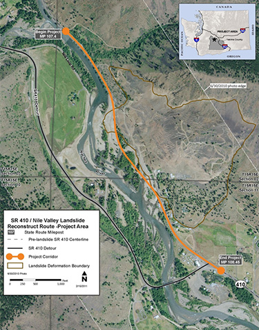
Figure 4: Aerial photograph noting finalized project design for reconstruction of the State Route 410 Corridor
Source: Washington Department of Transportation

Figure 3: Project involved many Federal, State, and local partners.
Source: Washington Department of Transportation

