Interim Guidance on the Application of Travel and Land Use Forecasting in NEPA
Federal Highway Administration, March 2010
- Executive Summary
- 1.0 Background
- 1.1 Rationale and Need for Guidance
- 1.2 Process for Developing Guidance
- 1.3 Using the Guidance
- 1.4 Evolving Forecasting Methods
- 2.0 Guidance
- 2.1 Project Conditions and Forecasting Needs
- 2.1.1 Conceptual Review of Anticipated Analysis
- 2.1.2 Establishment of Forecasting Analysis Requirements
- 2.1.3 Consideration of Tools Required to Forecast Needs
- 2.1.4 Review of Prior Forecasts and Technical Issues
- 2.1.5 Incorporating Analyses Done in Transportation Planning Studies
- 2.1.6 Documentation of Project Conditions and Forecasting Needs
- 2.2 Suitability of Modeling Methods, Tools, and Underlying Data
- 2.2.1 Age of Forecasts, Models, Data, and Methods
- 2.2.2 Calibration, Validation, and Reasonableness Checking of Travel Models
- 2.2.3 Calibration, Validation, and Reasonableness Checking of Land Use Forecasts
- 2.2.4 Policy Evaluation Considerations
- 2.2.5 Advancing Technologies and Methods
- 2.2.6 Consideration of Peer Review
- 2.2.7 Documentation of Suitability of Modeling Methods, Tools, and Underlying Data
- 2.3 Scoping and Collaboration on Methodologies
- 2.3.1 Reaching Consensus on Forecasting Methodologies
- 2.3.2 Documentation of Scoping and Interaction with Other Agencies
- 2.4 Forecasting in Alternatives Analysis
- 2.4.1 Overview of Transportation-related Effects and Impacts
- 2.4.2 Objective Application of Forecasting Data and Methods
- 2.4.3 Refinement of the Analysis during Screening
- 2.4.4 Development of Forecast Confidence
- 2.4.5 Moving from Regional Model Output to a Project Level Forecast
- 2.4.6 Addressing Land Development or Redistribution Effects
- 2.4.7 Documentation of Forecasting in Alternatives Analysis
- 2.5 Project Management Considerations
- 2.5.1 Potential for Reevaluating Analysis
- 2.5.2 Consistency
- 2.5.3 Enhanced Communication between
NEPA Study Team and Forecasting Practitioners
- 2.5.4 Considerations for Developing Scopes of Work for Forecasting Practitioners
- 2.6 Forecasting for Noise and Air Emissions Analyses
- 2.6.1 Noise Analysis
- 2.6.2 Air Quality Emissions Analyses
- 2.7 Documenting and Archiving Forecast
Analyses
- 2.7.1 Documenting Forecast Analyses
- 2.7.2 Archiving Forecast Analyses
- 3.0 Conclusion
- 4.0 Appendices
- 4.1 Case Law Summary (January 2009)
- 4.1.1 Introduction
- 4.1.2 Standard of Review
- 4.1.3 Travel and Land Use Forecasts: When Are They Relevant?
- 4.1.4 Issues Affecting Sufficiency Under NEPA
- 4.1.5 Linking Planning and NEPA
- 4.2 Definitions
Travel and land use forecasting is critical to project development and National Environmental Policy Act (NEPA) processes. In light of the importance of forecasting, the high variation in
practice, and the litigation risk involved, the Federal Highway Administration (FHWA) created this guidance to encourage improvement in how project-level forecasting is applied in the context of the NEPA process. While technical guidelines for producing forecasts for projects have been documented by others, little has been published on the procedural or process considerations in forecasting. This guidance attempts to fill that gap. The primary audiences are NEPA project managers, FHWA staff, forecasting groups at Metropolitan Planning Organizations (MPOs) and State Departments of Transportation (DOTs), as well as consultants that support MPOs and DOTs in conducting corridor and NEPA studies. Following this guidance is strictly voluntary. It is based on lessons learned and best practices and does not constitute the establishment of an FHWA standard. Not all studies are the same; therefore this guidance is intended to be non-prescriptive, and its application flexible and scalable to the type and complexity of the travel analysis to be undertaken.
This guidance document identifies seven key considerations:
- Assess project conditions and scope the forecasting needs of the study: It is crucial to scope the forecasting effort to meet the project analysis, decision-maker and stakeholder needs in the study area. For this reason it is useful to begin the forecasting process by understanding the requirements of the study and anticipating decision-maker and stakeholder interests with respect to forecasting.
- Review the suitability of modeling methods, tools, and underlying data: It is important that the study team review the suitability of available modeling methods and the underlying data, including consideration of the currency and quality of the model data and methods, and that they analyze the data and methods’ ability to adequately examine alternatives.
- Conduct scoping and collaborate on methodologies: Scoping is a collaborative process involving the lead agencies, resource and regulatory agencies, and the public and is typically how a NEPA study begins. It is critical for the study team to document the broad agreements reached during scoping on the assumptions to be used for the land use and travel forecasting.
- Objective application of forecasting in alternatives analysis: The requirement for the alternatives analysis to be an objective evaluation makes it essential for the study team to apply forecasting data and methods objectively without any bias towards a particular alternative. Important considerations include understanding uncertainty in assumptions and forecasts and how induced demand and land development effects are taken into account.
- Project management considerations: NEPA studies are often complex undertakings and may be accompanied by various special considerations that warrant extra attention, such as the potential for re-do analysis loops and ensuring documentation consistency.
- Forecasting for noise and air emissions analyses: Land use and travel demand forecasting models are used to provide inputs to noise and air quality assessments. It is important that assumptions that are made in general forecasting applications as part of the NEPA study are consistent with those used in the noise and air quality analyses.
- Documentation and archiving: It is important for NEPA documentation to include enough technical detail to explain complex information in an understandable manner, and to describe how analytical methods were chosen, what assumptions were made, and who made those choices.
As a companion to this guidance, the FHWA is creating a document that will include case studies and best practices to help further the improvement of forecasting techniques at the project level. Training and technical assistance will also be made available to provide educational and peer exchange opportunities to State DOTs, MPOs, resource agencies, and the consultant community, to encourage needed dialogue and discussion to improve the state-of-the-practice.
Back to Top
Travel and land use forecasting is critical to project development and National Environmental Policy Act (NEPA) processes. Forecasts provide important information to project managers and decision-makers, and provide foundations for determining purpose and need. They are essential in evaluating: the performance of alternatives; the estimation of environmental impacts such as noise and safety (based on traffic volume or exposure) and emissions (based on traffic volume and speed); induced land development effects (change in land development patterns due to changes in accessibility); and resulting indirect and/or cumulative effects (such as watershed effects). In short, travel and land use forecasting is integral to a wide array of corridor and NEPA impact assessments and analyses.
Forecasting methodologies and their applications are often a source of significant disagreement among agencies and interest groups, and are frequently the focus of project-level litigation. While many of the issues raised are technical and methodological, often they are process-related or procedural in nature: misunderstandings regarding what work was done, what assumptions were made or input used, how the methods and approaches were chosen, and how the procedures were carried out. Forecasting is not a heavily legislated or regulated area of science, and is thus mainly driven by professional practice. This situation makes assessments of standards of practice difficult, and results in a large variation in practice and experience among transportation and resource agencies and consultants.
In light of the importance of forecasting in project development and NEPA, the high variation in practice, and the litigation risk involved, the Federal Highway Administration (FHWA) created this guidance to encourage improvement in the state-of-the-practice in relation to how project-level forecasting is applied in the context of the NEPA process. While technical guidelines for producing forecasts for projects have been documented by others,[1] little has been published on the procedural or process considerations in forecasting (how to apply forecasting in the context of NEPA). This guidance attempts to fill that gap.
In 2007, the FHWA initiated a project to provide practitioners and stakeholders with process and procedural guidance on how to apply forecasting in the context of project development and NEPA studies. The project was scoped to include:
- Creation of an FHWA expert panel, consisting of modeling, NEPA, and planning experts to advise the project
- Outreach to stakeholders and interest groups
- Formulation of project development and NEPA guidance and a review of relevant case law
- Development of a guidebook to include case studies and best practice examples
- Creation of training materials and technical assistance
Early in 2008, the FHWA expert panel was assembled to discuss and provide advice on the purpose and format of the guidance, and how to move forward on supporting activities. The panel included active participation by FHWA headquarters and field offices. The panel provided invaluable input to the guidance development process. In addition, during 2008 and 2009, the FHWA Office of Chief Counsel developed a case law summary that related forecasting issues and the NEPA process; this was also used to inform the guidance. Information on the project was provided to stakeholder and interest groups at various national meetings and venues.
This guidance is intended to provide assistance to NEPA and forecasting practitioners on improving how forecasting is used and applied in the project development and NEPA processes. It does not examine the details of how to calibrate and validate models; rather, it provides procedural and process considerations in developing forecasts in NEPA studies. The primary audiences are NEPA project managers, FHWA staff, forecasting groups at Metropolitan Planning Organizations (MPOs) and State Departments of Transportation (DOTs), as well as consultants that support MPOs and DOTs in conducting corridor and NEPA studies.
Following this guidance is strictly voluntary,[2] and it is suggested that it be adjusted to the individual planning and project contexts, and the scale, size and capabilities of the project and the lead agencies. The guidance is based on lessons learned and best practices and does not constitute the establishment of an FHWA standard. Not all studies are the same; therefore this guidance is intended to be non-prescriptive, and its application flexible and scalable to the type and complexity of the travel analysis to be undertaken.
It is also intended that this guidance will improve communication between forecasters and NEPA practitioners. Travel and land use forecasters are encouraged to demonstrate and explain the validity of the forecasting process along with the reasonableness of the forecasts as a way to mitigate litigation risk. Significant efforts were made to consider relevant case law in the creation of the guidance and, where applicable, specific cases are cited. Hopefully, applying this guidance will assist agencies in creating better and more legally defensible forecasting applications.
The state-of-the-art and the state-of-the-practice in travel forecasting are always evolving, and the practice typically changes based on careful consideration of the potential or known benefits and costs of different approaches. While this guidance outlines important considerations in developing and documenting forecasts, the intent is not to advocate specific technical model design elements or models to produce forecasts. Because the practice is constantly evolving, forecasting methods are evaluated based on what peers are successfully doing with a reasonable effort.[3]
Travel forecasting methods are evolving because of: (1) advancements in software and hardware; (2) improved data collection methods; (3) a need for improved approaches for analyzing the wide array of transportation-related policies, pricing initiatives, and investments; and (4) the evolution of planning and project development processes and regulations. Each of these factors was considered when this guidance was drafted.
Clearly, it is very important that the methods utilized to produce forecasts are defensible and that the forecasts are reasonable. The specific methods used to produce forecasts can and do vary widely based on the timeframe for the study, and the defensibility of the methods must be judged based on the needs of the study. While certain aspects of models and approaches to forecasting are relatively common, well understood, and accepted, it can often be difficult to judge the merits, costs, and schedule considerations of one modeling approach over another. Additionally, it is not always the case that more difficult or costly modeling methods produce the best forecasts. One motivation for this guidance is to present a framework for considering these challenges in the context of a NEPA study where the forecasts may be questioned and the methods used to produce forecasts will be reviewed and compared to applications elsewhere.
Back to Top
This guidance document is organized around seven key considerations: (1) the project conditions and forecasting needs of the study; (2) the suitability of modeling methods, tools, and underlying data; (3) scoping and collaboration on methodologies; (4) forecasting in the alternatives analysis; (5) project management considerations; (6) forecasting for noise and air emissions analyses; and (7) documentation and archiving.
It is crucial to scope the forecasting effort to meet the project analysis, decision-maker and stakeholder needs in the study area. For this reason it is useful to begin the forecasting process by understanding the requirements of the study and anticipating decision-maker and stakeholder interests with respect to forecasting.
Far too often, the forecasting process is not given enough thoughtful proactive attention, and it is not scoped in a detailed manner that will minimize or account for potential issues or problems. It is common for one of the first exercises to be the production of a no-build forecast, with little consideration given to the credibility of and the assumptions made in the forecast. If, instead, the NEPA study team[4] determines the appropriate level of the forecasting effort at the outset and begins by ensuring the suitability of the tools, then the NEPA process can proceed more reasonably.
The NEPA lead agencies often define the study area while also developing the purpose and need statement. They typically base the boundary of the study area on the logical geographic termini, the project purpose and need, and the expected limits of potential impacts. It is important that the study area be large enough to encompass the range of alternatives that will be developed to meet the project purpose and need. The area within which transportation impacts can be measured will likely be substantially larger than the area within which direct environmental impacts are measured. It is important to ensure that the forecasting is extensive enough in its geographic reach to reasonably estimate the transportation and land development impacts.
An early assessment of the current and anticipated travel demand in the study area is important to the success of both the NEPA process and the forecasting effort. It is helpful to document what is understood about the existing travel demand and growth potential in the corridor or area being evaluated. For example:
- What is the nature of demand in the corridor in terms of trucks versus passenger cars, through versus local trips, or non-discretionary trips (such as commute to work) versus discretionary trips (such as shopping trips)?
- Are there unique major generators in the corridor?
- What magnitude of growth in travel demand is anticipated?
- To what extent is the need for the project based on today’s travel conditions versus anticipation of growth?
Answers to these questions, as well as others, can inform data collection and help assess the suitability of the forecasting models.
Once the lead agencies have considered the anticipated study needs, it is important to establish the travel forecasting requirements for the study. The principal forecasting analysis requirements to be defined early in the process include:
- Specifying the analysis years
- Identifying the geographic scope of the transportation and land development analysis
- Considering the level of detail required in the analysis
- Outlining an initial list of what travel and land use-related or -dependent impacts are to be estimated (see section 2.4.1 on direct, indirect, and cumulative impacts).
2.1.2.1 Identifying Analysis Years
Selecting the appropriate timeframes for analysis is essential. Forecasters typically use a 20- to 30-year horizon for long-range transportation planning purposes. In addition to a base year and a future forecast year, intermediate forecast years are usually considered, including (most notably) the opening date of the project. It is common for these intermediate forecast years to be chosen to correspond to future planning horizons already examined in the region or State’s long-range plan since modeling inputs, such as land use forecasts, for these years are readily available. Table 1 presents a list of possible analysis years.
Table 1: Possible analysis years for travel forecasting
|
Base Years
|
Base model year
|
The calibration year for the travel model
|
Base project year |
This could be different from the base model year; it is an updated base year that is validated and is as close as possible to the current year
|
|
Forecast Years
|
Open-to-traffic year
|
Expected future year that the project will open; in the case of phased projects this might be a sequence of intermediate forecast years
|
|
Plan horizon year
|
A future forecast year that often corresponds with the long-range plan horizon
|
|
Design year
|
An alternative future forecast year for the project that may be earlier or further into the future than the forecast year
|
The appropriate base and future analysis years for a particular study may not align with the available analysis years, which may lead the study team to update the travel model’s base year and/or create new land use and travel forecasts for NEPA analysis. Two common examples of this situation are:
- The travel model’s base year is several years ago and travel demand in the study area has changed. A more recent base year, as close to the current year as possible, is needed so that the travel model adequately represents current travel demand in the study area.
- The planning horizon year is different from the design year of the project. For example, the planning horizon is 25 years in the future and the design year of the project is 30 years.
Similarly, air quality or noise analysis requirements are a consideration; for example, when a hot-spot or noise analysis is needed this may require the selection of a unique analysis year(s) for that work.[5]
It is important for assumptions regarding open-to-traffic years to be explicit and discussed in the documentation. Also, a project might not rely on future performance to meet purpose and need, and its "design year" may be shorter, or the project is designed to manage current congestion. In that case, while forecasts could be required for potential impacts, forecasting to support purpose and need is less essential.
Phasing and sequencing considerations are also crucial when the study team is establishing forecasting analysis requirements. If an alternative will be implemented over time, or if alternatives could be implemented with phases in different sequences (for example the sections of a new highway may be built in phases as travel demand increases over time) then it is important for these assumptions to be discussed in the documentation as they will lead to particular analysis needs, such as intermediate analysis years and additional road network and land use assumptions.
2.1.2.2 Geographic Scope of Analysis
It is important to ensure that the forecasting is extensive enough in its geographic reach to estimate travel behavior, transportation, and land development effects.[6] Unique issues may arise when applying a model to evaluate a project near a model boundary. In such cases, model refinements may be needed. In these boundary conditions the traffic analysis zones (TAZs) are typically large, the coded road network is sparse, and travel patterns are heavily affected by external demand. Taken together, these issues lead to both less detail and less model sensitivity. If the project is proximate to the boundary of the model area, it is suggested that the study team code a more detailed road network. It is also suggested that the study team consider both adding more detail to the TAZ structure and expansion of the model to extend its boundary. Refining or expanding the model may lead to significant efforts such as the collection of additional land use data and the need to forecast land use changes for that area, the need to do additional model validation, or, in the case of expanding the model, the integration of land use data and forecasts from a different planning jurisdiction.
2.1.2.3 Level of Detail Required in the Analysis
Using a variety of methods, one can produce forecasts and output indicators at a regional scale (e.g., regional vehicle miles traveled, or VMT), at a microscopic scale (e.g., intersection turning movements), and at a corridor scale (e.g., difference in roadway volumes under two scenarios).[7] It is important for the lead agencies to determine the appropriate level of detail for forecasting analysis based on the specifics of the study, including considerations related to the stage of the project development process and stakeholder issues. It is suggested that performance measures reflect non-automobile impacts, such as transit use. It is important for the lead agencies to select the performance measures so that the impacts of each alternative can be fully explained in the NEPA documentation. It is also important to select the performance measures that can illustrate the relative merits of each alternative in the context of the project purpose and need.
The project development process can be long, with varying levels of forecasting detail typically necessary at different stages in the process; it is essential to avoid confusing detail with accuracy. Because more detail tends to require more time and effort, it is generally advised to begin a study focusing on more aggregated and large-scale impacts, particularly when the possible alternatives are numerous (pre-screening) or forecasting methods are being refined. Different forecasting tools and processes allow for analysis at different geographic scales; it is important for the study team to judge and explain which modeling tools are appropriate for which analyses and also to recognize the level of detail required at each stage in the study. Forecasting is an iterative process, and with iteration generally comes more confidence and ability to add detail to better inform complex decisions.
It is suggested that the lead agencies prepare a brief history describing the tools that have been used to make forecasts in the corridor and region. Once the available data and models have been reviewed, it is important for the study team to consider what data and tools are appropriate for the analyses. Depending on the needs of the study, this can include consideration of readily available data and models, as well as supplementing what is available. As the study team considers applying current models to evaluate the increasingly complex strategies and policies of interest in the project area, it is important to assess the limitations and sensitivity of those models. By identifying the significant issues related to alternatives to be considered, such as pricing, high-occupancy vehicles (HOVs), transit, and transportation control measures, the study team can ensure that methodology and analysis decisions are made with these factors in mind.
In many areas where land use and travel demand models are frequently used in planning and project development, multiple users may exist. For example, modeling staff within the MPO or DOT may be undertaking modifications to the land use or travel model as part of an ongoing model improvement process. In addition, consultants working on other studies in the region may be incorporating additional model functionality and/or correcting existing model errors and deficiencies. It is therefore critically important that the study team consider modeling tools under development, or ones that might be developed in the short term, for inclusion in the land use and travel forecasting process, especially when an improvement to the model would directly affect the project being studied. This is particularly true when the study team expects the project development process to be relatively long or complicated. See section 2.2.1 for additional discussion of these issues.
Before producing new forecasts, it is useful to critically review past efforts to be aware of the prior work and to improve on or complement that work. In its review of prior planning studies and prior NEPA studies either for the current study project or other projects in or close to the same study area, it is important for the study team to consider travel and land use forecasting needs, in terms of both the forecasts themselves and any known technical concerns related to forecasting. In many cases, projects have been in the planning phase for 10, 20, or more years, and transportation plans identify specific alternatives. To some degree, past decisions are supported by these prior analyses. Therefore, it is critical to assess the comprehensiveness and usefulness of past analyses and compare new analyses and forecasts to previously documented forecasts. In some cases, lead agencies in NEPA may choose to directly use previously developed forecasts. It is recommended that this decision be taken with some care, as previously developed forecasts may not have been subject to the same rigorous review that forecasts produced as part of a NEPA study are likely to face. See section 2.1.5 below for more detail.
To the extent that prior litigation has raised issues related to land use and travel forecasting in the project’s region or identified issues in the corridor germane to forecasting, it is important to ensure that these issues are fully addressed or that prior responses are understood and reconsidered. It is important for the study team to describe and clearly and completely address both past judgments in cases pertaining to the project and any ongoing litigation. It is also important to consider and adequately address the less obvious cases that have stalled or stopped planning and project development efforts in other regions with relevance to the subject project. Remedying the concerns raised by legal findings and opinions may lead to significant changes in the team’s approach to the analysis for the study.
Often, forecasts are prepared for a project or corridor prior to the beginning of the NEPA process. Forecasting may have been done as part of system-level planning activities, or as part of corridor, feasibility, or sub-area studies. At the system level, major efforts include defining the transportation problem, and developing and testing potential solutions. Many times these problems and potential solutions are identified and tested during planning because that is the scale at which they are appropriately analyzed. For example, developing system-level land development estimates is best done at a regional level, where systemic interactions between transportation and land use policies and the characteristics of existing land availability and transportation accessibility can be analyzed. Travel and land use forecasting procedures play a central role in these analyses.
Corridor, feasibility, and sub-area studies done in a transportation planning context are not as detailed as analyses performed for project-level NEPA alternatives analysis, but are often conducted to refine purpose and need in a corridor, to screen out unreasonable alternatives, and to preliminarily evaluate potential impacts of alternatives, including travel and land development effects. Again, forecasting is critical to performing these studies. All too often, these analyses are redone in the NEPA process, resulting in duplication of effort. This situation also can result in potentially undermining past analyses, and discounting public and agency involvement in the prior studies.
Recognizing these issues, the FHWA and the Federal Transit Administration (FTA) have worked over the past decade to improve the ability of agencies to utilize analyses done as part of planning studies in the NEPA process. Typically referred to as “linking planning and NEPA,” these efforts have culminated in a revision to 23 CFR Part 450 (the FHWA and FTA regulations for the Statewide and metropolitan transportation planning process), and 23 CFR Part 771 (FHWA and FTA NEPA implementing regulations).[8] These regulatory provisions represent new authority to the FHWA, FTA, State DOTs, and MPOs to use decisions and analyses conducted in transportation planning to be used in the NEPA process. Since forecasting is so central to planning studies and analyses, the methods and results can be incorporated by reference in the NEPA process. Such analyses or results should be made available during the NEPA scoping process.
However, the regulatory authority discussed above does not come without conditions.[9] The NEPA lead agencies determine the applicability and appropriateness of the methods used and the continued validity of the results before they can be used on a specific NEPA study or project. The studies must have contained a reasonable opportunity for public review and comment, must be adequately documented, and must have had appropriate interagency involvement in the efforts. From a forecasting perspective, the technical documentation must be adequate to explain and defend those decisions in the context of NEPA. Also, early public and interagency involvement in the forecasting efforts for the planning studies is essential as it helps build trust and comfort with how these analyses were performed, and increases the comfort level in using these forecasts in the NEPA process.[10]
This section of the guidance has discussed the importance of beginning the analysis effort with a careful review of forecasting needs. To ensure that the findings of this review are retained and can be referred to as the analysis progresses, it is important for the study team to produce documentation of this work. A possible structure for the documentation follows.
- Conceptual review of anticipated analysis
- Establishment of forecasting analysis requirements
- Identifying analysis years
- Geographic scope of analysis
- Level of detail required in the analysis
- Consideration of tools required to forecast needs
- Review of prior forecasts and technical concerns
- Incorporating analyses done in transportation planning studies
A key purpose of this documentation is to demonstrate that these issues have been considered by the study team. In addition to documenting the decisions that were reached regarding technical issues such as selection of analysis years, such documentation can demonstrate the process and rationale used to make the decision, the information considered in the decision-making process, and who was involved in the decision-making process.[11]
Back to Top
Once the conditions and forecasting needs of the study have been assessed, including a consideration of the forecasting tools and requirements, it is suggested that the study team review the suitability of available modeling methods and the underlying data. For this, it is important for the study team to both consider the currency and quality of the model data and methods and analyze the data and methods’ ability to adequately examine alternatives. The purpose of FHWA guidance on travel models and other published resources[12] is to promote good practice. Good practice in model development and application has positive consequences in project development.
It is important for the study team to establish how current the land use forecasts, travel demand model, data, and methods are before the alternatives can be analyzed. This process may begin with identifying whether the land use forecasts and the travel demand model are the current versions adopted by the MPO or DOT and whether the methods proposed for the analysis conform to current Federal, State and local requirements, as applicable. Section 2.5.2 explains that it is also important for the study team to identify which methods are being used by concurrent NEPA studies in the same region. However, requesting and receiving the latest land use forecasts and the travel demand model available from the MPO or DOT is only the first step. It may be advisable to update certain elements of the land use forecasts, travel demand model, or model data if they are based on data that were collected a significant time prior to the study. For example, trip generation rates based on survey data collected 20 years before the study may need to be updated. It is important that the study team ensures that the data reflect the most up-to-date assumptions about the relevant transportation infrastructure and land use and socioeconomic conditions. However, there is a limit to the scope of updates to forecasts, models, and data that are required as part of the analysis for a NEPA study. If the costs for updating tools and collecting data would be “exorbitant” then 40 CFR § 1502.22 (b) may apply. It is important to document decisions regarding model updates and also why the decisions were made.
If the study team refines a land use forecast, a travel demand model, or their inputs, it is critical that the study team knows which forecast and model version are being used and, if necessary, institute a system to track and manage the versions of forecast and model tools and inputs. It is important to do more than simply state that “the model” was used to generate travel forecasts. Because the travel demand model and land use forecasts for a particular region may often be in flux (as discussed in section 2.1.3), it is recommended that the study team use the most recently adopted version of the land use forecasts and the travel demand model. Although forecast and model refinements between versions may be few and unrelated to questions pertaining to the study, it is possible that the differences in results produced by a “Version 2.2” versus a “Version 2.3” could be substantial.
An MPO or DOT will not typically adopt a new version of a travel demand model until it has been validated and the results checked for reasonableness, although the thoroughness of these checks varies. It is important to keep in mind that a version of a travel model is made up of both the model code and the various model inputs, such as land use forecasts. Therefore, it is necessary to confirm that the proper model code is being used with the corresponding set of model inputs that together represent the current adopted version of the model.
During the course of a study, an MPO or DOT may adopt a new land use forecast or a new version of the travel demand model. In this situation, it is important for the study team to consider the implications of changing their analysis approach to use the newly adopted forecast or model; section 2.5.1 on consideration of the potential for re-do analysis loops discusses this issue.
The calibration, validation, and reasonableness checking of travel models constitute an important and necessary sequence of steps that are taken to prepare a travel model for making reasonable forecasts.
- Calibration, where adjustments are made to the model so that current observed conditions in the study area are reasonably reproduced, ensures that the travel model’s forecasts are built on a foundation that is a good representation of existing travel characteristics.
- Validation, where the sensitivity of the model to changes in inputs and assumptions is tested, ensures that the travel model responds reasonably to transportation system changes and will have the ability to produce forecasts.
- Reasonableness checks are additional tests of a model’s forecasting performance, including evaluating the travel model in terms of acceptable levels of error and its ability to perform according to theoretical and logical expectations. The checks help to ensure that the model tells a coherent story about travel behavior.
Forecasts from appropriately calibrated and validated models are likely to be more useful throughout a study and raise fewer questions. It is important to demonstrate that the modeling methods proposed for the study corridor have a strong foundation in observed data, are able to represent change, and credibly compare alternatives in a forecasting setting. The calibration and validation of travel models provide the best evidence that the models adequately represent the transportation system supply characteristics and traveler behaviors that are crucial to subsequent forecasts for NEPA studies. Consequently, the lead agencies have a substantial interest in exerting appropriate efforts to calibrate and validate models.
In the context of a NEPA study, it is important for the study team to focus any calibration and validation efforts that they undertake on the study area. Typically, a regional travel demand model will have been adequately calibrated and validated at least at a regional level prior to adoption. While it is important for the study team to critically review the documentation of this effort, it is suggested that more emphasis be placed on checks at the study area level.
It is suggested that the study team scale their calibration and validation effort according to the scale of the analysis, such as its geographic scope. For example, studies that involve the analysis of major changes to transportation system supply with impacts across a large study area require a much broader calibration and validation effort than a simpler project with a smaller study area.
There are several published sources[13] documenting useful calibration and validation checks, and the key elements of a comprehensive review are outlined below.
Calibration - A meaningful calibration effort would include:
- Review of trip generation particularly at key generators in the study area
- Detailed inspection of modeled origin–destination patterns in the study area to demonstrate that they compare closely to observed travel within and through the study area
- Careful comparison of point-to-point travel times or speeds on individual road segments, to demonstrate that the model responds appropriately to changing traffic volumes
- Comparison of modeled traffic volumes with traffic counts both for individual roadway segments and at more aggregate levels such as throughout the study area
- Network checks to identify coding errors in, for example, posted speeds and capacities.
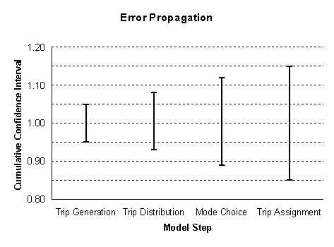
Figure 1[14] shows the possible effect of compounding error in travel models, where each step in the modeling process increases the overall error. This underscores the importance of identifying sources of error in each element of the travel model. Implementing a calibration effort such as described above is aimed at minimizing error in each step in the modeling process.
Figure 1: Effects of compounding error in model validation
Validation and Reasonableness Checking – It is important for the study team to conduct validation of the travel model at a level of detail that supports reliable forecasts and output indicators, focusing on the ability of the model to represent the effects of transportation system changes. This suggests validation of the travel markets deemed important in the study corridor by analyzing, for example, their trip generation, geographic distribution of trips, traffic volumes, and travel speeds.
The validation effort involves reviewing forecasting results, and results of sensitivity tests, to evaluate the credibility of the changes produced by the model. Sensitivity tests check the responsiveness of the travel forecasting tool to changes in the transportation system, socioeconomic data, and transportation policies. Often, sensitivity is expressed as the elasticity of an independent variable. For example, modelers can express a travel model’s sensitivity to the effects of a parking rate increase in an area by relating the increase in parking prices to the reduction in demand for travel to that area.
Reasonableness checks include the comparison of input such as rates and parameters, outputs such as total regional values, values for subregions covered by the model, and logic tests. Model parameters can be checked for consistency against observed values, parameters estimated in other regions, or secondary data sources. A model can be evaluated in terms of acceptable levels of error, its ability to perform according to theoretical and logical expectations, and the consistency of model results with the assumptions used to generate them.
There are several useful types of validation and reasonableness checks, including the following:
- Forecasting buildup to understand how the different model inputs contribute to changes from the base year to the forecasting year. It is useful to isolate and understand changes in travel patterns and congestion in a corridor that are due to land use growth versus transportation system expansion. Other inputs that may be important in a corridor include assumptions related to external trips and special generators. This series of tests could easily be conducted using the long-range transportation plan model inputs. Section 2.4.2 discusses the importance of the study team explicitly defining and documenting the future no-build highway (and transit) networks. Understanding the impact of planned changes to the transportation system is an important element of the forecasting buildup.
- Interpretation of the story told by the models themselves about the behavior of travelers. This test helps to ensure that the various parameters, assumptions, network coding conventions, and other decision rules in the models tell a coherent story about travel behavior. This helps prevent (by highlighting the need for correction) implausible relationships and explains the properties of the models to non-travel forecasters.
- Demonstration of reasonable predictions of change between today and the future as well as in response to changes in the transportation system. This last set of tests adds a major new dimension to the understanding of the properties of a new model set: the ability to respond reasonably to demographic growth and consequent changes in congestion, and to produce coherent responses to major changes in the transportation network.
Land use forecasts are one of the foundations upon which travel demand forecasts are built and, as such, it is important for the study team to invest effort in reviewing and checking both base year land use for accuracy and future year land use forecasts for reasonableness, and to understand the implications of growth on the transportation forecasts. A range of land use forecasting techniques may be used during a study from more qualitative techniques such as expert panels to quantitative techniques utilizing land use models. At the simplest level, it is important to understand how much of the justification for a project is based on current demand versus future growth and the implications of these findings related to the uncertainty in the forecasts; at a more complex level, where the study team’s analysis involves more complex land use analysis tools and models, a process akin to the calibration and validation of the travel model described above may be necessary.
As discussed in the context of reviewing the travel demand model, it is suggested that the study team scale their land use review effort according to the scale of the analysis, such as its geographic scope and potential for land development or redistribution effects. Section 2.4.6 discusses in detail considerations for addressing land development or redistribution effects in the preparation of project level forecasts.
A review of the base year land use in the study area will often be undertaken as the first step of travel demand model calibration and validation checks. Published sources[15] discuss recommended approaches to check base year land use and socioeconomic data, and also explain the importance of checking these input data to reduce the level of effort needed to perform other validation steps; indeed, it is critical as errors in these data propagate through the subsequent steps in the model system (as shown in Figure 1). In addition, errors that appear unimportant at a regional level may increase in significance as they are proportionally more important at a study area level.
The complexity of the review of the land use forecasts will depend on the approach selected for land use forecasting. A general framework for producing land use forecasts is as follows:[16]
- Understand existing conditions and trends: This principally involves assembling data that will be necessary to conduct the analysis.
- Establish policy assumptions: This step involves determining currently anticipated changes in regulatory or economic policies such as zoning, environmental regulations, and impact fees.
- Estimate regional population and employment growth resulting from change in accessibility: This step uses local population and employment trends; broader State and national economic industry trends; and economic forecasting models.
- Inventory land with development potential: This step identifies undeveloped and underdeveloped land and, in combination with environmental restrictions and zoning regulations, quantifies land available to absorb growth.
- Assign population and employment to specific locations: This step uses land availability, the cost of development, and the attractiveness of various areas to estimate the amount and type of growth that will occur in each zone.
The approaches used in this process vary from qualitative techniques (such as utilizing an expert panel and/or the Delphi process) to quantitative models to forecast regional population and employment changes (such as regional economic impact models) to land use models that are integrated with travel demand models.
For project level analysis in cases where alternative specific land development effects are not expected, it is common for the study team to review adopted regional level land use forecasts or use an integrated land use and travel demand model that has been calibrated at a regional level, rather than producing new forecasts. It is important that the study team reviews and understands how each of the steps in the forecast framework was undertaken and how each step applies to the land in the study area. This review might include checks of:
- Whether regional level trends used to produce forecasts have been reflected historically in the study area
- The accuracy of the land inventory (such as the amount of vacant land) for the study area
- Pending development/redevelopment proposals, particularly those that will exceed regulatory limits on density or other factors
- The reasonableness and feasibility of the resulting development allocations to the study area.
Consultation with local governments and others with knowledge of land development patterns can enhance this process.
A critical element of this review is for the study team to understand the future transportation network assumed in the land use forecasts, and particularly whether any of the alternatives under consideration are included in the transportation network assumed in the land use forecasts (see Section 2.4.2).
Forecasting models have been widely used to estimate the effects of standard roadway capacity improvements, like road widening or the addition of a new road. While these types of forecasting efforts can still be complicated and the models may need refinement to be useful, models are built with the basic intention of modeling roadway and major transit capacity improvements. Increasingly, however, requests are being made to assess the impacts of transportation demand and supply policies that models were not designed for when they were originally constructed. For example, alternatives in a study may include ramp metering to better manage flow on limited access facilities, a transit technology not currently existing in the region, or various pricing strategies. While some models are equipped to assess these policies, many that are routinely applied in current studies are not. Determining the extent to which some of these policies will be major components of a NEPA study will help ascertain the amount of effort it may require to test alternatives and model changes and/or adjustments that may be needed.
2.2.4.1 Evaluating Transportation System Management/Transportation Demand Management Strategies
Transportation system management (TSM) strategies, or intelligent transportation system (ITS) strategies, are put in place to reduce both recurring congestion and incident-related congestion. To the extent TSM strategies affect recurring congestion, the FHWA recommends that they be represented in road or transit networks as capacity improvements relative to facilities without these improvements. Additionally, ITS technologies are increasingly being implemented to monitor and collect travel data (e.g., speeds and volumes) and in this respect are valuable sources of model calibration and reasonableness checking data that can be used to assess capacities, free-flow and congested speeds, volumes by time of day, and the relationship between speed and volume.
Transportation demand management (TDM) strategies vary widely and are designed typically to discourage single-occupant vehicle use during peak hours. These include, but are not limited to, changes in parking policies, ride-sharing, employer-subsidized transit passes or van pools, policies allowing flexible work schedules and telecommuting, HOV lanes, and road or parking pricing. Since these policies vary dramatically in terms of the scale of the impacts and their cost, different analytical approaches may be warranted in each case. Generally speaking, it is reasonable to assess the impacts of the employer-based policies by reducing the number of auto trips to specific destinations during peak hours by a percentage agreed to be reasonable to account for the relevant policies. This exercise can quickly become daunting in its detail, so it is best to acknowledge the effects and develop a quick and reasonable approach to account for the effects if necessary.
2.2.4.2 Evaluating Managed Lanes and Pricing Strategies
Managed lanes and in particular roadway pricing are crucial elements of some regions’ networks and nationally are becoming particularly relevant as States and regions consider how to pay for maintaining and expanding their road networks. However, models are typically not well equipped to evaluate such policies as HOV lanes, high-occupancy toll (HOT) lanes, or tolled facilities. The consideration of managed lanes investments and in particular road pricing policies involves thoughtful consideration of how different travelers trade-off time and cost, along with a realistic representation of travel times and trip patterns.
While there are different methods that can be used to estimate demand for a managed lane or a toll facility (e.g., diversion curves, toll mode choice models, or traffic assignment methods that incorporate time and cost), for each approach to be successful it is recommended that the basic components leading to the demand estimate (trip distribution patterns by market segment, values-of-time, and travel time differences) be demonstrated to be reasonable and reliable. Traffic assignment models typically produce better estimates of volumes than speeds and, in the case of managed lanes, both are important.
Road pricing strategies also involve reliable estimation of the revenue potential for a facility, which adds an additional layer of complexity to the forecasting exercise. Typically, for projects involving private investment or bonding, a separate “investment-grade” forecasting study is carried out, which serves a different purpose from the NEPA study. While the NEPA travel forecasts are intended to form the basis for an informed Federal decision about the project, the “investment-grade” study provides assurances to investors that traffic levels will be sufficient to support the toll revenues anticipated for the project. The “investment-grade” study may involve different methodologies and produce different results from the NEPA study. If the results of the “investment-grade” study are released during the NEPA process, it is suggested that the study team explain differences between the two sets of forecasts in the NEPA documentation.[17]
2.2.4.3 Evaluating Transit Strategies
Transit provides important mobility benefits in congested corridors throughout the country and it is often necessary in a major NEPA study with highway alternatives to consider the potential benefits of upgrading transit services. While most models have the ability to represent transit to some degree, the models may not be a reliable predictor of travel by new transit modes, depending on the extent of the use of this aspect of the model. The introduction of a new transit mode in a corridor or a region is complicated to model and calls for careful consideration. The use of models that have been recently vetted and refined through the FTA’s New Starts project evaluation process[18] are most likely able to evaluate major transit alternatives. In situations where there is no transit modeling component, or one exists but has not been carefully reviewed, it is suggested that care be given to ensure that the transit model is working reasonably well, that transit model parameters are reasonable, and that transit markets and forecasts are validated.
2.2.4.4 Evaluating Integrated Land Use and Transportation Scenarios
From a travel demand forecasting perspective, the type of land use development can influence travel behavior and choices. A paper written by Cervero and Kockelman[19] provides the basic premise and foundation for subsequently developed sketch planning elasticity-based modeling methodologies. The “3D's” were eventually expanded to 4, and include land-use density, land-use design, destinations (i.e., the appeal of the places), and diversity in the attractions.
Incorporation of a 4D component into travel demand forecasting models is a very complex undertaking that, to be done correctly,requires extensive data collection to first observe how these components affect travel behavior, and then model the effects of urban design elements on each aspect of the travel model. Due to the high degree of complexity and high cost associated with such an endeavor, efforts to capture these effects have often utilized off-model adjustments based on elasticities, whereby auto tripsare removed to represent reductions in travel associated with specific land development characteristics. An additional and important layer of complexity is that models tend to capture some of these phenomena in some direct and indirect ways. Therefore, it is important for the study team to be very careful if they decide to apply additional off-model effects, and to document the need for the adjustments in addition to any effects captured by the model.
With research efforts continually developing new and improving existing technologies and methods, the state of the practice in land use and travel forecasting will never be static. Two particular methods that are becoming commonly used are integrated land use and transportation models and activity-based models, which are discussed below.
The use of integrated land use and transportation models is becoming more widespread, with implemented models in use in a number of metropolitan areas. Integrated models are designed to allow the two-directional interactions between land use development and transportation demand to be represented: for example, land use development increases demand for personal travel, while construction of new transportation infrastructure can affect land development patterns. The use of these models, while conceptually attractive, may add to the complexity of the analysis carried out by the study team.
Despite a long history of forecasting practice using traditional models, these tools have limitations, as described in TRB Special Report 288[20] and other publications. These limitations range from the theoretical (that aggregate four-step models do not reflect travel as a “derived” demand resulting from the needs of households and individuals to participate in activities) to the practical (that these models are fairly insensitive and lack detail needed to test some policies). In the past decade, more advanced “activity-based” forecasting approaches have been developed and implemented in a number of large- and medium-sized regions. These models offer expanded analysis capabilities, more behavioral, temporal, and spatial resolution, and better integration with long-term land use forecasting models and traffic micro-simulation models. However, there are many concerns with these models that are common with traditional four-step models: they are sequential systems, and they are subject to the same concerns regarding the quality of model input data and the robustness of the model calibration and validation. In addition, calibration and validation of an activity-based model system necessarily involves greater effort than one associated with a four-step model because of the more comprehensive treatment of all aspects of travel.
It is suggested that the study team consider the potential benefits but also the practical difficulties associated with these advanced techniques during their evaluation of the suitability of modeling methods and tools available to them. As with any tool used during analysis, if the study team chooses to use one of the advanced techniques discussed above, it is important to demonstrate its suitability. In many cases, the study team will not have an advanced model available to them or they will be faced with an analysis for which an advanced technique is not necessary.
There are substantive and procedural benefits from leveraging outside expert opinion. Lead agencies can use peer reviews to help ensure that the forecasting processes being applied meet the standards of professional practice and/or Federal, State, or local requirements. In addition, peer reviews of models inherently require an appropriate level of detailed technical documentation, and can have value for this reason alone. Finally, because forecasting can be a difficult and complicated process, an outside and objective perspective may be helpful.
There are several options for peer review of the forecasting work, including internal and external review approaches:
- Independent review of the travel forecasting methods and preliminary output by outside experts. A rigorous review would consist of a review of the model files and output, whereas a less rigorous review would cover the documentation only.
- Interagency panel of MPO, transit, transportation, and land use planning agencies. This review would be conducted by the stakeholder agencies in the study area to ensure the use of the best available forecasts and data. Effectively, this panel would form a technical advisory group for the project.
- Review of the forecasting effort by the agency responsible for maintaining the model. This can help ensure that the model was applied correctly, facilitate consistency across studies, and leverage the appropriate government resources and expertise.
- Internal, semi-independent review by senior staff from the study team. Such an effort would be analogous to the formal review required of engineers who produce designs.
The need for and appropriate level of review depends on the circumstances of each study. It is critical to engage in a peer review at a stage in the study where the findings of the review can still be taken into account when conducting the analysis. More complicated analyses, or situations where new methods have to be implemented, will obviously require more time.[21]
This section of the guidance discusses the importance of ensuring the suitability of modeling methods, tools, and underlying data. It is important for the study team to produce documentation that describes their review of the tools that they choose to use to support their analysis, and to document any updates or improvements that they identified as necessary for the analysis.
It is also important for the study team to focus this documentation on the needs and scale of the analysis that they are undertaking. The MPO or DOT that maintains the regional travel demand model is likely to publish a calibration report that can be referenced to demonstrate that the model is calibrated at a regional level; however, this report is unlikely to deal specifically with calibration for the study area for a particular project. Therefore, it falls to the study team to demonstrate that the travel demand model is adequately calibrated in their study area.
Other elements to consider for inclusion in the documentation are:
- Demonstration that the tools have the capability to forecast the range of policies that will be developed in the alternatives analysis
- Discussion of the appropriateness of using new or advanced methods that might be considered a departure from typical practice, given the context of the application
- Results of any peer reviews or an explanation detailing why no peer review was required.
As with forecasting needs, the key purpose of this documentation is to demonstrate that these issues have been considered by the study team. Again, the documentation can demonstrate the process used to make decisions relating to model suitability and record who was involved in the decision-making process.
The Council on Environmental Quality (CEQ) regulations for implementing the provisions of NEPA require that the lead agencies insure the professional integrity, including scientific integrity, of the discussions and analyses in environmental impact statements,[22] and this and other elements of documentation discussed in this guidance can help the lead agencies to demonstrate that they are meeting this requirement.
Back to Top
Scoping is a collaborative process involving the lead agencies, resource and regulatory agencies, and the public. Typically, this is how a NEPA study begins, and is intended to initiate activities in the most efficient and effective direction. Early consideration is given to determining what factors and resources will be issues of concern during the NEPA process and therefore have an impact on the decision being made, and conversely, what factors and resources are not likely to impact decision making.
SAFETEA-LU Section 6002 provided additional direction regarding the scoping process for environmental impact statements (EISs) by specifying that lead agencies collaborate with participating agencies on the methodologies to be applied and the level of detail required in the NEPA study.[23] Participating agencies are those Federal and non-Federal agencies that have an interest in the project. These agencies may also be cooperating agencies, meaning that they have special expertise or legal authority such as a permit approval. Such collaboration can be advantageous when conducting categorical exclusions or environmental assessments as well, although it is not required. The goal of the scoping process is to provide an opportunity for agencies and the public to raise critical issues and concerns early in the NEPA study so that these can be adequately considered as the NEPA study moves forward.
For this reason it is important to reach early agreements on the methodologies and conduct of the many technical studies that will support the overall NEPA analysis. The focus of this guidance is travel and land use forecasting, but the forecasts are relied upon as inputs for other technical studies, such as air quality, noise, and land development effects. Therefore, to ensure that the effects of potential alternatives are reasonably estimated, it is important for the travel forecast to provide an adequate representation of the travel patterns and volumes to be expected with each of the alternatives. Because future land use forms the basis for demand in the travel forecasting process, it is suggested that agreements be reached first on future land use scenarios for the alternatives and the methodologies to be used to develop those estimates.
The primary reason for reaching agreement early during the scoping process is to minimize the cost and schedule risk associated with “backing up” or re-doing work during the study. It is not uncommon during the NEPA process, particularly during alternatives analysis and evaluation, for the public and agencies to question the work done prior to that stage. Because not everyone will be 100% satisfied with the alternatives under consideration, it is natural for this questioning to take place. Having documentation on the agreements reached and the assumptions used for the land use and travel forecasts will facilitate the process to move forward with minimal delay and disruption. It is important to explain why the agreements were reached and how the team arrived at the assumptions used for land use and travel forecasting. In the absence of these agreements, the likelihood that the process may cycle back to this stage increases and could result in additional delay to the study and increased costs. Several agencies have developed procedures, such as templates, to assist with reaching consensus during scoping and documenting the agreed upon analysis approach.[24]
It is important for NEPA study teams to recognize that effective use of the scoping process is integral to a successful forecasting effort, since the scoping process sets the tone for participation throughout the study and can identify key issues germane to the forecasting exercise. The definition of a successful forecasting effort would be one where there is broad acceptance of the outputs from that effort. As described above, getting to that consensus requires early agreement on the inputs to the forecasting process and methods used. In addition to land use, it is important that the agreements cover all aspects of the forecast effort, such as whether the model accounts for modal splits, tolling, “induced” travel, and other items that relate to the range of alternatives being considered. All of these considerations are discussed elsewhere in this guidance.
Agencies would be well served to adopt written procedures for scoping all studies, regardless of the type of NEPA analysis. Simply stated, scoping sets the framework for everything that follows. It is suggested that the level of effort devoted to the scoping process be tailored to the context of the proposed project and/or the range of alternatives. Typically, the level of scoping effort associated with the replacement of a deficient bridge on an existing site would be different from the level of effort for a potential freeway in a new location, or a new commuter rail line. In addition, the roles of forecasts are different under each of those scenarios and would also require a commensurate level of effort in terms of reaching early agreements on how they will be determined.
As discussed above, it is critical for the study team to document their work on scoping of the analysis and their interaction with other agencies, recording the broad agreements reached and the assumptions used for the land use and travel forecasts. This documentation can then be used throughout the study as a reference during analysis and later to demonstrate what decisions were made and the process by which decisions were made, and to identify who was involved in making those decisions.
Back to Top
The CEQ regulations require lead agencies to “rigorously explore and objectively evaluate all reasonable alternatives.”[25] This provision establishes a standard for NEPA studies to treat each alternative in an unbiased manner so that the related benefits and impacts can be estimated and compared across alternatives. For EISs, the regulations go on to say that the study “shall provide full and fair discussion of significant environmental impacts and shall inform decision-makers and the public of the reasonable alternatives which would avoid or minimize adverse impacts or enhance the quality of the human environment.”[26] In addition, the regulations say that the alternatives analysis is “the heart of an environmental impact statement.”[27] From a land use and travel forecasting perspective, these provisions have direct relevance in how forecasting methods are applied for the purposes of analyzing alternatives.
The CEQ regulations define the effects and impacts that Federal agencies are to address and consider in satisfying the requirements of the NEPA process. These effects include direct effects, indirect effects, and cumulative impacts:
- Direct effects are caused by the action and occur at the same time and place (40 CFR § 1508.8).
- Indirect effects are caused by the action and are later in time or farther removed in distance, but are still reasonably foreseeable. Indirect effects may include growth-inducing effects and other effects related to induced changes in the pattern of land use, population density, or growth rate, and related effects on air and water and other natural systems, including ecosystems (40 CFR § 1508.8).
- Cumulative impact is the impact on the environment, which results from the incremental impact of the action when added to other past, present, and reasonably foreseeable future actions, regardless of what agency (Federal or non-Federal) or person undertakes such other actions. Cumulative impacts can result from individually minor but collectively significant actions taking place over a period of time (40 CFR § 1508.7).
The terms "effect" and "impact" are used synonymously in the CEQ regulations (40 CFR § 1508.8). "Secondary impact" does not appear, nor is it defined in the CEQ regulations or related CEQ guidance, but the FHWA has used the terms “secondary impact” and “indirect effect” interchangeably.[28]
There are several available resources that discuss the distinctions between these types of effects and provide guidance on considering and measuring them.28, [29] From a travel forecasting standpoint, there are numerous transportation-related impacts that are measurable and may be meaningful in an alternatives analysis. Following are examples of impacts that illustrate the type of information that comes from a travel forecast, or is closely related to travel forecasting output, organized into direct effects, indirect effects, and cumulative impacts.
2.4.1.1 Direct Effects
Transportation-related direct effects are generally well understood. Table 2 presents a brief list of typical direct effects that have their basis in travel and/or land use forecasting, including how each one is usually sourced:
Table 2: Typical Direct Effects Estimated using Outputs from Forecasts
| Effect |
Effect Type |
Effect Source |
| Congestion /Delay |
Peak hour/period level of service
|
Direct output of traffic assignment and/or post processed output to produce intersection turning movement volumes (see section 2.4.5)
|
|
Hours of congestion
|
|
Intersection level of service
|
|
Point-to-point travel times
|
| Travel Choices |
Mode shares
|
Direct output of mode choice model
|
|
Transit boardings and loadings
|
Direct output of transit assignment
|
| Revenue |
Toll revenue, transit revenue
|
Revenue forecasts based on traffic and transit assignment results
|
| Environmental/Social |
Noise
|
See section 2.6.1
|
|
Air quality
|
See section 2.6.2
|
|
Traffic diversion
|
Direct output of traffic assignment
|
|
Travel benefits for different socioeconomic groups
|
Post processed travel model outputs by socioeconomic groups
|
|
Accident rates
|
Post processed traffic assignment by functional class, and changes in non-motorized trips and shares from trip generation and mode choice models
|
2.4.1.2 Indirect Effects
Potential changes in land development patterns due to a transportation investment are typically examined as part of an indirect effects assessment, particularly on major projects.[30] These effects are not easy to forecast. The study team may undertake a land development impact assessment through the use of integrated land use and transportation models, the application of gravity or other more simplified models, or simply an analysis of regional and local trends. In some studies the team may also choose more qualitative methods such as surveys, interviews with developers, discussions with local planners, or the Delphi or expert panel process. These are considered further later in this document.
The FHWA’s Interim Guidance on Indirect and Cumulative Impacts explains that a proposal for a new alignment project in an area where no transportation facility currently exists, or one that adds new access to an existing facility may indicate an increased potential for project-related indirect impacts from other distinct but connected actions, such as the opening of access to land with a new highway leading to new development.[31] Likewise, the purpose and need of a proposed project that includes a development or economic element might establish an indirect relationship to potential land use change or other action with subsequent environmental impacts.[32] It is important for the lead agencies to identify potential indirect impacts of the transportation proposal early in the NEPA project development process.
Land development effects and potential redistribution of growth within a region may be analyzed more robustly at the regional level and during the regional planning process. Increasingly, MPOs, DOTs, and other agencies are using integrated land use and transportation forecasting procedures in the planning process to better understand the interrelationship between growth and the transportation system. It is therefore possible that the study team can glean insights at the project level from a regional planning analysis. One advantage of a regional analysis is that the study team can consider the region-wide growth pressure dynamics.[33]
Table 3 presents a brief list of typical indirect effects that may be considered in a NEPA study that are based on or use forecasting outputs:
Table 3: Typical Indirect Effects That are Based on or use Forecasts
| Effect |
Effect Type |
Effect Source |
| Land Use |
Residential development
|
Based on land development impact assessment
|
|
Commercial development
|
| Revenue/Economic Growth |
Increased tax revenue
|
Based on fiscal impact assessment of land development forecasts
|
|
Regional economic growth
|
| Environmental/Social |
Noise
|
See section 2.6.1
|
|
Air quality
|
See section 2.6.2
|
|
Visual impact of development
|
Based on land development impact assessment
|
|
Floodplain and wetland encroachment
|
|
Fragmentation of habitat
|
2.4.1.3 Cumulative Impacts
The FHWA’s Interim Guidance on Indirect and Cumulative Impacts states that cumulative impact analysis is resource-specific and generally performed for the environmental resources directly impacted by a Federal action under study, such as a transportation project. However, not all of the resources directly impacted by a project will require a cumulative impact analysis. The resources subject to a cumulative impact assessment should be determined on a case-by-case basis early in the NEPA process, generally as part of early coordination or scoping.[34]
Two types of direct impacts, both measured and part of travel model output, have potentially important cumulative effects: air emissions and noise. The study team will typically evaluate the cumulative effects on air quality during the regional air quality conformity modeling process. The study team can measure the cumulative noise impacts through a noise model and an understanding of existing noise levels.
If a project is expected to induce land development, such development could potentially cause additional cumulative impacts such as (but not limited to) impacts to farmland or open space, animal habitat, wetlands, water supply and quality, and air quality. In other words, to the extent the transportation system induces land development that development may cause further impacts to the environment and public health.[35]
Table 4 presents a brief list of typical cumulative impacts that may be considered in a NEPA study:
Table 4: Typical Cumulative Impacts That are Based on or use Forecasts
| Effect |
Effect Type |
Effect Source |
| Land Use |
Reduction in open space, farmland, animal habitat, wetlands
|
Based on land development impact assessment
|
|
Impacts on water supply and quality
|
| Environmental/Social |
Noise
|
See section 2.6.1
|
|
Air quality
|
See section 2.6.2
|
The requirement for the alternatives analysis to be an objective evaluation makes it essential for the study team to apply forecasting data and methods objectively without any bias towards a particular alternative. It is important for the forecasting data and methods applied in the alternatives analysis to be consistent and create a level playing-field where alternatives can be fairly and reasonably compared. In other words, if the lead agencies structure the analysis to be predisposed to favoring the preferred alternative, then they are not meeting NEPA requirements, thus falling short of FHWA program requirements and creating litigation risk.[36]
To ensure that the objective evaluation requirement is met, it is essential for the study team to maintain consistency in assumptions across the alternatives being considered, and to clearly understand the impact that differences in model parameters cause. Apparently small inconsistencies in assumptions or model parameters can affect particular alternatives disproportionately. For example, assuming a slightly lower maximum walk access distance to a bus stop compared to a light rail stop can lead to large differences in the forecast for a bus rapid transit alternative compared to a light rail alternative; in this case the land area accessible to each stop is related to the square of the maximum walk access distance, so small differences are magnified. There are certainly cases where the study team will be justified in varying assumptions between alternatives; in that case, it is important for the study to be as transparent as possible in documenting and justifying those variations.
It is important for the study team to explicitly define and document the no-build condition. The no-build scenario contains a highway and most likely a transit network, as well as a no-build land use forecast. Defining the no-build networks in the intermediate and final horizon year requires assumptions about which projects in both the transportation improvement program (TIP) and long-range transportation plan are to be included. This requires some dialogue among local stakeholders to determine which projects have already been approved and funded, which projects are likely to be approved, and which projects are unlikely and therefore do not need to be included in the no-build scenario. The study team needs to pay special attention to projects closely associated with the subject study alternatives (i.e., capacity enhancements upstream or downstream from the study area, or on parallel facilities). It is important for the study team to ensure that alternatives to be analyzed are not included in the future no-build networks.
The typical practice in forecasting for NEPA studies is to use the adopted land use forecasts, which are usually developed by the State, MPO, and/or other regional planning agency, as a basis for estimating travel demand. As a matter of good practice, it is important that the study team understand the assumptions and inputs for a travel forecasting exercise, and this applies to land use as well. Occasionally, during an alternatives analysis, the study team and/or planning officials will adjust the land use forecasts within a corridor based on a more thorough and focused review. This corridor-specific review would typically include comparisons to current land use patterns and consideration of land-use policies, land availability, and anticipated development plans.
In addition, the study team will typically use one land use forecast in the no-build scenario and the other alternatives. However, in studies where land development patterns (both new and redistribution effects) are likely to be substantially different among alternatives, it is critical to understand whether the land use forecasts provided for use in the study represent a no-build or a build condition in the corridor. The answer to this question may not be immediately obvious, and the difference will not be relevant in many studies. However, particularly in cases where a new transportation facility is being proposed, it is important that the study team consider whether the development patterns adjacent to and reliant on the proposed facility will be the same if an alternative is built or not built. This situation is discussed further below in section 2.4.6.
The alternatives screening process varies from one study to the next but, generally speaking, analysts follow a multi-step screening process. The Administrative Procedure Act requires that decisions made by Federal agencies are rational and clearly explained, with consideration given to all reasonable options.[37]
The tiered screening process often includes the following sequential decision points as the list of alternatives is vetted during project development:
1. Initial screening based on purpose and need. Does the alternative meet the study purpose and need? Are there fatal safety, engineering, mobility, or environmental flaws? Answers to these questions can sometimes be made with qualitative analysis. It is important to document all the reasons for screening out an alternative.
2. Long list screening based on an initial impact assessment. In a large or complicated study, it is not uncommon for a long list of alternatives to make it through the first screen. A second screen is then used that is based on preliminary analyses of impacts and performance at a level of detail that allows a reasonable decision to be made on the merits of the alternatives.
3. Short list screening and detailed alternatives analysis during environmental review. The short list of alternatives is the list that is carried forward to the environmental review. In this stage the analysis is typically the most detailed and time-consuming.[38]
The forecasting process typically mirrors the screening process in terms of the level of detail in the analysis. It is important for the study team to fully document the screening process and accompanying forecasting work. For example, it is important for the documentation to include an explanation of the screening performance measures and the process used to develop and select those measures (with reference to the purpose and need of the project), and to describe how each round of forecasting and screening was done and why key decisions were made.
If the forecasting methods change during this process, it is suggested that the study team evaluate in a reasonable manner the continuing validity of the prior decisions, to the extent that travel modeling was a basis for the screening out of alternatives.[39] This evaluation can include the use of sensitivity tests to assess the differences in the modeling results, assuming that the results of the tests pertain to a group of alternatives, or in more extreme cases by redoing the prior modeling work and subsequent analysis of the results.
For estimates of forecasts, substantial uncertainties include, but are not limited to, the following: population and employment forecasts, housing trends and costs, global and local economic conditions, other planned transportation improvements, time-of-day assumptions, parking prices, fuel prices, and long-term changes in vehicle technology. Obviously, the further the forecasting horizon is from the current year and the larger and more complex the alternatives that are being analyzed, the greater the level of uncertainty may be. To separate the various sources of uncertainty, it is suggested that the lead agencies identify the principal drivers of changes in traffic volumes through an incremental buildup of the forecasts for an alternative.
This forecasting buildup starts with a forecast using current conditions, such as land use and travel patterns, and then prepares a series of intermediate forecasts—in each case, replacing one of the inputs that describe current conditions with the analogous description of future conditions. The buildup concludes with a forecast that uses all of the forecast year conditions—effectively reproducing the traditional forecast for the alternative. The level of effort for this analysis is modest because it involves the straightforward reapplication of travel models with input files that are already available.
Identification of the key drivers of uncertainty in forecasts for an alternative can lead to very productive discussions early in the project development process, which is the right time to consider the reasonableness of future demand projections, while there is opportunity to reevaluate the approach used to analyze an alternative. As with other assumptions made and model tests carried out during the analysis, it is important for the study team to document their work to understand forecast confidence. The findings of these analyses form a key element of the demonstration that the approach used to analyze an alternative is appropriate. The documentation of these analyses is also essential so that the lead agencies can clearly communicate a level of confidence in the forecasts and point out areas where uncertainty in assumptions may lead to uncertainty in forecasts.
In the case of a regional travel model, it may not be advisable to directly use the raw forecasted volumes from a planning model and apply them in the context of a NEPA study. In most cases, the study team will need to conduct additional post processing or refinement of the travel model output before the forecasted volumes can be used in NEPA analysis. In practice, two approaches tend to be most commonly used for adjusting forecasts from regional planning models.[40] The first is a post-processing technique that aims simply to adjust the regional planning model forecasts of roadway volumes. The second is a sub-area analysis, which may involve the use of a microsimulation model to estimate traffic volumes on a detailed road network in a corridor.
When adjusting traffic volumes produced with a regional model, the modeler develops adjustment factors using base year volumes and observed traffic counts and applies those adjustment factors to the future traffic volumes estimated from a model. NCHRP Report 255[41] describes methodologies for performing this post processing and remains the standard for adjusting planning models forecasts to this day.
The methods and principles outlined in NCHRP Report 255 advise the modeler to use the regional planning model to estimate future changes in traffic levels across screenlines, which are then added to or used to factor up base-year screen line counts. The modeler would then allocate traffic to specific links, with consideration given to relative capacities on the links and/or base-year traffic distributions, depending on the specifics of the analysis. This adjustment of forecasts from planning models requires an additional level of effort and attention to detail due to the number of calculations involved, but can improve the consistency and quality of the project development forecasts. However, this approach assumes that the differences between base-year traffic counts and assigned volumes across a screenline will remain relatively constant in the forecast year.
For an intersection analysis, the modeler would use the methodologies mentioned above to obtain traffic volumes in and out of the intersection. An iterative procedure can be used to convert the adjusted future-year traffic volumes to future-year intersection turning movement volumes, using the base-year turning movement patterns as a starting point. The iterative process involves alternately balancing the future inbound and outbound traffic volumes until a certain level of consistency is reached. As always, professional judgment is necessary to determine the reasonableness of the future-year turning movement volumes, particularly considering the purpose of the forecast.
While developing future-year forecasts, the study team may determine that the regional travel model lacks enough detail for the level of analysis required. In such a case, a sub-area model and analysis may be needed. This would involve the use of a model based on Highway Capacity Manual (HCM) methods or a microsimulation model. A sub-area analysis may also be warranted if the validation of the regional model is poor in the sub-area or if the regional model is too coarse in the sub-area. The best time to develop a sub-area model is at the beginning of the project development process while the regional model is being reviewed and calibrated, when it is simpler to create additional detail in the regional model (e.g., TAZ splits and new roadway links) that will be useful in a refined sub-area model.
Refined travel forecasting models, such as HCM or microsimulation models, require substantially more attention to detail than a regional travel demand model but can produce a more useful and informative forecast. As with sub-area models, it is best if the decision to utilize microsimulation methods is discussed early in the study process at scoping. It is recommended that the study team consider the evolving nature of microsimulation techniques and use the most appropriate tools available to them during the NEPA analysis.[42]
Land development and/or redistribution that is an indirect effect of specific transportation alternatives is often difficult to forecast. This is particularly true regarding changes in a transportation investment due to the complex, dynamic nature of the urban development process. More specifically, local conditions, changing policies, the incremental long-term nature of land use change, and the flexibility of travelers’ responses all affect our ability to forecast transportation project outcomes. Despite these difficulties, transportation/land use impacts often need to be evaluated within the planning/NEPA process. Figure 2 presents a model of factors influencing development location decisions.[43]
Figure 2: Simplified model of various factors influencing development location decisions
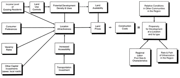
2.4.6.1 Options for Addressing Land Use Issues in NEPA Studies
Table 5 outlines some potential steps for conducting both base-case land use forecasts and analyses of the land use impacts from a build alternative.
Table 5: Comparison of Steps in Base-Case Forecasts and Impact Assessments
| Base-Case Forecast |
Impact or Policy Assessment |
| 1. Understand existing conditions and trends |
1. Understand existing conditions and trends |
| 2. Establish policy assumptions |
2. Establish policy assumptions |
|
3. Measure the transportation outcomes with and without project |
| 3. Estimate regional population and employment growth |
4. Estimate total study area population and employment growth with and without project |
| 4. Inventory land with development potential |
5. Inventory land with development potential |
| 5. Assign population and employment to specific locations |
6. Estimate how the project will change the location and type of development within the study area from what would occur anyway |
Both types of analysis require understanding existing transportation and land development patterns, making assumptions about the policy framework that will guide the process, estimating the amount of growth expected during the planning period in the study area, inventorying land that might be developed and any physical and regulatory constraints on that development, and assigning the expected growth in households and jobs to specific locations.
The key difference between the processes is that, to measure transportation outcomes with and without the project, an impact assessment uses estimates of the ways that accessibility and travel behavior will change because of the transportation investment. In addition, an impact assessment requires a comparison not only with existing conditions, but also with the quantity, type, and location of future growth that would occur without the project.
There is a wide range of specific techniques to assess the indirect land use impacts of transportation alternatives. Formal land use models require the most data and time, and they generally suit analyses at a larger geographic scale and better represent the complex interactions between transportation access and land development patterns. Qualitative methods suit smaller sites and projects, though they may also be applied to larger areas. As discussed in section 2.3, close collaboration on methodologies is critical to the success of a NEPA study and, whatever the decisions taken to select a methodology, it is important that the decision-making process is well documented.
Reference documents on this topic include the following:
- Handbook on Integrating Land Use Considerations into Transportation Projects to Address Induced Growth[44]
- NCHRP Project 25-25, Task 22, Forecasting Indirect Land Use Effects of Transportation Projects[45]
- NCHRP Report 423a: Land Use Impacts of Transportation: A Guidebook.[46]
- NCHRP Report 466: Desk Reference for Estimating the Indirect Effects of Proposed Transportation Projects[47]
2.4.6.2 Addressing Land Development Effects in Alternatives Analysis
It is important for the study team to consider and address, when applicable, induced land development that may vary by build alternative, or simply between build and no-build. For transportation investments that are regionally important in scale, such as new or substantially improved highway facilities, it is more likely that the future land use patterns will be different if the alternative is built. If this situation exists, it is important for the study team to look at whether the differences would be simply between the build alternative(s) and the no-build, or if there would be a difference between the no-build alternatives and each of the build alternatives. The latter case is more likely when alternative alignments being considered are far enough apart or have such different characteristics that there would likely be a discernable difference between the land development impacts of each alternative. In many cases, however, it is reasonable to find induced land development to not be an important issue in a corridor, and therefore to use the same land use forecast for all alternatives. Figure 3 presents a framework for analysis of projects that warrant alternative land use forecasts for each alternative.
Likewise, the purpose and need of a proposed project that includes a development or economic element might establish an indirect relationship to potential land use change or other action with subsequent environmental impacts. It is important for the study team to establish the potential relationship of alternatives to indirect land development impacts in the scoping phase of the NEPA process on a project-by-project basis.[48]
The study team has at its disposal at least a few ways to assess the potential for induced development, including talking with land-owners in the corridor and local officials. If land is currently vacant or underutilized in the corridor, it is suggested that the study team consider whether there are development plans or land use policies related to these parcels that assume the construction of the transportation facility. This is particularly likely if a right-of-way has been preserved and/or a specific alternative is envisioned on municipal master plans. It is not uncommon for new transportation projects to be anticipated by land use planners and developers in advance of the project development process.
During NEPA studies where an analysis of land development effects is warranted, the analyses of the impacts of land development are often considered as part of a discrete indirect effects analysis. This approach differentiates the direct versus indirect effects and analyzes the resulting indirect impacts of induced development on traffic, air quality, noise, water quality, etc., as appropriate.
Figure 3: Framework for analysis of projects that warrant using alternative land use forecasts
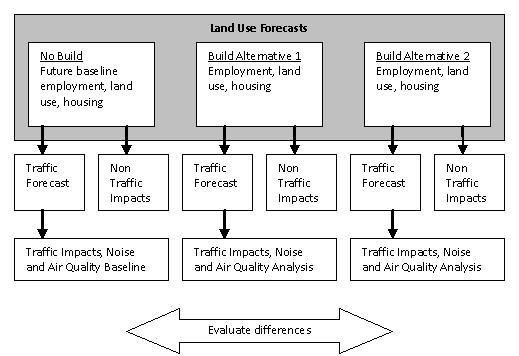
Another option for incorporating the land development effects as part of alternatives analysis is to include the land development effects of the build alternative(s) as part of the forecasting effort that supports the direct effects analysis. In effect, this approach embeds the indirect effects of land development in the direct effects analysis. One of the likely benefits to this approach would be the streamlining of the forecasting effort by eliminating the number of needed model runs.
Finally, before making a decision on how to handle land development effects in the NEPA document, it is important to consider how the scope of NEPA analysis is affected by the degree of Federal influence and control over the project.This issue, which is sometimes referred to as the “Federal handle” on the project, can have particularly important impacts with respect to the analysis approach for land use impacts.
2.4.6.3 Induced Demand and Land Development
One of the most controversial issues with regard to forecasting as part of the NEPA process is that of induced demand. While there are limits and complex factors in reality and every corridor is unique to some degree, it is important for transportation analyses to consider the significance of induced demand. Induced demand is the volume of traffic that is drawn to a new or expanded road by providing additional capacity. This induced demand comes from a number of sources, including trips diverted from other routes, discretionary trips that might not have been made without the service improvement, and improved access to employment and other activity location choices.
Those challenging the results of a NEPA process often cite induced demand in comments on environmental documentation and litigation involving travel models.[49] In economic terms, induced demand is the notion that demand increases as a result of increased supply. In a transportation context, the idea is that every action to improve travel conditions will lead to more travel demand. Table 6 shows the main components of induced demand according to prior research, and the extent to which typical practice models capture these components.[50]
Table 6: Components of Induced Demand
| Time frame of impact |
Induced Demand Components |
Effects on Forecasting Analysis |
Effectiveness of Model |
| Short–run Impacts |
Change in number of trips |
The net addition of trips will affect traffic, noise, and emissions impacts |
Poor – Trip generation models are typically based on demographic factors such as household size, income and auto ownership, and are insensitive to changes in travel time or accessibility. |
| Change in length of trips |
Change in trip length will affect duration of use of facility and emissions |
Fair – Trip distribution models use an aggregate measure of impedance based largely on travel times. Feedback of travel impedances from assignment to distribution enables distribution models to be sensitive to congestion effects. |
| Change in mode of travel |
Change in mode to or from auto will affect noise and emissions |
Good – Disaggregate mode choice models estimate mode choice probabilities based on relative attractiveness of alternative modes with respect to travel times, costs, and other factors. |
| Change in route |
Changes in route will affect traffic volumes on facility and emissions |
Good – Equilibrium traffic assignment models reallocate trips to alternative routes based on travel impedances and volume-delay functions. |
| Change in time of travel |
Changes in time of travel will affect levels of congestion |
Poor – Most travel models partition daily trips into fixed time periods with no option for adjustment between periods based on traffic volumes. |
| Long–run Impacts |
Change in development patterns |
Net addition of trip-generating land uses will increase traffic volumes, may increase trip lengths |
Poor – Most travel models use population and employment forecasts developed outside the model and have little or no feedback between the travel model and land use forecasts. |
| Change in behavior (e.g., vehicle ownership) |
Changes in behavior have long run-impacts on number of trips, length of trips, mode of travel and hence affect traffic volumes |
Poor – Most travel models use static assumptions about future residential locations, vehicle ownership, and mode preferences. |
Short-term induced demand results from changes in the number of trips people take, where people travel to, what mode they take, and what route they take. Table 6 shows that typical practice models tend to account reasonably well for some of these short-term induced demand effects but do not generally account for changes in the number of discretionary trips taken and the time of travel. Longer-term induced demand can arise from changes in household location or vehicle ownership, and these longer-term impacts are notably harder to measure and relate to a specific transportation project with a high degree of confidence. Figure 4 illustrates short and long-run sources of induced demand.[51]
Figure 4: Short-Run and Long-Run Sources of Induced Demand
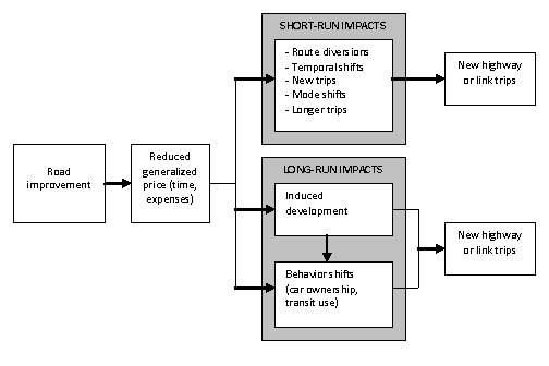
Typically, the long-term land development effects are more effectively analyzed at the system, metropolitan, or regional level. At this scale of analysis, systematic interrelationships between the transportation system and land development characteristics and dynamics (including other relevant policies and conditions) can be meaningfully evaluated. The results of these planning-level analyses may be incorporated in the NEPA process if appropriate (see section 2.1.5 for a more complete discussion).
Induced land development is development that may occur as a direct or indirect result of improvements to the transportation network. While the issues of “induced demand” and “induced land development” are related, they are in reality separate and are often confused and used interchangeably. Induced land development is one of the sources of induced demand on an improved roadway, but only accounts for a portion of the induced demand components.[52]
A range of approaches are available to address induced demand components not considered as part of an agency’s routine forecasting methods, and are discussed in other research.[53] When dealing with induced demand issues within a particular NEPA study, it is important to understand and document the different components of induced demand and which components are adequately dealt with within the forecasting analysis. It is also important to understand and document what elements require additional work and where it is not possible to perform this work given the unavailability of information or exorbitant cost of obtaining the information and performing the analysis.[54] These considerations should be weighed during the early stages of the analysis process and should be discussed during scoping.
2.4.6.4 Addressing Variations from “Approved” Forecasts
It is common for the land use forecast used in an EIS to vary from the land use forecast used in the MPO planning process and conformity analysis. If a review of the land use forecast provided by the MPO suggests that refinements are necessary within a corridor, typical practice involves starting with the MPO land use forecast and adjusting land use within a study area while preserving housing and employment control totals within an appropriate aggregate geographic area, such as the study area or a county. An essential element of a land use forecast review is to obtain and understand the assumptions that led to the forecast, such as changes to the transportation network. If refinements to the land use forecasts are made, it is important for the study team to document the changes so that they can be disclosed and explained. It is also suggested that improvements to land use forecasts made during NEPA studies be provided back to the MPO for their use to leverage the work performed during NEPA studies.
There are several aspects of forecasting in the alternatives analysis that are especially important to include in the documentation, in addition to presenting the travel model results and impacts for each alternative. They are highlighted here, and discussed in more detail in the relevant sections above:
- An explicit definition of the no-build condition with regard to land use, network, and modeling assumptions
- In cases where the study team is justified in varying modeling assumptions between alternatives, documentation that explains those variations
- If the forecasting methods change during the screening process, documentation of the evaluation of prior analyses and decisions
- Analyses to understand uncertainty in assumptions and forecasts
- How the travel forecasting work takes induced demand and land development effects into account
- The approach used to develop and the reasons for variations from approved land use forecasts
Back to Top
NEPA studies are often complex undertakings and may be accompanied by various special considerations that warrant extra lead agency and study team attention. These include the potential for re-do analysis loops and ensuring documentation consistency. If these issues are understood from the initiation of the study, there will be ample opportunity to proactively address them and facilitate a smooth and expeditious study process.
In the course of a NEPA study, changed conditions may trigger a reevaluation of past forecasting work. A reevaluation could lead to revisions of data inputs and model assumptions used to produce the study’s forecasts. The study team may need to conduct sensitivity tests to assess the magnitude of differences from prior analyses resulting from use of new data and their effects on past decisions. Depending on the outcome of such tests, the study team may need to decide how to choose the best and most appropriate way to address the new information. For example, updates to key data sets, such as new land use estimates or forecasts, updated project lists, or the availability of a new model version, may potentially bring into question the credibility of already-conducted forecasts, and consequently, the decisions made based on those data.
On the other hand, a sensitivity test may reveal that the changes caused by the introduction of the new data or model version do not change the conclusions made from the previous analysis. In this case, the study team would incorporate the updates to the model at a future milestone, such as for the final EIS, or simply document the change and the sensitivity analysis in the project administrative record and move on. Depending on the stage in the analysis, for example, when new land use forecasts become available, it may not be necessary to re-do analysis.[55]
Sometimes a change in the scope of the analysis may also require past model work to be reevaluated. For instance, the testing of a new alternative may be requested, such as a toll facility, that was identified after scoping and was not considered in the original analysis. It is then also possible that model refinements may be necessary to evaluate this unforeseen alternative, or existing tools may be adequate to use to test the new alternative. It is important that choices that are made regarding changes in the alternatives and analysis are the result of a deliberative process, and that the decisions and the decision process are well documented.
In sum, it is important for the scope of the modeling effort for the study to recognize the potential for reevaluation of the analysis and thus include adequate time and budget at the outset to address such contingencies. In the case of large, unforeseen issues, adequately addressing the study requirements may require scope and/or budgetary change orders. The implications of this issue for the scopes of work for consultants conducting forecasting analyses are discussed in section 2.5.4.
NEPA documentation often presents a large amount of data and uses several applications and iterations of land use and travel forecasts as the basis for alternatives screening and impact estimation. There are therefore numerous opportunities for inconsistencies of data or results. First, there are the obvious inconsistencies, such as the same performance measures for an alternative having different values in different tables or sections of the documentation. A recent NCHRP report[56] recommended systematically reviewing assumptions, data, and results to ensure internal consistency, and explained that careful cross-checking is a valuable effort that enhances the credibility of the documentation for the public, agency reviewers, and a reviewing court.
It is important that the reported differences in impacts across alternatives reflect actual differences between the alternatives instead of being the result of inconsistencies in the analysis across alternatives, such as from slightly different model versions or assumptions. It is important for the study team to explain the differences in impacts across alternatives and to demonstrate that they are the results of a consistent and reproducible modeling process. Typically, travel model results developed early in the analysis process are used for preliminary estimates of air emissions and noise impacts and preliminary engineering design. As the analysis process progresses, travel model results are refined. This refinement process creates an environment where, unless care is taken, inconsistencies can occur due to analyses being based on different sets of results. It is important for the study team to ensure consistency between the travel modeling efforts and the work that uses travel model results as inputs so that analyses are all based on a consistent set of travel model results. Finally, it is important for logical inconsistencies to be avoided between sections of the EIS (e.g., the land development effects assumed as part of the alternative analysis being different from the effects documented in the indirect and/or cumulative effects analysis). There is no easy way to eliminate these inconsistencies; careful attention to detail and review of the documentation is therefore essential.
In addition, the current project development effort may not be the first alternatives analysis prepared for the corridor; there may be a corridor or planning study, or a previous NEPA study. It is important to be aware of the differences in transportation-related impacts from one study to the next, and ideally be able to explain generally and credibly why the differences are logical. Further, this particular study may not be the only one occurring in the region or even in the same general area, and consistency across studies is important. Although it is not necessary that all the details are exactly the same, in some cases that may be necessary; in general, consistent methods are preferable. The likelihood of maintaining consistency between parallel studies can be enhanced by appointing a member of the study team to be responsible for consistency by checking with the other studies.
Because the NEPA process is often highly complex and, by its very nature, requires the involvement of multiple entities and individuals, it is appropriate to take special care to ensure logical and clear communication protocols are in place during the course of the study. This is particularly true with regard to communications between the project manager(s), other members of the NEPA study team, and the forecasting practitioners. Each needs to have an appropriately substantive level of understanding of the other’s work, especially regarding analytical assumptions, data sources and reliability, interpretation of analysis results, and documentation of work performed. Establishing clear and well-understood protocols for communication among the management and forecasting parties will help ensure a credible and defensible NEPA product.
The extent to which communication protocols need to be documented will vary depending on the specific circumstances of the study. For example, for a study in which the project manager and forecasting practitioners are co-located and generally work closely on a day-to-day basis, a relatively simple agreement describing the general information flow between parties, documented in a memorandum, may be sufficient. However, for a complex study involving a large team of practitioners, who may be located in various sites across a region or the country, it will likely be very important to clearly describe a protocol for communication between and among the project manager and forecasting practitioners. Such a protocol, documented in writing, could include, but not be limited to, the following:
- Personnel (management, forecasting, others as appropriate) and responsibilities
- Description of decision-making structure within the NEPA team (possibly in writing and flowchart form)
- Schedule of communication events (e.g., regular meetings/conference calls of forecasting team and project manager)
- Format for documenting key assumptions, decisions, and communications and maintenance of that documentation
The NEPA project manager and other key players will need to determine what is appropriate for a particular project regarding the structure of a communication protocol. The goal of any such protocol should be to facilitate consistent and useful communication between the project manager and forecasting practitioners.
In addition, the involvement of legal counsel may be needed during the NEPA study on complex, controversial, and/or previously litigated projects. The role of counsel in this context is to ensure that the work being done and the documentation of the work are legally sufficient and adequately address typical legal issues with regard to forecasting. This involvement will help to ensure that the forecasting work performed meets legal requirements and improves the defensibility of the study.
It is typical for the majority of the forecasting work carried out during a NEPA analysis to be performed by a transportation consultant hired by the lead agency. In practice, the level of detail of scopes of work for these forecasting efforts vary considerably from a few lines to a very detailed discussion of the needs of the forecasting effort. Beyond the provision for basic forecasting work to be conducted, the following are a few of the important elements of a scope of work that warrant consideration by a lead agency:
- Potential reevaluations and re-do loops: As mentioned above, new information, updated data and assumptions, or updated model versions can impact forecasting efforts, often in the middle of the NEPA study. While this may only happen on a few, complex or controversial projects, the impact on a study contract can be sizable. Incorporating resources into contracts to account for the potential of these occurrences will help ensure that needed analysis can be conducted. Professional judgment should be utilized to determine projects where this may be appropriate.
- Contract length and litigation contingency: a NEPA process can take place over a considerable time frame. That time-frame may be unexpectedly extended if the project is the subject of litigation. Because forecasting is often the focus of litigation, and to ensure continuity in the study team, it is important to consider that the work may need to be extended to provide additional analyses and support from the forecasting practitioners during responses to litigation
Back to Top
Land use and travel demand forecasting models are used to provide existing and future traffic volumes on the road network, estimated operating speeds, and information on mode usage that are used as inputs to noise and air quality assessments. This information is crucial to the successful completion of these analyses. It is important that lead agencies assure that assumptions that are made in general forecasting applications as part of the NEPA study are consistent with those used in the noise and air quality analyses. As an example, noise and air analyses may have specialized requirements regarding the needed forecasting analysis years, scales, or time periods. As a result, it is appropriate that the NEPA and forecasting practitioners take this into account early in the model development and scoping process.
More detail on the evaluation of noise and air impacts is provided below.
The results of travel demand forecasts are used as inputs to noise analyses routinely conducted as part of the NEPA process. The procedures used to identify and estimate noise impacts are found in 23 CFR Part 772, the FHWA regulations for the evaluation and mitigation of traffic noise in the planning and design of Federally funded highway projects.[57] This regulation establishes:
1. Methodologies for conducting a traffic noise analysis, and
2. Guidelines and requirements for the consideration of noise abatement measures.
In preparing traffic projections for NEPA documents, it is important to understand certain requirements of the FHWA regulations with respect to traffic volume estimation and modeling:
- Noise levels are established for the existing condition and a no-build and build scenario in the design year. The “design year” is “[t]he future year used to estimate the probable traffic volume for which a highway is designed” and is usually consistent with the design year established for other impact analyses in the EIS process.
- Impacts are measured during the one-hour period where the worst-case noise levels are expected to occur. This may or may not be the peak hour of traffic. That is, higher traffic volumes can lead to higher congestion and lower operating speeds. Since higher speeds lead to higher noise emissions from motor vehicles, the worst-case noise levels may occur in hours with lower volumes and higher speeds. In addition, vehicle mix may also change hourly. On many highways, the percentage of heavy trucks is reduced during peak hour. Since heavy trucks have greater sound emissions than passenger cars, vehicle mix is an important component in determining the peak hour of noise impact. It may be necessary to conduct screening runs on several hours to determine which combination of traffic volume, speed, and vehicle mix yields the greatest impact. It may be the case that the peak hour of noise impact changes as the result of the proposed project. For example, the introduction of a multimodal facility like a freight terminal could introduce a large volume of heavy trucks during off-peak hours. In this case, a different analysis hour could be evaluated for the no-build and build alternative scenarios.
If the hour to be modeled is not included as a direct output of the travel demand forecasting model, then adjustments can be considered based on factors developed for similar types of roads. For example, if a transportation model is used to develop annual average daily traffic (AADT), then adjustment factors based on automatic traffic recorders (ATRs) could be used to estimate time-of-day hourly volumes and vehicle mix. The methodology for adjustments of model volumes used in the noise analysis should be consistent with that used in other sections of the EIS, and should be documented.
Results from travel demand forecasting models are used as inputs for estimating the regional and project-level emissions impacts of transportation plans, programs, and projects, as well as NEPA project alternatives. Emissions analyses are required to demonstrate that transportation plans, programs, and projects conform to the goals as identified in the State Implementation Plan (for areas in non-attainment or maintenance for a specific pollutant) to meet specific Clean Air Act requirements.[58] Emissions analysis may also be conducted to estimate the potential impacts of a specific alternative for other pollutants such as mobile source air toxics (MSATs) and greenhouse gases (GHGs). In addition, two levels of analyses are typically conducted with regard to transportation emissions: regional and micro-scale or hot-spot analyses. The analyses required for a specific NEPA study will depend on several factors, including:
- The context of the project: Is the area a non-attainment or maintenance area? Are there sensitive groups near the project area?
- The scale of the project alternatives being considered: Are there alternatives that are major expansions of an existing highway or new alignment? Or are they minor improvements on an arterial?
- The type of pollutant involved: Is a regional or local-level analysis required for a particular pollutant? Have other pollutants been raised as issues of concern by the public or other agencies?
The details of how emissions analyses will be conducted for a plan or project in order to meet Clean Air Act requirements are too extensive to discuss here, so this guidance will focus on the forecasting implications of both regional and local-scale analysis.[59]
2.6.2.1 Regional Emissions Analysis
Regional emissions analyses are conducted to produce estimates of emissions over a large area, typically the air quality non-attainment or maintenance areas (such analyses are not routinely conducted in attainment areas). This type of analysis is usually conducted to assess regional emissions to support a conformity determination for an MPO long-range transportation plan to demonstrate conformity or for a project in an isolated rural non-attainment or maintenance area. Travel demand forecasting models are generally used to supply inputs for the emissions estimation process, although some areas may use other appropriate forecasting methodologies. Typically, forecasting models or methodologies are used to produce future VMT and speed estimates for the regional network. These estimates are used to represent travel activity in the study area. Emission rate models (such as MOBILE6.2 or MOVES) are used to create emission rates based on travel activity, vehicle fleet mix, temperature, and other variables. Emissions are estimated by multiplying the appropriate VMT estimate to the corresponding emission rate.
From a NEPA study forecasting perspective, the key considerations include consistency of assumptions and data and evolving analysis methods. It is important that the design concept and scope of the project in the NEPA analysis be consistent with that included in the conforming transportation plan and TIP in non-attainment or maintenance areas. Any substantial change in a project's design concept or scope will require a new plan/TIP conformity determination[60] and could require a reevaluation of regional and local-level emissions and a new project-level conformity determination. Also, certain analysis years will be required for the regional emissions analysis. These years may be different from the analysis years used in the NEPA study. The methodologies employed and assumptions used should be as consistent as practicable between the regional emissions analysis and the NEPA study. For example, if the land use assumptions in the NEPA study are sizably different from those used in the regional emissions analysis, then it is suggested that the differences be explained and documented. In addition, analysts are required to ensure that the latest planning assumptions are used in an emissions analysis.[61]
Periodically, a new emissions model is released by the Environmental Protection Agency (EPA) and is typically phased in over time. For example, the current emissions rate model from EPA is MOVES,[62] although MOBILE6.2 has been used until very recently, and will be required when conducting emissions analyses. It is strongly recommended that analysts ensure that the latest emissions model is being used and anticipate if new models or updates will be available during the course of the NEPA study. This may mean that updated emissions analyses are required prior to the final approval of the NEPA analyses.
2.6.2.2 Micro-Scale Emissions Analysis
Hot-spot analyses are conducted to determine the ground-level concentration of a pollutant of concern. In most cases, carbon monoxide (CO) is evaluated at intersections, as this is where the greatest concentrations are often found. However, these types of analyses can also be conducted for other pollutants, such as PM.[63], [64] Hot-spot analysis typically includes information on traffic volumes and free flow travel speeds on each roadway segment in the analysis. There are CO standards for both the 8-hour and 1-hour averaging period, although the 1-hour averaging period is almost never exceeded without the 8-hour averaging period being exceeded first. In general, the average of the highest consecutive 8 hours of traffic volume is chosen for the 8-hour analysis, or the peak hour is analyzed with a persistence factor to adjust the 1-hour impacts to 8 hours. When travel demand models are used to generate the peak 1-hour traffic volume, the latter method is most often used.
The evaluation of MSATs is generally conducted using a project level analysis.[65] As with CO, emissions of MSATs are dependent on traffic volume, vehicle mix, and operating speed. Other factors are also taken into account, such as fuel characteristics, but these are independent of whether traffic data are provided by a travel demand model or by other means. Since many of these air toxics are carcinogenic, long-term exposure is generally of the greatest concern. As a result, averaging times for analysis is usually one year. Therefore, AADT models are often sufficient for generating the traffic volumes, vehicle mix, and operating speeds.
Models of air impacts are required to be conducted during the year of peak emissions from the project.[66] This can typically be achieved by analyzing both the first build year and the design year, although an intermediate analysis year may also be necessary. This is because there is a tradeoff between traffic volume and emissions. That is, in the design year, traffic volumes are usually higher due to background growth, but emissions are lower due to the retirement of older and dirtier vehicles. Therefore, depending on which factor is more important, the worst-case impacts could occur earlier in the project life (such as the “open to traffic” year) or later.
Back to Top
As mentioned throughout this guidance, documentation is an essential component of the NEPA and the project development process, which supports transportation decision making and complements public involvement and interagency coordination. NEPA requires that Federal agencies disclose the results of their analysis and the effects of project implementation on the environment and solicit comments on the proposals from interested and affected parties. The purposes of documenting the NEPA process are to:
- Provide for full disclosure to the public
- Allow others an opportunity to provide input and comment on alternatives and environmental impacts
- Provide the appropriate information for the decision-maker to make a reasoned choice among alternatives
- Provide an adequate administrative record for potential legal challenges.
A forecasting effort typically involves a tremendous amount of technical work that the study team then documents and describes in a manner so that it can be understood and meaningful to both technical readers (i.e., other modelers) and non-technical readers more interested in the results of the analysis (i.e., decision-makers and the public). Given the amount of work that must be documented in a typical NEPA study, it is important for lead agencies to provide the study team with sufficient time and budget to complete this critical phase of the study.
From a legal standpoint, any work not documented as part of the Administrative Record (AR) is not useful, since the AR is the documentation that would be used by a judge reviewing the procedural aspects of project litigation.[67] Consequently, the technical documentation typically goes in an appendix, whereas the main document presents the salient points from the analysis relevant to decision making and comparing alternatives. CEQ regulations (40 CFR § 1502.18) support this use of technical appendices, stating that “if an agency prepares an appendix to an environmental impact statement the appendix shall...normally be analytical and relevant to the decision to be made.”
If a peer review is to be done, it is important for the study team’s technical documentation to present the forecasting process in enough detail for the peer reviewers to analyze. It is suggested that this documentation describe the forecasting methods, key assumptions, and data used in the analysis, as well as any changes made during the study, and fully explain the methods used. This explanation may cover base-year model calibration and validation, as well as any technical evidence supporting the reasonableness of the forecasts (or incorporate existing documentation by reference). It is advisable for the study team to coordinate and share refinements made to model inputs, algorithms, or methodology with the agency that maintains the model and data (such as an MPO).
It is important for NEPA documentation to include enough technical detail to explain complex information in an understandable manner and present information in a way that is easy to follow for agency reviewers, courts, and the public. In addition to explaining the technical information, it is important for agency reviewers, courts, and the public to understand the reasoning behind how analytical methods were chosen, what assumptions were made, and who made those choices. The study team can take several steps to achieve this balance, as outlined in a 2005 NCHRP report:[68]
- Identify and Explain Key Assumptions. The technical analyses contained in NEPA documentation generally are based on a series of assumptions. For example, travel forecasts are based on assumptions about future population and employment trends, and future transportation investments. It is important for decisions regarding these underlying assumptions to be reached using a reasoned approach. Also, it is important for the assumptions themselves to be reasonable in order for the results of the forecasts to be reasonable. Therefore, in presenting technical information, it is important for preparers of NEPA documentation to specifically identify key assumptions and explain why those assumptions were made.
- Describe Methods Used to Develop Forecasting Results. The persuasive power of technical data depends heavily on the reader’s confidence in the methods used to generate those data. If the reader cannot understand how the data were developed, the reader is essentially being asked to “take it on faith.” Thus, describing the methodologies used to develop the data can enhance the credibility of NEPA documentation. This approach requires more than giving the name and version of the model used; it requires explaining in simple terms how that model works and what type of information it provides. It also means explaining any inherent limitations in that model.
- Summarize and Explain the Forecasting Results. NEPA documentation presents a vast quantity of technical information. A critical task of a NEPA documentation preparer is to explain the data. Explaining the data involves more than reciting in text the data that appear in an accompanying table or figure. It is suggested that the explanation identify patterns in the data, explain causal relationships, and explain anomalous or otherwise unexpected results.
- Systematically Review Assumptions, Data, and Results to Ensure Internal Consistency. The large amount of data presented in NEPA documentation creates numerous opportunities for internal inconsistencies and contradictions. Careful cross-checking to ensure rigorous consistency is a valuable effort that enhances the credibility of the documentation for the public, agency reviewers, and a reviewing court.
An important job of the documentation writer is to explain what the technical data mean in relation to the decision(s) to be made. The writer might achieve this objective by capturing compelling cross-cutting issues that are important for the study and by summarizing key issues with perspective.[69] It is not enough to simply describe the technical work completed. Quality NEPA documentation effectively tells the project story through clear, concise writing; effective organization and formatting; and effective use of visual elements. It is suggested that if this story is to be presented in the main body of the documentation then it will present reasonable information and indicators describing how each alternative meets or does not meet the project’s purpose and need, explaining any technical details in a way that is understandable to non-technical readers, and referencing the technical documentation in an appendix.
Telling the story of a forecasting effort requires a shift in the thinking away from the technical aspects of the modeling work and towards the impacts of the project that stakeholders are concerned about. A recent report from AASHTO illustrates how an EIS can be reorganized to be more engaging to readers. This reorganization of the EIS document mirrors the shift in thinking necessary to convey forecasts—that it is important for the results of the technical analysis to be relevant and understandable. The report has several suggestions for improving the readability of NEPA documents that reflect the intent of the CEQ regulations:
- Use clear, concise writing
- Provide effective summaries
- Select an easy-to-use format
- Summarize information and use pictures and effective graphics to help communicate complex issues or comparisons[70]
- Separate technical information or high-volume materials into appendices or use cross-references as appropriate
- Include only the most relevant information—do not discuss effects that do not matter.
In addition to producing thorough and understandable documentation of the forecasting effort, it is important for the study team to preserve the ability to replicate the forecasts in the future by archiving the relevant modeling information. Relevant modeling information includes the data inputs, outputs, and the model setup files, including a written description of the model methodology, model version, and the software used in the analysis.
During a land use and travel forecasting effort, the study team will produce a tremendous amount of intermediate data. Not all of these data are pertinent to the decisions made in the NEPA process and, consequently, these may not need to be archived as part of the NEPA documentation. It is important that all decisions about whether to archive data are made between the NEPA project manager and the documenters; it is also important to retain any data that might be needed in the future. The study team may also want to keep in mind that the NEPA process can be lengthy, which may mean that examinations or interpretations of forecasting inputs, assumptions, or results may come at the end of the NEPA process or during a legal challenge. The study team may need to look at this information several years into the future. The archiving procedure, including the selection of storage medium, should reflect this.
Back to Top
Few analysis methods are as integral to NEPA and other project development studies as travel and land use forecasting. Forecasts provide important information to project managers and decision-makers, and are used throughout the project development and NEPA processes, providing foundations for purpose and need. They are important in evaluating the performance of alternatives, the estimation of environmental impacts, induced land development effects, and resulting indirect and/or cumulative effects.
Even though it is so integral to the NEPA process, forecasting is not a heavily legislated or regulated area and is mainly driven by the standards of professional practice. This results in a large variation in practice and experience. Forecasting methods are often the source of disagreements among agencies, and forecasting is often the subject of litigation.
The FHWA embarked on creating this guidance to help improve the state-of-the-practice in relation to how project-level forecasting is applied in the NEPA process, since no procedural or process guidance has been issued in the past. As a companion to this guidance, the FHWA is creating a document that will include case studies and best practices to help further the improvement of forecasting techniques at the project level. Training and technical assistance will also be made available to provide educational and peer exchange opportunities to State DOTs, MPOs, resource agencies, and the consultant community, to encourage needed dialogue and discussion to improve the state-of-the-practice.
Another important area that is not addressed by this guidance or any of the complementary activities discussed above is the need to improve the actual technical methods used to forecast land use and travel behavior as applied to NEPA processes. The FHWA is involved in efforts to initiate research, in cooperation with the Transportation Research Board and AASHTO, and to create information that discusses up-to-date technical methods and improvements that can be applied to project-level forecasting.[71]
Back to Top
This document was prepared to serve as a resource for the FHWA research project entitled “Development of Guidance on Travel Demand and Land Use Forecasting in NEPA.” The summaries below are intended to provide a sense of the current judicial perspectives on issues surrounding the preparation and use of travel demand and land use forecasts in evaluations prepared pursuant to the National Environmental Policy Act (NEPA).[72]
A word of caution is in order about how readers use this material. This document does not constitute legal advice to any party. Readers should keep in mind that judicial interpretations of issues under NEPA differ from court to court. While decisions from the various jurisdictions can be instructive, as the summaries below illustrate, jurisdictional differences or differences in case facts often lead to variations in outcomes.
Finally, these summaries are much abbreviated descriptions from more detailed decisions. Those wishing to use these decisions for other than background purposes are advised to review the decisions in their entirety.
A reviewing court determines whether the agency took a “hard look” at environmental issues. As a part of its review, the court will consider whether the agency’s actions were arbitrary or capricious, an abuse of agency discretion, or otherwise not in accordance with the law or with procedures required by law. The court will consider whether the agency has compiled sufficient information to permit the agency to make a decision, considered relevant factors, articulated the reasoning behind its decisions, and disclosed this information to the public. Where these standards have been met, the courts will accord deference to the agency’s decisions.
1. Kleppe v. Sierra Club, 427 U.S. 390, 410 (1976)
In a footnote to its decision (footnote 21), the Supreme Court noted the limitations on the role of a reviewing court, favorably citing to earlier cases on this point:
Neither the statute nor its legislative history contemplates that a court should substitute its judgment for that of the agency as to the environmental consequences of its actions….The only role for a court is to insure that the agency has taken a “hard look” at environmental consequences; it cannot ‘interject itself within the area of discretion of the executive as to the choice of the action to be taken….’
(citations omitted).
This “hard look” doctrine has been applied consistently since Kleppe.
2. Vermont Yankee Nuclear Power Corp. v. Natural Res. Def. Council Inc., 435 U.S. 519, 557-58 (1978)
The Supreme Court considered the standard of review under NEPA and emphasized that judicial review under NEPA is primarily focused on procedural requirements of the statute:
NEPA does set forth significant substantive goals for the Nation, but its mandate to the agencies is essentially procedural.… It is to insure a fully informed and well-considered decision, not necessarily a decision the judges of the Court of Appeals or of this Court would have reached had they been members of the decision making unit of the agency. Administrative decisions should be set aside in this context … only for substantial procedural or substantive reasons as mandated by statute … not simply because the court is unhappy with the result reached.
(citations omitted).
3. Strycker’s Bay Neighborhood Council v. Karlen, 444 U.S. 223, 227 (1980)
The Supreme Court further clarified the standard of judicial review under NEPA, emphasizing again the procedural nature of NEPA and limiting the ability of the reviewing court to substitute its judgment on substantive issues.
… the Court of Appeals [concluded in its earlier decision in Strycker] that an agency, in selecting a course of action, must elevate environmental concerns over other appropriate considerations. On the contrary, once an agency has made a decision subject to NEPA’s procedural requirements, the only role for a court is to insure that the agency has considered the environmental consequences; it cannot ‘interject itself within the area of discretion of the executive as to the choice of the action to be taken.’
(citations omitted).
4. Marsh v. Oregon Natural Res., 490 U.S. 360, 375-78 (1989)
In examining the question whether there was significant new information that required preparation of a supplemental EIS, the Supreme Court held that the proper standard of review is found in the Administrative Procedure Act (APA) at 5 U.S.C. § 706(2)(A), which provides that a reviewing court shall “hold unlawful and set aside agency action, findings, and conclusions found to be arbitrary, capricious, an abuse of discretion, or otherwise not in accordance with law.” The Court noted that the question presented for review was a ‘classic example of a factual dispute the resolution of which implicates substantial agency expertise’ and that the dispute involved primarily issues of fact that could be analyzed only by the application of a high level of technical expertise. The Court did note that, when determining whether an agency decision was ‘arbitrary or capricious,’ the reviewing court ‘must consider whether the decision was based on a consideration of the relevant factors and whether there has been a clear error of judgment.’ This inquiry must ‘be searching and careful,’ but ‘the ultimate standard of review is a narrow one.’
(citations omitted).
5. N. Buckhead Civic Ass'n v. Skinner, 903 F.2d 1533, 1543 (11th Cir. 1990)
Where an EIS was challenged on the basis that the agencies' review of the available traffic and environmental information was incomplete or inaccurate, the Court held that
[r]esolution of this dispute requires analysis of the relevant environmental documents and traffic projections, so we cannot accept appellants' contentions that our review is of a legal question. The questions presented for review in this section are classic examples of ‘a factual dispute the resolution of which implicates substantial agency expertise, so we must defer to the informed discretion of the responsible agencies.’ Accordingly, as noted above, the agencies' decisions on the adequacy of the environmental and traffic data should not be set aside unless arbitrary and capricious.
(footnotes and citations omitted).
6. Senville v. Peters, 327 F. Supp. 2d 335, 344-45, 69 (D. Vt. 2004)
The Court summarized the provisions of the APA, which governs judicial review of a Federal agency's compliance with NEPA, and of its application in NEPA cases. The Court noted that under the relevant provisions of the APA, a reviewing court shall “hold unlawful and set aside agency action, findings, and conclusions found to be...arbitrary, capricious, an abuse of discretion, or otherwise not in accordance with law, ... [or] without observance of procedure required by law.”[73] The Senville Court went on to state that a reviewing court may not substitute its judgment for that of the agency, but
an agency decision may be set aside where the agency ‘has relied on factors which Congress has not intended it to consider, entirely failed to consider an important part of the problem, offered an explanation for its decision that runs counter to the evidence before the agency, or is so implausible that it could not be ascribed to a difference in view or the product of agency expertise.’… An EIS will be upheld as adequate if the agency has followed a ‘rule of reason’ in its preparation, and has compiled it in good faith, and set forth ‘sufficient information to enable the decision-maker to consider fully the environmental factors involved and to make a reasoned decision after balancing the risks of harm ... against the benefits to be derived from the proposed action, as well as to make a reasoned choice between alternatives.’
However, the Court went on to hold that where there had not been a “hard look” at cumulative impacts,
[t]his neglect of a statutory duty is not subject to the arbitrary and capricious standard afforded an agency determination of whether new information is likely to have a significant impact on the environment; the Court concludes that the failure to produce any environmental document that addresses the cumulative impacts of the [project] when considered with other projects was ‘not in accordance with law.’ 5 U.S.C. § 706(2)(A).
(footnotes and citations omitted).
7. Senville v Peters, 2006 WL 2585130, at *2 (D. Vt. July 20, 2006)
The Court denied a government motion to amend its judgment in the 2004 case (see above). With respect to the scope of review, the Court noted that
[i]n this Circuit a court must ascertain that ‘the agency has made an adequate compilation of relevant information, has analyzed it reasonably, has not ignored pertinent data, and has made disclosures to the public.’ This Court was able to perform this task with respect to a portion of the induced growth analysis, and concluded that FHWA took the requisite ‘hard look.’
(footnotes and citations omitted).
8. Laguna Greenbelt v. U.S. Dep’t of Transp., 42 F.3d 517, 523 (9th Cir. 1994)
The Court, considering a challenge to a decision not to prepare a supplemental EIS, noted that “[we] may not substitute [our] judgment for that of the agency concerning the wisdom or prudence of a proposed action.” Under our “rule of reason,” we determine “ ‘whether the [EIS] contains a reasonably thorough discussion of the significant aspects of the probable environmental consequences' by making ‘a pragmatic judgment whether the [EIS's] form, content and preparation foster both informed decision-making and informed public participation.’ ”
(citations omitted).
Forecasts relating to future travel demand and land use have relevance for defining project purpose and need, selecting project alternatives, and determining likely project impacts (direct, indirect, and cumulative).
Data-driven determinations of purpose and need typically will be upheld so long as the data is valid and is interpreted in a reasonable and credible manner.
1. North Carolina Alliance for Transp. Reform v. U.S. Dept. of Transp., 151 F. Supp. 2d 661, 686-88 (N.D. N. C. 2001)
Although the parties settled the underlying case, the Court reviewed the NEPA issues in order to determine whether the plaintiffs were entitled to attorneys fees. The Court recognized that traffic projections prepared for the project played a legitimate role in establishing purpose and need. With respect to purpose, the Court found that providing a continuous north-south connecting road that would link the existing radial farm-to-market roadways was not an overly narrow statement of purpose where traffic projections showed that only 10 percent of the projected traffic in the relevant area would be through traffic and that the vast majority of the traffic needed to travel within that local area. The Court also indicated that it would defer to the transportation agencies on whether the traffic projections for the proposed facility sufficiently established need, but that the agencies' intentional misstatement of traffic modeling data showing expected daily traffic volumes on the new facility was impermissible.
In this case, the traffic projections used in the [Final Environmental Impact Statement] FEIS were not only overstated, they were considerably higher than the updated figures that Defendants decided to omit. While a need for the proposed project might have existed even under the lower traffic projections, the decision to purposefully include the higher, significantly overstated estimates of traffic projections in the FEIS conflicts with one of the major policy goals of NEPA and fails to accurately examine an important aspect of the project. Defendants violated NEPA by purposefully including the inaccurate data in the FEIS. See 40 C.F.R. § 1500.1(b) (“Accurate scientific analysis, expert agency comments, and public scrutiny are essential to implementing NEPA.”).
The Court concluded that the plaintiffs were entitled to attorneys’ fees under the Equal Access to Justice Act, 28 U.S.C. § 2412.
2. Burkholder v. Wykle, 268 F. Supp.2d 835, 849-50 (N.D. Ohio 2002)
Plaintiffs challenged a Finding of No Significant Impact issued for a project that would upgrade and/or relocate various highway segments in Ohio. Plaintiffs’ claims included an attack on the project’s purpose and need. Plaintiffs alleged that the purpose and need was overly narrow and based, in part, on faulty forecasting of the project’s probable benefits to traffic volume, safety, and economic prosperity. The District Court held that the purpose and need statement satisfied NEPA requirements. The Court found that
…the project's stated justification is supported by sufficient data. In fact, the record is clear that the data, upon which the defendants relied, showed that the level of service on the present U.S. 30 was seriously deficient… that traffic could be expected to increase as it had during the previous decade, that the safety of the route was a significant concern of both the public and highway officials, and that the improvement would be economically beneficial. Moreover, in light of the foregoing, the Court finds a factual basis for the defendants' conclusion that a limited-access, four-lane freeway would best solve the road's problems. While it is clear that the plaintiffs' expert has reached a different conclusion, the Court must be wary of interposing itself in such a technical or methodological dispute. This being so, the Court finds that the defendants' projection of the improvement's benefits was not arbitrary and capricious and rejects the plaintiffs' contention in this regard.
(citations omitted).
3. Sierra Club, Ill. Chapter v. U.S. Dep’t of Transp., 962 F. Supp. 1037, 1043 (N.D. Ill. 1997)
The Court found that, while it is legally sufficient to rely on existing transportation needs to justify a project even if the future needs analysis is flawed, in this case the FEIS contained no analysis of how the project would improve travel times, enhance community linkages, or alleviate other existing transportation problems. The Court found the FEIS legally insufficient because of the absence of such information.
NEPA documentation must demonstrate that forecasts have been used in a rational and supportable manner when they serve as part of the underpinning for project purpose, and where project alternatives are judged based on their ability to satisfy forecasted needs. Courts may, of course, come out with differing views of what is adequate based on the particular facts of the case. See also section 4.1.4.4 below.
1. Sierra Club, Ill. Chapter v. U.S. Dep’t of Transp., 962 F. Supp. 1037, 1043 (N.D. Ill. 1997)
Challengers alleged that the use of the same land use forecast for the build and no build scenarios prevented a rational analysis of alternatives. The Court agreed, stating that
…the final impact statement in this case relies on the implausible assumption that the same level of transportation needs will exist whether or not the tollroad is constructed....The result is a forecast of future needs that only the proposed tollroad can satisfy. As a result, the final impact statement creates a self-fulfilling prophecy that makes a reasoned analysis of how different alternatives satisfy future needs impossible.
(footnotes and citations omitted).
2. Laguna Greenbelt v. U.S. Dept. of Transp., 42 F.3d 517, 526-27 (9th Cir. 1994)
The Appellate Court upheld the agencies’ use of data for the build and no-build alternatives where they relied on local planning documents. The challengers claimed that the EIS's analysis was flawed because it purported to reflect a comparison between the environment with and without the tollroad through the year 2010, but that the traffic projections used in the EIS failed to provide a true comparison because they were based on population and housing data that assumed existence of the tollroad. The Court agreed that the projections did assume the existence of the tollroad, but held that the incongruity was not fatal because “the need for the corridor is based on existing as well as future traffic congestion…and the county's population probably will grow in the coming years even without the corridor, AR 31:013173 (population increased by 2.1 million from 1950 to 1989 with little highway improvement…).”
(citations omitted).
3. Jones v. Peters, 2007 WL 2783387, at *10-11, 23 (D. Utah September 21, 2007)
Plaintiffs challenged FHWA approval of two highway projects in Utah. Claims included the allegation that the traffic modeling used to screen alternatives was flawed and incorrectly calculated the ability of various alternatives to improve mobility. As a result, the plaintiffs claimed that the alternatives analysis failed to satisfy the NEPA requirement to “rigorously explore and objectively evaluate all reasonable alternatives....”40 C.F.R. § 1502.14(a) (2006). The Court rejected the claims, finding that
The traffic modeling relied upon by the agencies in …evaluating alternatives comprehends nearly 40 current regional transportation plans, federal and state, as well as the projected traffic demand for the region within and beyond the study area boundaries. It takes into account the phasing of plans from now through 2030, including increased mass transit development that may affect the study area. Alternatives to the proposed action are thus evaluated using projections that take into account that larger context.
While the plaintiffs dispute the methodology used and conclusions drawn from the agencies' traffic modeling, they have not persuaded this court that the agencies' traffic modeling and the analysis flowing from that modeling lacked a rational basis, lacked consistency, or failed to take relevant considerations into account. Expert opinions do clash over the efficacy of one approach to traffic flow analysis compared with another. But disagreement between experts often does not present an ‘either-or’ question, and each of the opinions may be footed upon its own rational basis.
Here, neither NEPA nor § 4(f) call upon this court to resolve those differences of expert opinion-to make a de novo determination of the comparative accuracy of the experts' contrasting approaches to traffic modeling, or to choose between differing interpretations of the modeled data. Those choices are for the FHWA, not the court. Instead, this court must decide whether the agencies' choices of method and interpretation as to the modeling of traffic data had a rational footing. Based upon the record now before us, this court concludes that they did.
(footnotes and citations omitted).
Impacts must be addressed if they are “reasonably foreseeable.” That standard has been interpreted as meaning that the impact is “sufficiently likely to occur that a person of ordinary prudence would take it into account in reaching a decision.”[74] The Supreme Court in U.S. Dep’t. of Transp. v Public Citizen, 541 U.S. 752, 769, 124 S.Ct. 2204, 2216 (2004) rejected the “but for” test that had evolved to determine whether effects required NEPA analysis because they were causally linked to a Federal action. The Court held that that the correct test is whether the Federal action is the “legally relevant cause” of the effects. Application of the Public Citizen test is requires a more complex analysis than the earlier “but for” analysis and practitioners are encourage to consult with counsel if there is any question whether the effects they are considering meet the Public Citizen test.[75]
CEQ regulations explicitly recognize induced growth among the potential indirect effects of a project:
Indirect effects may include growth inducing effects and other effects related to induced changes in the pattern of land use, population density or growth rate, and related effects on air and water and other natural systems, including ecosystems. 40 CFR § 1508.8(b).
As with alternatives, care should be taken to ensure that information is developed and used in a rational and supportable way.
1. City of Davis v. Coleman, 521 F.2d 661, 675-77 (9th Cir. 1975)
In an early case addressing the linkage between land use and transportation, the Court held that FHWA must prepare an EIS and must address the land use impacts of the proposed action. The Court found it particularly problematic that the environmental review performed by FHWA and the State had ignored such impacts even though the purpose of the project was to facilitate economic development in the project area. The Court stated that
… it is obvious that constructing a large interchange on a major interstate highway in an agricultural area where no connecting road currently exists will have a substantial impact on a number of environmental factors….The growth-inducing effects of the [interchange project] are its raison d' etre, and with growth will come growth's problems: increased population, increased traffic, increased pollution, and increased demand for services such as utilities, education, police and fire protection, and recreational facilities. The expert opinions and studies that [the plaintiff] has submitted during this litigation bolster the conclusion that [the State]…could not have known enough about the environmental effects of this project to ‘reasonably conclude’ that they would not be significant…. In this context the purpose of an EIS/EIR is to evaluate the possibilities in light of current and contemplated plans and to produce an informed estimate of the environmental consequences. That the exact type of development is not known is not an excuse for failing to file an impact statement at all. Uncertainty about the pace and direction of development merely suggests the need for exploring in the EIS/EIR alternative scenarios based on these external contingencies….It must be remembered that the basic thrust of an agency's responsibilities under NEPA is to predict the environmental effects of proposed action before the action is taken and those effects fully known. Reasonable forecasting and speculation is thus implicit in NEPA, and we must reject any attempt by agencies to shirk their responsibilities under NEPA by labeling any and all discussion of future environmental effects as ‘crystal ball inquiry.’
2. Utahns for Better Transp. v. U.S. Dep’t of Transp., 305 F.2d 1152, 1179-80 (10th Cir. 2002)
The geographic scope of forecasted land use changes does not necessarily define the areas of evaluation for impact analysis. Where the Federal agencies considered impacts on wildlife habitat only within an “arbitrary” 1000 foot distance from the right of way, the Court held the FEIS was inadequate. The Court noted that while the FWS had submitted information to show that “roads can cause significant adverse effects to bird populations as far as 1.24 miles from roadways, especially in open terrain like that adjacent to the proposed Legacy Parkway,” the agencies had decided to limit the analysis to the 1000-foot area because “the data …collected for land use (which extended to 1 mile from the edge of the wetland) did not result in any statistical difference from the data collected at 1000 feet.” The Court concluded that the 1000-foot limitation was overly restrictive and eliminated evaluation of species of concern to agencies and the public, including migratory birds. The failure to address migratory bird impacts rendered the FEIS inadequate.
3. Sierra Club v. U.S. Dep’t of Transp., 310 F. Supp. 2d 1168, 1186-88 (D. Nev. 2004)
Plaintiffs brought several challenges to the EIS for a proposed highway project. One of these challenges alleged that FHWA inadequately analyzed the indirect impacts of the project, including induced growth and induced travel. The Court upheld the sufficiency of the FEIS analysis of induced growth, finding that the FEIS discussed at length various land use and zoning issues including existing plans for master planned communities and other land uses in the area, city and county growth plans and zoning regulations and patterns, current and anticipated land use and zoning, and “induced” or “accelerated development impacts.”
The Court was more troubled by the treatment of induced travel. After reciting the effect that failure to account for induced travel may have on decision-making (“…may lead agencies to select projects which provide no relief from congestion combined with increased adverse impacts to air quality….”), the Court discussed the degree to which the modeling accounted for the full range of induced travel impacts. The FHWA admitted that the model did not account for impacts from new trips made in direct response to a perceived reduction in congestion, but said that the portion of induced travel that the model did not address was a small and indeterminate part of induced travel effects and that current models cannot accurately capture the information. In the end, the Court upheld the sufficiency of the EIS on this point, finding that
…the FEIS's treatment of induced travel effects is a reasonably thorough analysis. The FEIS considered nearly all induced travel effects. The portion not considered is the subject of scientific debate, and current models vary in their calculations to quantify induced travel effects. … Consequently, FHWA included a reasonably thorough evaluation of induced travel effects based on the information and modeling techniques available to the agency at that time.
(citations omitted).
The NEPA document’s discussion must be adequate to inform decision-makers and the public about the various ways in which induced growth and other effects may occur. The agency must examine the relevant data and articulate a reasoned basis for its choice of methodologies and its decisions. Conclusory statements are not enough. It is important to think through all of the “links in the chain” of potential effects and to disclose and discuss information on all sides of an issue.
When public or agency comments, or the transportation agencies' own evaluation, suggest that impacts may occur, the agencies should address those impacts in the NEPA documentation. The nature of the impact at issue will dictate the degree of evaluation and explanation required. The failure to provide any information on identified potential impacts often leads reviewing courts to find that the agencies have violated NEPA.
1. Senville v. Peters, 327 F. Supp. 2d 335, 368-69 (D. Vt. 2004)
The Court held that, even though the FHWA had taken a “hard look” at whether an alternative would cause growth that would not have occurred without construction, the agency failed to consider other requisite aspects of the induced growth issue.
Induced growth consists not only of growth that would not have occurred absent the project, however, but of relocated or redirected growth due to changes in accessibility. The 1986 FEIS assumed that relocated development would occur generally in the vicinity of the new intersections and in high density zoning districts. There was no discussion of the potential detrimental impact upon areas from which population and resources would be drained….In response to comments pointing out this omission, FHWA noted that growth rates in the urban core cities have been declining for thirty years and are predicted to continue, and that the change attributable to the [project] is too small to be material….To the charge that FHWA underestimated the impact on communities that will experience increased development pressure due to increased accessibility, FHWA responded only that towns in the area will experience increased but insignificant development pressure. The dismissive treatment of relocated growth pressures on the outlying towns … is inconsistent with a hard look at relocated or redirected growth, particularly when the issue was not part of the original EIS. Despite the massive number of pages devoted to attempting to quantify induced growth, the Court cannot conclude that the determination that relocated growth will have an insignificant impact upon the inner cities or outlying towns is based upon reason.
(citations omitted).
2. Conservation Law Found. v. Fed. Highway Admin., 2007 WL 2492737, at *24 (D.N.H. August 30, 2007)
The Court found that the agencies failed to consider appropriately the population growth and attendant traffic impacts on air quality.
Because Defendants based their air quality analysis on traffic counts derived from the use of an outdated OEP population forecast that did not account for induced population growth, they did not consider how air quality will be affected by the additional traffic that will result if the Delphi Panel's population growth forecasts are correct. Accordingly, they must revise their analysis to address the foreseeable air quality effects of the additional baseline and induced population growth forecast by the Delphi Panel.
4.1.4.2 Sufficient Disclosure and Discussion
Agencies have an obligation to disclose potential environmental impacts, including those identified by others (and especially those identified by agencies with relevant expertise). NEPA documentation should include at least a brief summary of potential impacts and the results of the evaluations of those impacts. Courts consistently reject documentation that contains a "mere conclusory statement" not accompanied by any rationale for the conclusion about the impact. With some regularity, courts find a NEPA violation where there is a failure to disclose new or conflicting data, or a failure to explain the rationale behind the agency’s choice about which data to use. The level of detail required in the documentation's discussion depends upon the importance of the impact under consideration.
1. Davis v. Mineta, 302 F.3d 1104, 1123 (10th Cir. 2002)
The Court held the EA inadequate where it failed to do more than make conclusory statements. For example, stand-alone statements like “growth would increase with or without the project,” or “development is inevitable“ are insufficient. The Court pointed out that the minimal and conflicting statements in the EA, which were the subject of an EPA comment calling for further analysis, failed to provide an adequate discussion of growth-inducing impacts. The Court also noted that the agencies apparently did not adequately address the EPA’s comments in the EA.
The EPA's viewpoint on this issue is undeniably relevant. While it is true that NEPA ‘requires agencies preparing environmental impact statements to consider and respond to the comments of other agencies, not to agree with them,’ it is also true that a reviewing court ‘may properly be skeptical as to whether an EIS's conclusions have a substantial basis in fact if the responsible agency has apparently ignored the conflicting views of other agencies having pertinent expertise.’
(footnotes and citations omitted).
2. Senville v. Peters, 327 F. Supp. 2d 335, 369 (D. Vt. 2004)
In ruling that the FHWA has failed to comply with NEPA, the Court found that
[o]ther than the bald assertion in the introduction to the induced growth study that ‘induced growth, as utilized in this study, includes both secondary and cumulative impacts’…the Court has been unable to find any discussion of cumulative impacts in the study or the [EA] overall.
NEPA requires a ‘sponsoring agency to consider the impact on the environment resulting from the cumulative effect of the contemplated action and other past, present, and ‘reasonably foreseeable’ future actions.’ As noted above, there has been no environmental analysis whatsoever, in the entire life of this project, of the cumulative effect of the [project] considered in conjunction with other past, present and reasonably foreseeable future actions.
(citations omitted).
The Court also pointed to “the cursory treatment of induced growth impacts in the 1986 FEIS; its failure to recognize that there will be induced growth impacts on outlying towns and on the cities; its inadequate treatment of secondary impacts on agricultural lands; the [EA's] omission of analysis of the effects of relocated growth on the inner cities and outlying towns” and other factors as grounds for its determination.
3. Laguna Greenbelt v. U.S. Dept. of Transp., 42 F.3d 517, 525-26 (9th Cir. 1994).
The Court, reviewing a challenge to the sufficiency of an EIS discussion of growth-inducing impacts, upheld the adequacy of the EIS. The Court noted the distinction between cases where the EIS contained unsupported, conclusory statements and those cases where an EIS's discussion of growth-inducing impacts was reasonably thorough. The Court acknowledged that the EIS's analysis of growth-inducing impacts had weaknesses, including some data that could be interpreted as contradicting the EIS’s conclusion about growth-inducing effects; but the Court determined that the weaknesses did not prevent a conclusion that the discussion of growth-inducing impacts in the EIS easily met the “rule of reason.”
NEPA does not require us to decide whether an EIS is based on the best scientific methodology available or to resolve disagreements among various experts. While Laguna may disagree with the EIS's substantive conclusion regarding growth-inducing impacts, the EIS's discussion of those impacts was reasonably thorough.
(footnotes and citations omitted).
4. Citizens Advocate Team v. U.S. Dep’t of Transp., 2004 WL 725279, at *5-6 (N.D. Ill. March 31, 2004)
Reviewing an allegation that the FEIS failed to satisfy NEPA because it failed to provide a detailed assessment of growth and traffic inducing impacts, the Court found that the FEIS was adequate and noted that the extent of discussion required should be determined based on the ”overall level of significance the agency places on the impacts.” The Court looked to whether the agency had made a “reasonable, good faith, objective presentation of the impacts sufficient to foster public participation and informed decision making.” It concluded that
…[a]lthough the Final EIS contains only a limited discussion of the projected traffic and population increases associated with the construction of the [project], the FHWA's decision to issue the ROD was not arbitrary and capricious in light of the minor role these growth-inducing impacts were determined to have on the surrounding area….Where the growth-inducing impacts or effects are determined to be minor, however, the agency is not required to quantify all possible effects provided it has reasonably explained why such a quantification is not necessary or feasible.
(footnotes and citations omitted).
5. Conservation Law Found. v. Fed. Highway Admin., 2007 WL 2492737, at *23 (D.N.H. August 30, 2007)
In addition to studies, the agencies used a Delphi Panel to estimate growth-inducing effects of the proposed project. The Court held that the agencies are obliged to disclose the effects of that panel's work on traffic projections for the project. The Court rejected the agencies' position that disclosure was not required because the additional traffic that would result from the panel's forecast was not significant.
While this argument may well justify a decision to proceed with [the preferred alternative]…it cannot excuse a decision to withhold information from the public that leaves it with the mistaken impression that the selected alternative will be substantially more effective in achieving one of the project's two primary objectives than may actually be the case. Reliable information produced by the agency's own experts that casts doubt on the agency's statements concerning a selected alternative's effectiveness is not insignificant….The additional traffic projected … is also significant because it will produce foreseeable indirect effects on secondary road traffic and air quality that Defendants failed to analyze in the FEIS.… This foreseeable effect of the [preferred alternative] must be assessed by the Defendants in a manner that allows for public comment.
The Court did uphold the agencies’ use of challenged forecasts for vehicle operation and parking cost assumptions in their decision to eliminate rail from further consideration as an alternative. The Court cited the fact that the agencies gave a rational explanation in the FEIS for why they relied on the assumptions, and performed an additional sensitivity test in response to DEIS comments.
(footnotes and citations omitted).
4.1.4.3 Choice of Methodology
Agencies generally are entitled to select the methodologies they will use for NEPA analyses. Courts typically will not substitute their judgment for the agencies' expertise if the agencies have explained in the NEPA documentation their reasons for choosing one method over another, including the reasons for rejecting other methodologies. There are limitations on this deference. If the chosen methodology lacks a rational basis, lacks consistency, or fails to take relevant considerations into account, or if the transportation agencies' choice of methodology ignores the comments of agencies with particular expertise and fails to explain why those comments were ignored, courts will take a harder look and may overturn the transportation agencies' decision.
1. N. Buckhead Civic Ass'n v. Skinner, 903 F.2d 1533, 1543- 44 (11th Cir. 1990).
Appeal of a case that attacked the validity of traffic modeling used to generate projections used in evaluating alternatives. The challengers argued that the estimates failed to take into account the possible beneficial effect of mass transit on traffic in the corridor. The traffic projections came from the State DOT’s analysis of present traffic amounts and projected future amounts, which in turn relied on system-wide projections calculated using the MPO’s computer model. The State DOT projected highway use statistics for the year 2010 by assuming that the calculated growth trend for 1990 to 2000 would continue into the next century and by incorporating planned improvements from the regional plan. The FHWA accepted the techniques, and it was used on several important highway projects. The MPO had agreed with the State’s traffic estimates as “consistent with 1990 and 2000 system traffic assignments and with 2010 [regional] socio-economic and land use forecasts.” The Court noted that the challengers had neither offered any alternate method of computation, nor identified specific errors in the calculations. The Court upheld the agencies’ action, referring to an earlier case where
this court was called on to determine the propriety of competing traffic projection methodologies. The court recognized that it could not expect the district court to designate itself as a ‘super professional transportation analyst’ to determine the proper traffic planning technique. The same result must obtain here. After reviewing all the evidence, the district court concluded in this case that the plaintiffs failed to show that the traffic computations were unreasonable. The choice of methodology was determined to have a rational basis and was consistently applied in an objective manner. Our review of the record convinces us that this finding [by the lower court] is not clearly erroneous.
(footnotes and citations omitted).
2. Senville v. Peters, 327 F. Supp 2d 335, 354, 365-67 (D. Vt. 2004)
The Court rejected several challenges to the agencies’ choice of methodologies for traffic and land use forecasts, even though it found the induced growth impacts analysis inadequate on other grounds. The plaintiffs alleged that the traffic methodology was flawed because it inflated the traffic levels under the no-build scenario, and failed to consider the impact of induced travel (increased road capacity that encourages additional travel) or peak-hour shifting (off-peak trips that shift into peak-hour due to perceived decreases in congestion). They also alleged that the traffic model was flawed because the demographic and economic forecasts that were used in the model assumed that sufficient infrastructure will be available to support the population and economic growth trends that they predicted, and therefore the same socioeconomic estimates were used to model both the build and no-build scenarios. As a result, the plaintiffs alleged, the build and no-build scenarios were bound to show no significant difference in the overall amount of growth in the area. The Court found that
[w]hile the Plaintiffs' objection may prove to be well-taken, a dispute over the inputs to a computer model is the kind of technical determination that requires deference to the agency from the Court, which is constrained to determine whether or not FHWA made a ‘reasoned decision,’ even if its conclusion is debatable. Given the wealth of opinion that supports the assumption of no significant increase in overall regional growth from construction of a circumferential highway, and the outcome of the … modeling, the Court cannot say that FHWA's conclusion was not a reasoned decision.
(footnotes and citations omitted).
3. Jones v. Peters, 2007 WL 2783387, at *23 (D. Utah September 21, 2007)
Plaintiffs alleged that the traffic modeling used in the screening of alternatives already included the future traffic flows both inside and outside of the FEIS study area. The Court found that the traffic modeling relied upon by the agencies considered
…nearly 40 current regional transportation plans, federal and state, as well as the projected traffic demand for the region within and beyond the study area boundaries. It takes into account the phasing of plans from now through 2030, including increased mass transit development that may affect the study area. Alternatives to the proposed action are thus evaluated using projections that take into account that larger context.
The Court concluded that
[w]hile the plaintiffs dispute the methodology used and conclusions drawn from the agencies' traffic modeling, they have not persuaded this court that the agencies' traffic modeling and the analysis flowing from that modeling lacked a rational basis, lacked consistency, or failed to take relevant considerations into account. Expert opinions do clash over the efficacy of one approach to traffic flow analysis compared with another. But disagreement between experts often does not present an ‘either-or’ question, and each of the opinions may be footed upon its own rational basis….Here, neither NEPA nor § 4(f) call upon this court to resolve those differences of expert opinion-to make a de novo determination of the comparative accuracy of the experts' contrasting approaches to traffic modeling, or to choose between differing interpretations of the modeled data. Those choices are for the FHWA, not the court. Instead, this court must decide whether the agencies' choices of method and interpretation as to the modeling of traffic data had a rational footing. Based upon the record now before us, this court concludes that they did.
4. Sierra Club v. Marita, 46 F.3d 606, 621-23 (7th Cir. 1995)
In a case challenging the U.S. Forest Service’s adoption of a forest management plan, the Court upheld the agency’s choice of methodology, stating that agencies are entitled to use their own methodology “unless it is irrational.” The record demonstrated that the agency developed its own method of analysis, and that it had considered (i.e., had taken a “hard look” at) the conservation biology principles put forth by the plaintiffs but rejected them based on the scientific uncertainty about the actual application of those principles. The Court upheld the agency’s application of the “uncertainty” provision in CEQ regulation.
[The challengers] misapprehend the ‘uncertainty’ of which the Service and the district court spoke. We agree that an agency decision to avoid a science should not escape review merely because a theory is not certain. But, however valid a general theory may be, it does not translate into a management tool unless one can apply it to a concrete situation….Nor did [the CEQ regulation on uncertainty at 40 CFR § 1502.22] require the Service to use a methodology it reasonably found lacking in certainty of application. ‘NEPA does not require that we decide whether an [EIS] is based on the best scientific methodology available, nor does NEPA require us to resolve disagreements among various scientists as to methodology.’
The Court also rejected the argument that the agency’s choice of science ought to be tested against evidentiary rules governing the admissibility of scientific expert testimony.
An EIS is designed to ensure open and honest debate of the environmental consequences of an agency action, not to prove admissibility of testimony in a court of law. Cf.40 CFR § 1500.1(c) (‘Ultimately, of course, it is not better documents but better decisions that count. NEPA's purpose is not to generate paperwork-even excellent paperwork-but to foster excellent action.’).
The Court went on to conclude that, to the extent that the CEQ regulation on uncertainty requires a discussion of the issue, the agency had complied by describing the alternate approach and stating its reasons for rejecting it.
(footnotes and citations omitted).
5. atural Res. Def. Council v. Herrington, 768 F.2d 1355, 1385 (D.C. Cir. 1985)
Where a Department of Energy final rule was challenged based, in part, on its choice of modeling, the Court upheld the agency’s action, stating that
As we have recently reaffirmed, ‘[a]n agency may utilize a predictive model so long as it explains the assumptions and methodology it used in preparing the model. If the model is challenged, the agency must provide a full analytical defense.’ However, we will defer to an agency's judgment to use a particular model if the agency examines the relevant data and articulates a reasoned basis for its decision.
(footnotes and citations omitted).
Consistency and integrity in the selection and use of data is important. Courts often fault agencies for appearing to “pick and choose” which data or assumptions to use in different parts of the NEPA analysis. Courts also sometimes find that agencies are overly eager to determine that there is “uncertainty” that excuses analysis. Agencies should disclose and resolve data conflicts (including “old” versus “new” data), inconsistencies, and validity problems. The agencies must ensure that the record contains an explanation of the problem and how it was resolved. If such problem is not cured, the agencies bear the burden of providing a full and credible explanation in the NEPA documentation.
1. Laguna Greenbelt v. U.S. Dep’t of Transp., 42 F.3d 517, 526-27 (9th Cir. 1994)
Appellate court, in reviewing a lower court decision that EIS satisfied NEPA, upheld the adequacy of the EIS. The Court upheld the agencies’ use of data for the build and no-build alternatives where they relied on local planning documents. The challengers had claimed that the EIS contained insufficient data and analysis regarding the need for the proposed tollroad, its air quality and traffic impacts, and alternatives to the project. Among the allegations was that the EIS's analysis was flawed because it purported to reflect a comparison between the environment with and without the tollroad through the year 2010, but that the traffic projections used in the EIS failed to provide a true comparison because they were based on population and housing data that assumed existence of the tollroad. The Court agreed that the projections did assume the existence of the tollroad, but held that the incongruity was not fatal because “the need for the corridor is based on existing as well as future traffic congestion…and the county's population probably will grow in the coming years even without the corridor, see AR 31:013173 (population increased by 2.1 million from 1950 to 1989 with little highway improvement…).”
(citations omitted).
2. Utahns for Better Trans. v. U.S. Dep’t of Transp., 305 F. 3d 1152, 1182 (10th Cir. 2002)
The Court of Appeals upheld a district court decision relating to alleged flaws in modeling and data analysis used for a FEIS. The challengers alleged that the agencies failed to meet their obligation to “insure the professional integrity, including scientific integrity, of the discussions and analyses in the environmental impact statements” (citing 40 CFR § 1502.24). The agencies, among other things, adjusted parameters used in the travel demand model, and used different estimates of vehicle miles traveled in future years. Describing its review as “applying the rule of reason and overlooking minor technical deficiencies,” the Court upheld the agencies’ decisions on these points. The Court also referenced earlier portions of its opinion, where it discussed the ability of agencies to depart from their normal protocols if a rational explanation is given for doing so.
The plaintiffs also had alleged that the agencies relied on outdated and questionable “household survey” results to determine the public's interest in using mass transit. The agencies argued that the Travel Demand Model Peer Review found the household survey to be adequate. The Court rejected the challenge, finding that the agencies were entitled to rely on their own experts and noting that the FEIS relied on the higher transit demand projection that was generated by an independent method that did not use survey results.
(citations omitted).
3. Conservation Law Found. v. Fed. Highway Admin., 2007 WL 2492737, at *22 (D.N.H. August 30, 2007)
Agencies used a Delphi panel and more recent state planning data to create an updated induced population growth forecast for the EIS, then used that updated information to evaluate the indirect effects of induced population growth on land use, water quality, and wildlife. However, the agencies chose not to use the forecast to evaluate the traffic-generating effects of induced population growth on the affected interstate or secondary roads, or for air quality issues. The Court concluded that the agencies had erred, stating that the agencies
…used the same outdated [state planning] population growth forecast in their traffic projections for both the No Action Alternative and the Four Lane Alternative even though commentators on the DEIS faulted [the agencies] for failing to modify their traffic projections to account for induced population growth forecast by the Delphi Panel. The traffic-generating effects of population changes were well understood by the Defendants as such effects can be projected through the use of the Statewide Model. Accordingly, such effects are among the least speculative effects of population growth. [The agencies’] willingness to consider the effects of induced population growth in other areas such as land use, water quality, and wildlife, where the effects of population growth are less well understood, belies [their] contention that the traffic-generating effects of induced population changes are too speculative to be considered in this case. Thus, having convened the Delphi Panel for the purpose of forecasting induced population growth, and having decided to rely upon the panel's induced growth forecast for certain purposes, [the agencies] were not free, at least without substantial additional explanation, to treat induced population growth as a non-existent factor in their traffic projections. Instead, [they] should have performed the [traffic sensitivity analysis], disclosed its results in the FEIS, and explained why the analysis did not affect their decision to proceed with the Four Lane Alternative. Their failure to do so was error.
The Court emphasized that the agencies possessed the updated information before the issuance of the DEIS. The Court determined that the agencies needed to account for both forecasts and went on to hold that
[w]hile NEPA does not require an agency to update its population forecasts whenever new forecasts become available, it ordinarily may not rely on outdated forecasts when it sets out to prepare an EIS even though more recent forecasts from the agency's own experts are readily available. Defendants' decision to do so here was error….Defendants cannot rely on the fact that they discussed the issue in the [post-FEIS] traffic sensitivity analysis] to excuse their failure to directly address it in the FEIS because the TSA was not subject to public comment.
The Court did uphold the agencies’ use of challenged forecasts for vehicle operation and parking cost assumptions in their decision to eliminate rail from further consideration as an alternative. The Court cited the fact that the agencies gave a rational explanation in the FEIS for why they relied on the assumptions, and performed an additional sensitivity test in response to DEIS comments.
(footnotes and citations omitted).
4. Sierra Club, Ill. Chapter v. U.S. Dept. of Transp., 962 F. Supp. 1037, 1043- 46 (N.D. Ill. 1997)
The Court held that the EIS failed to satisfy NEPA where the agencies relied on a single population forecast for analyzing impacts with and without the proposed project. The forecast used assumed the construction of a highway like the one proposed. In particular, the Court found that the resulting analyses of alternatives and ozone impacts were flawed.
The agencies argued that they had unsuccessfully attempted a study to provide the ‘with and without” data, but had found it impossible. The Court rejected that position, and citing 40 CFR § 1502.22, concluded that that NEPA, of course, does not require an agency to use the best scientific methodology available. Thus, this court cannot conclude, as plaintiffs urge, that the final impact statement must contain a socioeconomic forecast that reflects the growth inducing effect of the tollroad. Rather, this court merely holds that information about the growth inducing impact of tollroad construction is crucial to a reasoned conclusion as to alternatives and that the final impact statement was at least required to explain in some meaningful way why such a study was not possible….Second, the study relies on only one socioeconomic forecast in examining the effect construction would have on ozone production. As a result, the study does not accurately depict the true ozone-producing effect construction of the tollroad would have. Accordingly, defendants must either prepare a study that explicitly compares ozone production with and without the tollroad or explain why a study is not possible.
The Court also cited the agencies’ failure to address new information that had appeared in a regional planning agency’s draft report on cumulative impacts of the proposed project corridor. That report indicated that the population forecast used in the FEIS underestimated the development that would occur in the corridor as a result of construction of the tollroad. The Court ruled that further analysis was needed on ozone production and the purpose and need for the project, and that such analysis had to address the kind of information that was in the planning report even if the agencies did not use the planning report itself.
(footnotes and citations omitted)
5. Piedmont Heights Civic Club v. Moreland, 637 F. 2d 430, 442 (5th Cir. 1981)
The Court of Appeals rejected challenges to the validity of data used to justify the need for the project. The EIS relied on the MPO’s regional development plan estimates of population in the Atlanta metro region by the year 2000. The plaintiffs offered evidence in the lower court hearings that the Federal and state projections for the year 2000 were substantially lower than those in the regional plan. The Court stated that
[p]roof on an issue such as the inaccuracy of population projections is inherently difficult because of the uncertainty in population projections; however, citing a conflicting projection does not prove the invalidity of another projection. Furthermore, although population growth is important to the issue of whether highway improvements are needed in Atlanta, the record indicates and the district judge found that the need for the highway projects was based on current need as well as future need. Regardless of the amount of growth, all parties agree that Atlanta will grow by the year 2000. Evidence of growth in the record along with evidence of the current need for the highway improvements justifies the district judge's finding in the case.
6. Stop H-3 Ass'n v. Dole, 740 F.2d 1442, 1464-65 (9th Cir. 1984)
Appellate court held that EIS can rely on official demographic projections for the region at issue, even where projections subsequently were revised downward. The City and County of Honolulu had adopted a revised Oahu General Plan that altered significantly the planning objectives for Windward Oahu, changing from a large growth and development scheme to a limited one. The parties challenging the project alleged that the project was inconsistent with the population objectives and policies of the newer general plan and that the inconsistencies were not resolved in the EIS, therefore making the EIS inadequate. The Court acknowledged that the EIS analysis of the newer general plan was troubling because of a number of “old versus new” data issues, such as the EIS’s use of outdated population projections (based on the older plan) to justify project need, at the same time that the agencies relied on the newer plan’s population goals for the premise that induced growth would be controlled. Despite such inconsistencies in the agencies’ use of the old and new general plans, the Court upheld the agencies’ use of the data, stating that “…our role is not that of a ‘super-planner,’ and, under NEPA, we are not allowed to substitute our judgment for that of the agency concerning the wisdom of a proposed action. Our role is limited to insuring that the [agencies] have taken a “hard look” at [the project’s] environmental consequences. The [EIS] contains a fairly detailed discussion of [the project’s] relationship to state and city land use plans, policies, controls, goals, and objectives. Furthermore, the relationship between [the project] and the 1977 Plan specifically is discussed.” The Court also noted that one of the terms of the Secretary's concurrence in the EIS was that the State DOT would work with the local city and county to monitor land use and development trends, including the project’s impact on such trends, with the goal of achieving the current general plan objectives for the area.
The decision upheld the sufficiency under NEPA of a socio-economic analysis that used arguably “obsolete” data that had been superseded by a new general plan. The Court found that the EIS adequately updated the pre-plan study, relied on conclusions and data derived from that later general plan, and displayed “a reasonably thorough discussion of [the project’s] secondary impacts in light of the planning changes that have occurred.”
The Court addressed allegedly contradictory assertions in the EIS with respect to the ability of the general plan to control growth induced by the project. The Court noted that such contradictions might indicate a “less than complete evaluation of [the project’s] secondary impacts,” but upheld the lower court’s determination that the analysis was sufficient. “…NEPA only requires a “reasonably thorough discussion” that “fosters informed decision making,” not a “complete evaluation.” Therefore, it is our view that the District Court was not “clearly erroneous” in finding that the EIS assesses and discusses adequately [the project’s] socio-economic impacts.”
(footnotes and citations omitted).
7. Audubon Naturalist Soc’y of the Cent. Atl. States v. U.S. Dep’t of Transp., 524 F. Supp. 2d 642, 673 (D. Md. 2007)
Plaintiffs alleged that the FEIS was inadequate because it
failed to use an updated growth forecast that became available shortly before the issuance of the DEIS and that included secondary and induced growth impacts (unlike the forecasts used in the DEIS). The earlier forecast was used to model all of the traffic and air impacts of the no-build alternative and the build alternatives. The Court examined the steps taken by the agencies to address the updated forecast, including a sensitivity analysis, and found the efforts satisfied NEPA requirements.
Federal agencies are not obligated to restart the NEPA process every time new information becomes available. Given the fact that the [updated] land use forecast became effective only a week before Defendants released its DEIS and given the sensitive analysis conducted, the Court believes that Defendants' refusal to re-calculate the traffic model did not preclude informed decision-making and informed public participation in this instance. Therefore, the Court finds that Defendants complied with NEPA and did not act arbitrarily and capriciously by not relying on the [updated] forecast.
(footnotes and citations omitted).
8. Town of Winthrop v. Federal Aviation Admin., 535 F.3d 1, 9-12 (1st Cir. 2008)
This case provides useful insight on the effect of more recent data on the data used for earlier parts of the NEPA process. The core issue was whether the Federal Aviation Administration (FAA) violated NEPA by not preparing a Supplemental EIS (SEIS) in connection with approval of expansion facilities for Boston’s Logan Airport. In issuing its original ROD for the project in 2002 (a revised ROD was issued after reevaluation in 2007), the FAA committed to further study of the potential effects of additional operational measures on the taxiway component of the project. The plaintiffs’ alleged, among other things, that the new data gathered for the resulting study constituted significant new information triggering the need for a SEIS. The Court rejected the claim:
…data [in the EIS] remain ‘current’ [within the meaning of a FAA regulation] if there has been no major change that would cause one to expect contemporaneous conditions to vary significantly from conditions at the time the data were gathered. By validating through the [post-ROD study] that more recent conditions generate similar data as the data used in the EIS, the FAA could reasonably conclude that all the data still reflected current conditions.
The Court went on to quote from Vill. of Bensenville v. FAA, 457 F.3d 52, 71 (D.C. Cir. 2006), which decided a similar issue relating to whether more recent data invalidates modeling performed with earlier data:
However desirable it may be for agencies to use the most current and comprehensive data available when making decisions, the FAA has expressed its professional judgment that the later data would not alter its conclusions in the EIS ..., and it is reasonably concerned that an unyielding avalanche of information might overwhelm an agency's ability to reach a final decision.... The method the FAA chose, creating its models with the best information available when it began its analysis and then checking the assumptions of those models as new information became available, was a reasonable means of balancing those competing considerations, particularly given the many months required to conduct full modeling with new data.
9. Rivers Unlimited v. U.S. Dep’t of Transp., 533 F. Supp. 2d 1, 6-7 (D.D.C. 2008)
Claims challenging a tier 1 EIS included the allegation that the gasoline price used in economic modeling ($1.13/gallon) was unrealistically low and violated the “accurate data” requirement under NEPA. The Court rejected the claim, but did so with words of warning:
The price of gasoline used did not inflate the economic benefits of the project, however, nor did its use give insufficient weight to environmental factors. The price of gasoline was used in the modeling to calculate the benefits of the project based on vehicle hours saved from shorter routes, decreased congestion, and improved mass transit. The use of a more realistic gasoline price would likely have raised the calculated benefits associated with the project. It is distressing that FHWA bases many of its calculations on unrealistic estimations of the cost of driving, but, in this particular instance, lack of realism does not appear to have skewed the analysis in the agencies' favor.
(citation omitted).
4.1.4.5 Use of Local, Regional, or State Land Use Plans and Decisions
Agencies may point to local, regional, and/or statewide land use and transportation plans as a basis for defining project needs and the range of alternatives for detailed evaluation. Caution is needed to ensure that such use of planning products and outcomes is credible and that the material used is adequately explained in the NEPA documentation or in planning materials incorporated by reference into the NEPA documentation.
1. City of Carmel-By-The-Sea v. U. S. Dep’t of Transp., 123 F.3d 1142, 1160- 63 (9th Cir. 1997)
The Court held that the agencies' analysis of the project's growth-inducing impacts was adequate where the FEIS acknowledged the possibility of growth inducing impacts but concluded that the development constraints imposed by local authorities would prevent such development from occurring. The Court pointed to FEIS statements that any impacts associated with the project already had been addressed in local land use plans, which meant that there was no potential for project-induced growth beyond what was in those plans. The Court also noted that the project area already was well developed. The Court stated that
[the project] will not spur on any unintended or, more importantly, unaccounted for, development because local officials have already planned for the future use of the land, under the assumption that the [the project] would be completed…. This development is nonetheless planned for…it has been accounted for and properly analyzed. No further analysis is warranted.
(footnotes and citations omitted).
2. N. Buckhead Civic Ass'n v. Skinner, 903 F.2d 1533, 1541-42 (11th Cir. 1990)
The Court upheld the action of the agencies in relying on local plans for definition of the project's "need and purpose." The Court stated that
…NEPA does not confer the power or responsibility for long range local planning on federal or state agencies. ‘An obvious and indeed central aspect of this relationship must be respect for the sovereignty of local authorities.…’ In the present case, the record is replete with documents indicating that the agencies consulted with and cooperated with local authorities. The district court found that ‘[t]he transportation demand in the corridor and the goals of the project were developed by the [MPO] and are set out in the Need and Purpose section of the FEIS ... The Georgia DOT took the goals as developed by [MPO] and did a feasibility study to try and fulfill them.’ There is no evidence in the record to indicate that FHWA officials acted arbitrarily in certifying the project. The district court correctly found that federal, state and local officials complied with federally mandated regional planning procedures in developing the need and purpose section of the EIS.
(footnotes and citations omitted).
3. Citizens Advocate Team v. U.S. Dep’t of Transp., 2004 WL 725279, at *9 (N.D. Ill. March 31, 2004)
The Court upheld the agencies where the FEIS deemed a no-build alternative inconsistent with the project purpose and needs, which was based on a regional need "to provide transportation improvements which would increase access across the Fox River in the North Region of Kane County ... [and] to provide access to proposed land uses in the Northern region which are compatible with Kane County's 2020 Land Resource Management Plan and local land use plans." The Court noted that "[b]y its very nature, the No-Build Alternative cannot satisfy these objectives. Finding that this is adequately explained in the Final EIS, the Court concludes that no further analysis is needed."
(footnotes and citations omitted).
4. Stop H-3 Ass'n v. Dole, 740 F.2d 1442, 1464-65 (9th Cir. 1984)
Appellate court held that EIS can rely on official demographic projections for the region at issue, even where projections subsequently revised downward. The City and County of Honolulu had adopted a revised Oahu General Plan that altered significantly the planning objectives for Windward Oahu, changing from a large growth and development scheme to a limited one. The parties challenging the project alleged that the project was inconsistent with the population objectives and policies of the newer general plan and that the inconsistencies were not resolved in the EIS, therefore making the EIS inadequate. The Court acknowledged that the EIS analysis of the newer general plan was troubling because of a number of “old versus new” data issues, but the Court upheld the agencies’ use of the data, stating that "[t]he [EIS] contains a fairly detailed discussion of [the project’s] relationship to state and city land use plans, policies, controls, goals, and objectives. Furthermore, the relationship between [the project] and the 1977 Plan specifically is discussed."
(footnotes and citations omitted).
5. Jones v. Peters, 2007 WL 2783387, at *19-20 (D. Utah Sept. 21, 2007)
The Court looked at the question whether the agencies had adopted too narrow a statement of purpose and need, thus predetermining the outcome of the alternatives analysis. The plaintiffs alleged that the agencies had included consistency with local and regional transportation plans as a part of purpose and need, then used it to eliminate alternatives from consideration. The Court stated that the purpose and need must be broad enough to encompass analysis of alternatives other than the specific project produced by the planning process, but observed that
[o]n the other hand, the project's purpose and need cannot be divorced completely from the planning process that generated the proposed project in the first place. Pursuant to Congressional mandate, see 23 U.S.C. § 134, the…long-range planning process identifies the specific existing and future needs that transportation projects are designed to meet. If ‘purpose and need’ were to be defined for NEPA purposes in total isolation from the existing regional and local transportation plans, the federal environmental assessment process would soon supplant the regional and local planning process envisioned by Congress, and the evaluation of alternatives would soon become transportation planning de novo on the part of the FHWA. Neither NEPA nor § 4(f) may fairly be read to mandate that….Applying a rule of reason and practicality, this court is not persuaded that the FHWA's consideration of alternatives to the 10400 South Project as delineated in the EA/4(f) was arbitrary, capricious, ‘reverse-engineered,’ or pre-determined.
(footnotes and citations omitted).
6. Sierra Club v. U.S. Dept. of Transp., 310 F. Supp. 2d 1168, 1189-90 (D. Nev. 2004)
Plaintiffs made several challenges to the EIS for a proposed highway project. One of these challenges alleged that FHWA relied on population and traffic forecasts generated by the metropolitan planning organizations modeling system. The Court upheld FHWA’s reliance on the forecasts and modeling efforts of the designated metropolitan planning organization responsible for developing transportation plans and programs for the area, noting that
[the metropolitan planning organization] is a government entity charged with developing transportation plans based on forecasted needs in the area. Although some citizen and agency comments suggested RTC historically underestimates growth, FHWA's reliance on figures produced by a state governmental entity statutorily charged with developing state transportation plans based on projected need is not arbitrary or capricious.
(citations omitted).
4.1.4.6 Resolution of Inconsistencies Between Project and State, Regional, or Local Plans
CEQ regulation (40 CFR § 1506.2(d)) requires that NEPA documentation discuss inconsistencies with state or local plans and laws, and describe the extent to which the differences will be reconciled (although reconciliation of differences is not required). Courts tend to apply this requirement strictly only where there is a direct and explicit conflict between the project and the plan(s). Courts may provide agencies some deference where the inconsistencies are not well-addressed, but reliance on such deference creates an unnecessary risk.
1. Utahns for Better Transp. v. U.S. Dept. of Transp., 305 F. 2d 1152, 1172-76 (10th Cir. 2002)
The lawsuit challenged the agencies’ alternatives analysis because of its alleged failure to consider travel demand management through a combination of alternative land use scenarios and mass transit. The Court noted that land use is a local and regional matter and cited the number of communities that would be affected if alternative scenarios were pursued.
There are, therefore, a number of local and regional governmental entities whose cooperation would be necessary to make an alternative land use scenario a reality. The [agencies] replied to comments made after the FEIS that ‘[t]o date, [the state, regional and local entities with responsibility for land use planning] have resoundingly declined to alter their plans based upon such comments.’ We, therefore, conclude that the Agencies' treatment of the alternative land use was adequate.
The Court also concluded that the FEIS was not inadequate for failure to discuss alleged inconsistencies between the local transportation master plan and the proposed action. The master plan reflected a shift in priorities "to mass transit and multiple forms of transportation and away from increasing road capacity and meeting the needs of the single-occupant automobile." The Court pointed to the existence of several local transportation plans, including some that referenced a project similar to the one at issue. The Court concluded that a shift in priorities was not the same as a rejection of all new highway construction and that 40 CFR § 1506.2(d) had not been violated.
(footnotes and citations omitted).
2. Audubon Naturalist Soc’y of the Cent. Atl. States, Inc. v U.S. Dept. of Transp., 524 F. Supp. 2d 642, 714-15 (D. Md. 2007)
The plaintiffs alleged that the proposed project was inconsistent with the land use general plans in one of the counties that the project would traverse, and that the agencies failed to reconcile those conflicts as required by 40 CFR § 1506.2(d). The Court rejected both claims, finding that
[t]he difference between a preference and an inconsistency is significant. An inconsistency is a point of controversy, whereas a preference is choosing one option over another. Even though the [project] is not a specific project on the General Plan, the Plan does not completely exclude the building of new roads in the county. Simply because a proposed highway is not preferred or is not specifically mentioned in a General Plan does not constitute an ‘inconsistency’ that NEPA requires to be explained in an EIS. Neither Plaintiffs nor amici provide support for such a rigid reading of the NEPA regulations.… [the county] has stressed mass transit in its General Plan, but has not abandoned the building of new highways or roads. The [project] remained a part of the General Plans for the County up until 2002, and it is currently a part of the proposed plan for 2007. Furthermore, the Record shows that the FHWA consulted with all agencies with jurisdictions for planning in the study area, reviewed more than fifty local and regional plans, and documented its considerations of national, State, and local environmental protection goals.
Another challenge rested on the alleged failure to duly consider the objections of local officials to the proposed project. The Court rejected that allegation as well, stating that the FEIS demonstrated both that the FHWA had not ignored the political opposition in the county and that views about the project among elected officials clearly varied. The Court noted that
[a]n environmental impact statement is to discuss any inconsistency between a proposed action, but the federal regulation ‘does not require that [an agency] bow to local law-only that it consider it.’
(footnotes and citations omitted)
Any reader contemplating the use of products from the transportation planning process in the NEPA process, should consult the FHWA and the FTA joint planning regulation at 23 CFR Part 450. Sections 450.212 and 450.318 of the regulation outline the procedures and considerations for incorporating planning products into the analysis and documentation required under NEPA. The regulation cites the relevant provisions in the NEPA statute (42 U.S.C. § 4321 et seq.) and implementing regulations (23 CFR Part 771 and 40 CFR Parts 1500-1508) that support the use of planning products in NEPA (23 CFR §§ 450.212 and 450.318.[76] More detailed non-binding guidance appears in Appendix A to 23 CFR 450.
The regulation envisions that material produced by or in support of the planning process may be incorporated directly or by reference if the requirements specified in 23 CFR § 450.308(b) are satisfied. This material would include any travel demand or other modeling performed in connection with the project. See, i.e.., 23 CFR Part 450, Section II, Questions 13-14. However, prior to using such material, it is important to consider the questions outlined in Section II, Questions 7 and 14 of 23 CFR 450 Appendix A. For land use and travel demand modeling, those questions include the key issues discussed in the preceding sections of this summary:
· How much time has passed since the modeling was performed?
· Were the assumptions used in the modeling reasonable and clearly stated, and are they consistent with those to be used for other aspects of the NEPA process?
· Is the information (including the assumptions) still relevant and valid, or does it need to be updated?
· What changes have occurred in the area since the modeling was completed?
· Are the data, analytical methods, and modeling techniques reliable, defensible, reasonably current, and consistent with those used in other regional transportation studies and project development activities?
If all of the above questions are answered favorably, the decision whether to use modeling results from the planning phase still must take into consideration other factors. For example, it is important to consider whether the FHWA and other relevant agencies were involved in the planning process, whether the material was available to those agencies and the public during both the planning process and during NEPA scoping, and whether the proposed use of the modeling results was discussed and agreed to during NEPA scoping. See 23 CFR Part 450, Appendix A, Section II, Question 7.
Where the material is carried forward into the NEPA process, it is important to continue to monitor the need for updates in data, assumptions, and modeling techniques. This monitoring should be done to minimize the possibility of successful challenges after the NEPA process is complete.
The cases on the use of planning products in the NEPA process are not numerous, but do provide a sufficient body of law to validate this “linking planning and NEPA” approach. Most of the cases focus on the question of whether planning actions may be used to define purpose and need under NEPA. The courts have pointed to the long-standing regime under which community planning is the province of the States and local communities, not Federal agencies, and upheld the Federal agencies reliance on such planning decisions. Examples of such cases appear below, excerpted from a FHWA/FTA Chief Counsel joint memorandum on “Integration of Planning and NEPA Processes,” dated February 22, 2005.
1. N. Buckhead Civic Ass’n v. Skinner, 903 F.2d 1533, 1541-42. (11th Cir. 1990)
The Plaintiffs challenged the purpose and need articulated in the EIS for a multi-lane limited access highway connecting two existing highways. The purpose and need was derived from a series of planning studies conducted by the Atlanta Regional Commission. Plaintiffs argued that the purpose and need was crafted in a way that the proposed highway was “conclusively presumed to be required” and a rail alternative perfunctorily dismissed for its failure to fully satisfy the objectives of the project. The Court of Appeals disagreed with the Plaintiffs, stating that their objections reflected “a fundamental misapprehension of the role of federal and state agencies in the community planning process established by the Federal-Aid Highway Act.” The Court went on to explain that the Federal-Aid Highway Act contemplated “a relationship of cooperation between federal and local authorities; each governmental entity plays a specific role in the development and execution of a local transportation project.” The Court emphasized that Federal agencies did not have responsibility for long range local planning, and found that the “federal, state and local officials complied with federally mandated regional planning procedures in developing the need and purpose section of the EIS.” Although the Court in Buckhead acknowledged the validity of a purpose and need based on the results of the planning study, it did not in any way scale back the holdings of other cases relating to purpose and need which caution agencies not to write purpose and need statements so narrowly as to “define competing ‘reasonable alternatives’ out of consideration (and even out of existence).”
2. Carmel-by-the-Sea v. U.S. Dep’t of Transp., 123 F.3d 1142 (9th Cir. 1997)
The Plaintiffs challenged the sufficiency of an EIS for failing to adequately consider the proposed project’s growth-inducing effects. The Ninth Circuit disagreed, finding that the EIS satisfied this requirement by referencing several local planning documents that specifically included construction of the highway in their growth plans and which discussed overall growth targets and limits. In addition, the Court found that achieving “Level of Service C,” an objective derived from the local congestion management plan, was an appropriate part of the purpose and need statement (although ultimately the EIS was found inadequate on cumulative impact grounds).
3. Laguna Greenbelt, Inc. v. U.S. Dep’t of Transp., 42 F.3d 517 (9th Cir. 1994)
The court held that the absence of a more thorough discussion in an EIS of induced growth, an issue that was sufficiently analyzed in referenced state materials, does not violate NEPA. However, regardless of the source, the analysis of induced growth must be in sufficient detail and must provide an analytical basis for its assumptions in order to be adequate under NEPA.
4. Utahns for Better Transp. v. U.S. Dep’t of Transp., 305 F.3d 1152, 1172 (10th Cir. 2002), as modified on rehearing, 319 F.3d 1207 (10th Cir. 2003)
Plaintiffs contended that the FEIS was inadequate because it failed to consider reducing travel demand through alternative land use scenarios in combination with mass transit. Noting that “reasonable alternatives” must be non-speculative, the Tenth Circuit found that Plaintiffs had not demonstrated a deficiency in the FEIS on this basis (although it was ultimately found inadequate on other grounds). The Court stated that “Land use is a local and regional matter,” and that, in this case, the corridor at issue would involve the jurisdiction of several local and regional governmental entities whose cooperation would be necessary to make an alternative land use scenario a reality. The fact that these entities had clearly declined to alter their land use plans in such a way was justification for not considering their alternative.
5. Sierra Club v. U.S. Dep’t of Transp., 310 F. Supp. 2d 1168, 1193 (D. Nev. 2004)
Plaintiffs made several challenges to the EIS for a proposed highway project. One of these challenges alleged that the EIS had improperly rejected a fixed guideway as a reasonable alternative under NEPA. The Court disagreed, finding that FHWA reasonably relied on a “major investment study” conducted as part of its planning process to establish that such an alternative (1) would not meet the project’s purpose and need, even when considered as part of a transportation strategy, (2) was too costly and (3) depended on connections to other portions of such a system for which construction was uncertain. The Court stated that
CEQ regulations mandate federal and state cooperation ‘to the fullest extent possible to reduce duplication between NEPA and State and local requirements, including joint planning, environmental research and studies, public hearings, and environmental assessments.’ 40 C.F.R. § 1506.2(b). Accordingly, a federal agency does not violate NEPA by relying on prior studies and analyses performed by local and state agencies.
(citations omitted).
Back to Top
The following are definitions for terms hyperlinked in the text of the guidance:
Annual Average Daily Traffic (AADT): AADT is the total volume of traffic recorded on a road during one year divided by 365 to give the traffic volume on an average day.
Automatic Traffic Recorders (ATR): ATRs are permanent traffic recorders that are placed at locations across the road network to continuously count traffic, and possibly also traffic speeds, vehicle classification data and other attributes of the traffic on the road.
Base Model Year: an analysis year that is the calibration year for the travel model.
Base Project Year: an analysis year that can be different from the base model year; it is an updated base year that is validated and is as close as possible to the current year.
Calibration: calibration of travel models is the adjustment of travel model assumptions and parameters so that current observed conditions in the study area are reasonably reproduced.
Control Totals: control totals are county or district level land use forecasts of housing or employment. During forecasting, when adjustments are made within a study area to redistribute future housing or employment locations, the total amount of housing or employment is often maintained, or controlled, at a constant level for the larger geography.
Design Year: an analysis year that is an alternative future forecast year for the project. It may be earlier or further into the future than the planning horizon year.
Gravity Model: a form of trip distribution model that develops a synthetic trip table based on assumptions that the amount of travel between two zones is related to the size of the two zones in terms of the amount of trip generating and attracting land use in the zones, and the distance between the zones in terms of travel time, travel costs, and travel distance.
Open-to-Traffic Year: an analysis year that is the expected future year that the project will open; in the case of phased projects this might be a sequence of intermediate forecast years
Persistence Factor: a persistence factor is used in CO hot-spot analysis to convert CO concentrations based on peak (one) hour traffic to estimates of eight hour CO concentrations.
Planning horizon: a future forecast year used for long range transportation planning purposes, such as in the preparation of a region or state’s long range plan. It is usually 20 to 30 years in the future.
Reasonableness Checks: reasonableness checks of travel models are checks that evaluate the travel model in terms of acceptable levels of error and its ability to perform according to theoretical and logical expectations. The checks are performed to ensure that the travel model tells a coherent story about travel behavior.
Validation: validation of travel models is the systemic testing of the sensitivity of the model to changes in inputs and assumptions to ensure that the travel model responds reasonably to transportation system changes and will have the ability to produce forecasts.
References
[2] There are instances where this guidance references regulatory requirements; following those regulatory requirements is not voluntary
[4] “The study team” refers to the lead agencies and their staff and consultants conducting the analysis for the study
[6] Often different study areas exist on the same project for a variety of reasons, for example the Area of Potential Effect under Section 106 of the National Historic Preservation Act will not be the same as study areas for air or noise impacts or for wetland mitigation purposes
[7] See, for example, Volume I: Traffic Analysis Tools Primer (July 2004) in the FHWA Traffic Analysis Toolbox
[8] See 23 CFR § 450.212 , 450.318, and Appendix A, and 23 CFR § 771.111(a)(2) and 771.123(b)
[9] See 23 CFR § 450.212 (b), 450.318 (b) and Appendix A
[16] Adapted from Handbook on Integrating Land Use Considerations into Transportation Projects to Address Induced Growth, prepared for AASHTO by ICF Consulting, March 2005
[18] Federal Transit Administration Guidance on New Starts/Small Starts Policies and Procedures, FTA June 2007, available at: http://www.fta.dot.gov
[19] R. Cervero and K. Kockelmann. Travel Demand and the 3 Ds: Density, Diversity, and Design. Transportation Research D, 2, 3: 199-219, 1997
[22] See 40 CFR § 1502.24
[24] See, for example, North Central Texas Council of Governments pre-analysis consensus plan template.
[25] See 40 CFR § 1502.14
[27] See 40 CFR § 1502.14
[28] FHWA’s Interim Guidance on Indirect and Cumulative Impacts, January 2003
[29] Draft Baseline Report, Executive Order 13274: Indirect and Cumulative Impacts Working Group, March 15, 2005
[30] CEQ regulations specifically mention “growth inducing effects” as potential indirect effects. See 40 CFR § 1508.8(b)
[31] This in an example of a “but for” action: induced actions that would not or could not occur except for the implementation of a project
[33] See Section 2.1.5 “Incorporating Analyses Done in Transportation Planning Studies” for more information
[35] Draft Baseline Report, Executive Order 13274: Indirect and Cumulative Impacts Working Group, March 15, 2005
[38] Note that SAFETEA-LU Section 6002 added the flexibility of analyzing the preferred alternatives to a higher level of detail, see 23 U.S.C. 139 (f) (4) (D)
[40] One other approach worth noting is matrix estimation, which is less common in practice, but can be used successfully with a high degree of attention to detail. See, for example, Improving the Estimation of Travel Demand for Traffic Simulation: Part 1
[41] NCHRP Report 255: Highway Traffic Data for Urbanized Area Project Planning and Design, TRB 1982
[42] Volume II: Decision Support Methodology for Selecting Traffic Analysis Tools in the FHWA Traffic Analysis Toolbox (June 2004) provides a detailed decision support methodology for selecting the appropriate type of analysis tool for the problem facing the study team. Volume III: Guidelines for Applying Traffic Microsimulation Modeling Software in the FHWA Traffic Analysis Toolbox (July 2004) provides procedures for performing simulation modeling, including detailed information regarding the preparation of simulation models and their calibration and use in analyzing alternatives.
[43] Figure 7-6 from NCHRP Report 466: Desk Reference for Estimating the Indirect Effects of Proposed Transportation Projects, TRB 2002
[44] Handbook on Integrating Land Use Considerations into Transportation Projects to Address Induced Growth, prepared for AASHTO by ICF Consulting, March 2005
[45] Forecasting Indirect Land Use Effects of Transportation Projects, NCHRP 25-25 Task 22, December 2007
[46] NCHRP Report 423a: Land Use Impacts of Transportation: A Guidebook, TRB 1999
[47] NCHRP Report 466: Desk Reference for Estimating the Indirect Effects of Proposed Transportation Projects, TRB 2002
[50] Adapted from Table 1: Sensitivity to Environmental Analysis to Induced Demand, and Table 4: Effectiveness of Current Travel Models in Accounting for Components of Induced Demand from Working Together to Address Induced Demand, Eno Transportation Foundation, 2002
[51] Adapted from Figure 2 of Working Together to Address Induced Demand, Eno Transportation Foundation, 2002
[52] See, for example, NCHRP Report 466: Desk Reference for Estimating the Indirect Effects of Proposed Transportation Projects, TRB, 2002, pp 58 – 65
[53] See, for example, NCHRP Report 423a: Land Use Impacts of Transportation: A Guidebook, TRB 1999; Working Together to Address Induced Demand, Eno Transportation Foundation, 2002; NCHRP Report 466: Desk Reference for Estimating the Indirect Effects of Proposed Transportation Projects, TRB, 2002; Handbook on Integrating Land Use Considerations into Transportation Projects to Address Induced Growth, prepared for AASHTO by ICF Consulting, March 2005
[54] See 40 CFR § 1502.22 Incomplete or unavailable information. It is important to note that a high bar is placed on demonstrating the inability to obtain information or perform analysis. See case law summary Section 4.1.4.4, discussion of Sierra Club, Ill. Chapter v. U.S. Dept. of Transp., 962 F. Supp. 1037, 1043-1046 (N.D. Ill. 1997)
[55] See case law summary Section 4.1.4.4 for discussion of several cases that deal with the need to redo analysis, including Stop H-3 Ass'n v. Dole, 740 F.2d 1442, 1464-1465 (9th Cir. 1984), Audubon Naturalist Society of the Central Atlantic States, Inc. v U.S. Dept. of Transportation, 524 F. Supp. 2d 642, 673 (D. Maryland 2007), and Town of Winthrop v. Federal Aviation Administration, 535 F.3d 1, 9-12 (1th Cir. 2008)
[56] Synthesis of Data Needs for EA and EIS Documentation – A Blueprint for NEPA Document Content, NCHRP Project 25-25(01), January 2005
[57] Additional guidance can be found in Highway Traffic Noise Analysis and Abatement: Policy and Guidance (1995)
[58] 42 U.S.C. § 7506(c) (Clean Air Act § 176(c))
[60] See 40 CFR § 93.104(d)
[63] See 40 CFR § 93.123(b)(1)
[66] See 40 CFR § 93.116(a)
[67] See, for example, Protect Our Water v, County of Merced (03 C.D.O.S. 6067 July 9, 2003, _Cql. App. 4th_)
[68] Synthesis of Data Needs for EA and EIS Documentation – A Blueprint for NEPA Document Content, NCHRP Project 25-25(01), January 2005
[69] Improving the Quality of Environmental Documents, A report of the joint AASHTO/ACEC Committee in cooperation with FHWA, May 2006
[70] For example, effective graphics could include the use of GIS and thematic mapping tools to display benefits and tabulations of forecasts at aggregated levels of geography (e.g., district to district trip tables)
[71] For example, a key
reference document in this field is NCHRP Report 255: Highway
Traffic Data for Urbanized Area Project Planning and Design,
TRB, 1982, which documents techniques that were the state of the
practice over 25 years ago; since then there have been many
technological innovations that are now in common use
[72] 42 U.S.C. §
4231 et seq.
[73] 5 U.S.C.A 706(2)(A),
(D)
[74] Dubois v. U.S.
Dep't of Agric.,
102 F.3d 1273, 1286 (1th Cir.1996) (quoting Sierra Club v. Marsh, 976 F.2d 763, 767 (1th Cir.1992)).
[75] For a helpful
discussion of Public Citizen and its progeny, see
Humane Soc. of U.S. v Johanns, 520 F.Supp.2d 8, 22-28
(D.D.C. 2007).
[76] See 23 CFR
§§ 771.105(a)-(b), 771.111(a)(2), 771.123(b); 40 CFR
§§ 1501.1(a)-(b), (d), and § 1501.2.

