CASE STUDIES
Utah Department of Transportation (UDOT) Streamlines Environmental Screening with Innovative GIS Platform, UPLAN
UPLAN Overview
The Utah Department of Transportation’s (UDOT’s) UPLAN provides a framework for users to share data and support useful, content-driven discussions. UPLAN is an interactive planning and analysis tool that enables users to upload, manage, and share geospatial data across a wide range of datasets including transportation plans, environmental and natural resources, safety, and maintenance. UPLAN provides a comprehensive repository of data, allowing users to access and view data that was once spread across agencies and UDOT departments. Staff use the tool to create web-based maps and generate reports, allowing users to quickly and easily share data within UDOT and among planning partners.
Since 2008, UDOT has been using UPLAN to identify the potential impacts of proposed projects on environmental and community resources early in the planning process and to facilitate discussion and collaboration between local, State, and Federal resource and regulatory agencies and other stakeholders. UPLAN allows users to share data and reports, facilitating collaboration both within an agency and with members of other agencies.
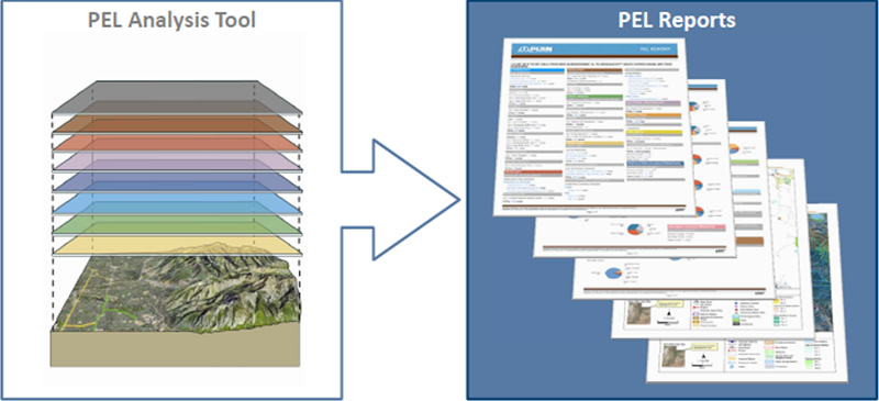
UPLAN summarizes the potential environmental impacts of proposed projects in a report.
Source: UDOT
UPLAN Tools Foster Collaboration and Increase Expediency
With UPLAN, transportation planners can assess the potential environmental impacts of proposed and planned transportation projects. In the tool, transportation planners can view critical environmental attributes such as streams, wetlands, rare plant habitats, historic sites, and other attributes simultaneously with planned transportation projects. Much of this environmental data are provided by State resource agencies; many agencies signed memorandums of understanding with UDOT to provide sensitive, non-public data for use in UPLAN.
For each project, UPLAN generates a PEL Report that summarizes all of the resources that are intersected by the project’s footprint. This report and an accompanying factsheet that provides information related to the project needs, forecasts, conditions, and other current and planned work in the area, are shared with stakeholders to facilitate discussion about the potential resource impacts.
Within the UPLAN tool, decision-makers determine the viability of a project based on its potential impacts by viewing project alignments and adjacent resource and transportation data. Comments can be made directly in the online workspace, which are recorded and linked spatially to the project through an interactive map. This feature allows users to quickly see and understand the specific areas of the project with which various stakeholders have questions or concerns. The early evaluation of potential impacts also helps the agency to more accurately anticipate the overall project development schedule and cost.
In addition to streamlining the data gathering process, UPLAN has also helped to facilitate the transfer of planning data and information for use in project development. The PEL report helps staff determine a project’s appropriate class of action under National Environmental Policy Act (NEPA). In addition, UDOT has piloted the use of the PEL Report to support documentation for compliance with NEPA for preservation projects that qualify as a Categorical Exclusion (CE). In the future, UDOT is looking to further streamline this process by automating the workflow to auto-populate sections of the CE based on the PEL report.
Based upon the successful application of the UPLAN analysis to support CEs, UDOT may also use the tool to support documentation for larger, more complicated projects that require an Environmental Assessment or Environmental Impact Statement. For example, some resources, such as Section 6(f) lands, geology and soils, and floodplains, could be evaluated within UPLAN and the results directly incorporated into the NEPA documentation.
Benefits
UPLAN offers streamlined and centralized data gathering and visualization, simple and organized communication of opportunities, and one-step reporting – all of which are essential to improving project delivery timeframes while avoiding or minimizing impacts on natural resources.
UDOT’s implementation of UPLAN has strengthened relationships among local, State, and Federal agencies as well as with community stakeholders; it has helped UDOT prioritize projects based on resource sensitivities, time and financial constraints, and the level of public involvement; and it has made data more accessible and available to both internal and external audiences, which promotes accountability and transparency at UDOT and related agencies.
UDOT is continuing to develop and systematize UPLAN. As more users join the platform, more opportunities for collaboration, increased efficiency, and improved environmental planning arise.
UPLAN Supports Programmatic Mitigation
UDOT used UPLAN to support analysis for its Programmatic Biological Assessment (BA) for the Utah prairie dogs, which streamlines the Section 7 Consultation by eliminating the 135-day consultation period on a project by project basis. Using the UPLAN tool, UDOT and the U.S. Fish and Wildlife Service conducted one single Section 7 consultation that “cleared” an entire sub-set of projects for a 20-year period.
UDOT conducted a GIS analysis to identify locations where Utah prairie dog habitat intersected highways. UDOT used the data in UPLAN to identify the quality of the habitat and to assess temporary and permanent impact acreage for projects that fell within those areas. This analysis informed the number of credits that UDOT purchased on the Utah prairie dog habitat exchange in order to meet its environmental mitigation requirements.
The Programmatic BA enabled UDOT to streamline compliance with the Endangered Species Act while ensuring conservation of the Utah prairie dog. Without the agreement, UDOT would be required to repeat the Section 7 consultation process for each project, which can take as long as 135 days.
For more information on UPLAN please visit https://uplan.maps.arcgis.com/home/index.html or contact Brandon Weston, UDOT Environmental Services Director, at BrandonWeston@utah.gov. Click here to view an example PEL Report.
back to top

