Eco-Logical Grant Program Annual Report
April 22, 2011
 |
Prepared for:
Office of Project Development and Environmental Review
Federal Highway Administration
U.S. Department of Transportation
|
 |
Prepared by:
Multimodal Systems Research and Analysis
John A. Volpe National Transportation Systems Center
Research and Innovative Technology Administration
U.S. Department of Transportation
|
Acknowledgments
The U.S. Department of Transportation (DOT) Volpe National Transportation Systems Center (Volpe Center), in coordination with the Federal Highway Administration (FHWA), prepared this report, which was funded by FHWA's Office of Planning, Environment, and Realty's Surface Transportation Environment and Planning Cooperative Research Program (STEP). The project team included Haley Peckett of the Volpe Center's Transportation Systems Planning and Assessment Division, Julianne Schwarzer of the Volpe Center's Program and Organizational Performance Division, and Kirsten Holder of MacroSys.
Methodology
The Volpe Center project team collected data for this report through several methods. First, it conducted 30-to-60-minute telephone discussions with grant recipients over a two-month period. The Volpe Center project team then supplemented the telephone discussions with data collected while reviewing grant quarterly progress reports, final reports, and products submitted in 2010, as well as through ongoing monitoring of the grant program. The team then compiled, analyzed, and synthesized the data into project summaries and findings. Additionally, the Volpe Center compiled a list of presentations that grant recipients gave, which is included as Appendix A.
Table of Contents
Back to top
Executive Summary
The Federal Highway Administration's (FHWA) Eco-Logical grant program funded 15 projects to implement the principles that are outlined in the 2006 multiagency publication Eco-Logical: An Ecosystem Approach to Developing Infrastructure Projects (Eco-Logical).
The goals, accomplishments, lessons, and implementation steps of grant recipients from January through December 2010, the third year of the FHWA grant program, are included in this report. The findings are based on information gathered during discussions with grant recipients; reviews of grant-project final products, such as reports, websites, brochures, and analysis tools; and information from quarterly progress reports.
Most Eco-Logical grant recipients have completed the planning and development stages of their projects and have started implementation and stakeholder outreach. Their experiences demonstrate many lessons about the adoption of the Eco-Logical framework:
- Partner-agency participation is critical in order to effectively implement grant projects and build widespread support for the adoption of Eco-Logical principles. Several projects have made significant progress toward implementation. Partner organizations or multiagency steering groups were the main implementation agents.
- Leadership support for organizational culture change is essential for adoption of the Eco-Logical approach. Many organizations struggle to widely adopt Eco-Logical principles because their leaders are slow to accept such change.
- A strong understanding of Eco-Logical principles and the use of an integrated planning framework lead to greater success in the adoption and application of Eco-Logical grant projects.
- Transportation agencies partnered with non-transportation organizations to create tools that brought ecological considerations to the forefront of infrastructure planning.
- Targeted education and outreach are critical to the adoption of Eco-Logical. Grant recipients who focused on targeted outreach efforts had greater success in enlisting support for and adoption of Eco-Logical products and tools by regional stakeholders.
- A clear work plan helped grant recipients to achieve project goals and implement their Eco-Logical projects efficiently and effectively.
- Data updates, staff cutbacks, and leadership changes might cause support for the Eco-Logical approach to waiver, both within grant-recipient organizations and throughout their regions.
Suggestions for improving the Eco-Logical grant program:
- Sponsor a second round of the grant program to provide others with the opportunity to implement Eco-Logical pilots.
- Develop criteria and performance measures to ensure that future Eco-Logical grant recipients have the capacity and knowledge to implement Eco-Logical.
- Collaborate with signatory-agency partners and FHWA staff to provide targeted technical assistance and greater oversight to grant recipients.
- Improve awareness of Eco-Logical among FHWA Division Offices, State Departments of Transportation (DOTs), and regional offices of signatory agencies.
Back to top
Overview
In 2007, the Federal Highway Administration (FHWA) created the Eco-Logical grant program to pilot a new, ecosystem-scale approach to infrastructure development. The program funded 15 projects across the country that were aimed at applying the goals and principles outlined in the 2006 multiagency publication Eco-Logical: An Ecosystem Approach to Developing Infrastructure Projects (Eco-Logical). Figure 1 shows the names and locations of the grant recipients.
This third annual report supplements the Eco-Logical Grant Program Progress Report (February 2009) and the Eco-Logical Grant Program Annual Report (February 2010) and documents lessons learned and successes achieved during the third year of the Eco-Logical grant program (January through December 2010). The majority of grant recipients completed their projects during Calendar Year 2010.
The assessment of project successes and impacts is a major focus of this report. The report also summarizes the interim progress of each grant and provides findings in the following areas:
- Measuring success;
- Relationships between grant recipients and their partners;
- Project implementation; and
- Organizational adoption of the Eco-Logical approach.
Figure 1: Eco-Logical grant projects
Background of the Eco-Logical Program
The development of infrastructure facilities can adversely impact ecosystems by disrupting wildlife connectivity, degrading plant and animal habitats, and damaging watersheds. Current approaches to avoid, minimize, and mitigate adverse impacts to resources may not always provide sustainable environmental compensation. An interagency steering team1 created an infrastructure development process that enhances ecosystem sustainability and is sensitive to wildlife habitat, culminating in Eco-Logical: An Ecosystem Approach to Developing Infrastructure Projects, which was published in 2006. Eco-Logical encourages flexibility in regulatory processes under existing authorities. Specifically, it sets forth the conceptual framework for integrating plans and data across agency and disciplinary boundaries and endorses ecosystem-based mitigation.
Development of the Grant Program
The FHWA Office of Planning, Environment, and Realty developed and established the Eco-Logical grant program in 2007. FHWA selected 15 projects and provided a total of approximately $1.4 million in funding. Project activities included planning, data collection and analysis, mitigation, public education for sustainable streets, and prioritization of natural and cultural resources.
FHWA required grant recipients to provide matching funds greater than or equal to 50 percent of project costs. The grant periods of performance range from 12 to 40 months; several grants extended these intervals by three to 15 months to accommodate unforeseen challenges or changes in project scope. Nine grant recipients had completed their projects; eight completed their projects between January and December 2010 and Envision Utah completed its grant project in June 2009. The remaining six grant recipients completed reports, maps, interactive tools, stakeholder engagement campaigns, or other significant project milestones during the past year.
Back to top
Findings
Overall, grant recipients reported that the Eco-Logical grant has been a positive experience that has helped them to institute integrated planning processes and create ecosystem sensitivity in their own organizations and their partners' agencies. The findings from 2010 can be categorized into five main topics: successes, relationships, organizational adoption, implementation, and challenges.
Measures of Success
Grant recipients that understood the basic principles of Eco-Logical more successfully implemented their grant projects. Recipients who described the Eco-Logical approach in terms of broad ecosystem applications and the importance of working together with partner agencies and stakeholders demonstrated greater success. By better understanding Eco-Logical principles, they were more successfully able to apply the Eco-Logical approach and to develop concrete long-term plans for integrating and using the products they had developed through their Eco-Logical grants. These grant recipients entered into collaborative partnerships and identified priorities with their partners that helped them to complete their grant projects.
Conversely, less successful grant recipients did not strongly consider Eco-Logical principles during the planning, development, and implementation of their projects. Other recipients tried to complete the eight steps of integrated planning, as explained in the Eco-Logical document, but did not recognize the relationships between these steps and Eco-Logical's underlying goals of conservation, connectivity, predictability, and transparency. Grant recipients who demonstrated a weaker understanding of Eco-Logical were unable to adopt it within the practices of their organizations or more widely in their regions.
Successful grant recipients adopted grant products that informed the transportation-planning process. Many grant recipients considered adoption of Eco-Logical products, such as regional conservation priorities or data tools, or principles into the long-range transportation plan (LRTP) as the measure of successful organizational adoption. Such integration of the Eco-Logical products in the LRTP ensures that the region will at least consider the ecosystem when making transportation-planning decisions, which will help to achieve Eco-Logical's broader goals.
Grant recipients with completed projects intend to integrate their grant products into the LRTP or another such guiding document through the following actions:
- Adoption by the board of the Metropolitan Planning Organization (MPO) of the grant product or data into the goals or project-selection criteria for the LRTP. Some grant recipients developed their projects in partnership with the MPO to create a tool for use in the LRTP.
- Use of the grant product by transportation planners as a screening tool to select which projects should be included in the LRTP.
- The MPO publication of project maps in the LRTP as an advisory tool for local governments.
The Eco-Logical approach is compatible with the FHWA Livability Initiative and when agencies apply Eco-Logical they support the goals of the Livability Initiative. Eco-Logical emphasizes collaboration across agencies and disciplines and promotes integrated planning to achieve optimal environmental outcomes. Similarly, the FHWA Livability Initiative encourages interagency collaboration and integration of transportation, environmental, and land-use plans to create more transportation choices and livable communities.
The Sustainable Communities Partnership between DOT, EPA, and the Department of Housing and Urban Development (HUD) established six livability principles and a series of goals to improve livability in communities throughout the U.S. Through their Eco-Logical projects, grant recipients formed relationships and created products that address the goals of the Sustainable Communities Partnership. Specifically, grant recipients produced data tools that will lead to an increase in safe and ecologically sound transportation choices. Other grant recipients and their partners developed joint regional visions and resource priorities. They use these priorities to direct future growth towards existing communities and preserve intact resource areas. The strongest evidence for connections between Eco-Logical and livability comes from grant recipients that reported that their regions will have improved planning for future growth due to new interagency relationships and linkages between the transportation, land use, and environmental planning processes.
Due, in part, to the strong linkages between Eco-Logical and the Partnership, five grant recipients received a Sustainable Communities Regional Planning Grant from HUD to continue implementation of their Eco-Logical project or pursue related work. These livability-focused grants are intended to increase economic competitiveness through the linking of housing, jobs, schools, and transportation. The success of Eco-Logical grant recipients in the Sustainable Communities Regional Planning Grant Program demonstrates the close connection between pursuing the Eco-Logical approach and the Livability Initiative.
Grant recipients applied early project accomplishments to receive additional grants to continue project work. In many cases, the early outcomes from Eco-Logical grant projects enabled recipients to leverage additional funding for their projects from local, regional, State, and Federal agencies and NGOs. Many recipients planned to use these funds to update maps and data, conduct outreach and training, and integrate Eco-Logical products into agency plans and programs. Other grant recipients received grants for additional projects within their organizations but planned to integrate findings or tools from their Eco-Logical projects into the new work. Most grant recipients who received additional funding in 2010 will begin or continue project work using the new funding in 2011.
Table 1 lists grant recipients who received additional grants and funding partnerships for their Eco-Logical project implementation or related work; recipients not included in the table did not report receiving additional grants. The information is based on what recipients supplied during interviews. Additional grant awards and funding partnerships are one of several measures of project success.
Table 1: Additional funding partnerships of Eco-Logical grant recipients
| Type of Grant |
Chicago DOT |
TCRPC |
MARC |
LOSRC |
OSU |
NCDENR |
H-GAC |
TJPDC |
| Federal Government Agency |
|
HUD Sustainable Communities |
HUD Sustainable Communities
EPA Mitigation Strategy Workshop
|
HUD Sustainable Communities |
|
|
HUD Sustainable Communities |
HUD Sustainable Communities |
| State Government Agency |
Illinois EPA 319 Program |
|
|
|
Oregon EPA wetlands development grant |
NC Natural Heritage Trust Fund |
|
|
| Local/Regional Government Agency |
Chicago Metropolitan Agency for Planning |
|
|
|
|
|
|
|
| NGO |
|
|
|
Blue Ridge National Heritage Area
National Association of Regional Councils grant
|
Transportation Research Board Strategic Highway Research Program |
|
National Association of Regional Councils grant |
|
Grant recipients had several means of measuring the success of their projects. Table 2 aggregates the measures of success most commonly cited among grant recipients, along with the status of the success achieved for each project and measure.
Table 2: Measures of success among Eco-Logical grant recipients
Measure of
Success |
CO DOT |
Chi DOT |
TCRPC |
MARC |
TCSWCD |
NHA |
LOSRC |
NCDNR |
OSU |
CAPCOG |
H-GAC |
NCTCOG |
Envision Utah |
TJPDC |
EPA Region 6 |
| Formal adoption into transportation-planning process |
|
|
 |
 |
|
 |
 |
 |
|
|
 |
|
|
 |
|
| Use of plan/product by partners |
|
|
 |
|
|
|
|
 |
 |
 |
|
|
 |
|
|
| Signed Memorandum of Understanding or Agreement/Interagency working group |
 |
|
|
 |
|
 |
|
 |
|
|
 |
|
 |
|
 |
| Publication/dissemination of analytical tool |
 |
|
|
|
|
|
|
 |
 |
 |
 |
|
|
 |
 |
| Publication/dissemination of data |
 |
|
 |
|
|
 |
|
 |
 |
|
|
|
|
 |
 |
| Publication/dissemination of priority maps |
|
|
|
|
|
|
 |
|
|
 |
|
|
|
|
|
| Publication/dissemination of report or publication |
|
 |
 |
 |
|
|
|
|
 |
 |
|
 |
 |
 |
|
| Use of project products or tool in project selection |
 |
|
|
 |
|
|
 |
 |
|
 |
 |
|
 |
 |
 |
| Performance measures |
|
 |
|
 |
|
|
|
|
|
|
|
|
|
|
|
| Receipt of additional grants |
|
|
 |
 |
|
|
 |
|
 |
|
 |
|
|
 |
|
 Achieved measure Achieved measure
 Partially achieved measure Partially achieved measure
 Future plans to achieve measure Future plans to achieve measure |
Relationships Between Eco-Logical Grant Recipients and Their Partners
Grant recipients' key partners took ownership of the Eco-Logical grant project and helped with project implementation. Grant recipients who strategically engaged partner agencies and organizations realized greater success in implementing their projects. Evidence of this success included widespread use of Eco-Logical tools, inclusion of project priorities in conservation and infrastructure plans, and ongoing interagency collaboration to implement the grant project.
In previous years, grant recipients stated that they gained or strengthened relationships through working jointly on the grant project. In Fiscal Year (FY) 2010, recipients recognized the value of partnership in implementing their projects. Partner agencies helped to implement grant projects by providing funding for later project phases and including conservation and mitigation decisions. A few grant recipients created county-specific plans and worked with county governments to help them formally adopt recommendations from the plans.
Some grant recipients formed multiagency steering groups that provided input throughout the grant project. The steering groups helped recipients to create a final product that better reflected regional or State priorities. Several recipients formally established ongoing implementation committees through signed agreements.
Relationships between grant recipients and their partners led to broader institution of the Eco-Logical approach throughout the region. In addition to adopting specific grant products, such as plans or data tools, partners took an active role in broadening general support for the Eco-Logical approach in the region. For example, steering-committee participants helped to build political support for Eco-Logical within their organizations or among their constituents.
Grant recipients who did not engage stakeholders early in the process sometimes found it difficult to enlist their support later. The absence of key decisionmaker involvement from partner organizations led to grant products not being widely instituted or adopted by influential regional organizations.
Grant recipients expect that relationships gained or strengthened through project work will bring future benefits. Staff from regional planning agencies (RPAs) and MPOs formed new relationships with local government staff. Staff expects these relationships to help their RPAs and MPOs direct future regional planning to meet local needs. MPO staff anticipates more meaningful engagement with resource and regulatory agencies during consultation for future LRTPs or consultation with additional agencies beyond those required by Federal law. Several grant recipients invited their partner agencies to participate in projects on which they might not have previously collaborated.
Resource-agency grant recipients partnered with transportation agencies to more successfully implement their grant products. Eco-Logical grants provided an opportunity for resource-agency grant recipients to establish new relationships with FHWA, State DOTs, and MPOs. The Eco-Logical process helped resource agencies to better understand the transportation-planning process and the role of environmental mitigation in infrastructure development. Collaboration between transportation and non-transportation agencies and organizations also increased the impact of grant projects in many ways, such as the adoption of products into LRTPs.
Similarly, transportation-based grant recipients successfully enlisted resource agencies to add new environmental considerations to infrastructure planning. Regular communication and identification of program intersections among Eco-Logical's signatory agencies could provide a good model for local and State organizations to better understand the missions of their partner agencies.
Organizational Adoption and Implementation of Eco-Logical
Grant recipients successfully raised awareness of the Eco-Logical grant project throughout their organizations. Through a combination of environmental, land-use, and transportation planning, Eco-Logical projects can be integrated into existing tools and programs. For many recipients, the grant project strengthened organizational support for Eco-Logical principles by providing an integration tool to incorporate those principles into the organization's programs. Grant recipients integrated data, methodologies, or analysis tools from the Eco-Logical project into their established programs. One recipient used data gathered for the Eco-Logical process to update existing environmental analysis tools. Grant recipients also increased organizational awareness by giving presentations at internal board meetings and interdepartmental staff meetings over the course of the grant project.
Some grant recipients relied on outside organizations to implement grant projects. Some recipients collected data and/or created a tool intended for other organizations to use, such as in transportation-project selection or identification of mitigation opportunities. These grant recipients lacked the jurisdiction or funds to implement projects independently and viewed outreach as especially critical. Recipients that had to rely on other organizations for implementation reported greater initial challenges in instituting the grant project or slower adoption in their region.
Grant recipients targeted their educational and outreach efforts to selected stakeholders with greater capacity for project implementation. These stakeholders included local governments with land-use jurisdiction, State DOTs that funded new infrastructure and mitigation projects, and environmental organizations that applied natural resource data to conservation projects. These groups had the potential to integrate Eco-Logical products and principles into policies, regulations, and infrastructure.
Grant recipients used outreach as a means to broadly implement completed projects. Recipients used outreach techniques to help raise awareness of grant projects and to increase regional adoption of Eco-Logical products. Recipients hosted regional workshops, trained partners and local governments, produced publications, and conducted informal communications about their grant products. At least one recipient's product centered on education and outreach for a larger ecosystem effort. Additionally, grant recipients shared their projects through presentations before local, State, and national audiences, as detailed in Appendix A.
Some recipients focused on outreach as the main means to implement their projects. However, implementation was more successful when grant recipients combined outreach with concrete actions to integrate Eco-Logical products into planning efforts.
Challenges and Solutions for Implementing the Eco-Logical Approach
Adoption of the Eco-Logical approach required leaders who were willing to embrace organizational culture change. There were challenges in convincing colleagues and partners of the value of the Eco-Logical approach, in part because it relies on a fundamentally different attitude towards infrastructure development. Leaders of some agencies and organizations were reluctant to shift their business practices to adopt the Eco-Logical approach without significant evidence of its benefits. Some grant recipients aimed to use their Eco-Logical projects to prove the benefits of integrated planning to organizations that remained skeptical, in the hope of enlisting their future support. In most cases, the required organizational change must evolve over time, as leaders recognize positive outcomes from Eco-Logical projects.
The overall economy creates opportunities for planning but can also delay transportation-project delivery and process innovation. The current economic climate has led to a decrease in development activity in many regions. This lull provides local government and environmental agency staff with time to conduct long-term planning, such as prioritizing conservation opportunities and strategizing for smarter growth. The slowed development and reduced spending also caused delays and uncertainty in transportation projects. The uncertainty in the transportation-development timeline reduces predictability for grant recipients trying to implement their projects, while the decrease in revenue related to development projects has reduced available staff and financial resources for innovative programming. Grant recipients frequently cited the challenge of limited staff time devoted to the Eco-Logical grant project. The Eco-Logical process is designed to save time and money in transportation delivery.
Grant recipients anticipated that they would struggle to keep their grant products and data up-to-date. Recipients expected that they would need additional resources to keep data-based products updated. Maintaining current information on natural resources, infrastructure, and regional growth, and having the resources to input these data, will be imperative to the future utility of spatial and data-analysis tools. Several grant recipients have applied for additional funding for future data updates. Additionally, future technology changes may affect the utility of data-based tools, as software, data-collection methods, and recipients may need to update technical aspects of their data tools or inputs in several years.
Grant recipients encountered unexpected delays that resulted in missed deadlines or unachieved goals. Several grant recipients crafted work plans and allocated resources to meet project goals, but they experienced setbacks from factors beyond their control. EPA Region 6, for example, was unable to get data from the State of Louisiana due to the 2010 oil spill in the Gulf of Mexico and several other regions experienced delays from major weather events.
Back to top
FHWA's Eco-Logical Activities
The FHWA Office of Project Development and Environmental Review engaged in additional activities to support the agency's Eco-Logical program and build on lessons learned over the past few years. These activities included meetings among Eco-Logical signatory agencies,2 the publication of Eco-Logical Successes, the first in a series of Eco-Logical webinars, and a study of the ITEEM pilot. The findings for 2010 relative to grant recipients offer insights on how organizations in the field are implementing the Eco-Logical approach. This section of the report draws connections between these findings and other activities in the FHWA Eco-Logical program. These insights help inform the selection of activities that will continue the implementation of Eco-Logical on a national scale.
Eco-Logical signatory-agency meetings. FHWA supports ongoing meetings and collaboration among Eco-Logical signatory agencies to identify opportunities where it can provide guidance and support to groups shifting toward the Eco-Logical approach. In 2010, the signatory agencies reconvened to discuss methods for more broadly implementing the Eco-Logical approach in their business practices and those of their local and regional counterparts. The signatory agencies have also begun to identify points of overlap between their respective Eco-Logical-based activities. These overlaps may lead to opportunities to incorporate Eco-Logical principles into multiagency activities.
Eco-Logical Successes publication. Eco-Logical Successes contains brief summaries of signatory-agency programs that implement or include Eco-Logical principles. This publication includes the goals and activities of each agency's programs as well as information on one program from each agency. FHWA will distribute the publication as an outreach tool in 2011.
Eco-Logical webinars. FHWA launched a series of webinars to share the successes and lessons of the Eco-Logical program more broadly before a national audience. FHWA hosted the first webinar in the series, entitled “The Eco-Logical Approach as a Path to Livability,” in October 2010. The webinar, which focused on an audience of grant recipients, included three presentations by recipients and a fourth by FHWA's Office of Human Environment.
Montana ITEEM study. The ITEEM Eco-Logical pilot represents one of the earliest attempts to implement the Eco-Logical approach. To learn about the benefits and challenges of implementing Eco-Logical over a multi-year period, FHWA conducted a study of the ITEEM pilot, which included interviews with multiagency stakeholders and a site visit to western Montana. The study provides insights on how the ITEEM pilot was able to implement the Eco-Logical approach through the collaborative efforts of an interagency team working along Montana's Highway 83 corridor.
Eco-Logical grant recipients have a great deal in common with other organizations that are implementing Eco-Logical, including ITEEM participants and other programs of Eco-Logical signatory agencies. The shared lessons, summarized below, can help to inform FHWA on how to broadly implement the Eco-Logical approach and how to shift infrastructure planning and implementation to be more ecologically sensitive.
ITEEM participants and signatory-agency representatives cited challenges in implementing Eco-Logical similar to those expressed by grant recipients. This suggests that implementing organizations will need to devote more consideration or effort to several steps or elements of the Eco-Logical approach. Both grant recipients and ITEEM participants recognize the cost of staff commitment as a barrier in the Eco-Logical process. Also, most implementing agencies have yet to see tangible mitigation or conservation projects that resulted directly from the Eco-Logical approach, due to the long timeline between project planning and infrastructure- and mitigation-project development, with the exception of Envision Utah, as described later in this report. By identifying common challenges in the Eco-Logical process, FHWA can better target improvements and technical assistance in the future.
Eco-Logical grant recipients and signatory agencies, as well as ITEEM participants, overcame challenges and accomplished project milestones. The solutions developed through these implementations of Eco-Logical will help other groups to successfully implement the Eco-Logical approach. Successful practices included the following:
- Develop clear goals and work plans. Several grant recipients, including H-GAC and ITEEM participants, cited the use of a work plan and clear documentation to guide the accomplishment of project goals. The work plan helped these organizations to more efficiently enlist support and fulfill project activities, such as data collection and analysis.
- Establish stakeholder participation and roles. Organizations that were successful at implementing Eco-Logical identified the partners needed to help achieve project goals. Implementing organizations enlisted partners to collect data, serve on steering committees, and raise awareness about the final product. Organizations that established these roles at the outset had greater success than those that solicited partner support later in the process.
- Encourage partner agencies to adopt the Eco-Logical process. The success of an Eco-Logical project depends on it being instituted within both the lead agency and partner agencies and local governments. Organizations that could explain Eco-Logical's benefits had greater participation from partners and raised awareness and support among stakeholders throughout the region.
- Keep stakeholders engaged through frequent engagement and concrete tasks. Once the Eco-Logical project is complete, stakeholders can help with ongoing implementation and outreach. Eco-Logical initiators that engaged stakeholders early on, through formal committees, trainings, workshops, or regular communication, reported greater success and efficiency at instituting the Eco-Logical approach in their regions.
The FHWA Eco-Logical grant project, signatory-agency activities, and the ITEEM program demonstrate that organizations can apply the Eco-Logical approach across a diverse array of circumstances. Several broad findings on diverse applications of Eco-Logical across FHWA programs include the following:
- Eco-Logical brings benefits to transportation, resource, and regulatory organizations. Organizations implementing Eco-Logical represent not only transportation but also resource and regulatory agencies, indicating the potential for Eco-Logical to bring value to agencies outside the transportation realm. The Eco-Logical process requires the participation of each type of agency and is most likely to be successful when all agencies are working together.
- Eco-Logical can be applied on multiple geographic and political scales. Several projects included data collection for entire States or regions, producing valuable tools and reaching a large number of potential users. The Eco-Logical approach can bring benefits to local, State, and Federal agencies.
Back to top
In addition to Eco-Logical, FHWA has many signature environmental programs, or major initiatives with environmental components. These programs and initiatives interlace with Eco-Logical and understanding their intersection can help ensure more collaborative and environmentally sensitive processes and outcomes for transportation projects nationwide.
Every Day Counts (EDC). The FHWA EDC Initiative is a nationwide program designed to identify and deploy innovation that is aimed at shortening project delivery, enhancing road safety, and protecting the environment through a series of highly effective initiatives. FHWA Administrator Victor Mendez launched EDC through a series of national innovation summits. Based on these summits, States will determine the specific EDC initiatives that best fit their region and will begin to implement these initiatives.
Eco-Logical meets all three of the EDC goals and the application of Eco-Logical employs several of the tools and initiatives highlighted by EDC: Planning and Environment Linkages, Use of In-Lieu Fee and Mitigation Banking, Expanding Use of Programmatic Agreements, Flexibilities in Right-of-Way and Clarifying the Scope of Preliminary Design. Most projects that are implementing Eco-Logical are already meeting the goals of EDC, through activities that directly relate to these EDC initiatives.
Planning and Environment Linkages (PEL). FHWA developed PEL as an approach to transportation decisionmaking that considers environment, community, and economic goals early in the planning process and carries them through project development, design, and construction. FHWA promotes PEL through tools, training, and demonstrations of effective practices.
PEL and Eco-Logical are closely linked programs that integrate environmental considerations into the transportation planning process. FHWA broadly supports both programs to achieve better interagency coordination and environmental outcomes for transportation projects.
Structured, Transparent, Accountable, Reproducible, Sustainable (STARS) Workshops. The purpose of the FHWA-funded STARS workshop series is to promote the exchange of ideas, data, tools, concepts, and methods for better collaboration and information exchange between transportation planners and environmental practitioners in support of a better integration of transportation and conservation planning into the project development process. Currently FHWA has planned six STARS workshops around the country.
The mission of STARS is linked closely to the Eco-Logical principles in that both emphasize multi-agency collaboration for better environmental and transportation outcomes. In the future STARS workshops could be used to implement Eco-Logical at the local and regional scale.
The Strategic Highway Research Program 2 (SHRP2). The purpose of SHRP2 is to improve the state of the transportation industry through short-term focused research. The Transportation Research Board (TRB) launched SHRP2 in 2007 and the program will conclude in 2015. SHRP2 has the following four primary research focuses: safety, renewal, reliability, and capacity. FHWA shares responsibility for the implementation of SHRP2 research.
Several of the SHRP2 capacity projects related directly to Eco-Logical and its implementation. These projects include: C01—A Framework for Collaborative Decision Making on Additions to Highway Capacity; C06A—Integration of Conservation, Highway Planning, and Environmental Permitting Using an Outcome-Based Ecosystem Approach; C06B—Integration of Conservation, Highway Planning, and Environmental Permitting through the Development of an Outcome-Based Ecosystem Approach and Corresponding Credit System; and C21—Pilot Test the C06 A&B Approaches to Environmental Protection.
Context Sensitive Solutions (CSS). CSS is a collaborative, interdisciplinary approach to planning and project delivery that involves all stakeholders in the development of a transportation facility that fits with its physical setting. The definition for CSS and context sensitive design stemmed from a joint conference for FHWA and the American Association of State Highway and Transportation Officials (AASHTO). This conference led to additional meetings and workshops that helped further define approaches to implement CSS. The CSS approach leads to preserving and enhancing scenic, aesthetic, historic, community, and environmental resources, while improving or maintaining safety, mobility, and infrastructure conditions.
Eco-Logical and CSS share many goals including appropriate engagement of relevant stakeholders in the transportation planning and project development processes, as well as the use of CSS principles to fit transportation solutions within their environmental surroundings.
Partnership for Sustainable Communities. Since 2009, the three agencies in the Partnership for Sustainable Communities have agreed to collaborate to help communities become economically strong and environmentally sustainable. Major focuses of the partnership include: interagency coordination of investments; more housing choices; efficient and reliable transportation systems; reinforcement of investments in existing communities and infrastructure; and support for vibrant and healthy neighborhoods that attract businesses.
Eco-Logical directly supports several of the key principles and goals of the Partnership for Sustainable Communities, including emphasizing interagency collaboration and integrated planning. Eco-Logical grant projects in urban and metropolitan region settings have already begun to adapt the work done through their Eco-Logical grants to meet the goals of the Partnership for Sustainable Communities.
Sustainable Highways Self-Evaluation Tool. The FHWA Sustainable Highways Self-Evaluation Tool allows users to identify characteristics of sustainable highways. The Tool then provides information on ways organizations can apply and integrate sustainability best practices into highway and other roadway projects and programs.
Many of Eco-Logical's founding principles are described as credits that transportation organizations can receive through their use of the Sustainable Highways Self-Evaluation Tool. The implication is that in the future States and regions will be able to receive credit for applying Eco-Logical to transportation projects.
Back to top
Conclusions
As many Eco-Logical grant recipients moved towards completion and implementation of their projects, they identified factors that facilitated success and helped them to overcome challenges in the Eco-Logical process. All of the recipients reiterated the importance of multiagency involvement and adoption, of having a work plan to guide the achievement of project goals, and of maintaining leadership support for the Eco-Logical approach.
In FY2011, FHWA can play an important role in ensuring the success of Eco-Logical pilot projects that are both within the grant program and elsewhere in the country. Through financial support and technical expertise, FHWA can enable the successful implementation of existing grant projects. FHWA can also apply the lessons learned through the first round of Eco-Logical grants to help other organizations implement Eco-Logical. Establishing a second round of grants, with selection criteria based on the successes of existing grant recipients, will advance FHWA's goal of more widely adopting the Eco-Logical approach.
Back to top
Grant Projects
FHWA funds 15 Eco-Logical grants across the nation. This section includes information on each grantee's status, accomplishments, and challenges from January through December 2010, providing summaries of individual projects and highlighting outcomes and challenges to date.
Developing a Regional Ecosystem Framework for Terrestrial and Aquatic Resources along the I-70 Corridor: An Eco-Logical Field Test
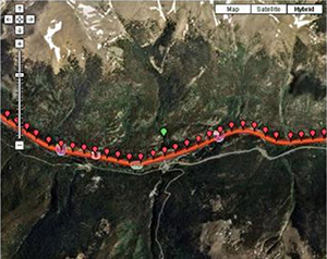
Website for the public to report wildlife sightings on I-70. (Courtesy of I-70 Wildlife Watch)
Colorado Department of Transportation
| Total cost: |
$323,330 |
| FHWA share: |
$152,500 |
| Period of performance: |
36 months |
| Dates: |
May 22, 2008 – May 22, 2011 |
| Status: |
In progress |
| AOTR: |
Dennis Durbin/Bethaney Bacher-Gresock |
| Grant-project website: |
No longer available |
Project Goals
The goal of the Colorado Department of Transportation (CDOT) Eco-Logical grant project is to help CDOT identify mitigation projects to improve wildlife connectivity for the Interstate 70 (I-70) corridor. CDOT created a Regional Ecosystem Framework (REF)3 for the corridor that incorporates wildlife-habitat and crossing data into a Geographic Information System (GIS) database. CDOT staff and their multiagency partners will use this data tool to inform mitigation decisions along the corridor.
Project Accomplishments
In 2010, CDOT inventoried connectivity opportunities and current wildlife crossings along the I-70 corridor. The project team then used GIS to categorize opportunities and observations, creating a draft analysis tool. The team met annually with a multiagency stakeholder group consisting of representatives from local governments, State and Federal agencies, and local NGOs. CDOT engaged the stakeholder group as part of its larger I-70 Context Sensitive Solutions (CSS) corridor analysis. The group discussed corridor projects and provided the project team with a forum for outreach and feedback on wildlife-connectivity data and tool applications. In addition to the project website, CDOT maintains a related website for the I-70 CSS corridor analysis that documents the CSS decisionmaking process and the roles of each agency. The transparency of the process and roles has strengthened stakeholder involvement and interagency relationships.
Evaluation and Lessons Learned
The project team recognized several limitations with implementing its Eco-Logical project. The economic climate limited the resources available for enhanced mitigation activities. The team believed that the tool would improve the ecosystem benefits of required mitigation but that enhancement activities might remain unfunded, especially for smaller projects, unless CDOT leaders strongly support them. The project team predicted that the early connectivity analysis would enable planners to effectively incorporate wildlife information into their transportation projects despite long planning and construction timelines. Additionally, the team thought that the most useful outcomes of the project would be relationships with partner agencies and the collaborative model for conducting business along the corridor.
Future Steps and Implementation
The project team is working to bring connectivity issues to the forefront of the infrastructure-planning process, as these concerns are often less straightforward than technical and engineering project components. In 2011, the team plans to compile connectivity opportunities into a tool to identify current and ideal connectivity along the I-70 corridor. CDOT predicts that this model will be useful for collaborative planning along other corridors in Colorado. CDOT is preparing an Environmental Impact Statement (EIS) that covers projects in the corridor from Denver to Glenwood Springs; the EIS will incorporate connectivity opportunities identified through this grant project.
Back to top
Sustainable Infrastructure Standards for Urban Ecology
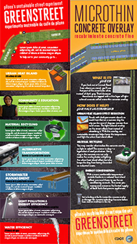
Educational and graphic interpretation on best practices for construction and materials. (Courtesy of
CDOT)
Chicago Department of Transportation
| Total cost: |
$147,608 |
| FHWA share: |
$73,281 |
| Period of performance: |
40 months |
| Dates: |
August 22, 2008 – December 16, 2011* |
| Status: |
In progress |
| AOTR: |
Kevin Moody |
| Grant-project website: |
No longer available |
| * Indicates an extension of the interval of the period of performance |
Project Goals
The Chicago Department of Transportation (CDOT) Eco-Logical grant project covered the outreach and education components of the construction of a sustainable streetscape pilot using Leadership in Energy and Environmental Design (LEED) principles. These components consisted of a regional educational workshop, completed in 2009; publication of a sustainable design manual; and production of educational kiosks and brochures. When complete, the Eco-Logical products will be used to inform regional governments and the public about LEED principles and provide residents with information on how to integrate low-impact strategies into their travel and household patterns.
Project Accomplishments
CDOT has completed 25 percent of the streetscape construction for the pedestrian, bicycle, parking, and planter improvements. CDOT expects to finish construction in the summer of 2011. Due to construction delays, the project team was unable to finalize its educational materials, because some of the content relies on data that will be gathered during final construction. The team has completed much of the draft content for its sustainable design manual, including goals and other technical information, and circulated the draft among regional peer agencies for review. In addition, the team sent educational materials, including Chicago's Sustainable Streets Program brochure and hybrid signs, to local citizen groups for review. The program brochure includes the project's sustainability goals, a guided walking tour of the pilot, and an explanation of LEED technologies. CDOT is collaborating with the Chicago Climate Action Plan team to highlight sustainable practices that residents can incorporate into their daily lives. The project team works closely with nonprofit organizations and the Benito Juarez High School to involve the community in the construction of the streetscape.
Evaluation and Lessons Learned
The project team worked to educate staff in other city departments about changes in design and material specifications that incorporate sustainable principles. The team recognized that some new principles can be incorporated into standard practice quickly while other strategies may take longer. CDOT encountered some challenges in obtaining data from contractors, related to the origins of construction materials and the percentage of recycled materials. CDOT needed this data to fulfill a series of project-performance metrics and test LEED principles. To monitor performance metrics, a CDOT engineer collected weekly data updates and compared findings with project goals.
Future Steps and Implementation
Upon completion of construction, CDOT will integrate project data into its design manual and educational material, solicit comments, and finalize public documents. To show the positive impact of the pilot, CDOT will use its performance metrics to measure the change in environmental impacts and travel on the street. CDOT hopes that the demonstration project and design manual will serve as examples for future project managers both within CDOT and in other transportation agencies.
Back to top
Regional Transportation, Ecosystem, and Land-Use Integration Plan
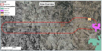
The Big Plan analysis of Illinois Route 336 between Peoria and Macomb. (Courtesy of
TCRPC)
Tri-County Regional Planning Commission (Illinois)
| Total cost: |
$218,954 |
| FHWA share: |
$109,477 |
| Period of performance: |
24 months |
| Dates: |
April 4, 2008 – April 3, 2010 |
| Status: |
Complete |
| AOTR: |
Neel Vanikar |
| Grant-project website: |
https://tricountyrpc.org/ |
Project Goals
The goal of the Tri-County Regional Planning Commission (TCRPC) Eco-Logical grant project was to complete an integrated planning document known as “The Big Plan,” which focuses on methods to improve the sustainability of the transportation system with respect to ecosystems in the Peoria region. The Big Plan includes regional priorities and strategies for land-use and infrastructure development, policy concepts, GIS-based scenario-planning models, and technical implementation.
Project Accomplishments
In September 2010, TCRPC completed The Big Plan, which created a regional vision focused on five themes. The Plan contains regional data, discussion of the themes, and concept plans that integrate transportation, land-use, and environmental planning. TCRPC engaged in public education and outreach components to encourage more widespread adoption of the Plan. As MPO for the Peoria region, TCRPC is coordinating internally to integrate the Plan's themes and concept plans into project selection for the Transportation Improvement Program (TIP) and the long-range transportation plan (LRTP). Peoria County adopted the Plan's recommendations, and the two other counties in the region are in the process of doing so. Other municipalities support specific Plan elements, such as green infrastructure projects and mode shifts, but have yet to adopt the Plan.
Evaluation and Lessons Learned
TCRPC shifted the focus of The Big Plan to transportation planning after discovering that local governments in the Peoria region were more open to innovation in transportation planning, whereas they were less willing to embrace innovative land-use strategies. Recognizing that it could not require local governments to adopt the Plan's sustainable practices, TCRPC relied on education and outreach to encourage these government partners to adopt the Plan's findings and it worked closely with MPO staff to integrate sustainable transportation strategies into federally funded projects. TCRPC reported that GIS was extremely valuable in locating and analyzing natural resources, infrastructure, and regional growth.
TCRPC engaged several local governments and State agencies, including Illinois DOT (IDOT) and the Department of Natural Resources, in the Plan's steering committee. The committee clarified misunderstandings about the transportation-planning and design process. At the same time, TCRPC experienced difficulty in engaging other local governments and the State EPA due to staff turnover and distances between Peoria and government offices. Finally, some local engineers wanted to see more quantitative data on the monetary benefits of using green infrastructure strategies before they were willing to utilize them in transportation projects.
Future Steps and Implementation
TCRPC plans to involve resource agencies and the IDOT District Office in future outreach and education. TCRPC is also researching methods for using the TIP to implement more green infrastructure projects. It received a Sustainable Communities Regional Planning Grant, which will aid in implementation of its Eco-Logical project, including integration of the stormwater infrastructure into traditional infrastructure.
Back to top
An Eco-Logical Approach to Transportation Planning in the Kansas City Region
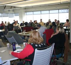
Stakeholders participate in meetings to devise the Action Plan. (Courtesy of
MARC)
Mid-America Regional Council
| Total cost: |
$180,000 |
| FHWA share: |
$90,000 |
| Period of performance: |
24 months |
| Dates: |
March 18, 2008 – March 18, 2010 |
| Status: |
Complete |
| AOTR: |
Mary Gray |
| Grant-project website: |
No longer available |
Project Goals
The Mid-America Regional Council (MARC) Eco-Logical grant project was aimed at building a framework for an efficient and sustainable transportation system in the Greater Kansas City region. MARC developed an Action Plan with the goals of formalized collaboration with regional partners, creation of a regional mitigation strategy, and alignment of transportation decisionmaking with a regional sustainability vision. Through their Action Plan, MARC sought to frame transportation priorities in the context of natural resource conservation and community goals.
Project Accomplishments
In 2010, the MARC project team worked with MPO staff to integrate the Eco-Logical product Linking Environmental and Transportation Planning: An Action Plan into its 2040 LRTP, which was adopted in June 2010. LRTP goals, performance measures, and project-scoring criteria were based on the Kansas City region's sustainability vision. (MARC's board of directors adopted the Action Plan in May 2009.)
Through a project workshop in 2008, MARC enlisted local officials, State and Federal agencies, and transportation planners to inform creation of the Action Plan. The multiagency advisory group that helped to create the Action Plan continued to meet quarterly to provide feedback on implementation and related programs. As the first official policy step in implementing the Action Plan, MARC has begun to establish a Memorandum of Understanding (MOU) with the advisory group.
Evaluation and Lessons Learned
Through the Eco-Logical project, MARC continued to work with existing partners and formed new relationships with State and Federal agencies. However, the advisory group struggled to reach consensus on MOU language due to the diverse priorities of participating organizations. MARC also recognized that State DOT partners were slower to adopt changes to their planning processes. MARC tried to overcome this challenge by investing more time in strengthening its relationship with State DOTs in the hope of encouraging gradual change. It also identified the additional ongoing challenge of defining the role of resource agencies in the MPO planning process.
Future Steps and Implementation
MARC is working both internally and through outreach to implement the Action Plan. Internally, MARC staff will integrate criteria related to the Action Plan into formal planning for several LRTP projects. For outreach, MARC plans to continue development of a regional ecosystems-based mitigation strategy, including hosting four workshops in 2010 and 2011. MARC received a Sustainable Communities Regional Planning Grant from HUD, which it will use to conduct a community initiative to study high-activity corridors. The corridor study will incorporate many of MARC's Eco-Logical findings. In addition to signing a MOU with its advisory group, the MARC project team would like to see local jurisdictions adopt principles from the Action Plan.
Back to top
Opportunities for Highway Programs to Remediate Natural Resource Concerns in New York
| Total cost: |
$232,390 |
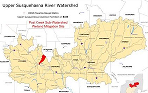
Upper Susquehanna River watershed. (Courtesy of Upper Susquehanna Coalition)
|
| FHWA share: |
$112,490 |
| Period of performance: |
36 months |
| Dates: |
March 4, 2008 – March 4, 2012* |
| Status: |
In progress |
| AOTR: |
Bethaney Bacher-Gresock |
| Grant-project website: |
No longer available |
| * Indicates an extension of the interval of the period of performance |
| |
Project Goals
The goal of the Tioga County Soil and Water Conservation District (TCSWCD) Eco-Logical project is to work with the New York FHWA Division Office and New York State DOT (NYSDOT) staff to develop an REF4. TCSWCD planned to use the REF to study the Susquehanna Basin and the Finger Lakes-Lake Ontario Basin to identify areas for conservation or mitigation. Due to project delays, the project team has an interim goal of establishing an in-lieu fee program in the Upper Susquehanna River Basin.
Project Accomplishments
In 2009, the project team collected natural resource, transportation-project, and conservation GIS data, which will be used to identify priority mitigation sites to streamline infrastructure development. TCSWCD expected NYSDOT to sign an MOU with the New York State Department of Agriculture and Markets in January 2011. The partnership with this department will allow all county districts to provide environmental support to NYSDOT.
In 2010, the non-profit Upper Susquehanna Coalition (USC) began to develop the region's first in-lieu fee program for the Susquehanna River watershed by identifying sites that NYSDOT can utilize for mitigation. USC is a network of soil and water conservation districts in New York and Pennsylvania with a mission to protect and improve water quality and natural resources. Through the new in-lieu fee program, USC is acting on behalf of TCSWCD in working toward interim project goals.
Evaluation and Lessons Learned
TCSWCD and USC benefited from positive relationships with the New York Department of Environmental Conservation, Fish and Wildlife Service, U.S. Army Corps of Engineers, and EPA. These relationships allowed USC to leverage funding to purchase and construct wetlands, conduct outreach to local community partners, and market accomplishments of the in-lieu fee program. The in-lieu fee program has been a positive addition to USC's Eco-Logical effort, enabling it to purchase land outright, work with partners to acquire wetland sites, and inventory other potential sites in the region. USC has learned that nonprofit organizations can more easily start an in-lieu program than institute a mitigation bank.
Future Steps and Implementation
Once the in-lieu fee program begins, USC will concentrate on maximizing property purchases. USC used its endowments to establish the nonprofit Wetland Trust, designed to protect wetlands and pay for long-term maintenance. The Trust will own the mitigation lands and manage the in-lieu fees, and USC will be responsible for the restoration work.
When the MOU is signed in 2011, TCSWCD plans to finish the Eco-Logical grant project by identifying mitigation sites for NYSDOT that are on State lands or that cross USC boundaries. TCSWCD looks forward to continuing its work pending receipt of matching funds from NYSDOT.
Back to top
Creating Tools to Support Integrated Transportation and Resource Planning in New Hampshire
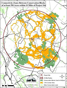
GIS-based wildlife-connectivity model with conservation lands and connectivity zones. (Courtesy of
NHA)
New Hampshire Audubon
| Total cost: |
$48,939 |
| FHWA share: |
$24,464 |
| Period of performance: |
20 months |
| Dates: |
September 1, 2008 – April 30, 2010* |
| Status: |
Complete |
| AOTR: |
Dennis Durbin/Bethaney Bacher-Gresock |
| Grant-project website: |
https://www.nhaudubon.org |
| * Indicates an extension of the interval of the period of performance |
Project Goals
New Hampshire Audubon (NHA) developed a connectivity framework to integrate transportation and land-use planning for the Eco-Logical grant project. NHA predicts that MPOs and RPAs will use the model and framework for environmental screening of transportation projects before they submit their connectivity framework to New Hampshire DOT (NHDOT).
Project Accomplishments
NHA and the New Hampshire Fish and Game Department developed a GIS-based wildlife-connectivity model to evaluate the impact of transportation projects on wildlife species. To create the model, NHA convened a working group with representatives from State and Federal agencies and conservation organizations. The impact analysis rated the resistance for 16 wildlife species by measuring how natural and unnatural barriers impacted the species abilities to move across the landscape. The analysis incorporated information on proximity to traffic, proximity of riparian areas, land cover, and slope. NHA also worked with the Rockingham Planning Commission to apply the framework to transportation projects.
Evaluation and Lessons Learned
While NHA has a long-standing relationship with State conservation agencies, the Eco-Logical grant program provided a new opportunity to initiate discussions with transportation-planning staff. A major challenge for NHA was engaging planners at NHDOT to incorporate the connectivity framework into State transportation planning. NHA addressed this challenge by suggesting that FHWA offer incentives to State transportation agencies. At the start of the grant period, NHA planned to apply the wildlife data to a transportation corridor to determine connectivity in the landscape, but it was unable to carry out this level of analysis within the grant timeframe due to staff and financial limitations.
Future Steps and Implementation
NHA plans to share the model and framework with other organizations that develop connectivity frameworks. The model could be integrated into highway and transmission-corridor planning and community development in New Hampshire and other States. The Maine Audubon Society is already applying a similar connectivity model. Maine Audubon and NHA want to involve conservation commissions, volunteers, and residents in a future GIS analysis of wildlife-connectivity data to inform future culvert replacement. Culvert replacements provide wildlife species a safe location to cross the roadway.
Back to top
Linking Lands and Communities in the Land-of-Sky Region
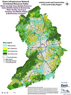
Green infrastructure map with biodiversity corridors and hubs. (Courtesy of
LOSRC)
Land-of-Sky Regional Council (Western North Carolina)
| Total cost: |
$208,000 |
| FHWA share: |
$104,000 |
| Period of performance: |
24 months |
| Dates: |
March 17, 2008 – March 17, 2010 |
| Status: |
Complete |
| AOTR: |
Mary Gray |
| Grant-project website: |
http://www.landofsky.org/ecdpast.html |
Project Goals
The goal of the Land-of-Sky Regional Council (LOSRC) Eco-Logical grant project was to develop a green infrastructure framework to identify priority ecological resources and areas suited for future development. Based on stakeholder involvement and data analysis, LOSRC expanded the initial project to encompass a larger boundary and created several publicly available resource maps. The infrastructure network presented data on water resources, agricultural and recreational lands, wildlife habitat, and cultural resources.
Project Accomplishments
LOSRC engaged several State and local resource agencies as partners to assist in data collection and in applying the framework to a wider audience of local and regional plans and projects. It enlisted the expertise of regional biologists and ecologists to ensure that wildlife habitat and corridor maps best reflected regional values and scientific data. In addition, LOSRC partnered with the Renaissance Computing Institute at the University of North Carolina-Asheville to conduct the analysis and produce maps. The French Broad River MPO, housed within LOSRC, incorporated maps and data from the framework in its LRTP update, which helped LOSRC to raise awareness of the framework beyond its stakeholder group.
With the support of the North Carolina Wildlife Resources Commission, LOSRC is conducting training workshops to disseminate the project methodology and findings for local government agencies to adopt. The audience at the first workshop included representatives from local government, land trusts, and councils of governments. The workshop helped others in the region to better understand LOSRC's mission and values, which the project team believes may lead to future project-based partnerships. LOSRC has worked closely with the Blue Ridge National Heritage Area, a federally designated multi-agency partnership, which would like to see LOSRC's infrastructure network replicated in other regions.
Evaluation and Lessons Learned
LOSRC crafted flexible data-collection and analysis methods, which allowed them to add another county to the analysis midway through the process to address expanding regional transportation patterns. In the early stages of outreach, LOSRC encountered challenges in communicating with some local and State agencies, several of which held different conservation and planning values. LOSRC recast its outreach efforts to emphasize that local governments could decide how to incorporate the data and framework into their planning activities. LOSRC also had difficulty engaging North Carolina DOT (NCDOT) transportation staff, as they are in different locations throughout the State and have complex systems for dividing planning and engineering work.
Future Steps and Implementation
LOSRC planned a second workshop for the City of Asheville, with representatives from local parks, recreation, and planning departments. LOSRC will continue to work with NCDOT and internal MPO staff to use the framework as a tool in infrastructure planning. LOSRC hopes to expand its outreach to help agencies in other regions replicate the project methodology.
Back to top
Integration of North Carolina's Conservation and Transportation Planning
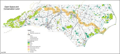
Sample open-space and conservation-assessment map from the project's Conservation Planning Tool.
North Carolina Department of Environment and Natural Resources
| Total cost: |
$274,257 |
| FHWA share: |
$136,689 |
| Period of performance: |
25 months |
| Dates: |
April 3, 2008 – April 30, 2010* |
| Status: |
Complete |
| AOTR: |
Dennis Durbin |
| Grant-project website: |
Content no longer available |
| * Indicates an extension of the interval of the period of performance |
Project Goals
The goal of the North Carolina Department of Environment and Natural Resources (NCDENR) Eco-Logical grant project was to produce a Strategic Conservation Plan for North Carolina that included wildlife-habitat and vegetation data. An intended application of the project was to improve the integration of conservation data into the transportation-planning process in coordination with NCDOT. In addition, State and regional planning agencies could use the data to inform their long-range planning.
Project Accomplishments
The grant project provided data on upland and non-riparian wetland habitats that enhanced the State wildlife action plan. NCDENR also digitized cultural resource features to demonstrate their role within the State's ecosystems. NCDOT began to apply the tool to transportation projects and North Carolina's Green Growth toolbox. The project team integrated the data into a conservation-planning tool, One NC Naturally, [no longer] available online to the public. With the help of other State agencies and regional partners, NCDENR reached out to over 1,000 potential data users at the municipal, county, and State levels, focusing on introducing them to the conservation tool and data sets. The website received 8,000 online requests and 5,000 written requests to download the data sets. NCDENR also reported strong support for the tool at the State level for use of the tool. NCDENR met with and gave presentations to regional planners and State agencies at the beginning of the Eco-Logical grant process, which improved its ability to collaborate with these partners.
Evaluation and Lessons Learned
NCDENR will need additional funding to address the challenge of maintaining accuracy of the natural resource data, which will become outdated as development occurs, or to develop a change-detection process to automatically update data. Change detection has been successful in some pilot programs, although it requires a State land-cover update.
NCDENR noted that Federal requirements for transportation planning could boost the use of the conservation tool and data. The Safe, Accountable, Flexible, Efficient Transportation Equity Act: A Legacy for Users (SAFETEA-LU) requires that transportation agencies address conservation plans in their LRTPs. This requirement improves NCDENR's ability to approach State DOTs and MPOs regarding the use of conservation tools, such as One NC Naturally, for transportation planning.
Future Steps and Implementation
NCDENR had limited resources to create a user-friendly web platform for the tool. Therefore, it has been less successful in sharing data with the general public than the project team had hoped. NCDENR plans to update its website to improve data availability and utility to the public, and to release a new data set in early 2011, once it has hired new staff. NCDENR hopes to share the project methodology, including the wildlife biologist's findings, so that other agencies can replicate the process.
Back to top
Using the Eco-Logical Approach to Develop and Implement Conservation and Mitigation Priorities for Oregon
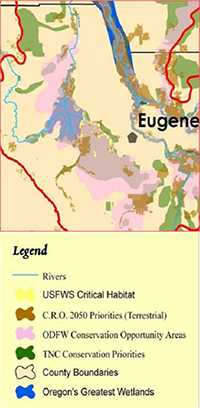
Integrated conservation priorities in the Willamette Basin. (Courtesy of
OSU)
Oregon State University
| Total cost: |
$101,552 |
| FHWA share: |
$49,962 |
| Period of performance: |
20 months |
| Dates: |
June 11, 2008 – February 11, 2010* |
| Status: |
Complete |
| AOTR: |
Mary Gray |
| Grant-project website: |
No longer available |
| * Indicates an extension of the interval of the period of performance |
Project Goals
Two project goals of the Oregon State University (OSU) Eco-Logical grant were to identify Oregon's conservation priority areas and to consolidate disparate data from each area into an online format. The project builds on the Oregon Conservation Strategy, an action plan for long-term conservation of wildlife and habitats developed by the Oregon Department of Fish and Wildlife, and the Comprehensive Mitigation/Conservation Strategy developed by the Oregon Department of Transportation (ODOT).
Project Accomplishments
The completed project tool has led to planning for mitigation and conservation projects that will be conducted in association with transportation projects. In a pilot study to apply the online tool broadly to the Willamette Valley, OSU demonstrated how projects could be characterized on the basis of priority areas. The two MPOs in this region began to use the tool after the completion of the pilot to inform their planning activities. The Department of State Lands and the Willamette Partnership are also currently using the tool. On the basis of its initial use, OSU hoped that the tool would help local governments to make better environmental decisions in future projects. In addition to performing the pilot study, the project team met with ODOT staff to provide instruction on how ODOT can implement project tools and decisionmaking techniques.
Evaluation and Lessons Learned
The project tool supported the selection of mitigation projects by identifying the likelihood of the presence of a threatened or endangered species. The resulting projects may be in the form of mitigation banks or may include ecosystem service markets, which is one goal of the Willamette Partnership. OSU has supported the efforts of local advocacy groups seeking to mitigate transportation projects through ecosystem-scale approaches.
OSU hoped to expand its mitigation tool to include data from across the State of Oregon. However, statewide data collection and aggregation posed several challenges to OSU, including the possibility that several State and regional agencies would be resistant to adopting the tool. Agencies in regions that face less development pressure than the Willamette Valley do not see the need for the tool or believe that its use will add expense to their projects. In response, OSU will demonstrate the tool's economic and ecological benefits as part of a related research effort sponsored by the National Cooperative Highway Research Program (Project 25-25, Task 67).
Future Steps and Implementation
While OSU had initial success in encouraging other agencies to adopt its tool, the project team wants to continue to expand the tool's application to mitigation projects throughout the State. OSU received funding through the Transportation Research Board's (TRB) Strategic Highway Research Program 2 (SHRP2) to pilot the methodology around the U.S. In association with the SHRP2 project, OSU is actively tracking the use of its data to demonstrate how the tool can be used at the national scale.
Back to top
Central Texas Greenprint for Growth: A Tool for Balancing Sustainable Conservation Goals with the Infrastructure Needs of Our Rapidly Urbanizing Region
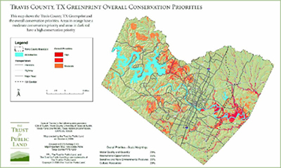
Travis County Conservation Priority Plan. (Courtesy of
CAPCOG)
Capital Area Council of Governments
| Total cost: |
$227,764 |
| FHWA share: |
$113,882 |
| Period of performance: |
24 months |
| Dates: |
May 16, 2008 – May 16, 2010 |
| Status: |
Complete |
| AOTR: |
Bethaney Bacher-Gresock |
| Grant-project website: |
https://www.capcog.org/ |
Project Goals
The goal of the Capital Area Council of Governments (CAPCOG) Eco-Logical grant project was to create a Greenprint for the region to help planners and transportation agencies plan for future growth. With input from regional and local stakeholder groups, CAPCOG's Greenprint for Growth plan prioritized the protection of water quality, ecological resources, farm and ranch lands, recreational and cultural resources, and scenic corridors. The Greenprint expanded on a previous CAPCOG project, the Travis County Greenprint, to include three other counties in the Austin-Round Rock metropolitan statistical area. (Williamson County did not participate.)
Project Accomplishments
CAPCOG completed the final report, maps, and opportunity areas for three additional counties in the region. The Greenprint for Growth integrated data into a GIS model that prioritized conservation opportunities and displayed them in a series of maps, available in PDF versions and on the >Greenprint website. During development of the maps, CAPCOG held a series of meetings with elected officials, technical experts, and county representatives to determine the county and regional priorities that informed the maps and the individual county-based Greenprint reports. The priorities from the Greenprint for Growth were included in the Bastrop County Comprehensive Transportation Plan and informed the selection of conservation easements and mitigation lands in Travis and Hays Counties.
Evaluation and Lessons Learned
CAPCOG successfully enlisted the participation of many organizations during Greenprint development but experienced challenges with some organizations upon implementation. While Texas DOT (TxDOT) was aware of the Greenprint, it was not actively engaged in incorporating priorities from the Greenprint into its transportation-planning and design process. CAPCOG would like its relationship with TxDOT to continue to improve. Through its partnership with the Trust for Public Land, which conducted outreach and meeting activities, CAPCOG improved its relationships with county governments and municipalities. CAPCOG received positive feedback from counties on the Greenprint for Growth, but the level of involvement and degree of integration of the Greenprint into the planning process varied. CAPCOG found that counties have not officially incorporated the Greenprint into their planning processes, instead relying on the Greenprint in a guidance capacity. Also, small counties had less staff capacity to participate in developing the Greenprint. However, these counties also had few or no environmental planners on staff and therefore would need to place more emphasis, in their planning work, on priorities identified in the Greenprint.
Future Steps and Implementation
CAPCOG continues to conduct follow-up with county government stakeholders to encourage the use of the Greenprint in infrastructure development and land-use planning. For example, CAPCOG is reaching out to counties to ensure that new staff are aware of the Greenprint document. CAPCOG also plans to improve availability of the Greenprint for wider use among local governments.
Back to top
Developing a Regional Decision-Support System for the Houston-Galveston Region
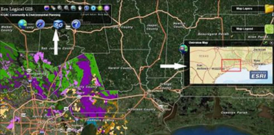
H-GAC online decisionmaking mapping tool. (Courtesy of H-GAC)
Houston-Galveston Area Council
| Total cost: |
$200,000 |
| FHWA share: |
$100,000 |
| Period of performance: |
27 months |
| Dates: |
March 13, 2008 – June 14, 2010* |
| Status: |
Complete |
| AOTR: |
Diane Turchetta |
| Grant-project website: |
https://www.h-gac.com/eco-logical |
| * Indicates an extension of the interval of the period of performance |
Project Goals
The goal of the Houston-Galveston Area Council (H-GAC) Eco-Logical project was to create a GIS tool, known as the Eco-Logical Mapping Tool, to identify environmental resource priority areas. The tool serves a regional need to balance growth with the conservation of natural resources, and it allows for the consideration of environmental impacts in the transportation-project prioritization process. The project team also aimed to create a methodology that could be replicated in other regions.
Project Accomplishments
H-GAC completed all resource mapping and published a web-based, interactive Eco-Logical tool in June 2010. The tool comprises over 12,000 mapped features covering six ecotypes. The project team and volunteers evaluated each feature on a number of metrics. Transportation planners can use the tool to overlay proposed projects on mapped resources in order to evaluate potential impacts. During production of the tool, H-GAC convened an advisory committee consisting of Federal, State, and local environmental agencies. This group determined appropriate metrics for each ecotype, evaluated mapped features, and provided general advice for considering environmental resources in transportation planning.
Since completion of the project, H-GAC has developed several mechanisms for outreach within the region, including a brochure for local governments, an interactive website, and an iPhone application. As part of external outreach, H-GAC hosted a well-attended webinar in December 2010, with participants from other planning organizations who could use the H-GAC model to create a tool for their own regions. The project team also coordinated with H-GAC's transportation staff to plan applications of the tool in project selection for the 2040 Regional Transportation Plan (RTP), which will be completed in 2012.
Evaluation and Lessons Learned
H-GAC faces a challenge in maintaining current data to keep the Eco-Logical tool timely. Due to time and resource constraints, the project team cannot replicate the fieldwork involved in creating the tool. Though the project team built mechanisms into the tool so that data would update automatically, these mechanisms may not keep pace with advancing technology. H-GAC hopes that its new data standards, established through Eco-Logical, will help with future updates. The project team's work plan guided H-GAC and its advisory committee in developing a tool that met project goals. Recognizing that the tool could not serve all of the region's needs, the team generalized components such as metrics and scale to meet the project's primary purpose of long-range transportation planning. Finally, H-GAC recognized the importance of the role of its partner resource agencies and nongovernmental organizations in adding credibility to the project outside of the transportation arena.
Future Steps and Implementation
As MPO staff within H-GAC develop the 2040 RTP, the project team will apply the tool to the prioritization of transportation and mitigation projects. H-GAC also wants to encourage more public awareness of the Eco-Logical process and the project tool at the local level. It hopes that its resource-agency partners will champion the project to help the Eco-Logical tool gain more momentum. H-GAC was awarded grants from the Sustainable Communities Regional Planning Grant Program and the National Association of Regional Councils, which will improve its ability to conduct outreach.
Back to top
North Central Texas Regional Ecosystem Framework
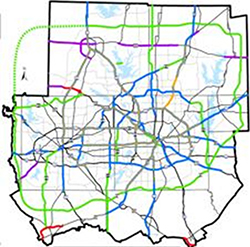
Recommended roadway projects in the
MTP. (Courtesy of
NCTCOG)
North Central Texas Council of Governments
Project Goals
The goals of the North Central Texas Council of Governments (NCTCOG) Eco-Logical project are to develop an REF5 to help agencies assess environmental impacts of proposed infrastructure projects and to enhance multiagency understanding of critical resource-protection areas. NCTCOG's REF is an overlay of the individual plans of city, county, Federal, and State agencies. NCTCOG also intended to analyze resource-agency management plans and GIS data to assess potential environmental effects, by watershed.
Project Accomplishments
NCTCOG developed a watershed-scale approach that integrated conservation data and infrastructure planning in the region. To assess the watersheds, NCTCOG assigned scores to subwatersheds on the basis of surface water, natural areas, habitat, impaired water segments, and other environmental data. NCTCOG also used data from the EPA Region 6 REAP in their grant project. The project team developed an REF users' guide to introduce the public to the watershed concept and a technical overview document to help other COGs replicate the process.
NCTCOG involved regional stakeholders, including Federal and State agencies, cities, counties, and water districts, in the development of the REF. For many local stakeholders, the Eco-Logical project was their first interaction with NCTCOG in relation to environmental activities. The project team created a customer relations management database to organize 1,000 project-related contacts by location, organization, and watershed. Feedback from resource agencies, including EPA, helped the team to strengthen the project methodology. The relationship with resource agencies also improved NCTCOG's ability to conduct outreach during the development of its Metropolitan Transportation Plan (MTP) and to meet the consultation goals of SAFETEA-LU.
Evaluation and Lessons Learned
NCTCOG had some difficulty with stakeholder consultation, as several stakeholders had goals and needs for the planning tool that conflicted with project goals. The project team recognized that the tool could not satisfy the needs of all agencies in the region. To overcome the challenge, NCTCOG set up a liaison group to engage stakeholders in the creation and improvement of the REF tool. It also educated resource agencies on the transportation-planning process. NCTCOG faced data-collection obstacles in terms of data currency, resolution, and willingness of partner agencies to contribute data.
Future Steps and Implementation
NCTCOG plans to produce a website for counties to use in land-use and infrastructure planning. The web-based tool will require significant data manipulation and will not be completed until after the grant period ends. NCTCOG reported that the Eco-Logical project grant is well integrated into other program areas within the agency and that the agency has grants and resources that will fund future Eco-Logical project work. In addition, NCTCOG would like to broaden application of the REF beyond transportation planning and to complete a pilot construction project to demonstrate use of the data.
Back to top
Blueprint Jordan River: A Lake-to-Lake Vision
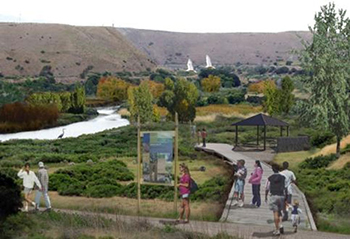
Vision of a nature preserve and public trail from the Blueprint Jordan River plan.
Coalition for Utah's Future/Project 2020
| Total cost: |
$208,000 |
| FHWA share: |
$85,000 |
| Period of performance: |
12 months |
| Dates: |
June 9, 2008 – June 9, 2009 |
| Status: |
Complete |
| AOTR: |
Frederick Bowers |
| Grant-project website: |
https://jordanrivercommission.com/vision/ |
Project Goals
The goal of the Blueprint Jordan River grant project was to develop a collective vision for the Jordan River corridor that integrated transportation planning and natural resource restoration. With community, local government, and State and Federal agency collaboration, the project team, coordinated by the public-private partnership Envision Utah, produced the Blueprint Jordan River vision document to guide development and restoration along the Jordan River.
Project Accomplishments
Envision Utah worked with planners, local government representatives, community members, and NGOs in Salt Lake and Utah Counties to guide the Blueprint Jordan River visioning process. Once the Blueprint document was complete, Envision Utah helped to establish the Jordan River Commission in November 2010 to implement the Blueprint vision. The Commission comprises representatives from the Utah Department of Transportation, Utah Transit Authority (UTA), and State resource agencies.
Envision Utah predicts that the Commission will be able to maintain stakeholder support and enthusiasm for low-impact development and regional use of the Jordan River corridor. The Commission will be responsible for raising funds to purchase critical lands, restoring wetlands, and completing capital projects for new trails, boat landings, bridges, and restrooms. The Commission will provide input during design review for riverside projects and will create a forum to discuss projects that may impact the river. Several planned and constructed projects that cross the river incorporate recommendations from the Blueprint. As an early sign of success, UTA selected a mitigation site that was included in the Blueprint report to offset impacts of one of its transit projects.
Evaluation and Lessons Learned
The relationships that Envision Utah developed during the grant project helped to increase awareness of stakeholder engagement in the Blueprint visioning process. As a small NGO, Envision Utah faces a challenge in changing the culture of regional planning. It does not have jurisdiction over local municipalities, several of which expressed some initial resistance to implementing the Blueprint's recommendations. Envision Utah worked to improve these relationships through stakeholder outreach, ongoing involvement, and establishment of the Commission.
Future Steps and Implementation
The Jordan River Commission will apply for grants that can help to fund future restoration projects. Eco-Logical helped Envision Utah to create new partnerships with transportation agencies, which will improve its ability to communicate with these agencies. Envision Utah will continue to use Eco-Logical principles in community outreach and planning projects.
Back to top
Integrating Green Infrastructure and Transportation Planning
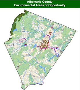
A page from the 2009
TJPDC Green Infrastructure Study. (Courtesy of TJPDC)
Thomas Jefferson Planning District Commission (Virginia)
| Total cost: |
$155,731 |
| FHWA share: |
$77,833 |
| Period of performance: |
36 months |
| Dates: |
May 20, 2008 – May 20, 2011 |
| Status: |
In progress |
| AOTR: |
Bethaney Bacher-Gresock |
| Grant-project website: |
https://tjpdc.org/ |
Project Goals
The goal of the Thomas Jefferson Planning District Commission (TJPDC) Eco-Logical project is to develop a green infrastructure plan to connect transportation, development, and natural resource plans in the five-county planning district. The project team developed two methodologies for streams and wetlands, which will be implemented with use of a GIS-based tool, to help transportation planners prioritize mitigation projects.
Project Accomplishments
TJPDC completed much of its methodology development in the past year. It also completed and implemented a draft version of the stream methodology and it is working with the State Department of Conservation and Recreation to implement the Department's wetland methodology. TJPDC used its technical advisory groups, which include resource-agency and local government representatives, to guide the methodologies for prioritizing wetland and stream mitigation projects. The TJPDC project team developed both methodologies to fit within the Federal and State regulatory framework and for application in its current planning products. TJPDC selected several projects from its regional transportation plans and overlaid them on the environmental resource maps. It then ranked the project list in order of importance for natural resources. The project mapping demonstrated the most appropriate places for protection and restoration.
Evaluation and Lessons Learned
The project team faced technical challenges in incorporating large data sets into GIS and obtaining data from some project stakeholders. The team has seen improvement in its relationships with environmental staff from the City of Charlottesville, planners, resource agencies, conservation districts, and State agencies. Through its initial grant products, TJPDC anticipates successful application of the methodologies to the regional transportation-planning process.
Future Steps and Implementation
TJPDC will finalize its stream and wetland methodologies and make them available as a GIS data set. It will then incorporate the data set into regional plans such as the LRTP. The project team suggested that Eco-Logical can give LRTP projects more environmental context during the planning process. The process traditionally has focused on politics and growth in the selection of transportation projects, but the next LRTP update will consider environmental components at the outset. Another project application is the informing of environmental inventories for local comprehensive plans. The project team is collaborating with the Nature Conservancy and the Virginia Aquatic Trust Fund to incorporate project data to inform its purchase of future mitigation projects. TJPDC is planning to present its findings more widely to increase the number of data-set users, particularly in rural areas within the Planning District.
Back to top
A Regional Ecological Assessment Protocol for the South Central United States
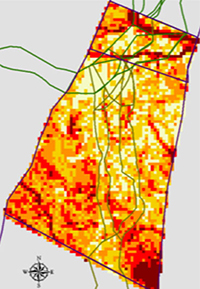
Integration of
REAP tool into
GISST. (Courtesy of
EPA Region 6)
U.S. Environmental Protection Agency, Region 6
Project Goals
EPA Region 6 developed a Regional Ecological Assessment Protocol (REAP) that uses a GIS analysis to classify land on the basis of its ecological significance. This project is an expansion of the Texas Ecological Assessment Protocol, which collected and analyzed data for the State of Texas. When complete, the REAP will comprise all five States in Region 6 (Arkansas, Louisiana, New Mexico, Oklahoma, and Texas). By incorporating data from the entire region, the REAP will portray significant ecological relationships across State boundaries and serve as a planning tool for local, State, and Federal agencies.
Project Accomplishments
In 2010, EPA Region 6 completed nearly all data collection for the REAP, with project staff collecting data by ecoregion. The ecoregion concept is a meaningful way to identify significant resources, as natural systems do not follow State or political boundaries. EPA Region 6 staff formed new, positive relationships with State Departments of Natural Resources in the region through the Eco-Logical project. They were able to work with State wildlife agencies to acquire species data to aggregate in the REAP model, a task that had previously been perceived as a major challenge. The project team also began to form relationships with State DOTs and FHWA Division Offices. It plans to concentrate on strengthening these relationships through outreach about the REAP upon project completion.
Evaluation and Lessons Learned
The large scale of the tool can better highlight resource relationships and rankings that might not appear in an analysis at the State scale. Unlike similar tools, the REAP tool has a clear methodology and requires data aggregation but no new data collection, which the project team believes will aid in its application. EPA Region 6 originally planned to complete calculations for the REAP by the end of 2010; however, unexpected events, including the 2010 oil spill in the Gulf of Mexico, caused a delay in acquiring data from some States. It now expects to complete final calculations in January 2011. EPA Region 6 anticipates challenges in ensuring that the REAP data remain up-to-date. As with all GIS tools, the REAP requires time to gather and update data from States. Also, running the program to perform REAP calculations is expensive and time-consuming for the tool managers. To avoid this obstacle, EPA Region 6 hopes to find a programming code to conduct calculations in real time as users update data.
Future Steps and Implementation
The data from the Eco-Logical grant project will remain an integral component of ongoing work in the EPA Region 6 office. As it completes the REAP tool, the project team will publish the data as a stand-alone data set and will incorporate it into several existing EPA tools for NEPA practitioners, such as the GIS Service Tool (GISST) and NEPAssist. The integration with these tools will increase the accessibility of the REAP for NEPA practitioners. EPA Region 6 would like to see REAP data integrated into these tools and used prior to the Draft EIS to help inform the transportation-planning process throughout the region. The REAP's question-based nature will allow it to enhance the capabilities of NEPAssist when the two tools are used together. As part of future outreach activities, EPA Region 6 plans to work with FHWA to identify contacts, communicate with State transportation offices, and conduct a webinar. EPA headquarters and other regions have shown interest in the REAP tool and would like to expand its use.
Back to top
Appendix A: Grant-Recipient Presentations (2010)
| Project |
Event |
| Colorado DOT |
| State |
Meetings with resource-agency partners |
| Chicago DOT |
| National |
American Society of Landscape Architects Annual Meeting
American Rivers, location unknown
FHWA Eco-Logical Livability Webinar
Greenbuild, Chicago
Joint Stormwater Conference, Milwaukee and St. Paul
National Women and Transportation Conference, Washington, DC
|
| State |
Illinois Chamber of Commerce |
| Local |
University of Illinois-Chicago
Greentown (local sustainability conference), Chicago
Chicago Architecture Foundation
Benito Juarez High School, Chicago
American Society of Civil Engineers, Chicago Chapter
|
| TCRPC |
| State |
Illinois Association of Regional Councils |
| Local |
Central Illinois Green Expo, East Peoria
PBS video interview on sustainable development, Central Illinois
Local government units
|
| MARC |
| None in 2010 |
| TCSWCD |
| Local |
Wetland Conference (in-lieu fee program) |
| NHA |
| Regional |
New England Wildlife Conference, Amherst, MA |
| Local |
Ammonoosuc NHA Chapter, Littleton, NH |
| LOSRC |
| National |
American Planning Association Conference, New Orleans
Blue Ridge Parkway/America's Great Outdoors Listening Sessions
Southern Appalachian Man and the Biosphere Conference, Gatlinburg, TN
|
| State |
Mountain Green Conference, Asheville, NC |
| Local |
Blue Ridge Sustainability Institute
Forum on Growth and Development at Western North Carolina
City councils, county boards, and extension groups
Local university planning classes
|
| NCDENR |
| National |
Southern Appalachian Man and the Biosphere Conference, Gatlinburg, TN |
| State |
North Carolina Wildlife Resource Commission
Presentations to additional Federal, State, and local agencies
|
| OSU |
| National |
National Association of Environmental Professionals Meeting, Atlanta
TRB Ecology Program
|
| Local |
Regional transportation organizations |
| CAPCOG |
| National |
FHWA Eco-Logical Livability Webinar |
| Local |
Presentations to county and city commissioners |
| H-GAC |
| National |
H-GAC Eco-Logical Tool Webinar |
| State |
Texas State Soil and Water Conservation Board |
| Local |
Galveston Bay Council
Houston Tomorrow
Houston Advanced Research Center
H-GAC Technical and Policy Committees
|
| NCTCOG |
| Local |
University of Texas-Arlington |
| Envision Utah |
| National |
American Public Transportation Association Annual Meeting, San Antonio
FHWA Eco-Logical Livability Webinar
|
| Local |
University of Utah planning and sustainability classes
Local governments and city councils
|
| TJPDC |
| National |
Association of Metropolitan Planning Organizations Conference, St. Louis |
| Local |
Soil and Water Conservation District Board |
| EPA Region 6 |
| National |
SHRP2 Symposium, Boulder
TRB Energy and Environment (presented by the State of Maryland)
|
Back to top
Appendix B: Acronyms and Abbreviations
AOTR
CAPCOG
CDOT
CDOT
CSS
EIS
EPA
FHWA
FY
GIS
GISST
H-GAC
HUD
IDOT
ITEEM
LEED
LOSRC
LRTP
MARC
MOU
MPO
MTP
NARC
NCDENR
NCDOT
NCTCOG
NEPA
NGO
NHA
NHDOT
NYSDOT
ODOT
OSU
PWG
REAP
REF
RPA
RTP
SAFETEA-LU
SHRP2
TCRPC
TCSWCD
TEAP
TIP
TJPDC
TRB
TxDOT
USC
|
Agreement Officer's Technical Representative
Capital Area Council of Governments
Chicago Department of Transportation
Colorado Department of Transportation
Context Sensitive Solutions
Environmental Impact Statement
Environmental Protection Agency
Federal Highway Administration
Fiscal Year
Geographic Information System
Geographic Information System Service Tool
Houston Galveston Area Council
Department of Housing and Urban Development
Illinois Department of Transportation
Integrated Transportation and Ecological Enhancements for Montana
Leadership in Energy and Environmental Design
Land of Sky Regional Council
Long Range Transportation Plan
Mid-America Regional Council
Memorandum of Understanding
Metropolitan Planning Organization
Metropolitan Transportation Plan
National Association of Regional Councils
North Carolina Department of Environmental and Natural Resources
North Carolina Department of Transportation
North Central Texas Council of Governments
National Environmental Policy Act
Non-Governmental Organization
New Hampshire Audubon
New Hampshire Department of Transportation
New York State Department of Transportation
Oregon Department of Transportation
Oregon State University
Partnership Working Group
Regional Ecological Assessment Protocol
Regional Ecosystem Framework
Regional Planning Association
Regional Transportation Plan
The Safe, Accountable, Flexible, Efficient Transportation Equity Act: A Legacy for Users
Strategic Highway Research Program 2
Tri-County Regional Planning Commission
Tioga County Soil and Water Conservation District
Texas Ecological Assessment Protocol
Transportation Improvement Program
Thomas Jefferson Planning District Commission
Transportation Research Board
Texas Department of Transportation
Upper Susquehanna Coalition
|
Back to top
| 1 |
The interagency steering team comprised representatives from the U.S. Army Corps of Engineers, Bureau of Land Management, Environmental Protection Agency, Federal Highway Administration, Fish and Wildlife Service, Forest Service, National Oceanic and Atmospheric Administration Fisheries Service, National Park Service, Volpe National Transportation Systems Center, Knik Arm Bridge and Toll Authority, North Carolina Department of Transportation, Vermont Agency of Transportation, and Washington State Department of Transportation. |
| 2 |
Eight agencies signed the 2006 Eco-Logical document, endorsing the Eco-Logical framework: U.S. Army Corps of Engineers, Bureau of Land Management, Environmental Protection Agency, Federal Highway Administration, Fish and Wildlife Service, Forest Service, National Oceanic and Atmospheric Administration Fisheries Service, and National Park Service. |
| 3 |
The REF is an element of integrated planning that consists of an overlay of maps of agencies' individual plans, accompanied by descriptions of conservation goals in the defined region. The REF can provide agencies with a joint understanding of the locations and impacts of proposed infrastructure. |
| 4 |
The REF is an element of integrated planning that consists of an overlay of maps of agencies' individual plans, accompanied by descriptions of conservation goals in the defined region. The REF can provide agencies with a joint understanding of the locations and impacts of proposed infrastructure. |
| 5 |
The REF is an element of integrated planning that consists of an overlay of maps of agencies' individual plans, accompanied by descriptions of conservation goals in the defined region. The REF can provide agencies with a joint understanding of the locations and impacts of proposed infrastructure. |

