Printer-friendly PDF →
FHWA Eco-Logical
Wildlife Crossing Workshop and Peer Exchange
October 24-25, 2018 | Maggie Valley, NC
This activity report summarizes the workshop presentations and breakout sessions. The summaries follow the order of appearance on the workshop agenda. Each presentation summary is one page long, has a brief overview, findings, highlights from the participant discussion, and has a text box containing the speaker’s contact information.
Workshop Session Notes
The workshop focused on elk and black bear vehicle encounters, data collection, case studies, and adaptive management strategies. Sixty-two key stakeholders and experts representing Federal, State, and nongovernmental agencies attended. The impetus for this workshop is largely due to the large black bear population in the region that has frequently crossed the I-40 corridor presenting safety concerns for both the traveling public and the species itself. Further, an increasing elk population which were reintroduced in 2001, has recently become a safety concern.
Key Issues:
Attendants and experts shared information on wildlife data collection, data collection techniques, wildlife crossing options, and wildlife-vehicle collisions in the North Carolina/Tennessee I-40 corridor.
Products:
Stakeholders discussed creating a core working group committed to collaborating and working towards a unified goal of developing a strategy to manage black bear and elk, reduce the risk of wildlife vehicle conflicts, inform the traveling public, and incorporate wildlife management strategies for consideration in highway design.
Next Steps:
As the core working group takes shape, assesses next steps, and develops strategies and work products, FHWA will be available to provide technical assistance. FHWA found value in assisting with the workshop by bringing this group together, providing facilitation, and helping guide the group’s thoughts on next steps.
For More Information
Contacts
David Williams
FHWA Office of Project Development and Environmental Review
(202) 366-4074
David.Williams@dot.gov
Kevin Moody
Environmental Protection Specialist
FHWA Resource Center
(401) 780-3921
Kevin.Moody@dot.gov
Workshop Purpose and Objectives & Setting the Stage
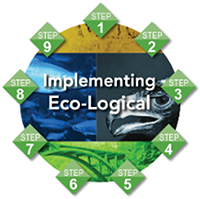
The Eco-Logical Approach
Eco-Logical’s nine steps can be applied in order or independent of each other.
Step 1:
Build and strengthen collaborative partnerships and vision
Step 2:
Characterize resource status and integrate natural environment plans
Step 3:
Step 4:
Assess effects on conservation objectives
Step 5:
Establish and prioritize ecological actions
Step 6:
Develop crediting system
Step 7:
Develop programmatic consultation, biological opinion, or permit
Step 8:
Implement agreements, adaptive management and delivery projects
Step 9:
Update REF and plan
Visit the Eco-Logical website for more information.
Goals and Objectives of the Workshop
Create a coordinated multi-jurisdictional approach is to address the wildlife management and connectivity issues, and increasing risk of wildlife vehicle collisions (WVC). Growing bear and elk populations are causing vehicle collisions and wildlife mortalities to rise along I-40 in Pigeon River Gorge and US 19 between Maggie Valley and Cherokee, North Carolina.
Overview of Eco-Logical
- Eco-Logical is an approach designed to help transportation, resource, and regulatory agencies integrate infrastructure development and conservation planning processes and arrive at a joint set of environmental priorities.
- It organizes current methods to address natural resource identification, avoidance, minimization, and mitigation into a systematic, nine-step process that starts at the beginning of the transportation planning process and concludes with establishing programmatic approaches to recurring natural resource issues that are implemented at the project level.
- Eco-Logical promotes transparency, brings partners together across agency and political boundaries, saves time and money through partnerships and resource sharing, provides better environmental outcomes, and streamlines the National Environmental Policy Act (NEPA) process.
- FHWA assisted with Colorado DOT (CDOT) wildlife crossing efforts and obtained information that is transferable.
Setting the Stage
Contact: Jeff Hunter
Organization: National
Parks Conservation
Association (NPCA)
Organization Information:
NPCA advocates for the protection and enhancement of America’s National Park System for present and future generations.
Phone: 828-545-1401
Email: jhunter@npca.org
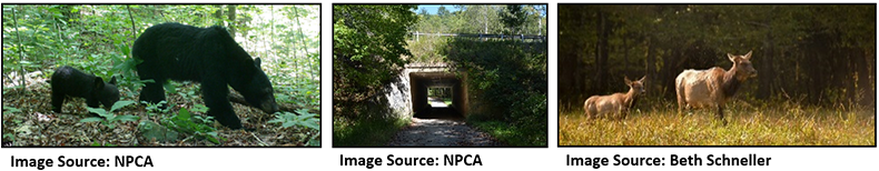
Setting the Stage –What are the Issues at Hand?
Workshop goals include building agency relationships, formalizing collaboration strategies, and developing a strategy to move forward and improve data collection/research efforts related to bear and elk WVC. There is a need to predict use in a changing landscape and there is data to support wildlife use of crossing structures in the local area.
- Stakeholders meetings started in February 2017, with a growing number of interested parties in the past 2 years.
- The Smoky Mountains are home to a robust black bear population and elk, posing safety and wildlife issues. Elk were reintroduced in the park in 2001, after an absence of 200 years, and this species is being considered proactively.
- Multiple jurisdictions are managing the land utilized by the elk herd.
- NPCA produced a Story Map to illustrate the issues and the collaborative effort that has been occurring to find solutions.
The Issues at Hand and Lessons Learned: State Agencies Perspective
Tennessee DOT (TDOT) Perspective
Contact: Zane Pannel
Organization: TDOT
Presentation Summary:
Presented Pilot Projects for Wildlife Fencing along Interstates in Tennessee, the statewide hot spot map for animal crash locations, and discussions on solutions and lessons learned.
Phone: 865-806-4319
Email: zane.pannell@tn.gov
TDOT Presentation Highlights
- TDOT has two pilot locations:
- Cocke County I-40 mile markers (MM) 440 through MM 446 (experiencing deer collisions and a few bears); and
- Sullivan County I-26 MM 0 through MM 5.
The biggest challenge in these pilot areas was determining the most efficient countermeasures to use, both ecologically and economically. TDOT is interested in mitigation measures for bears.
- Safety is the primary priority for TDOT.
- TDOT developed a crash map using WVC data from police reports (14 crashes, 4 involving bears). Police crash forms typically do not have species information.
Findings
- Interested in lessons learned from WVC countermeasures implemented in Colorado. CDOT approaches WVC from a safety perspective, but works alongside biologists and ecologists. CDOT has design standards mitigation measures. Some mitigation methods are ineffective (reflectors, signage, and electronic detection).
Participant Discussion Highlights
Crossings
Over/underpasses are required if fencing is installed.
Public education
TDOT gets WVC data from the Highway Safety Patrol. There is an opportunity to educate the public on reporting WVCs.
Infrastucture
High, slick barriers on the I-26 corridor are contributing to bear WVC.

Image Source: TDOT
North Carolina DOT (NCDOT) Perspective
Contact: Wanda Austin
Organization: NCDOT
Presentation Summary:
Presented NC’s experience with WVC and countermeasures.
The state of North Carolina has over 79,000 miles of road, one of the largest state-maintained highway systems in the country.
Between 2011 and 2013, there were over 61,000 WVC resulting in 20 human fatalities, over 3,400 injuries, and $149 million in property damages in NC.
From 2013 to 2018, there were 29 WVC incidents, 90% involving deer.
Since May 2018, there have been 25 bear fatalities in the Gorge area and 10 additional fatalities across the TN border.
There are no current elk fatalities, but there has been in the past.
Phone: 828-586-2141
Email: whaustin@ncdot.gov
NCDOT Presentation Highlights
NCDOT Wildlife Crossings
Bridge extensions
Allow wildlife to cross under the road
Culverts
Worked with NC Wildlife Resource Commission (NCWRC) to determine crossing locations. Installations were smaller than recommended due to roadway geometry constraints.
Crossing poles
Allow flying squirrels to safely glide across the road. Depending on wind and other conditions, flying squirrels can travel up to 80 feet.
Overpasses
There are 2 tunneled roadway sections in NC that now also serve as land bridges for wildlife.
Right-of-way (ROW) fencing
Used in conjunction with these crossing methods. It is easily crossed by bears.
Findings
- Monitoring suggests limited wildlife use of culverts and no bear use.
- Wildlife crossing behavior changes with time. Wildlife does not always cross where signed on the road.
- Human use of wildlife crossings has potentially negatively impacted wildlife use.
Participant Discussion Highlights
Cost impact
Consult with the insurance industry to collect medical costs to fully capture economic impacts of WVC. NCDOT does not capture medical cost information. Numbers are compiled from insurance companies and police reports.
Funding
Prioritize WVC with other issues competing for funding.
Priority corridors
Consider controlling/excluding hunting.
Partners
Consult law enforcement for data collection. The insurance industry could be an interested stakeholder. Consider adding the hunting community as a partner.
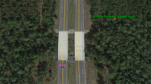
Image Source: NCDOT
The Issues at Hand and Lessons Learned: Historical Bear Research and Ongoing Elk Research
Black Bear Research
Presenter: Mike Pelton
Organization: University of Tennessee
Presentation Summary:
Presented black bear research from 1982 to 1990 in the Harmon Den area of Pisgah National Forest, adjacent to the Pigeon River Gorge and I-40 in NC.
The Harmon Den became a bear sanctuary in this time frame and has been effective for bear conservation.
Supported by the NCWRC and U.S. Forest Service, research efforts focused on bear habitat use and response to roads to examine possible impacts of ongoing timber management activities on black bears.
Phone: 540-885-3050
Email: mpelton@utk.edu
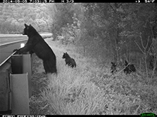
Image Source: Bridget Donaldson,
Virginia DOT
Black Bear Research Efforts
Researchers tracked and trapped bears for 8 years, collaring 61 bears, about half male to female. Specimens were monitored every 20 hours. Researchers recorded 5,500 locations and 40 den visits. 33 of the 61 collared bears were killed through road kill or legal/illegal harvest. Bears remaining in the sanctuary fared better.
Findings
- I-40 presents a definite barrier. Increased traffic volumes lead to fewer road crossings. This study showed 13 recorded crossings, all male and primarily nocturnal, though exact locations are unknown. Research never recorded a bear location within 300 meters of I-40.
- Black bears are intelligent adaptable omnivores and agencies need to accommodate this adaptability in their plans. Bears change behaviors to survive.
- Females incorporated a large stand of oak trees as part of their home range. This adaptation is motivated by the availability of acorns which dictates their movement and can lead to mortalities from crossing I-40.
- Culverts provide good bear crossings, but require larger box culverts.
- Roadway infrastructure consisting of bridges and tunneling rather than crossing and cutting have contributed to thriving populations of brown bear and wolves in populated areas in the Alps.
- Reasons bears are thriving in the area include:
- Millions of acres of uninhabited forest land,
- Matured forests producing acorns,
- Adaptability of the species, and
- Management agencies’ actions and bear sanctuaries.
Participant Discussion Highlights
Gene integrity
Gene integrity is not a concern since bears are able to cross I-40.
Culvert sizing
Culverts are recommended approximately 8 feet by 8 feet (wider is preferable to taller) and there needs to be daylight and vegetation on both sides.
Food supply
Bears’ primary food source is acorns. Forest management techniques should consider the aging oaks population. Oaks decline/stop producing at about 80 years.
Local culture
Bears are part of the local culture and have increased visitation to the park. There are mini bear sanctuaries around the park with private landowners prohibiting hunting on the premises.
Elk Research
Contact: Joe Clark
Organization: U.S. Geological Survey, University of Tennessee
Presentation Summary:
Presented the history of the NC elk herd and summarized early research to determine the population dispersal and mortality rates, assess habitat use, and evaluate elk’s impact on the national park to estimate the probability of success in establishing a permanent elk population in the Great Smoky Mountains National Park (GSMNP).
Gave an overview of a five-year elk population study beginning October 2018.
Phone: 865-974-4790
Email: jclark1@utk.edu
Elk Research Efforts
25 elk were released in GSMNP in 2001 and 27 were released in 2002. The 2003 release was cancelled. Elk were radio collared and put in acclimation pens for 2 to 3 months before releases. Calves were radio collared.
There were 5 years of monitoring post-release. Research predicted the population would stabilize or decrease due to the cancelled third release and/or calf mortality rates (mainly due to the need to adapt to predation by bears). Researchers established a bear relocation program to increase calf survival, moving 15 bears in 2006 to the edge of the park, 12 in 2007, and 22 in 2008.
The National Park Service (NPS) has management responsibility. Current research efforts with NCWRC, NPS, Eastern Band of Cherokee Indians (EBCI), University of Tennessee (UT), and U.S. Geological Survey (USGS) are estimating elk population based on DNA assessments. Sampling will continue for 3 years.
Findings
- The herd has a small home range. The core population is in the Cataloochee area and a satellite population is in the Cherokee area. Elk could move across I-40 as the population increases due to suitable habitat on either side of I-40.
- Survival rates are reasonable for adult males and females, but there is a low recruitment rate for calves (though it is improving). Rates improved over time (2006-2008 results), but the population is still vulnerable. Follow-up studies and new population estimates are needed.
- The cause for increased survival rates is due to elk adapting to local surrounds and resources, the bear relocation program, and elk adapting to bears when rearing young. Meningeal worm is still impacting the herd but mortality rates are below what is sustainable for the population.
Participant Discussion Highlights
Illnesses and mortality
The Park screened and treated elk for brain worm before releases. There are no local cases of chronic wasting disease, but it is expected. Elk WVC mortality is now the main source of adult fatalities.
Food supply
Elk currently have minor environmental impacts, but this could change with population growth. Vegetative sampling was done inside and outside the enclosures. Woody stems were different inside and out but all other vegetation was the same. Vegetation monitoring is on-going.
Fecal sampling
Fecal sampling is using transect grids based on elk locations and is focused on open areas (to help locate and collect samples, and due to the location of surrounding towns). Fecal DNA sampling costs $100 per sample to analyze and 6 months to process. Fecal DNA sampling is difficult because the sample moisture affects the DNA.
Ongoing Elk Collar Study, Proposed I-40 Camera Trap Study Design, US 64 Mitigation Efforts
Elk Collar Study
Presenter: Liz Hillard
Organization: Wildlands Network
Presentation Summary:
Presented ongoing elk collaring efforts with GSMNP and NCWRC staff as one part of the multifaceted Pigeon River Gorge Wildlife Connectivity Project.
I-40 creates a significant barrier for the growing elk herd from moving from GSMNP to surrounding national and state forests, causing WVC and elk mortality.
Research supports long-term goals to reduce WVC, promote human safety, and restore habitat connectivity across the interstate.
Phone: 217-840-4613
Email: liz@wildlandsnetwork.org
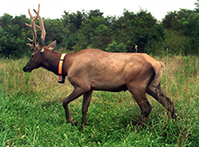
Image Source: Wildlands Network
Elk Collar Study Research Efforts
Five elk were collared March/April 2018, 3 female and 2 male (1 male road mortality), to collect information on elk roadway behavior. These elk were targeted due to their potential higher probability of larger movements and interactions with roadways and the I-40 corridor. Collars provide hourly fixes on location, and will give 20 minute fixes on location if elk are within 500 meters of I-40 and US 19 to provide details on elk road crossings.
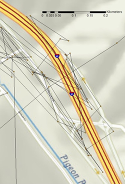
Image Source: Wildlands Network
Findings
- Elk tend to travel along slopes less than 40° which can help determine where elk use the landscape.
- Elk used structures in the area. Research should investigate synergy between camera and collar data.
- Movements can be individualistic and many factors contribute to behavior differences.
- More spatial and temporal data is needed from more elk to understand movement patterns and guide crossing location installations.
- Wildlands Network is interested in sharing data with NCWRC on 10 collared elk to answer questions about home range and movement patterns, and address road elk interactions and behaviors.
Participant Discussion Highlights
Collaring bears
Collaring bears to see movement patterns has been discussed and has been considered with more funds. It is unlikely due to the large effort and the number of bears that would need to be collared to gain sufficient information on bear interactions with the roadway.
How collars interact with elk
To date, collars are not used to change animal movement behaviors, only track patterns. Collars on elk in other regions have been used to trigger flashing lights, but research has shown this to be ineffective.
Proposed Camera Trap Study
Presenter: Proposed Camera Trap Study
Organization: NPCA
Presentation Summary:
Presented a proposed camera trap study for the Pidgeon River Gorge Wildlife Connectivity Project.
Suggestions for improvements are welcome.
Phone: 828-550-6815
Email: sgoodman@npca.org
Image Source: Jake Fabar and Hap Endler, SouthWings
Proposed Camera Trap Study Presentation Highlights
WVC mortalities are underreported, and reporting is not centralized. Data collection needs to improve.
Project Goal – increase the understanding of black bear and elk movement patterns, mortality, and permeability within the highway corridor.
Long-term Goal – improve wildlife’s ability to cross I-40 and improve public safety.
Research Objectives –
- Assess mortality hotspots to understand where animals are attempting to cross. Methods will include surveying to describe road aspects, using wildlife cameras, and compiling a master database from other sources.
- Assess crossings at grade to understand where animals “prefer” to cross. Use cameras along randomly selected 500 meter segments of the corridor to understand animal distribution and landscape use. Some areas across the Gorge may be prohibitively steep to put out cameras. Cameras will be placed closest to a forested ridgeline in an area with the least slope using existing wildlife trails/paths when possible.
- Assess use of existing structures to confirm use. The focus will be on structures with a reasonable expectation of usage based on literature and existing knowledge. Other tracking methods like DNA will be considered.
- The study area is mainly Federal lands with some private land. Connecting large landscapes is one of highest national priorities for wildlife conservation.
- The project will require permitting (ROW encroachment permits, State and federal wildlife permits), collaboration on mortality data collection, and consultation of subject matter experts. The agency still needs to apply for permits.
Participant Discussion Highlights
Data collection protocol
Goodman would like to lead starting a database and establishing protocol to coordinate collection and documentation of wildlife mortality data. Platforms could include DropBox or GoogleDrive. Suggestions are welcome.
Available resources
Currently, the 70 cameras and 2 biologists on the project will provide adequate coverage and statistically sound results. Additional resources would increase the rigor of the study, but the immediate need is to design the study most appropriately given the constraints.
Strategy to employ
The amount of tolerable error depends on how the data will be used in decision making. Understand the decision makers’ comfort level and tolerance for risk to have robust statistics.
US 64 Widening
Presenter: Travis Wilson
Organization: NCWRC
Presentation Summary:
Presented the resource agency perspective of the comprehensive wildlife crossing plan stemming from the NCDOT proposal to widen US 64.
This project spanned the majority of a decade, addressing habitat fragmentation and road mortality concerns for black bear, avifauna, and herpetofauna. Diverse and competing human/natural environment constraints required communication, coordination, education, compromise, and innovation.
Phone: 919-707-0370
Email: travis.wilson@ncwildlife.org
US 64 Widening Research Efforts
Research focused on highway permeability for wildlife while maintaining the usability and access of the roadway. Studies assessed the potential impacts of widening US 64 on species of interest and wildlife in general to understand landscape use and determine wildlife crossing locations.
| Target Species |
Location |
Study Methods Used |
- Black bear
- White-tailed deer
|
Dare County |
- Hair traps
- GPS tracking collar data
- Camera trapping
- Road kill data
- Driving surveys
|
| Red wolf |
- Dare County
- Tyrell County
|
- GPS tracking collar data
- Remote camera trapping
|
| General wildlife |
Tyrell County |
- Camera trapping
- Road kill data
- Tracking beds
|
The National Wildlife Refuge (NWR) System Improvement Act of 1997 provides a process for determining compatible uses for refuges. A compatibility determination, required for permitting refuge use, is when the use of a refuge will not interfere or detract from the purpose for which the refuge was established.
The project faced management issues and competing needs:
- US 64 provides unique habitat areas for species, namely the red-cockaded woodpecker and red wolf.
- Being located on NCWRC Game Lands used by the public, designs needed to maintain access points along the roadway but not allow black bear entry.
- Designs needed to provide the ability to retain the hydraulic connection to the waterfowl impoundments.
- The project needed to account for DOT standards and driver expectation.
Findings
- Identified candidate crossing structure locations for large and small crossings based on the black bear, red wolf, and general wildlife impact studies.
- Installed 73 structures total. Only 1 large pipe crossing was installed. Crossing structure height was constrained by maintaining a church and community center driveway access.
- Fencing was not buried at these crossings. Future installations will bury fencing to prevent gaps.
Participant Discussion Highlights
Project motivation
US 64 was widened from a two-lane to four-lane highway as it is used in hurricane evacuations.
Lessons Learned From Colorado on Wildlife-Vehicle Collision Reduction Efforts
CO WVC Reduction Efforts
Presenter: Mark Lawler
Organization: Colorado DOT
Presentation Summary:
Presented WVC countermeasures employed by CDOT with an emphasis on large game/elk, and considerations for developing a wildlife mitigation project from scoping through construction.
Phone: 970-385-8371
Email: mark.lawler@state.co.us
Image Source: Colorado DOT
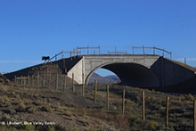
Image Source: Colorado DOT
CO WVC Reduction Efforts – Background
CO deals with different types of conflicts depending on the season: herd migrations with large, high magnitude movements across roadways and winter range where individuals linger on and near roadways throughout both day and night. CO has some of the largest elk and mule deer herds in North America. 74 percent of WVC in CO are mule deer. Elk are also hit.
CDOT data sources to determine critical locations for WVC reduction treatments include:
- Law enforcement crash reports. Law enforcement data is known to be underreported and is estimated to be about half to a third of WVCs.
- DOT carcass removal data. DOT maintenance staff record species and location of wildlife carcasses on and near roadways which can be input into GIS. Maintenance staff do not remove or record carcasses in the ROW far from the roadway or in the woods when injured animals wander off and die. Data is considered underreported due to carcasses not recorded.
- Other data from other agencies, researchers, and universities.
Project Scoping Considerations
Target species
Target species are not limited to primary users. Crossings need to be sized to accommodate all species of interest.
Existing infrastructure
Check for simple fixes to alleviate the problem, such as opening or closing a gate or removing pipe grates to permit or prohibit crossing. Consider enhancing or retrofitting existing infrastructure such as bridges and concrete box culverts to save costs.
Landscape
Consider the topography, slopes, and attractants in the landscape, such as water sources and vegetation forage areas, that can help predict animal movement behaviors.
Habitat connectivity
Consider more than just animals crossing the road.
Permitting
Ensure treatments are a meaningful use of resources. Permitting can be cost prohibitive.
Future development
Consider potential expansions and barriers in the area.
Land ownership
Consider using public lands if possible.
Funding
Consider low budget methods that can provide some level of mitigation.
WVC Countermeasures and Treatment Options
- Crossing structures. Overpasses may be used more often by certain wary species, but underpasses are typically more feasible.
- Designate small species crossings to maintain roadway permeability for wildlife with limited movements and ranges.
- Exclusion fencing treatments are required with crossing structures.
- Consider the fence end. Ensure animals are not circumventing the fence end.
- Use escape ramps to give animals caught on the street side of fencing a safe place to exit. Install escape ramps where animals are naturally moving. Consider the ramp height.
- Vegetation management reduces attractions to the roadway while maintaining motorists’ line of site. Do not create foraging areas in the ROW.
- Reduce speed limits. This may cause pushback; consider implementing nighttime speed reductions.
- Be creative with signage, both permanent and seasonal. Motorists are sign-numb, especially commuters. Consider flashing lights at at-grade crossings.
- Be innovative. Stay on the cutting edge of research to determine mitigation options that work and that don’t.
- Engage local communities to garner public support. Install cameras immediately, regardless of monitoring plans, and share images with local media to prove to the public that construction was worthwhile.
Example Projects
| Project |
Parameters |
Treatments Approved |
Results |
Notes |
| State Highway 9 Wildlife Crossing |
- High WVC location
- Good habitat/vegetation
- Riparian corridor
- Seasonal movement and resident animals
|
- Overpasses
- Underpasses
- Exclusion fencing
- Escape ramps
|
- 86% reduction in carcasses removed
- 70% reduction in WVC
- Used by multiple species
|
Successful partnership between CDOT, private landowners, and local government |
| US 160 Dry Creek Wildlife Underpass |
- High WVC location
- Good habitat/vegetation
- Elk and mule deer winter range
- Migration route
|
Underpass under the 4-lane divided highway with break atrium and Jersey barriers to mitigate noise and snow debris |
Newer project but successful to date |
- Conflict data made the NEPA process move more smoothly
- Public land on either side secures ingress and egress
|
| US 285 Nathrop Wildlife Crossing |
- Growing WVC location
- Terrific habitat/vegetation
- Intersects wildlife use corridor
|
- Underpass
- Retrofit existing underpass structures
- Tied exclusion fencing into existing landscape barriers
|
Design allowed for use by mule deer, black bear, and elk |
Worked with Colorado Parks and Wildlife (CPW) |
| US 160/SH-151 Wildlife Crossing |
|
CDOT is completing analyses to determine treatments and locations to increase permeability |
Still in design |
Partnered with CPW and Southern Ute Indian Tribe for funding (the Tribe’s interest stems from the cultural and economic significance of elk) |
A Case Study From Banff National Park
Banff National Park Case Study
Presenter: Terry McGuire
Organization: Parks Canada
Presentation Summary:
Presented on the adoption of extensive highway mitigation in Banff National Park, detailing various mitigation measures and lessons learned.
Phone: 403-671-3517
Email: terry.mcguire@shaw.ca
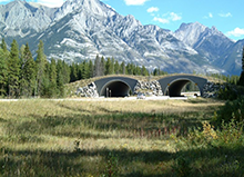
Image Source: Parks Canada
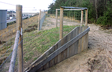
Image Source: Tony Clevenger
Banff National Park Case Study – Background
Parks Canada maintains sections of the Trans Canadian Highway (TCH) running through national parks. With Park Canada’s mandate to protect resources for current and future generations, project goals were to improve motorist safety, reduce wildlife mortality, maintain habitat connectivity, and increase traffic level of service—all of equal priority.
TCH runs through Banff, home to many iconic species, and creates a high barrier to wildlife movement. TCH was twinned, creating 4 lanes to increase capacity. The project was completed in phases over 30 years with the team learning from one phase to the next using context sensitive designs.
Mitigation measures reduced WVC and promoted connectivity. In total, 83 kilometers of highway were twinned, 42 wildlife crossing structures were installed providing a crossing every 1.5-2 kilometers, and 166 kilometers of fencing was installed. Wildlife mitigation costs were about 30 percent of the overall budget.
Project Scoping Considerations
Objectives
Establish objectives early on and determine how to measure success.
Data
Use both data and common sense to determine crossing locations. Don’t get paralyzed by the amount of data and monitoring. Take risks. Consider using a ranking system for structures based on use type and probability of use.
Flexibility
Target species will influence the overall design, but target species may change with time. Designs should be flexible.
Finances
Including treatments in initial construction saves money versus incorporating mitigation in rehabilitation projects.
Monitoring
Monitor treatments to determine effectiveness and share results with the public to garner support.
WVC Countermeasures and Treatment Options
- Fencing and crossing structures must be used together. Fencing is mandatory to address mortality issues and crossing structures are mandatory to address connectivity. Fencing guides animals to the crossings.
- Fencing – consider the alignment. Monitoring found sheep were precluded from using rock faces as an escape route and were being killed by wolves.
- Crossing structures – consider species preference to overpasses or underpasses when selecting crossing types. Generally, big works best.
- Charged fences and electromats are good deterrents to keep animals out of the ROW. Electromats are less effective with snow.
- Cattle guards, electrified or not, are not effective and can fill with snow/salt brine.
- Escape routes are required to allow animals trapped inside the corridor to escape.
- Consider other methods to increase permeability, such as including small openings in Jersey barriers to allow small species to cross.
- Take advantage of topographic features. Manipulate the landscape to achieve desired outcomes.
- Be prepared to adapt and use adaptive management. Animal behavior changes and is not always what is expected.
- Monitor treatments and allow enough time to capture changes in animal behavior. Be prepared to monitor for a long time. Some species may use a crossing structure before construction is complete but others may take years to incorporate crossing structures into their movement patterns.
Lessons Learned
- Sharing results changed the public perspective from lack of support to full support of the project.
- Mixed human and wildlife crossings do not work. Pedestrian connectivity should be considered separately. Pedestrian walkways were included above the roadways and have self-closing gates to prevent animal access.
- Crossings are not prey traps for predators, but may be used by humans/hunters.
- Fencing prohibited bears’ digging and climbing efforts, but bears gained access through a weak connection between the fence and apron.
- Total or 100 percent exclusivity is difficult to achieve. Pre-post mortality data shows improvement. There was an 80 percent reduction in WVC and a 95 percent reduction for elk and deer WVCs, but coyote WVCs increased because they can get under the fence.
Participant Discussion Highlights
Road design
Twinning impacted the funding and feasibility of solutions. This approach could be used in NC, but could present challenges for maintaining traffic in the region during construction.
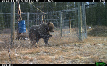
Image Source: Parks Canada
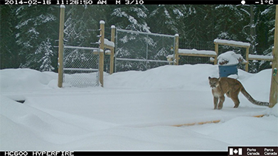
Image Source: Parks Canada
Mortality Data Collection Best Practices and Cost-Benefit Threshold for Mitigation
Mortality Data and CBA for Mitigation
Presenter: Marcel Huijser
Organization: Western Transportation Institute - Montana State University
Presentation Summary:
Presented on the effects of roads and traffic on wildlife, human safety related to WVC, data sources and how they can be used, effectiveness of mitigation measures aimed at reducing WVC and at providing safe crossing opportunities for wildlife, and cost-benefit analyses (CBA).
Phone: 406-543-2377
Email: marcelhuijser@mphetc.com
Ecological Impacts of Roadways
All need to be addressed, not just road mortalities and barrier effect.
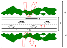
Image Source: Western Transportation Institute
- Loss of wildlife habitat around the road where animals cannot and should not live.
- Road mortality.
- Barrier effect as animals will not cross the roadway.
- Decreased habitat quality due to pollution, disturbances, lighting, and other factors. Impacts can extend from yards to miles, depending on the parameter and species.
- Ecological function in the ROW can provide habitat for invasive plant species.
Steps to compensate for ecological impacts include:
- Avoid. Determine if the mode of transportation can be rerouted to avoid impacts. Consider avoidance measures immediately in the planning process.
- Mitigate.
- Compensate. Provide offsite mitigation to create new or larger habitat patches and promote connectivity.
Human Safety and WVC
WVC present safety concerns. Larger animals lead to a higher probability of human injury or fatality. There are 1-2 million large mammal-vehicle collisions/year (mostly white-tailed deer, mule, elk, and moose) costing $6-12 billion/year. The total number of crashes (all types) are stable from the 1990s, but WVCs are increasing with time.
Highway upgrades to improve driver safety can inadvertently increase driver speeds, leading to increased WVCs, requiring implementation of mitigation measures.
Project Scoping Considerations
- Define objectives and purpose first to determine what information is needed. Then consider data types and sources and how they can be used. Outcomes will differ based on different objectives.
- Safety focuses on reducing collisions with large game. Biological conservation focuses on species and habitat, indiscriminate of size or safety. Direct road mortalities are the main concern for protected amphibians and reptiles, but most mitigation measures are for ungulates and large mammals.
Data Sources and Uses
- Species and spatial data accuracy are important considerations when identifying hotspots. Consistent search and reporting efforts are critical.
- Applications are available to track data on dead and live sightings, such as the Federal application ROaDS (Roadkill Observation and Data System). Consider public safety in citizen science efforts.
- Crash data is reported by law enforcement, representing larger scale crashes with a minimum damage threshold. This provides a better description of what happened and where, but accounts for 30 percent of carcass removal data and often lacks species information.
- Carcass removal data is collected by maintenance, but doesn’t include animals that die outside the corridor.
WVC Countermeasures and Treatment Options
- Fencing is the main mitigation measure, with the primary function to keep animals off the highway and reduce collisions. Fencing also promotes connectivity by guiding wildlife to safe crossing locations. Study results show fenced areas had less WVC than non-fenced control areas. Fence end runs can increase WVCs.
- Crossing structures are required to allow safe passage. Crossings are for species and individuals that approach highways. Some will never approach highways and so cannot benefit from crossing structures by definition.
- Consider target species. Structure use does not mean it is appropriate for the target species. Camera data can be used to determine the acceptance ratio of crossing types by different species to identify best options for species.
- Continue monitoring until usage is stable to accurately capture use and interpret if it meets the objectives. Wildlife use increases as animals learn crossings provide safe passage. Study results showed deer and black bear use doubled over 5 years and continued to increase.
Study Results – Effectiveness
- Fencing longer road segments can reduce WVC by 80 to 100 percent. Shorter segments can reduce about 50 percent. Results are highly variable from location to location.
- Monitoring results showed more deer and bears crossed through the structure than ever crossed at-grade, showing that a combination of fences and wildlife crossing structures can increase habitat connectivity.
- Large mammal use of large underpasses (7 meters wide) is 146 percent higher than at random locations in the area. However, if the objective is to have the same number of movements under the highway compared to what moves in the immediate vicinity, 41 percent of the highway needs to be permeable with these structures.
Cost-Benefit Analysis (CBA)
Implementing mitigation measures can be less expensive than continuing to allow large mammal-vehicle collisions. Property damage estimates from WVC with large mammals and economic estimates for human injuries and fatalities range from $6,000 to $30,000 per collisions for deer, elk, and moose. CBA shows that only a small number of avoided collisions pays for mitigation measures. The model is currently based on human safety parameters, but can be expanded to include other parameters such as biological considerations, conservation value, tourism, and hunting abilities.
Participant Discussion Highlights
Monitoring
Implementing mitigation measures should be based on informed decisions through population viability analyses. Install cameras on the edge of crossing structures to capture animals’ decisions rather than installing cameras in the middle of the structure to monitor use.
Data collection
Jeff Hunter has a survey template to share. Utah State and Utah DOT (UDOT) are developing a tracking app. Consider information and data management for larger scale perspectives outside the study corridor. Wildlife hospital data should be taken as incidental information since location accuracy is unknown. There are potential partnering opportunities with postal and delivery services already on the road.
Getting to an Answer. How Much Data Do You Need?
Camera Trapping
Presenter: Joe Kolowski
Organization: Smithsonian Conservation Biology Institute
Presentation Summary:
Presented on camera trapping, data collection and limitations, and appropriate applications.
Phone: 540-635-0205
Email: kolowskij@si.edu
Camera Trapping – Uses
- Camera trapping is an easy way to monitor crossing structure activity before and after modification to evaluate the effectiveness of mitigation measures.
- Regular monitoring efforts and mortality data improve modeling by locating hotspots and determining parameters influencing animals’ use of landscapes.
- Mortality and carcass data provide information for conservation as well as safety (collisions and injuries). Consider what camera monitoring data will show that other data is not already capturing.
Camera Trapping Limitations and Challenges
- Cameras monitor microhabitats. Cameras only capture a small area in front of them and do not capture all crossings. This can provide a false confidence that an entire corridor is monitored when there are large gaps in monitored space.
- Camera placement is highly influential on results.
- One study showed large variation in capture rates from cameras placed 20 meters apart in the same habitat at the same height.
- The same study showed some variation in capture rates was due to variation in effective detection distance of cameras based on factors such as landscape slope, habitat conditions, and placement on a trial.
- Capture rates can be independent of the species density. Studies have shown density can vary despite no change in capture rates, and vice versa. This results from changes in likelihood of photo capture across areas and cameras.
- Numbers of individuals can be elusive to estimate. The same individuals can appear multiple times and inflate numbers and/or some individuals may not be captured.
- Misses information about the likelihood of collisions. Cameras along roadways may not provide information on intent/attempts to cross roads and cannot determine if animals are near the road or if the location is a safe crossing site.
- GPS tracking data may be more valuable for modeling. Analyzing elk collar data can provide information for a detailed habitat analysis to determine how elk are using the landscape (traveling along roadways or open grass feeding) and identify likely/existing crossing locations.
Participant Discussion Highlights
Camera technology
Determine what’s best given study objectives considering time required to review data (video/photos). Technical specs for some newer cameras are similar to high-end Reconyx cameras for $200 to $250 per camera.
Research tools
Cameras are a great tool but are just one tool in the toolbox. Determine how to use each tool most appropriately and choose the most appropriate tool for study objectives.
Breakout Session – Developing a Strategy
FHWA provided an overview of potential strategies, Eco-Logical and Adaptive Management approaches, that could be applied to address the issues identified in the region and discussed in the first portion of the workshop. Regardless of strategy, basic information is necessary for decision making; namely a problem statement, data acquisition and analysis, funding mechanisms, stakeholders and core working group(s) with identified objectives, and next steps. The Eco-Logical Practitioners Guide was used help frame the breakout session and generate group discussion.
The sections below provide highlights from the four group breakout sessions and the collective group discussions during session preparation and the report out session.
What are some Potential Strategies?
Eco-Logical Approach
Eco-Logical – The recommended 9-step approach serving as the starting point from which ecosystem-based mitigation decisions can be made. Following Eco-Logical, agencies work together with the public to integrate plans, identify priority areas, and determine migration options.
See the Overview of Eco-Logical section for more information.
Adaptive Management Approach
Definition – A type of natural resource management in which decisions are made as part of an ongoing science-based process. Adaptive management involves testing, monitoring, and evaluating applied strategies and incorporating new knowledge into management approaches that are based on scientific findings and the needs of society. Results are used to modify management policy, strategies, and practices.
Organizational Structure Example: US Forest Service
US Forest Service Figure 7-8 – Conceptual structure for adaptive management strategic groups in the Lake Tahoe basin. Solid lines represent administrative authority and dashed lines represent technical exchange.
Commonly used Management Structure:
- Executive Coordinating Committee
- Adaptive Management Working Group
- Scientific Advisory Group
- Consultants
- Research Institutions
- Agency Working Groups
What is the Problem to be Addressed?
Consider how the problem statement will be received; perception becomes reality. Address the underlying sources of the problem and avoid portraying increased wildlife populations as the cause of WVC issues to avoid any negative connotation with wildlife.
| Original Problem Statement |
Increasing bear and elk populations are causing a rise in the number of vehicle collisions and wildlife mortalities along I-40 in Pigeon River Gorge and US 19 between Maggie Valley and Cherokee, NC. A coordinated multi-jurisdictional approach is necessary to address the growing safety and wildlife connectivity issues. |
| General Problem Statement Discussions |
Redefine the statement – developing an appropriate problem statement, reframed as an “issue statement,” is critical to identify the best approaches.
- Justification – Defining the problem and why it is important will justify expended efforts and funding. Frame the problem statement to include conservation and safety issues to justify funding.
- Classification – Determining how the issue should be classified will help frame next steps. There are multiple angles to this issue and a variety of interests, captured in four pillars:
- Economic – WVC costs, traffic delays, impacts to tourism, and local resources
- Human safety – fatalities and injuries
- Ecological – habitat connectivity, mortality rates, population management, and biological considerations
- Culture/Public outreach/Education – public investment; public support is essential
|
| Species Considerations Discussions |
Black bear, elk, and deer focus – black bear are considered since they are currently involved in WVC and elk are considered for proactive measures, but deer should also be considered in the problem statement since the best WVC data available is for deer. This data can be used in CBA to advocate for and justify mitigation measures.
Resolution: limit the focus to these 3 species.
Other discussions:
- Address wildlife generally, but demonstrate how efforts can benefit keystone species.
- Address habitat connectivity generally rather than individual species.
- There are conservation issues with the species, but elk were extricated 200 years ago and the infrastructure has grown without elk being present in the area.
- Threatened and endangered species focus could help justify efforts and drive data collection.
|
| Potential Resolutions |
Revised issue statement: “There is a perceived rise in collisions with wildlife, especially large mammals (bear, deer and elk) along I-40 in Pigeon River Gorge and US-19 between Maggie Valley and Cherokee, NC, but also extending to the larger region from Newport, TN to Waynesville, NC. Due to rising populations and increased tourism in the area, it is expected that this situation will continue to increase, so there is an immediate need to begin to coordinate a multi-disciplinary and multi-jurisdictional exploration of solutions.” |
What are the Data Needs and Funding Opportunities?
| More Data is Needed |
WVC are vastly underestimated and the validity of reporting needs to be addressed and improved. Data gathering is required to fully understand the issues and justify actions. |
| Collaboration Opportunities |
Capitalize on opportunities to collect the appropriate data to prove what the problem truly is. Current efforts are data limited. Agencies need to collaborate to determine who has what data, and proactively collect, manage, and share data.
- Databases – EBCI has a WVC database. They raised safety concerns with NCDOT since the Tribal DOT has been unresponsive.
- Challenges – Consider challenges combining datasets across DOTs. Develop statements and materials for staff to bring to leadership.
- Engaging other groups for data collection – Consider including other groups:
- Local hunters can provide data on unreported roadway mortalities.
- Non-motorized recreation groups (bikers, birders, campers, horseback, cyclists, hikers, outfitters, etc.) can aid in data collection efforts.
|
| Data Analysis |
Projections – Projections are based on expanding populations and increasing traffic; more people traveling in the area will lead to more WVC. If the road becomes an impermeable barrier (e.g., traffic is too heavy, too many mortalities, etc.), wildlife may stop trying to cross.
CBA and modeling – Utilize CBA and modeling to address safety issues and focus on exact locations/MM with the highest conflicts.
Best practices – Investigate agency methodologies and protocols in other regions.
|
| Consultant Assistance |
Consider involving a consultant in data efforts (gathering and analysis) since agencies are at capacity. |
| Funding Opportunities |
Investigate grant opportunities to improve data collection to compile the necessary datasets.
Submit a grant proposal to conduct a CBA using consolidated data from collection efforts.
Investigate how to expand efforts so solutions can be tailored to specific regions beyond the corridor. Eastern NC is having more significant issues with black bear WVC.
Get creative.
- Investigate innovative funding options related to different interest groups and priorities.
- Incorporate mitigation measures in Long Range Transportation Plan efforts, if possible.
- Determine the foci. Conservation may be an internal focus with safety as the public focus. DOT funding is safety driven based on WVC data. CDOT partnered with other agencies to provide flexibility and more innovative solutions.
|
What Other Stakeholders Need to be Included, and What are Potential Outreach Opportunities?
| Stakeholders |
Ensure all stakeholders are involved. Consider including:
- Agencies (Farm Bureau, US Forest Service (FS), US Fish and Wildlife Service (FWS), NPS, EBCI, NCWRC, and Blue Ridge Parkway)
- Chamber of Commerce (to understand the value of wildlife on tourism)
- Land Trust (when acquiring land)
- Local groups (commuters, landowners, conservationists, recreation groups, and hunters)
- Media (influence public opinion)
- Schools (assist in public awareness campaigns and garner support)
- Economic-trucking groups (freight, United States Postal Service, United Parcel Service, FedEx, Amazon)
- Insurance agencies
|
| Public Engagement |
Engage the public to understand local communities’ perspectives on issues and sustain efforts.
- Investigate ways to alleviate the agricultural group’s concerns. Bear are iconic in the region, as are elk, but elk are also contentious due to mixed public opinions on the species. Elk have a large impact on local agriculture and some local farmers with large voices are not pleased with the reintroduction so may not be supportive of conservation efforts.
- Develop strategies for public communication. Relaying economics to the public can be challenging, especially when assigning a monetary value to life.
- Be innovative. Motorists are numb to deer collisions and signage.
|
| Media Outreach |
Jeff Hunter has been approached by the media a number of times. This story will come out and it is up to the group to make sure agency and stakeholder perspectives are accurately reflected. Jeff will provide the stakeholder contact information to the media.
The Asheville Citizen Times published an article on this topic on January 4, 2019.
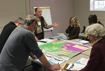
Image Source: FHWA
|
What are Potential Group Organizations and Roles?
| Communication and Collaboration |
Communication and collaboration are paramount moving forward. Establish regular meetings and working groups to continue the dialog, foster agency relationships, and encourage collaboration and cooperation. Developing a working group will be useful for streamlining communications and engaging the media.
A potential group structure could include:
|
| Working group |
Membership – Develop a comprehensive stakeholder contact list including agency connections and work portfolio to share expertise. Include all stakeholders, organizations, and agencies bringing expertise, data, and/or vital information related to the topic.
Meeting Schedule – Establish an annual meeting for all stakeholders involved.
Working Group Objectives – Provide expertise and data. Continue inter-agency communication and collaboration.
|
| Task Force |
Membership – Establish a task force representing the various stakeholders, organizations, and agencies.
Meeting Schedule – Establish regular meetings for the task force.
Task Force Objectives – Draft a short-term project plan for circulation and input from the working group. Provide periodic updates to the working group.
|
| Steering Committee |
Membership – Establish a steering committee of 5-7 people.
Meeting Schedule – Establish an appropriate schedule.
Steering Committee Objectives – Direct the long term plan.
|
| Informal PR & Communications Team |
Establish an informal team to draft talking points for the media sensitive to the variety of interests/pillars. |
| Champions |
NPCA is the principle driver for this effort, but DOTs and local resource agencies are central partners for its long-term success.
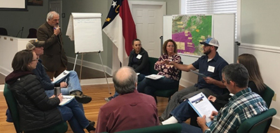
Image Source: FHWA
|
What are Potential Immediate Actions to Take for Wildlife Connectivity?
| Incorporate Wildlife Upgrades |
Pursue opportunities to improve the corridor and incorporate mitigation measures through regular maintenance, upgrades, and rehabilitation. Aging infrastructure in the corridor will need to be replaced. Opportunities are arriving sooner than later and it is important to know what agency/who is contacting what agency/who to get information to the larger group so people can communicate ways they can contribute. Maintaining communication between DOTs and other agencies can facilitate incorporating mitigation measures in infrastructure upgrades.
- Role of the working group – The working group can help facilitate two-way conversations – DOTs provide notice of opportunities to incorporate mitigation measures in regularly scheduled work, and agencies provide DOTs suggestions and data.
- Suggested alternatives – Established suggestions on how to upgrade and improve infrastructure will facilitate incorporating mitigation measures into emergency rehabilitation projects and others. Otherwise, infrastructure will be replaced as is.
|
| Craft Agency Plans Together |
Collaboratively develop DOT problem statements and agency plans that drive funding. TDOT currently develops its own problem statements annually. |
| Flexibility |
Be flexible and ready for the political churn of a new administration and local/agency leadership to make sure these priorities are on the agenda. Each organization’s leadership guides its own priorities. Priorities need to coincide.
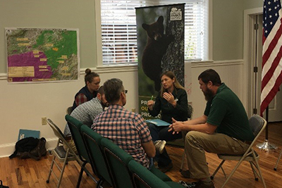
Image Source: FHWA
|
Next Steps
Below are the suggested next steps offered by the breakout groups. FHWA will be available to provide technical assistance.
| Suggested Next Step |
Description |
| Redefine the problem statement |
Develop an appropriate problem statement to frame the issues. |
| Engage stakeholders |
Ensure all stakeholders are involved in the conversation. |
| Develop a working group |
Establish core groups and regular meeting schedules to provide updates, share upcoming opportunities, data, and expertise, and work collaboratively toward unified goals. |
| Maintain communication |
Communication and collaboration efforts will facilitate incorporating wildlife upgrades into regular maintenance and rehabilitation of the aging corridor infrastructure.
- DOTs should provide notice of upcoming scheduled infrastructure work.
- Other agencies should provide DOTs with suggestions, data, and locations for implementation.
|
| Engage the public and media |
Prepare a set of talking points for addressing the media and engaging local communities to better understand the issues and garner support. |
| Explore funding opportunities |
Investigate various innovative funding opportunities and grant proposals to collect and share the necessary data, run analyses, build models, and better understand the data and issues in the region. |
| Collect data |
Collect and share data to address data needs and gaps. Consider engaging other groups for data collection. |
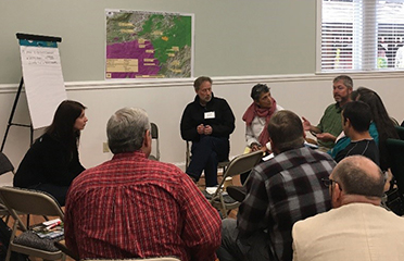
Image Source: FHWA
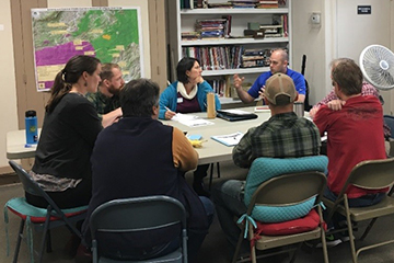
Image Source: FHWA

