CASE STUDIES
Maine Department of Transportation: Gateway 1 Strategic Plan
Planning and Environment Linkages: State DOT Institutional Mechanisms
The Maine Department of Transportation (MaineDOT) is currently conducting a landmark corridor plan, known as Gateway 1, to develop a long-term strategy to coordinate land use and transportation decisions for the Midcoast Route 1 region. Through a collaborative planning process amongst
MaineDOT, local communities and the public, Gateway 1 strives to balance community growth and local values with transportation services and needs.
Background
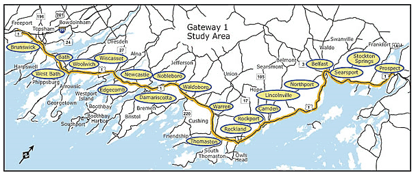
The twenty-one communities along Maine’s Midcoast Route 1 are a combination of small, traditional New England towns and cities, including both rural countryside and coastal areas. Along this 100-mile stretch, Route 1 serves differing roles, from major thruway to Main Street. These roles sometimes conflict with each other, and over the last 15 years, as traffic, population growth, commercial development and residential sprawl have increased, the conflicts have increased in frequency and intensity. In addition, many residents feel that Route 1 is changing both too quickly and for the worse.
Traditionally, the MaineDOT has focused solely on providing transportation improvements and did so by addressing issues one town at a time. Planning on a town-by-town basis resulted in projects that produced benefits to one community, without regard for potential detrimental impacts to another. Over time, MaineDOT realized that it needed an improved planning process to take a more holistic approach to planning for a Corridor. As a result, in 2004, MaineDOT, in collaboration with the State Planning Office (SPO) and the Federal Highway Administration (FHWA), initiated Gateway 1, a long-term strategic planning process created to preserve both transportation capacity and the quality of life of Route 1.
Source: Maine Department of Transportation
Gateway 1 Planning Study
Gateway 1 represents a departure from traditional planning in Maine in that it addresses both transportation and land use issues in a corridor. In addition, the strategic planning process represents an unprecedented effort to engage communities and the public throughout the process.
The Gateway 1 Strategic Plan is being conducted in three phases.
Phase 1
In Phase I of the process, MaineDOT met with each of the 21 communities to identify priority land use and transportation issues and collect relevant data. These initial meetings were a critical element in generating the towns’ support and willingness to participate in the process; through the meetings MaineDOT was able to build trust with the communities. For MaineDOT, a key factor in developing the communities’ trust was admitting that its previous methods had been flawed and that this planning approach would be based on building consensus. When the communities realized how this strategic planning process would benefit them they were open to participating.
Following a year of targeted outreach and public participation, all of the 21 towns agreed to participate in the planning process and signed a Memorandum of Understanding (MOU). The
MOU
outlined the process for preparing and adopting the strategic plan, as well as the roles and responsibilities’ of the stakeholders involved.
Before the MOU was signed, an interim Steering Committee of citizens from the region was formed. The interim committee helped to draft the Scopes of Work for Phases I & II, including identifying the information and data to be collected, and helping to select the study team to lead the work. Having community members provide input to these critical decisions helped to ensure that the community’s needs were addressed and that they continued to engage in the process. Acknowledging that this planning process was about more than just transportation, the MaineDOT and the Steering Committee chose a planning firm with land use expertise rather than a traffic engineering firm to lead the study team. In addition, since the success of the Gateway 1 process depended upon participation and support from the affected communities, it was critical that the study team include individuals with excellent outreach and education skills.
Phase 2A
The second phase of the process, Phase 2A, began in the summer of 2005. Work in Phase 2A revolved around creating alternative corridor scenarios. These scenarios were created by collecting data and using a travel demand model to simulate and test future transportation and land use conditions in the corridor.
As in Phase 1, public and agency engagement played a major role throughout Phase 2A; the second phase provided multiple opportunities for the public to participate and offer input. A key element of this public participation goal was the formation of the following three groups:
- Town Response Panels (TRPs): each community formed a Town Response Panel of 7 to 15 people, representing a broad range of interests and points of view in the community. The
TRP
role is to provide local feedback as the Strategic Plan is developed to ensure that local needs are being met.
- Steering Committee: The Steering Committee is made up of one representative from each community who was chosen by the TRP and the local government. In addition, representatives from a number of sectors, including environment, highway-oriented businesses, historic preservation and housing, were invited to provide input at all meetings of the Committee. The Steering Committee serves as the corridor-wide advisor to MaineDOT in developing the strategic plan.
- Regional Subcommittees (RSs): Five Regional Subcommittee groups were formed, representing 3-5 communities each. The
RSs
serve as the link between the TRPs and the Steering Committee. The groups review and provide feedback on the draft products of the study.
All three groups met on a regular, ongoing basis and were open to the general public. In addition, MaineDOT,
FHWA, the State Planning Office and the Study Team members attended the various committee meetings.
In addition to extensive public outreach, the Phase 2A process also involved coordination with other state and Federal agencies. MaineDOT regularly holds monthly Interagency Group meetings with resource and regulatory agencies, including the U.S. Fish and Wildlife Service, Army Corps of Engineers, Environmental Protection Agency, Maine Department of Environment Protection, and the Maine Historic Preservation Commission. At key points in Phase 2A, the materials and maps prepared during Phase 1 and 2A were provided to the resource agencies, and their comments were solicited.
It is MaineDOT’s intent that all documents, both technical and non-technical, developed during Phase 2A will be used to provide basic
NEPA
documentation for projects that result from the plan. To this end, MaineDOT engaged FWHA throughout the process in order to ensure that the products being developed were done in a manner that meets NEPA requirements.
Phase 2B
The Gateway 1 strategic plan is currently in its third and final phase, Phase 2B. Phase 2B is focused on identifying priority strategies to achieve the desired outcomes agreed upon in the earlier phases. The strategies developed will include a mix of recommendations for physical transportation projects, as well as transportation and land use management techniques and policies, such as design standards, permitting standards and recommended zoning ordinances.
The priority strategies outlined in the final plan, which is expected in 2009, will be used to guide MaineDOT’s future transportation investments. While land use decisions will remain the responsibility of the local governments, as part of the MOU, each community involved in Gateway 1 agreed to present the completed plan before its Town’s legislative body to adopt the plan or relevant sections into the municipality’s comprehensive plan. Adopting the strategic plan as town policy will allow the communities along Route 1 to grow in a collaborative manner to achieve the shared goals of preserving mobility, while enhancing the quality of life along the Corridor.
Conclusion
The Gateway 1 process represents a new approach for MaineDOT in transportation decision-making. Through the Gateway 1 strategic planning process transportation improvements are being integrated with the social, economic, historic, scenic, cultural, and natural resource values of the communities along the Midcoast Route 1 corridor.
While it is unlikely that Maine will be able to invest the same resources and time to recreate the Gateway 1 process, MaineDOT has adopted the corridor planning process as a beneficial approach and will utilize it when planning for additional regions of the state.
For more information, contact:
Kat Fuller
Director, Bureau of Planning
Maine Department of Transportation
Email: Kat.Fuller@maine.gov

