St. Croix River Crossing Project, Minnesota
Case Study Introduction
Project Overview
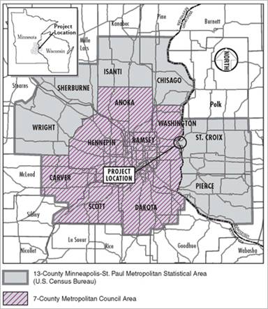
Figure 1: Map showing location of St. Croix River Crossing
The St. Croix River crossing at Stillwater, Minnesota, is a
highway bridge connecting downtown Stillwater to the Town of St.
Joseph in St. Croix County, Wisconsin. The crossing consists of a
1,050‑foot-long, 10-span, 2-lane bridge and a 750-foot
earthen causeway extending from the Wisconsin shoreline. It is
known as “the Lift Bridge,” because one of the spans is
a distinctive vertical lift span. The bridge, which opened in 1931,
was listed on the National Register of Historic Places in 1989.
Frequent raising of the bridge to allow boats to travel the St.
Croix River causes traffic congestion in Stillwater and Houlton,
Wisconsin, as traffic backs up to wait for the bridge to lower and
resume vehicular traffic.
The Lift Bridge links Minnesota Trunk Highway (TH) 36 to
Wisconsin State Trunk Highway (STH) 64. TH 36 is a four-lane
divided highway through Oak Park Heights, Minnesota, that merges
with TH95 near the St. Croix River, a National Wild and Scenic
River. TH 36/TH 95 is a two-lane highway connecting Oak Park
Heights to downtown Stillwater, where TH 36 continues east to the
Lift Bridge. STH 64 is a three-lane rural highway up the Wisconsin
bluff into Houlton in the Town of St. Joseph. STH 64 merges with
STH 35 in Houlton and continues as a two-lane rural highway
northeast through St. Joseph, expanding to a four-lane highway at
150th Avenue.
The 80-year-old bridge requires substantial investments to keep
it operating and to maintain navigation on the St. Croix River.
Traffic often is disrupted because of bridge deck lifts, flooding,
and maintenance. The narrow widths and functional deficiencies of
the approach roadways cause safety and congestion issues, because
the roadways are at or above traffic capacity.
Planning History
Consideration of a replacement bridge over the St. Croix River
near Stillwater began in the early 1970s. Formal assessment of
alternatives began with the preparation of the St. Croix River
Crossing Draft Study Outline and Scoping Document (1985).
Alternatives assessed with the 1985 document eventually led to the
analysis of three river crossing corridor alternatives and two
tunnel alternatives with the 1990 Draft Environmental Impact
Statement (EIS). In 1995, the Final EIS identified a preferred
alternative, and a Record of Decision was issued on July 10,
1995.
Final design, right-of-way acquisition, and site preparation
began but were halted following the 1996 finding of the NPS Section
7(a) Evaluation that the project would have a direct and adverse
effect on the values for which the Lower St. Croix River was
included in the National Wild and Scenic River System. New
alternatives were identified in 1998. Work on a Supplemental Draft
EIS was halted in January 2001 because of inability to reach a
consensus on the future of the Lift Bridge.
In 2002, FHWA, Mn\/DOT, and WisDOT reinitiated the St. Croix
River Crossing Project EIS process, including a mediation and
dispute resolution process that centered on a stakeholder group
made up of representatives of the diverse interests in the project
area. The 2004 scoping document identified four build alternatives
for study in the Supplemental Draft EIS (2004).
The 2006 St. Croix River Crossing Supplemental Final EIS
identifies the preferred alternative and documents the social,
economic, and environmental impacts associated with it. The
preferred alternative was identified from the alternatives
evaluated in the 2004 Supplemental Draft EIS. The Supplemental
Final EIS documents the river crossing location, approach roadway
design, bridge type, and mitigation package to be included with the
preferred alternative.
Following public review of the Supplemental Final EIS, FHWA
signed a Record of Decision in November 2006. Final design is under
way, although a lawsuit against the project is pending. Mn\/DOT
plans a pile load test in 2010.
Purpose and Need
The purpose of the project is to improve Minnesota TH 36 and
Wisconsin STH 64 through Oak Park Heights and Stillwater into the
Town of St. Joseph, and to provide a safe, reliable, and efficient
transportation corridor by reducing congestion, improving roadway
safety, and providing an adequate level of service for traffic
volumes forecast for 2030. Transportation needs for this project
fall into two primary categories:
- Transportation mobility on a safe and efficient
facility
- A reliable crossing of the St. Croix River
As part of its work on the project, the stakeholder group
developed a project purpose and need statement. The goal of the
project is to manage congestion and improve mobility in a reliable,
safe, and cost-efficient manner as part of a broader program of
regional transportation improvements while avoiding (and when
unavoidable, minimizing and mitigating for) impacts to the
area’s social, economic, cultural, and environmental needs
and objectives.
The deficiencies of the existing and future no-build
transportation systems are:
- Poor traffic operations on TH 36 and in downtown
Stillwater
- Diversion of traffic volumes to other St. Croix River
crossings
- High crash rates
- Delayed emergency response
- Impeded access
- Interrupted, unreliable river crossing
- Lack of bicycle/pedestrian facilities.
- Inability of transportation system management /travel
demand management methods to address transportation needs in the
project area (Note: A possible transit market has been
identified.)
Travel Forecasting Summary
The regional travel demand model developed by the Met Council,
the MPO for the Twin Cities, includes the Minnesota side of the
study area. The study team added the Wisconsin portion of the study
area into the Met Council model. The study team used the
project-specific model to document purpose and need and to assess
alternatives. A peer review panel assessed the study team’s
methodology for developing the model, including underlying land use
assumptions, and made suggestions to enhance the modeling.
Case Study Illustration of the Guidance
The St. Croix River Crossing Study provides a good illustration
of three of the key consideration contained in FHWA’s
Guidance on the Application of Travel and Land Use Forecasting in
NEPA. With a study area that contained a natural barrier to travel
– the St. Croix River – and a travel model that
originally did not include the portion of the study area in
Wisconsin, much effort was directed toward early efforts to
coordinate with stakeholders and determine the modeling
requirements. This case study emphasizes the following
considerations from the guidance: 1. Project Conditions and the
Forecasting Needs of the Study; 2. Suitability of Modeling Methods,
Tools, and Underlying Data; and 3. Scoping and Collaboration on
Methodologies.
Key Consideration 1 of the Guidance: The Project Conditions and
Forecasting Needs of the Study
The St. Croix River crossing remains one of the most
controversial highway improvements in the country. Areas of
controversy include historic preservation, natural environment
impacts, and indirect effects related to future development. The
proposed location for a new bridge, at the far east end of the Twin
Cities metropolitan area connecting to a rapidly developing area of
western Wisconsin, puts the project in the middle of a debate on
the role of transportation: accommodating planned development, or
promoting development?
The large St. Croix is an excellent barrier to sprawl. Critics
of building a new, wider bridge are concerned that the bridge would
reduce that barrier and facilitate low-density development far from
the center of the Twin Cities. Proponents argue that the 2-lane
bridge, in addition to being functionally obsolete, is inadequate
to accommodate the growth that had already occurred.
In 2002, years after the Record of Decision had been set aside
because of a lawsuit, Mn\/DOT, WisDOT, and FHWA, in consultation
with other federal agencies, decided to prepare a supplemental EIS.
Mn\/DOT’s preparation of the supplemental EIS included a
formal scoping process.
The final scoping document (amended March 2004) did not mention
travel demand forecasting as a key issue, but the
transportation–land use relationship had been the subject of
considerable discussion dating back to the original EIS process.
The travel demand forecast memorandum (June 2004) discusses at
length the methodology and findings, including the use of a peer
review panel.
The study area is considerably larger than the immediate
6.5-mile corridor. The Lift Bridge is one of four river crossings
between the Twin Cities and less-developed western Wisconsin.
Adding capacity to the Stillwater crossing would lower traffic
volumes at the other three crossings, just as the travel demand
model indicates that the existing bridge results in diversion to
the other three crossings today. Seventy percent of weekday trips
on the bridge begin or end in the six Minnesota and Wisconsin
communities adjacent to it. However, on weekends 45 percent of
trips begin and end outside the local area (St. Croix River
Crossing Supplemental Final EIS, pp. 4-3 and 4-4).
On the Wisconsin side of the St. Croix River the population of
the St. Croix County area increased from 78,000 to 96,000 between
1990 and 2000, or 2.1 percent annually. St. Croix County itself had
the second highest rate of growth of any county in Wisconsin during
the 1990s (see travel demand technical memorandum, p. 2).
Average annual daily traffic volumes on the Lift Bridge has
remained essentially unchanged since 1990, at 15,000 to 16,000
vehicles per day. The lack of growth in traffic is due to the lack
of excess capacity on the bridge. During the same period, traffic
on adjacent bridges has grown at an annual rate of 3.5 to 3.8
percent (travel demand memorandum, p. 2).
Stable traffic volumes on the Stillwater Bridge, in the face of
strong population increase in the surrounding area on both sides of
the crossing, clearly indicates that the bridge capacity is
constrained. Therefore, the travel demand forecast methodology
examined the unconstrained traffic volumes at this and the adjacent
crossings.
Key Consideration 2 of the Guidance: The Suitability of
Modeling Methods, Tools, and Underlying Data
Peer Review Panel
In 2004 the study team selected and convened a peer review panel
made up of four travel demand modeling experts from around the
country. The panel consisted of two consultants and two academics.
Two panelists were travel demand modelers, the other two land use
experts. None was from the Twin Cities area. The panelists were
selected based on discussions between the MPO, MnDOT and their
consultant, and the Sierra Club. MnDOT concurred with the suggested
panelists. The panelists were paid by MnDOT and WisDOT through
their consultant’s contract.
The purpose of the panel was to conduct an independent
assessment of the methodologies the study team had used in
developing the travel demand forecast. The panel focused on the
process of forecasting methodologies; it did not check the travel
demand model for accuracy. The peer review committee concluded its
analysis of the model before the alternatives were developed.
The peer review resulted in a number of recommendations. The
following recommendations were implemented:
- The initial proposal included recommendations for
commuter rail lines and longer-distance water taxis. These options
were eliminated from Alternative A based on discussion of
preliminary results by the peer review panel
- The calculation of value of time was made at the
recommendation of the peer review panel for travel forecasts. It
differs from the value of time estimates used by Mn\/DOT’s
Office of Investment Management.
- One change from the standard Twin Cities Regional
modeling process made at the suggestion of the peer review panel
was to increase the number of iterations in the gravity model to
improve model closure—the equalization of modeled attractions
to input trip attractions.
- Other key recommendations were to incorporate more
iterations of the highway assignment model, to specifically assess
the stability of the Lift Bridge volumes across iterations, and to
increase the number of full model iterations (or feedback loops).
The object of these improvements was to increase the stability of
the model.
Consideration of Tools Required to Forecast Needs
The study area is at the edge of the Twin Cities MPO’s
regional travel demand model. As a result the study team used the
MPO model as a base and then added in the roadway network on the
Wisconsin side of the study area to develop a project-specific
model. The MPO’s 7-county model was modified to add areas
north and west of the MPO boundaries. Additional highway network
and traffic analysis zones, as well as modified external links,
gravity model, and highway assignments, were included the model to
make is usable for the St. Croix River crossing study. Once the
model was developed and validated, the level of forecasting did not
vary as the number of alternatives decreased.
In relation to land use forecasts, the study team noted that the
St. Croix County Development and Management Plan (2002) and the MPO
travel demand model assumed a new bridge. This was the subject of
considerable discussion during and before the 2004 scoping process
on the relationship of transportation and land use. There was
little question among project stakeholders that the travel demand
model was technically sound, but there were many questions from
stakeholders on the land use assumptions used to develop the travel
demand model. The key question in the debate was whether the new
bridge would accommodate planned development or promote new
development.
The MPO’s travel demand model, which formed the basis of
the project team’s travel demand model, was based on one
fixed set of land use assumptions. Because dynamic land use
modeling was not available at the time, the study team addressed
the issue of whether the need for the project would remain valid
under different land use assumptions.
Working with the peer review panel, the study team developed an
“accessibility-based growth redistribution model” that
the peer review panel deemed a good surrogate for a dynamic land
use model. Under this model, a series of assumptions on
commercial/industrial development, reasonable travel time, retail
employment, households, and population were developed for a
scenario with no new bridge.
The reduced growth methodology relied on the travel forecasting
model, in tandem with findings on correlation coefficients between
transportation facilities and development in the Twin Cities
metropolitan area. The results suggested that under the No-Build
Alternative population growth in western Wisconsin portion of the
study area would be 36 percent lower than under the Build
Alternatives. The travel demand forecasting memo notes that the
results likely overstate the reduction in growth because the
analysis assumed full elasticity between development location and
access to jobs; in reality many other factors are at play.
Despite the relatively large reduction in growth that the
analysis suggests, when translating the reduced growth to trips and
specifically St. Croix River crossings, the projected demand for
crossings in the Stillwater-area still exceeded the capacity of the
existing Lift Bridge. This allowed the study team to illustrate
that if less growth occurred, there still would be a need for
improvements to the river crossing.
Key Consideration 3 of the Guidance: Scoping and Collaboration
on Methodologies
The study predated the SAFETEA-LU Section 6002 provisions, but
the study team developed and used a broad and thorough agency
coordination process. The origin of the Supplemental EIS study was
discussions among Mn\/DOT, WisDOT, FHWA, and other state and federal
agencies that recognized the need to address the project issues by
starting a new study (the project was suspended in 2001). According
to Section 15 of the 2004 Supplemental Draft EIS:
In September 2002, the facilitation firm RESOLVE was selected by
a multi-agency and stakeholder panel to facilitate a project
decision through mediation. RESOLVE developed a dispute resolution
process that centered on a “Stakeholders Group,”
composed of representatives of the diverse interests in the project
area (see table). This process, known as the “Stakeholder
Resolution Process,” responded to the need for a new start to
the project, and a new approach to address the environmental,
historical and transportation concerns surrounding the project.
Local, State, and Federal Agencies, and Nongovernmental
Groups
Involved in Stakeholder Group Discussions
- Advisory Council on Historic Preservation (Washington, D.C.)
- City of Oak Park Heights (Oak Park Heights, MN)
- City of Stillwater (Stillwater, MN)
- Federal Highway Administration (St. Paul, MN)
- Friends of the St. Croix (Marine on St. Croix, MN)
- Minnesota Center for Environmental Advocacy (St. Paul, MN)
- Minnesota Department of Natural Resources (St. Paul, MN)
- Minnesota Department of Transportation (St. Paul, MN)
- Minnesota State Historic Preservation Office (St. Paul, MN)
- National Park Service (St. Croix Falls, WI)
- New St. Croix Bridge (Stillwater, MN)
- Preservation Alliance of Minnesota (Minneapolis, MN)
- Sierra Club (Minneapolis, MN)
- St. Croix Alliance for an Interstate Bridge (New Richmond, WI)
- St. Croix County Transportation Committee (Hammond, WI)
- St. Croix River Association (Stillwater, MN)
- Stillwater Area Chamber of Commerce (Stillwater, MN)
- Stillwater Heritage Preservation Commission (Stillwater, MN)
- Stillwater Lift Bridge Association, Inc (Stillwater, MN)
- Town of St. Joseph (Town of St. Joseph, WI)
- U.S. Army Corps of Engineers (St. Paul, MN)
- U.S. Coast Guard (St. Louis, MO)
- U.S. Environmental Protection Agency (Chicago, IL)
- U.S. Fish and Wildlife Service (Bloomington, MN)
- Western Wisconsin Realtors Association (River Falls, WI)
- Wisconsin Department of Natural Resources (La Crosse, WI)
- Wisconsin Department of Transportation (Eau Claire, WI)
- Wisconsin State Historic Preservation Office (Madison, WI)
The purpose of the Stakeholder Resolution Process was
established in an Operating Agreement developed by RESOLVE. The
purpose of the Stakeholder Resolution Process as agreed by the
stakeholder group was:
- To facilitate a common understanding of the
transportation, environmental and historic reservation issues among
the government and non-government stakeholders;
- To define the various solutions (including transportation
alternatives) to these issues by exploring the advantages and
disadvantages of each solution;
- To arrive, if possible, at a consensus; and
- To reach agreement among permitting/cooperating/core
agencies on the components of the Supplemental Draft EIS for the
long-term bridge project and on the related regulatory conclusions,
among them: Section 7 of the Wild and Scenic River Act, Section 106
of the Historic Preservation Act, Section 4(f) of the U.S.
Department of Transportation Act, and local concurrence.
The Operating Agreement for the St. Croix River Crossing
Stakeholder Resolution Process was formally accepted by the
stakeholder group in June 2003.
The stakeholder group was involved in all aspects of the
project, not just travel demand forecasting. But the work of the
peer review panel helped to address such issues as land use
assumptions and indirect effects, which were a key topic of debate
among the stakeholders group. The peer review panel gave the study
team’s travel demand model credibility among the
stakeholders. Specifically, the stakeholder group accepted the peer
review panel’s validation of the accessibility-based growth
redistribution scenarios—how future land use would be if
there were no new bridge—as a surrogate in the absence of
dynamic land use planning. When the accessibility-based growth
redistribution scenarios showed a need for the project, even under
a reduced land use development scenario, discussion of whether
additional river crossing capacity was needed was put to rest. This
allowed the NEPA process to proceed with developing and assessing
alternatives.
Additional Background and Sources
FEIS and ROD
Supplemental Draft and Final EISs were prepared for the St.
Croix River Crossing project and were sources of information for
this case study. The St. Croix River Crossing Supplemental Draft
EIS was signed in August 2004. The Supplemental Final EIS was
approved in June 2006. A Record of Decision was issued by FHWA in
November 2006.
Documents available at: http://www.dot.state.mn.us/metro/projects/stcroix/documents.html - content is no longer available.
Technical Reports
Travel Demand Forecast Technical Memorandum, June 2004.
(Available at the same website as the EIS.)
New Reports and Addendum to the Existing Technical
Documents
Amended Final Scoping Document, 2004.
Contacts
- Todd Clarkowski
- Minnesota Department of Transportation
- 1500 W Co Road B2
- 050
- Roseville, MN 55113
- (651) 234-7714

