Linking Lands and Communities in the Land-of-Sky Region

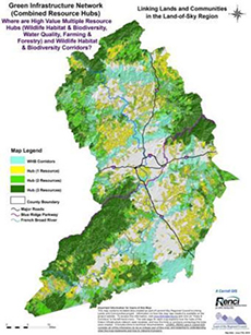
Green infrastructure map with biodiversity corridors and hubs. (Courtesy of
LOSRC)
Land-of-Sky Regional Council (Western North Carolina)
| Total cost: |
$208,000 |
| FHWA share: |
$104,000 |
| Period of performance: |
24 months |
| Dates: |
March 17, 2008 – March 17, 2010 |
| Status: |
Complete |
| AOTR: |
Michael Lamprecht |
| Grant-project website: |
http://www.landofsky.org/ |
Project Goals
The goal of the Land-of-Sky Regional Council (LOSRC) Eco-Logical grant project was to develop a green infrastructure framework to identify priority ecological resources and areas suited for future development in a four-county region of Western North Carolina. Based on stakeholder involvement and data analysis, LOSRC expanded the initial project to encompass a larger boundary and created several publicly available resource maps. The project materials include data and maps on water quality, agricultural suitability, wildlife habitat, and biodiversity.
Project Activities and Accomplishments
LOSRC developed resource assessments and a Regional Green Infrastructure Network map, using State and local GIS data and national spatial data integration tools. The French Broad River MPO, housed within LOSRC, incorporated information and maps from the Green Infrastructure Network into the “Environmental Analysis” chapter of its LRTP. The MPO used the information to map priority transportation projects over the Green Infrastructure Network to identify potential areas of conflict and shared the results with NCDOT.
LOSRC engaged State and local resource agencies, local developers, and landscape architects to assist in data collection and in applying the framework to local and regional plans and projects. LOSRC enlisted the expertise of regional biologists and ecologists to ensure that wildlife habitat and corridor maps best reflected regional values and scientific data. In addition, LOSRC partnered with the Renaissance Computing Institute at the University of North Carolina-Asheville and a GIS consultant to conduct the analysis and produce maps.
Future Steps
LOSRC has incorporated data from its Eco-Logical project into GroWNC, a current three-year regional planning initiative supported by U.S. Department of Housing and Urban Development grant funds. GroWNC is using the Eco-Logical grant project tools and maps to prepare scenarios that present possible futures related to economic growth and land development patterns for five local counties. LOSRC anticipates that the selected scenario will include strong natural resources components, supported by data from the Eco-Logical project. Through GroWNC, LOSRC staff are reaching out to local governments to help them better use maps and tools from the Eco-Logical project. LOSRC also received additional grant funding from the Blue Ridge National Heritage Area to share the project approach and results with four adjacent councils of governments. Data from the Eco-Logical project will also be utilized in future regional economic development, conservation, agricultural, and water resources projects.
Insights on Eco-Logical
Through its Eco-Logical grant project, LOSRC has recognized the importance of communicating the benefits (especially economic benefits) of data and tools to stakeholders, as they are more likely to use these resources if they understand the resulting benefits. This communication, however, is a significant time investment for LOSRC. LOSRC noted that encouraging commitment from local governments at the beginning of the planning process can help to streamline later implementation efforts. In addition, this commitment can help to strengthen Eco-Logical’s integration into daily business practices among environmental and transportation agencies.
<< Return to Grant Projects

