VIRGINIA DEPARTMENT OF TRANSPORTATION
Comprehensive Environmental Data and Reporting System (CEDAR)
Program Description

Virginia Department of Highway Building.
(Source: Wikimedia Commons, Morgan Riley, 2011.)
Program Benefits
- Virginia DOT’s (VDOT) Comprehensive Environmental Data and Reporting System (CEDAR) provides VDOT designers data on historic properties and other potential “red flag” environmental issues early in project development.
- The availability of cultural resource spatial information, along with other environmental datasets, has improved the comprehensiveness of VDOT’s transportation planning efforts.
Virginia Department of Transportation’s (VDOT) “Comprehensive Environmental Data and Reporting System” (CEDAR) was developed primarily as a tool for improving early project development. CEDAR includes data on historic properties, in addition to natural resources and other environmental factors. The program organizes all environmental data (including specific project documents, forms, and images) into one system, accessible to VDOT staff.
Setting Up the Program
The CEDAR Geographic Information System (GIS) database was developed by in-house Information Technology (IT) experts augmented with work by a few consultants. As a first step, VDOT spent six months conducting research and discussing the program with potential users within VDOT’s environmental office. The goal was to fully document how VDOT staff would want to use the proposed GIS once it was in place.
State Planning and Research (SPR) funds were used to develop the CEDAR program and database. These funds covered staff costs, but were not used for software or hardware purchases. The State’s IT agency reviewed the development of the GIS, as did an internal VDOT IT board. Since SPR funds were used, FHWA also had a review role.
Prior to initiating the development of the environmental database, VDOT IT staff had just finished developing the State Historic Preservation Office’s (SHPO) data-sharing system, a web-based, GIS-enabled cultural resource database. VDOT used SPR money to develop SHPO’s database.
After one full year (2003) of internal interviews and requirement development, VDOT created a read-only release of the CEDAR database. All existing cultural resources databases, including the SHPO database, were converted into the new CEDAR database. In 2004, the new system was in place.
Challenges Encountered
Program Elements
- Historic Preservation in Early
Project Development
- Geographic Information Systems
- Historic Property Database
- Historic Property Screening Tool
- Historic Property “Red Flags”
One challenge was getting buy-in from the environmental staff and from staff unfamiliar with using computers to track environmental data. This new program placed all environmental data in one place, and forced everyone to work the same way, using predefined environmental screens. Implementing this program was the single largest change in the history of VDOT’s environmental program.
Working with the environmental staff (i.e., the future users) in developing the program helped advance CEDAR. Users had input into the design of the program, so CEDAR was built from the bottom up, not the top down. This helped in obtaining buy-in from VDOT staff.
Program Maintenance
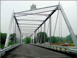
Goshen Bridge, Goshen, Rockbridge County, Virginia
(Source: SRIF AASHTO publication, 2011.)
VDOT’s CEDAR system and its associated GIS platform have been enhanced to include additional modules and increase performance. Additional modules include environmental contract procurement functionality. Performance increases include transformation of the GIS platform (Integrator 2.0) to current software standards.
System modifications to CEDAR and its associated GIS platform have been funded primarily through remaining SPR funds. Economic and budget issues have not affected the program directly; however, it is clear that there is increased competition for limited funds available for system development and enhancement.
The most significant challenge to maintaining the program is the delays in implementing the system enhancements due to competing agency information technology needs. To overcome the backlog and increase the speed of deploying enhancements, the Environmental Division is funding a position in VDOT’s Information Technology Division that is devoted exclusively to CEDAR enhancement.
VDOT is placing increasing emphasis on highway maintenance and less on construction. Accordingly, more maintenance projects are being entered in the system – especially if Federal funds or permits are involved. Some of these maintenance projects have minimal or no involvement with environmental issues; thus attention is paid to identifying the most efficient methods to clear such “minimal” projects by reducing the burden of using system functionality designed for larger highway construction projects.
VDOT is committed to using and enhancing CEDAR as its platform for environmental analysis and documentation. Short-term future enhancements include implementation of mobile data collection functionality, and continued enhancement of “real time” GIS relationships with provider-agencies, such as the SHPO.
Critical Factors for a Successful Program
There are three critical factors that have contributed to the success of the CEDAR program:
- Effective linkage to other VDOT systems (avoidance of “stove-piping” and data entry duplication);
- Use of the system to produce environmental review products (e.g., Section 106 effect determinations); and
- Training of staff throughout VDOT on the use of CEDAR.
June 1, 2012

