Federal Highway Administration and Federal Railroad Administration
April 17, 2015
View Concurrence Letter →
Table of Contents
Back to top
ACRONYMS
| AASHTO |
American Association of State Highway and Transportation Officials |
| ALIS |
Accident Location Information System |
| AMM |
Avoidance and Mitigation Measure |
| BA |
Biological Assessment |
| BMP |
Best Management Practice |
| DOT |
Department of Transportation |
| EPA |
Environmental Protection Agency |
| ESA |
Endangered Species Act |
| FAHP |
Federal-Aid Highway Program |
| FHWA |
Federal Highway Administration |
| FLHP |
Federal Lands Highway Program |
| FLMA |
Federal Land Management Agency |
| FRA |
Federal Railroad Administration |
| FTA |
Federal Transit Administration |
| HMA |
Hotmix Asphalt |
| HSM |
Highway Safety Manual |
| LED |
Light-Emitting Diode |
| LPA |
Local Public Agency |
| NEPA |
National Environmental Policy Act |
| NLAA |
Not Likely to Adversely Affect |
| NLEB |
Northern Long-Eared Bat |
| NPDES |
National Pollution Discharge Elimination System |
| NPS |
National Park Service |
| P1 |
Priority 1 |
| P/A |
Presence/Absence Survey |
| PA |
Programmatic Agreement |
| PCCP |
Portland Cement Concrete Pavement |
| PPV |
Peak Particle Velocity |
| ROW |
Right-of-Way |
| SWPPP |
Storm Water Pollution Prevention Plan |
| TOY |
Time-of-Year |
| TRT |
Track Renewal Train |
| USACE |
U.S. Army Corps of Engineers |
| USDOT |
U.S. Department of Transportation |
| USFS |
U.S. Forest Service |
| USFWS |
U.S. Fish and Wildlife Service |
| WNS |
White-Nose Syndrome |
Back to top
1 INTRODUCTION/BACKGROUND
1.1 Involved Agencies
This Biological Assessment (BA) covers many of the activities funded or authorized by the Federal Highway Administration (FHWA) and/or Federal Railroad Administration (FRA). The FHWA and FRA are modal administrations within the U.S. Department of Transportation (USDOT). FHWA supports State and local governments in the design, construction, and maintenance of the Nation's highway system (Federal-Aid Highway Program (FAHP) and various Federal and Tribal owned lands (Federal Lands Highway Program (FLHP). The FRA issues, implements, and enforces rail safety regulations and provides selective investment in rail corridors across the country through grant development and oversight. For FHWA and/or FRA projects that involve Federal permits, such as U.S. Army Corps of Engineers (USACE) permits under the Clean Water Act, the FHWA and/or FRA will generally be the lead Federal agency for the purposes of consultation with the U.S. Fish and Wildlife Service (USFWS) under Section 7 of the Endangered Species Act (ESA). For FHWA and/or FRA projects that involve other Federal Land Management Agencies (FLMAs), the FHWA and/or FRA may use the consultation protocol established herein; initiate consultation on a case-by-case basis; or if applicable, follow another existing consultation mechanism developed by the FLMA (e.g., existing consultations established for USFWS National Wildlife Refuges, U.S. Department of Agriculture (USDA) Forest Service [USFS] lands).
1.2 Covered Species
This BA addresses two species, the federally-listed endangered Indiana bat (Myotis sodalis) and the federally-listed threatened northern long-eared bat (NLEB) (Myotis septentrionalis) (effective May 4, 2015). An interim 4(d) rule (80 FR 17974) was published for the NLEB on April 2, 2015, (also effective May 4, 2015). The interim rule does not remove, or alter in any way, the consultation requirements under Section 7 of the ESA.
1.3 Programmatic Consultation Process
FHWA, FRA and USFWS jointly developed this programmatic ESA Section 7 consultation for common types of transportation actions. The intent of USDOT and USFWS is to implement a range-wide programmatic consultation for the Indiana bat and NLEB that streamlines the consultation process and results in better conservation for both bat species. USFWS Field and Regional Office staff and managers from Regions 2, 3, 4, 5, and 6 have been involved in developing this programmatic biological assessment and programmatic ESA Section 7 consultation process. This consultation is not intended to cover all types of FHWA/FRA transportation actions. Separate or additional Section 7 consultation would be required for projects that may affect these ESA listed bat species and their designated critical habitat or other ESA listed species and their designated critical habitat outside the scope this assessment.
Programmatic consultations provide a framework for conducting efficient ESA Section 7 consultations through consistency and standardization of project reviews. Programmatic consultations also help expedite the review and permitting process for proposed activities. This programmatic informal consultation applies only to those projects that can meet the effect determinations, project conditions, and conservation measures described in this document. For most projects, this is a one-time consultation with no additional tiered or site-specific consultation between the FHWA/FRA/State Departments of Transportation (DOTs) and USFWS.
Under the terms of this programmatic consultation, FHWA/FRA and/or State DOTs will submit project level information to the appropriate USFWS Field Office prior to project commencement (as described in the User Guide). FHWA/FRA and/or State DOTs will ensure that all submitted projects are within the scope of work, and adhere to the criteria of this BA. Upon receipt, USFWS Field Offices may check for consistency and request any additional information. USFWS Field Offices will have time (see User Guide) to notify FHWA and/or State DOTs if they determine a particular project does not adhere to the parameters of this programmatic consultation, otherwise FHWA and/or State DOTs will proceed under the programmatic agreement. This verification period is not intended to be another level of review; the presumption is that the vast majority of submitted projects fall correctly within the programmatic agreement. Rather, it is an opportunity for USFWS Field Offices to apply local knowledge to these projects, and they may identify a small subset of projects as potentially having unanticipated impacts.
FHWA/FRA and/or State DOTs may identify a small number of proposed projects that require additional site-specific information to determine if they conform to this consultation. Such projects will require FHWA and/or State DOTS to coordinate with the appropriate USFWS Field Offices in order to make a final determination of no effect or not likely to adversely affect, or alternately may affect, likely to adversely affect (see User Guide). If a project “may affect” any other federally-listed or proposed species, additional consultation (or conference if applicable) is required.
A requirement for all projects using the informal programmatic consultation is that site-specific projects will be documented and tracked in a data management system. Information required, roles and responsibilities, specific monitoring requirements, and other details regarding this process will be addressed in the Programmatic Consultation User's Guide. USFWS Field Offices must be provided the initial documentation for every project submitted for inclusion within the informal programmatic consultation. If the required project level information is not received, USFWS Field Offices will then assume the individual proposed project is not within the scope of the programmatic agreement and should expect FHWA and/or State DOTs to initiate individual consultation with the USFWS.
Monitoring individual projects will inform this programmatic process on project specific effects as well as the effectiveness of avoidance/minimization measures and conservation measures. The FHWA and USFWS will meet on an annual basis, or as needed, for the following purposes:
- Discuss annual report of covered projects,
- Evaluate and discuss the continued effectiveness of the programmatic consultation, and
- Update procedures and project criteria, if necessary.
There is no hard expiration date for this consultation, but there will be a review between the agencies and USFWS after the first year of implementation to evaluate function and determine needed improvements. Standard reinitiation conditions (e.g., new information on species or effects) also apply. Additional information may warrant changes to the programmatic BA either for the entire range of the species or specific geographic locations. For example, the effects analysis can be modified should data be gathered about the proximity of bat roosts to roads or the potential use of specific bridge types by Indiana bats or NLEBs. FHWA and FRA plan that this programmatic consultation be adaptive to new information regarding the species' ecology, conservation, and project effects. As relevant information becomes available, FHWA/FRA, in consultation with USFWS, may need to revise determination(s) and/or avoidance and minimization measures. In some cases, these data may be relevant in only a portion of the bats' ranges and the range-wide programmatic agreement can be amended specifically for a State or other geographic region to reflect those distinct conditions.
At any time, FHWA or the USFWS may revoke or revise this programmatic consultation if it is determined that it is not being implemented as intended.
Back to top
2 DESCRIPTION OF THE PROPOSED ACTION
2.1 Introduction
The proposed action is the continuing implementation of the FAHP, FLHP, and rail improvements funded or authorized by the FRA. The action includes current and future projects.
FHWA provides stewardship over the construction, maintenance, and preservation of the Nation's highways, bridges, and tunnels. FHWA also conducts research and provides technical assistance to Federal, State, and local agencies in an effort to improve safety, mobility, and livability, and to encourage innovation. FHWA strives to advance environmental stewardship and streamlining for FHWA-funded projects through the application of National Environmental Policy Act (NEPA) and related environmental laws and regulations.
The FAHP and FLHP are two FHWA programs addressed in this BA.
The FAHP provides the financial resources and mechanism to assist States and local public agencies (LPAs) in constructing, preserving, and improving transportation for the movement of people and goods. FAHP funds are authorized by Congress; tax dollars are allocated and distributed by FHWA directly to the State DOT, as a direct-recipient for Federal-aid projects or LPAs, as sub-recipients, for “eligible” activities.
The FLHP provides financial resources and technical assistance to support a coordinated program of public roads that service the transportation needs of Federal and Tribal lands. FLMAs include: the Bureau of Indian Affairs, Bureau of Land Management, Bureau of Reclamation, Surface Deployment and Distribution Command, USFS, USFWS, National Park Service (NPS), and the USACE.
Road miles (interstate, State highway and local roads) total 100,000 miles or more in many States within the range of the bats. Rail miles range from 3,000 to 6,000 in a sample of States within their range. On an annual basis, the number of existing road and rail miles undergoing maintenance or improvements involving tree clearing in suitable habitat will largely be influenced by available funding. It is anticipated to represent only a fraction of a percent of the total infrastructure network.
The FRA is responsible for working with stakeholders to develop cohesive goals and policies for maintaining and improving U.S. freight and passenger rail networks, including approximately 760 railroads. The agency conducts strategic investment to accommodate growing travel and freight demands and provides leadership in national and regional system planning and development. FRA implements Federal environmental laws and policies related to railroads, and provides information and resources for environmentally sound planning and development.
For State or local transportation projects without any Federal involvement, this document can be used to help design projects to avoid “take”1 of Indiana bats and NLEBs.
2.2 New Road/Rail Construction
New construction activities can be associated with both railway and highway projects. Primary project objectives may include mobility and/or safety improvements. Examples of rail improvements include new siding track, a second mainline track, or a new rail maintenance access road. New roadway project examples range between construction with large project footprints, such as new interchanges, new general purpose lanes, realignments, new road corridors, or bypass routes or smaller footprints such as reconstructing existing interchanges, minor realignments, bicycle/pedestrian facilities, and new sidewalks. Widening or replacing aging bridges could occur for both highway and rail projects.
Several activities and components of transportation are described within the new roadway and rail construction category, such as staging area establishment, culvert extension and installation, and drainage system installation and enhancements. Blasting may also be required when expanding the road or rail corridor. Blasting is further described in the Slide Abatement section.
Unique components of highway construction include stormwater treatment facility construction, paving, painting, illumination, and signing. New roadway construction that is designed to increase mobility often occurs in urban areas. In these cases, very little undeveloped or undisturbed property is impacted and most of the impacts would occur in the existing rights of way. New highway interchange construction could occur in areas that are highly developed or within areas that are becoming increasingly developed, but do not typically occur in rural areas. Some new road construction is designed to improve the safety of the highway system. These projects include installation of sidewalks, slope flattening (which often require culvert extensions), and alignment modifications. Slope flattening and clear zone maintenance reduces hazards for automobiles that inadvertently leave the roadway. The clear zone is the total roadside border area that is available for safe, unobstructed use by errant vehicles. Slope flattening typically involves the placement and removal of fill material on existing cutslopes. Slopes are flattened to make them more traversable and improve site distance. Slope and ditch repair involves re-grading ditches and slopes to the current safety standards and design slopes. It may also include filling in or repairing sides of the ditches where necessary. Alignment modifications may include adding auxiliary lanes (e.g., truck climbing and acceleration lanes), channelization (new turn lanes), or on- and off-ramp extensions, or realigning an intersection to improve the sight distance. If a new lane is added, an alignment modification of the adjacent road may be necessary to maintain continuity of the roadway. Alignment modifications may also straighten curves or approaches to bridges. Alignment modifications could range in length from a few hundred feet to a couple thousand feet for curve realignments, or up to a few miles for realigning a major section of roadway. Truck lanes, turn lanes, and acceleration lanes typically average between 10 and 12 feet wide. Sidewalk widths vary from 5 to 10 feet wide, depending on jurisdiction and intended use. Road realignments and widenings often range between 0.25 and 5.0 miles in length. New interchanges and interchange improvements are also common but less frequent safety projects.
Staging Areas – Staging areas are used for delivery and storage of construction materials and equipment, contractor office and storage trailers, and employee parking. They would be similar for road and rail projects and are typically contractor-selected and permitted. These areas are often fenced and located in proximity to project construction. Temporary fencing prevents machinery and equipment, materials storage, and construction activity from intruding into adjacent properties, wetland and stream buffers, and shoreline areas. Office trailers, placed on temporary foundations, are often connected to available utilities including power, telephone, water, and sewer as needed. Connecting to these utilities may include installing poles for power lines and excavating trenches to place water and sewer pipelines. After construction is complete, staging areas are restored, if appropriate, and disconnected from any utilities.
Depending on site conditions, construction staging areas vary in size and may require vegetation clearing, grubbing, and grading or excavation to level the site and install drainage improvements. Extensive alterations to establish a staging area, such as blasting, are extremely unlikely. Cleared vegetation is often hauled offsite, mulched and redistributed, or less commonly piled and burned onsite. Excess material (e.g., soil, rock, debris) is disposed of at offsite facilities or reused as appropriate in construction. Conveyance systems for the movement of stormwater from a collection point to an outfall can consist of drainage pipes and stormwater facilities (such as ponds, vaults, and catch basins), using gravity or pumps to move the stormwater. Temporary driveways and access roads may be established from staging areas to the existing roadway network. Some staging areas may also be equipped with wheel washes that clean truck tires to reduce tracking dirt and dust offsite. Additional dust control is provided via water trucks and street sweepers.
Staging, fueling, and storage areas are typically located in areas that minimize potential effects to sensitive areas. Specialized best management practices (BMPs) are employed around concrete-handling areas to prevent water contamination from uncured cement entering water bodies or stormwater facilities. Temporary erosion and sediment (E&S)control measures are implemented prior to ground disturbance on these sites. Examples include marking clearing limits, establishing construction access, controlling runoff flow rates (sediment ponds, check dams, etc.), installing sediment controls and soil stabilization (silt fence, coir blankets, temporary seeding), protecting slopes, protecting drain inlets, and preventing/containing contaminant spills.
Offsite Use Areas – Offsite use areas are necessary for rail and roadway projects and mainly consist of borrow material and waste disposal sites. Depending on the project, they can be owned by the State DOT or another public or private entity. They are typically permitted separately from the project and are contractor-selected. Common activities associated with material sites include vegetation removal, excavation, rock crushing, and blasting.
Project specific locations include such areas as staging areas, access roads, borrow areas, and waste disposal areas for project related activities. These types of project-related activities may or may not occur within the project limits of construction and are often carried out by State DOT contractors. For projects included in this programmatic consultation 1) State DOTs and their contractors shall adhere to Federal (FHWA/FRA) contract requirements; 2) comply with all state and federal laws concerning activities in those offsite areas; and 3) implement the applicable avoidance and minimization measures (AMM) list in this document, as appropriate. Contractors must provide documentation to State DOTs and FHWA/FRA when requested to demonstrate compliance with Federal contracting requirements and all state and Federal laws. If a new staging or access area, or new pit is used outside the projects construction limit, such new offsite use areas must meet the requirements for coverage under the programmatic BA. Projects not meeting these criteria will not be covered under this informal programmatic consultation and will require individual consultation with the local USFWS Field Office.
Site Preparation – Site preparation applies to rail and roadway projects and begins with vegetation removal, which may be permanent or temporary. Permanent conversion of a vegetated area into a developed area includes clearing vegetation then grubbing out the roots. Temporary vegetative clearing includes cutting vegetation but maintaining the root mass to allow for regrowth. Removed vegetation is disposed of similarly to staging area vegetation clearing. Preliminary earthwork consists of stripping topsoil from an area and either removing earth or placing and compacting earth for roadway prism construction or slope construction. The earth may be moved from or to another section on the same project, or it may come from or be disposed off-site. Completed cut or fill prisms may then be covered by any number of treatments, such as rock base and pavement, rock stabilization and rip-rap, or mulch and seeding. Drainage and utility work often accompany excavation and embankment. Impacts to wetlands and other sensitive areas are first avoided and minimized as much as possible, then mitigated when unavoidable. Utility work includes excavation to install new utility poles or trench excavation to install underground utilities. This work can be in forested areas.
Temporary road construction is often necessary for equipment access and involves similar site preparation activities as conducted for permanent roads. However, these roads are often unpaved, either constructed by grading, laying fabric and quarry spalls, or construction mats. Compaction is minimized so the materials can be removed and the site restored and replanted following construction.
A variety of temporary construction BMPs are used for site preparation, including silt fences, berms, fiber wattles, storm drain inlet protection, straw bale barriers, check dams, and detention or siltation ponds. Erosion control measures are installed and operational before commencement of ground-disturbing activities. Areas where vegetation should be preserved are clearly marked or fenced. If work is conducted at night, temporary lighting is utilized.
Culvert Installation – Culverts include small concrete and box girders that do not qualify as bridges due to their size. Typically bridges less than 20 feet wide are referred to as either culverts or structures. Conventional culverts include, but are not limited to, concrete, corrugated metal, timber, and PVC piping. Culvert installation may occur independently or as part of a larger road improvement project. Culvert replacements also may occur as part of larger rail improvement projects. Proper culvert sizing is determined by consulting hydraulics manuals and fish passage guidance. Average culvert lengths range between 18 and 200 feet. Culvert replacements typically require less than one month to complete. Typical culvert replacements involve removing vegetation at the outlet and inlet area, removing existing pavement and roadbed to extract the existing culvert, placing the new culvert, backfilling and replacing the pavement, installing armoring and headwalls, re-vegetating if necessary, and if flow is present, dewatering the work area and establishing a flow bypass prior to initiating work. In-water construction typically occurs during low-flow months or work occurs during dry periods.
Bridge Construction – Bridge construction may be a component of a larger roadway or rail construction project or a stand-alone project. There are multiple types of bridges including but not limited to concrete slab, concrete arch, concrete box girder, concrete T beam, steel beam, pre-tensioned concrete beam, post-tensioned concrete beam, steel truss, and timber trestle. Bridges can span wetlands, streams, and other water bodies as well as roadway and other transportation infrastructure. Some bridges span the stream systems they are crossing, while others have piers in the channel. The number of piers in the channel varies by bridge. Most new bridges are designed to span as much of the river as possible, and to provide the least amount of constriction that is practicable on the system. Many bridge piers are now drilled shafts, eliminating shallow footings that are susceptible to scour.
Bridge replacements tend to be long-term projects requiring one or more years to complete. Installation of new bridges may require construction of a detour bridge. Occasionally, half of the new bridge is constructed adjacent to the old bridge and acts as the detour bridge while the original is removed and replaced. Occasionally, only the superstructure of railway bridges is replaced. Most bridge replacements use the same alignment, or they may be constructed near the old alignment. Temporary bridges may be built as construction platforms. Often, in-water work is timed to minimize impacts to sensitive aquatic species. Some sedimentation of the waterway may occur during pile driving and removal. Bridge removal can also result in sediments and small concrete chunks entering the water.
Major bridge replacement construction activities often include:
- Clearing and grading for road widening
- Clearing and grubbing of existing streamside vegetation
- Construction of stormwater facilities
- Excavation for new bridge abutments
- Construction of bridge columns/piers/abutments
- Concrete pouring
- Pile installation and removal
- Bridge demolition
- Riprap placement
- Paving with asphalt or concrete
Piles are installed using several different methods. Pile driving involves the use of an impact pile driving hammer, which is a large piston-like device that is usually attached to a crane. The power source for impact hammers may be mechanical, “air steam,” diesel, or hydraulic. In most impact drivers, a vertical support holds the pile in place while a heavy weight or ram moves up and down, striking an anvil which transmits the blow of the ram to the pile. In hydraulic hammers, the ram is lifted by fluid, and gravity alone acts on the down stroke. A diesel hammer, or internal combustion hammer, carries its own power source, and can be open-end or closed-end. An open-end diesel hammer falls just under the action of gravity. A closed-end diesel hammer (double acting) compresses air on its upward stroke and can therefore run faster than open-end hammers. Impact hammers can drive at a rate of approximately 40 strikes per minute.
Vibratory hammers can also be used to both install and remove piling. A vibratory hammer is a large, mechanical device, mostly constructed of steel (weighing 5 to 16 tons) that is suspended from a crane by a cable. A vibratory pile driving hammer has a set of jaws that clamp onto the top of the pile. The pile is held steady while the hammer vibrates the pile to the desired depth. Because vibratory hammers are not impact tools, noise levels are not as high as with impact pile drivers. However, piles that are installed with a vibratory hammer must often be “proofed.” Proofing involves striking the pile with an impact hammer to determine the load bearing capacity of the pile and may involve multiple impacts. If this is the case, noise will be elevated to that associated with impact pile driving. To remove piles, the hammer is engaged and slowly lifted with the aid of a crane, extracting the piling from the sediment.
Cofferdams are often installed to create an isolated work area which can be dewatered for bridge and culvert installations or improvements. Cofferdams may consist of large casings (hollow cylinders) or structures created out of sheet piles. The majority of these cofferdam installations are completed with vibratory hammers. The exception to the use of vibratory hammers is when the substrate consists of very hard material, such as bedrock. In such cases, impact pile driving may be necessary. In some cases, other construction methods are used, such as stacked Jersey barriers with an impermeable liner, sand bag/impermeable liner barriers, etc. These are accomplished typically by using a crane or excavator (Jersey barrier) or placed by hand (sand bags).
Bridges can be removed using several methods, including: (1) dismantled over water from adjacent bridge deck or approach; (2) dismantled over the water and lowered onto a barge and barged out to a dismantling site; (3) dismantled over water and sections removed by crane; and (4) falsework (temporary structures) can be built under and around the bridge, and the bridge dismantled by sections. Bridge removal methods are selected based on a number of factors, including the structure of the bridge, the size of the bridge and river, the location within the system, the topography, and the amount of access to the bridge and the banks. Since many older bridges have bridge piers in the system, these also need to be removed. Concrete piers can be removed by demolition using a hoe ram (as long as pieces do not enter the water), or removed by a vibratory hammer; they can be cut off two feet below the ground level, or a temporary cofferdam can be constructed and the material can be hydraulically removed (Table 1). The bridge demolition method will be determined by site and project-specific conditions.
Table 1: Bridge Removal Technique Examples
| Type of Structure |
Construction Method |
Access Method |
| Steel or Timber |
(a) Remove structure in segments with or without dropping pieces into water. |
(a) Work from shore via crane arm or other heavy equipment. |
| |
(b) Work from adjacent bridge deck or bridge approach. |
| (c) Work from temporary platform or false work erected within the water. |
| (d) Lower structure or segments onto barge. Barge material to shore. |
| Concrete |
(a) Remove structure in segments without dropping in water. Frequently concrete slabs may be removed via saw cutting |
(a) Work from shore via crane arm or other heavy equipment. |
| |
(b) Work from adjacent bridge deck or bridge approach. |
| (c) Work from temporary platform or false work erected within the water. |
| (d) Lower structure or segments onto barge. Barge material to shore. |
| Piers |
(a) Leave the piers in place |
N/A |
| |
(b) Piers located out of water - cut at ground level and remove. |
(a) Work from shore via heavy equipment. |
| (c) Piers located out of water - removed with hoe ram. |
(a) Work from shore via heavy equipment. |
| (d) Piers located in water - construct cofferdam around and remove pier. |
(a) Work from shore via crane arm or other heavy equipment.
(b) Work from adjacent bridge deck or bridge approach.
(c) Work from temporary platform or false work erected within the water.
(d) Lower structure or segments onto barge. Barge material to shore.
|
| (e) Piers located in water - use vibratory hammer to lift and remove. |
(a) Work from shore via crane arm or other heavy equipment.
(b) Work from adjacent bridge deck or bridge approach.
(c) Work from temporary platform or false work erected within the water.
(d) Lower structure or segments onto barge. Barge material to shore.
|
| (f) Piers located in water - cut or break off at or below surface level (dependent upon substrate). |
(a) Work from shore via crane arm or other heavy equipment.
(b) Work from adjacent bridge deck or bridge approach.
(c) Work from temporary platform or false work erected within the water.
(d) Lower structure or segments onto barge. Barge material to shore.
|
Isolation of the work area and stream is often required on bridge replacement projects. This may require the use of cofferdams, sandbag berms, temporary culverts or flumes, depending on site conditions. Bridge replacement projects often require column construction within stream channels. Column construction typically involves the isolation of the column location through the use of a large diameter steel sleeve that is driven into the stream substrate. All work, including excavation for the footing, placement of forms, and pouring of the concrete, would then be completed within the sleeve at each column location. This technique helps minimize construction impacts by isolating the work from the stream.
Bridge replacements may require more than one construction season, for multiple factors such as project complexity or if the in-water work may be limited to certain periods to minimize impacts to sensitive aquatic species. Often times, work on the out of water portions or behind cofferdams will occur year round.
Roadway Construction – Roadway construction activities generally include installation of the roadway itself, and associated facilities such as retaining walls, noise walls, and stormwater treatment.
A roadway embankment is a raised area of fill often used in roadway approaches. The construction of roadway embankment consists of building up soil or rock to create a new ground surface at the elevation needed for the new roadway or structure. Roadway embankments slope outward; therefore, the higher the embankment, the wider the surface area needed at the base. To avoid later settlement, rollers and hauling equipment thoroughly compact each layer of soil or rock. Retaining walls will be used to support the embankment fill area where other constraints may exist along the alignment. Once final grading is achieved, the roadway is paved, striped, and signed. Guardrails may also be installed if applicable. More detail on paving is provided in the Maintenance and Preservation section.
Retaining walls are used to minimize the footprint width of the roadway cut or fill. Because retaining walls can be virtually vertical, they create a much smaller footprint than an earth slope. They can be used to support the roadway when the roadway is higher than the surrounding ground. Retaining walls can also be used in situations where the road is lower than the surrounding ground. In this case, the retaining wall supports the adjacent soils and prevents them from slumping onto the roadway. Retaining walls are also used in areas where there is a high possibility of erosion, such as near a bridge abutment or water. The walls must have an area of free drainage between the retained soil and the back of the retaining wall to prevent water pressure from developing and adding to the soil loads. The drainage is usually provided by placing a layer of clean gravel and drainage pipes against the back of the retaining wall. There are a variety of wall types (soldier pile, mechanically stabilized earth [MSE], soil nail, etc.); the type used depends on the structure it supports, the ground slope being retained, and available area.
Noise walls are mitigation measures designed to reduce noise impacts on sensitive receivers. They are typically precast panels or cast-in-place walls. They can be cast in a wide variety of patterns to improve their aesthetics. On bridges, noise walls may be cast into the traffic barrier. Noise walls are constructed to withstand the forces of wind and seismic loads.
Stormwater facilities are typically constructed to collect and treat stormwater runoff from impervious surfaces such as roads and bridges. The type of facility constructed will depend on the topography, profile of the road or bridge segment, availability of land, and availability and proximity of an outfall site for collected and treated water. A variety of approaches are utilized, such as bioswales, constructed stormwater wetlands and ponds, vaults, and where possible, infiltration and dispersion.
Rail Second Mainline, Siding, and Turnout Track Construction – New track installation generally requires additional subgrade preparation and earthwork. These improvements may also require additional right-of-way (ROW) and construction easements. Sidings are a second/alternate track that provides passing opportunities for trains moving in the opposite direction as well as slower trains moving in the same direction. These improvements are similar to mainline track reconstruction, but require additional clearing, grubbing, subgrade preparation, and earthwork. They may also require additional ROW and construction easements. Subgrade work involves placing new rock ballast, compacting and leveling, and laying track once final grade is achieved. Track turnouts are placed in areas needing passing sections, or when there is a potential safety risk, such as during the construction of grade crossings. Reconstruction of turnouts may require easements for the construction pads.
Rail Access Road, Fencing, and Drainage Improvements – Access roads are generally 10 feet wide and run parallel to the railroad and are typically gravel surfaced. Construction is similar to temporary construction access roads, but these roads provide long-term access to the rail system for maintenance. Construction of access roads includes clearing, grubbing, grading, and associated drainage work. Fencing requires the installation of fence posts, which require less than 10 cubic feet of excavation at each fence post site.
Equipment – General equipment associated with roadway and railway construction includes, but is not limited to, dump trucks, front-end loaders, cranes, asphalt grinders, paving machines, compactive rollers, bulldozers, chainsaws, vibratory and impact pile drivers, barges, explosives, excavators, rock crusher (if blasting is used for on-site fill) track or pneumatic drill, graders, jack hammers, stingers, wire saws, air compressor, traffic control devices, generators, and other heavy equipment.
Post Construction – Following road and rail construction, the site(s) are stabilized and restored using a variety of techniques. All exposed areas are typically mulched and seeded with an approved herbaceous seed mix and/or planted with woody shrub vegetation and trees (if appropriate) during the first available planting season. Temporary access road material is removed and the area is restored to a more natural grade and stabilized through seeding and planting. Wetland and stream mitigation activities can occur at any point in the project, depending on site location. Common activities include wetland creation (excavation and fill removal), wetland restoration, enhancement (invasive plant removal and replanting with native species), stream channel reconstruction, and aquatic habitat enhancements (adding gravels and woody material).
2.3 Safety and Mobility
Projects in this category are designed to improve safety, traffic flow, and operations on existing roadways and rail corridors. Work described in this section is intended to focus on those safety and mobility improvements that typically, by themselves, do not require new significant road or railway construction which was previously described in Section 2.2. Intelligent Transportation System highway projects typically include installing or repair/replacement of fiber-optic cables, traffic cameras, variable message signs, traffic information signs, weather stations, and highway advisory radio systems.
Highway safety projects may also include installation or repair of sidewalks, guard rail and curbing, concrete jersey barriers, and impact attenuators. Additional safety projects include signal and illumination improvements, raised (island) or painted channelization, tree removal from the clear zone, shrub cutting from the road prism when encroaching on sight distance, and rumble strip grinding. Channelization is the separation of conflicting traffic movements with the use of new turn lanes (mentioned in New Roadway Construction section), traffic islands or pavement markings.
Occasionally, dead or dying trees or trees susceptible to wind damage may create a hazard if they are in danger of falling into the ROW. Hazard tree removal occurs as highway maintenance, but is often included within a larger safety improvement project. DOTs may combine safety projects with pavement preservation projects or complete them separately.
Safety and mobility projects may occur within both rural and urban environments. These activities typically have limited or no vegetation impacts (e.g., installation of a jersey barrier or raised channelization), and consist of activities described in other transportation project categories.
Railroad Grade Separation – At-grade intersections of rail lines and roadways can result in safety issues and traffic and rail (freight and passenger) delays. At-grade crossing improvements of a rail line and an intersecting roadway include new roadway work adjacent to tracks, improvement of roadway approaches to the railroad crossing, new sidewalks, curb and/or shoulder work to tie into existing crossings, and new pavement markings and signage. Some at-grade crossings require more extensive improvements to meet safety and design requirements which may involve culvert and drainage ditch improvements, adjacent roadway re-alignment shifting the roadbed further from the railroad, or new medians. At-grade crossings may require easements or new ROW to meet design standards.
Rail safety improvements may also include new crossing gates, including four-quadrant gates with vehicle-detection equipment installed within the four quadrants. Four-quadrant gates involve replacing existing pedestals, signals, and gates. In most cases, it requires construction of additional pedestals, signals, and gates in the crossing quadrants where none currently exist. At some crossing locations, like farm-to-farm crossings, a two-gate system could be installed. This would also require new pedestals, signals, and gates where none currently exist.
2.4 Maintenance, Preservation, and Facilities Improvements
Bridge Repair, Retrofit, and Maintenance
Bridge repair, retrofit, and maintenance activities are implemented to prolong the use and function of bridges, ensure motorist safety, and protect the environment. Whether a bridge is repaired, rehabilitated, or replaced depends on the age of a bridge and damage that may occur to a bridge (e.g., from a storm event, earthquake, or vehicle or boat collision). The length of stream and/or wetland potentially affected by bridge repair and maintenance depends upon the scale of the bridge project and the required actions. Culvert and bridge replacement activities are described in the new road construction narrative.
Seismic retrofit activities are not temperature and/or time sensitive and may occur anytime throughout the year, while joint replacement and bridge deck replacement are temperature dependent activities, limited to the warmer months. Bridge scour repair work tends to occur during low-water times of year, and bridge painting may only occur late spring through fall when temperatures are high enough to allow the paint to dry properly. Bridge maintenance projects can be long-term, lasting more than one construction season.
Scour Repair Projects – Scour at bridge piers can become a major safety issue for some bridges. Repair of scoured bridge piers can include construction of temporary cofferdams around affected piers to isolate work areas; concrete or gabion repair to footing, columns or abutments; placement of riprap at scour locations; placement of concrete mattresses along bridge piers; or installation of concrete armor tetrapods (four-legged, interlocking concrete structures). A-Jacks are also used for direct bridge scour repair, especially where there is a low bridge with a limited hydraulic opening and when hauling rock is cost prohibitive.
Concrete mattresses consist of flat, continuous blocks of cured concrete (closed cell) or contain voids in which stream gravel can be placed (open cell). The concrete blocks are linked together with steel or synthetic cable. To install a concrete mattress, the streambed must be excavated at the leading and trailing edge to avoid the undermining of the device. The mattress is placed on geotextile or filter fabric with an excavator, and earth anchors are often used to secure it. The A-Jacks system is composed of cured concrete pieces resembling “jacks” that are assembled into a continuous, interlocking, yet flexible matrix. This matrix provides protection against high-velocity flow. The use of A-Jacks is an alternative to riprap placement and may avoid the need for streambed excavation. A-Jacks are typically secured together with steel cable. Placement typically requires an excavator which is operated from the stream bank whenever possible. Concrete armor tetrapods are similar in function but differ in shape.
Construction of temporary access fills may be required to provide a working platform for machinery. Working platforms are usually constructed of light, loose riprap matched to the material necessary for the repair. The platform material is then repositioned as the machinery backs from the work site. Installation methods vary on a site-specific basis. In navigable waters, access from a barge may be utilized. Whenever possible, equipment such as excavators operate from stream banks, bridges, or temporary work platforms to avoid in-channel operation. Should in-channel equipment operation be necessary, aquatic spider excavators are often used, especially if access to the site is difficult because they are small, relatively light, and have rubber tires to minimize substrate disturbance. Aquatic spiders are usually used in small streams because the size of rock they can pick up is limited. Sometimes materials can be placed directly on the streambed with little to no excavation; in other instances excavation is necessary to key in materials. Often, stream flow and anticipated erosion will determine specific aspects of design such as anchoring.
Seismic Retrofit Projects – Many bridges are undergoing or have undergone seismic retrofits. Retrofits can involve any of the following depending on the structure: (1) removing and replacing bolts and or rivets with high-strength connections; (2) installation of concrete catcher blocks at piers. These are constructed using steel-reinforced forms filled with concrete that is typically poured on site (not pre-cast); (3) installation of pier sleeves (collars) to the depth of the spread footing; and (4) installation of longitudinal restrainers, transverse girder restrainers, and/or transverse deck restrainers which are typically installed under the bridge as looped steel cables or bolts. No fill or pile driving is required for their installation. Longitudinal restrainers prevent abutting spans from being pulled apart during an earthquake. Transverse restrainers pin abutting spans together, preventing them from being sheared apart vertically or laterally during an earthquake.
Deck Repair and Replacement Projects – Bridge deck repair and replacement is another activity that occurs regularly. Removal may involve traditional mechanical methods such as jackhammers, concrete saws, and cold-milling (grinding), or hydrodemolition (hydro-milling). Hydrodemolition uses a high pressure water jet stream (up to 20,000 PSI) to remove unsound concrete. Concrete debris is contained and then removed with vacuum equipment. Deck repair can involve either partial-depth or full-depth patching. Partial-depth replacement repairs surficial damage to the travel surface by cleaning and filling voids with a suitable material (concrete, asphalt, etc.). In general, when full-depth patching occurs, a temporary form is held against the underside of the deck and material fills the void from above. Longer bridges have finger joints that must be repaired and replaced as needed.
Maintenance Projects – Bridge maintenance activities may include washing, painting, debris removal from bridge piers, guardrail, lighting and signage repairs, and structural rehabilitation. Such activities generally include work such as repairing damage or deterioration in various bridge components; cleaning out drains; repairing expansion joints; cleaning and repairing structural steel; sealing concrete surfaces; concrete patching; and sanding and painting. Bridge painting involves washing the bridge with highly pressurized water, abrasive sand blasting to remove all corrosion, and then applying a minimum of a number of coats of paint. Paint must be applied when temperatures are above 40°F, and it is not raining. Steel bridges also require rivet replacement and crack stabilization. These activities are often added to a bridge painting contract. Debris removal can be accomplished in a variety of ways depending on the type and quantity of debris, and the size and configuration of the bridge. Hand removal is possible in some instances, while the use of mechanical aids such as chainsaws, winches, and heavy equipment are often necessary. Structural rehabilitation may include replacement or repair of degraded steel superstructure, repair to bridge approaches, or repair or replacement of bridge rail. Work is typically done in a stepwise fashion, moving from one section of the structure to the next, rather than on the entire structure at once.
Equipment – Commonly used equipment for bridge repair and maintenance include backhoes, bulldozers, excavators, barges, dump trucks, front-end loaders, scaffolding, drapes, generators, cranes, impact and vibratory pile drivers, drilling rigs, concrete saws, traffic control devices, compressors, and other heavy equipment. The equipment operates most frequently from the bridge deck, a work barge in navigable waters, or temporary false work hung beneath the bridge deck, although in rare instances equipment may be required to operate from the bank to remove debris or repair bridge abutments and supports.
Drainage System Repair and Maintenance
Drainage System Repair and Maintenance activities include all work necessary to maintain roadside ditches and channels, cross culverts and pipes, catch basins and inlets, and detention/retention basins. Drainage features function to keep the highway free from excess water that could create an unsafe condition. Thus, drainage facilities are cleaned periodically to permit free flow and to avoid erosion and damage to roads and other infrastructure. The extent of the area to be affected by drainage system repair and maintenance activities depends upon the size of the drainage channel or ditch and the specific actions required.
Drainage system repair and maintenance work may occur throughout the year depending on the weather and the specific project; however, most work is scheduled to occur during the summer, during low-water flow or dry conditions. Work may occur at any time of day or night, seven days a week. Most activities are completed within a few hours in any given location. However, some projects may take from one to five working days to complete.
Roadside ditches are impacted by the accumulation of sediments, debris, vehicles that leave the roadway, and slides. Regular maintenance is required to remove built up sediments, debris or blockages, re-slope the sides, and maintain capacity. Material that is removed is recycled when possible or placed at suitable disposal sites.
Cross culverts convey water from one side of the highway to the other. These can be blocked by debris, sediment, vegetation, beaver deposited materials, or slide materials. Occasionally, scour within the system can result in blocking the culvert with rock or gravel. Blocked culverts can result in flooding over the roadway, or in severe cases, the culvert and the roadway can blow out. Regular removal of debris, sediment, and vegetation will help eliminate the problem. All of these obstructions must be removed regularly. Sometimes temporary diversions, such as sandbag berms, are installed to allow for culvert cleaning in a dewatered environment. Beaver dams may be removed if the dams impact the effectiveness of cross culvert drainage facilities.
Catch basins and inlets are part of the highway storm drain system. Sediment accumulates within these structures; therefore, they require regular cleaning. Material is removed by manual clearing methods or by using a vacuum truck. Solids are tested, and disposed of at an approved disposal facility. Solids may be recycled as fill material when suitable. Otherwise, they will be disposed of at an approved disposal facility. Liquids may be decanted at an approved decant facility. Regular cleaning improves water quality and minimizes sediments that enter the natural stream systems.
Retention/detention facilities are used to contain runoff and remove sediments. Over time, sediments build up and must be removed to maintain capacity and filtration. Backhoes or other equipment remove the sediment build up, normally during dry conditions.
Other activities typically include: excavation of debris and sediment from ditches and detention/retention basins, minor grading and reshaping along ditches and at storm drain outfalls and inlets, and repair of damaged culverts. Removal of newly constructed beaver dams is often necessary when the dams impact the effectiveness of storm drainage facilities.
Equipment – Commonly used equipment includes dump trucks, front-end loaders, backhoes, bulldozers, double drum dragline, vacuum truck, culvert rodder (trailer-mounted water jet system), water tank truck, truck-mounted attenuator, other heavy equipment, and hand tools such as shovels and rakes. The equipment generally operates from the road prism, although in rare instances equipment may be required to operate outside of the developed road prism.
Pavement Preservation
Pavement Preservation consists of patching, repairing, and replacing roadway surfaces and pavement. These include three types of pavement: (1) asphalt, (2) chip seal, and (3) concrete. If the existing pavement is in good condition, it may be covered over with a new layer of asphalt. Repair of badly deteriorated pavement could require grinding of existing pavement or replacement of the road foundation material prior to repaving. This typically involves grinding off and replacing the existing asphalt pavement.
Most paving occurs during May through September. Activities may occur seven days a week, taking place either during the daylight hours, night hours, or both, depending on traffic volumes. Project duration depends on the size of the area being paved and could take from 1 to 120 working days to complete.
Pavement preservation through chip sealing (alternately termed bituminous surface treatment or BST) involves the application of hot liquid asphalt and a layer of crushed rock on an existing asphalt surface. The application of BST is a temperature- and weather-sensitive activity. These projects may include a rock crushing operation to produce the necessary aggregate.
Hotmix Asphalt (HMA) paving is also a temperature- and weather-sensitive activity. Typically the existing pavement is ground down (cold-milling) and replaced, or simply overlaid with new asphalt. Cold milling creates dry pavement grounds that are hauled to a dumpsite, spread along the road shoulders, or recycled into new pavement. Profile grinding is another optional method of removing the pavement surface. All asphalt paving projects involve the use of an asphalt plant area where asphalt is mixed with crushed rock to produce the new HMA, as well as occasionally crushing of rock for the pavement materials.
Preservation of existing Portland Cement Concrete Pavement (PCCP) is typically accomplished by removal and replacement of the existing PCCP, the placement of additional dowel bars into the existing pavement, or grinding of the existing surface. The removal results in concrete rubble that is typically hauled to a dumpsite. This is often accompanied by profile grinding as is the placement of additional dowel bars. Profile-grinding employs a series of diamond saws cooled by water that cut away the pavement. This creates pavement slurry that requires disposal at a dumpsite.
Since paving may result in a slightly higher road surface, manholes, inlets, and guardrail etc. may need to be raised or replaced. Guardrail raising involves the removal of existing guardrail, installation of taller posts, and reinstallation or replacement (depending on condition) of the rail.
Culverts may also require extension, repair, or installation as part of pavement preservation projects. Repair or replacement of worn or damaged culverts prevents damage to the roadbed from water saturating the roadbed fill material. Culverts require maintenance when at least 25 percent of their capacity is restricted by debris, sediment, or vegetation.
Installation of roadside signs, guide posts, and raised pavement markers; guardrail improvements, fence installation and repair; and paint striping may also be included in a paving project. For most projects, installation of road signs, guideposts, and fencing involves minor amounts of excavation and vegetation removal. However, installation of very large signs, including concrete footings and steel supports, can potentially disturb substantial areas.
Trenching may also be required to run utilities from existing sources to lighted signs. Paint striping may be completed with oil-based or latex-based paints, self-adhesive strips, or inset durable lane strips. Painting must be conducted in dry weather.
Equipment – Commonly used equipment for pavement preservation includes heavy trucks, asphalt grinders, pavers, chip spreaders, rock crushing operations, asphalt plants, front end loaders, compactive rollers or tampers (both vibrating and static), guardrail post drivers, small trucks and backhoes, and traffic control devices.
Facilities Preservation and Rail Reconstruction
Facilities Preservation is the preservation, maintenance, and expansion of weigh stations, rest areas, rail facilities, and road maintenance facilities. Activities at these facilities may include expansion of buildings and parking areas; septic system expansion or alteration; paving, painting, striping, and signage; vegetation alteration and removal (including trees); and erosion and sediment control practices. Improvements to existing roadway facilities occur year-round depending on the weather, and rarely involve expanding the building footprint.
Rail station work includes construction of new station facilities, new platforms with free-standing canopies, and new parking lots. This work is very similar to road facilities activities described previously.
Rail reconstruction work includes using a Track Renewal Train (TRT) to install new rail and concrete ties along an existing mainline track, as well as resurfacing of the stone ballast, renewal of crossing surfaces and approaches, and upgrade of signals and crossing warning systems.
Equipment – Commonly used equipment for facilities preservation and rail reconstruction includes dump trucks, front-end loaders, asphalt grinders, paving machines, generators, traffic control devices, TRTs, and other heavy equipment.
2.5 Slide Abatement
Slide abatement typically involves removing slide debris from the roadway, stabilizing the slide areas, and repairing roads damaged by slides. The natural occurrence of landslides and other erosive slope processes is generally dependent on the geologic conditions, vegetation growth, antecedent groundwater conditions, and significant climatic or geologic events in a specific area. Original construction methods or other human factors may also influence landslide occurrence. Most landslides occur during the winter or during periods of heavy rainfall. The area affected by activities under slide abatement varies depending upon the scale of the material that is present on the roadway and that must be removed. The area affected will generally include the managed road prism/ROW but could include surface waters or wetlands in some instances.
Immediate clean-up of slides that directly impact highways is imperative, and may occur at any time of year, any time of day or night. Work may take from a few days to more than 120 working days depending on the magnitude of the slide. Construction of temporary access fills and roads may be required to provide a working platform or access for machinery. Working platforms are usually constructed of light, loose riprap matched to the material necessary for the repair. The platform material is then repositioned as the machinery backs from the work site. Landslides, rockfall, debris flow, slope erosion, and settlement are different unstable slope categories defined below.
Landslide – The vertical and horizontal displacement of a soil or rock mass, under the influence of gravity, within a slope or embankment. Generally, landslides can be divided into two categories based on failure geometry: circular (or rotational) which refers to all landslides having a concave upward, curved failure surface and involving a backward rotation of the original slide mass; and translational slides in which the surface of rupture along which displacement occurs is essentially planar. The rate of movement of landslides can vary from very slow moving to very rapid.
Rockfall – The fall of newly detached segments of bedrock of any size from a cliff or steep slope. Movements are very rapid to extremely rapid, and may not be preceded by minor movements.
Debris Flow – A rapidly moving fluid mass of rock fragments, soil, water, and organic debris with more than half of the particles being larger than sand size. Generally, debris flows occur on steep slopes or in gullies, entrain debris and grow in volume as they move, and can travel long distances. Debris flows typically result from unusually high rainfall or rain-on-snow events.
Slope Erosion and Failure – The wearing-away of a soil mass by water, wind, or weathering. On slopes, this process can result in the overland flow of water in an unconcentrated sheetwash, or the development of rills. Along streams or rivers, the process can entail the undercutting of adjacent stream/river banks.
Settlement – The vertical displacement of a soil mass not associated with a horizontal movement within a slope or embankment. Generally, movement is slow. Settlement usually results from poor foundation conditions, or loss of support from internal erosion (i.e., piping [culvert] failures).
The underlying cause of a slide is determined before permanent stabilization occurs. Permanent slide stabilization is often sought immediately following an event. For existing unstable slope problems, particularly those involving wet ground conditions, repairs are normally programmed for summer months when conditions are dryer.
Stabilization methods that provide support include buttresses/berms/shear keys, retaining walls, and ground improvement. Buttresses are large, shaped piles, commonly constructed with coarse, angular, strong rock. Often buttresses must be keyed into stable material beneath the failure zone requiring significant excavations that sometimes result in tree removal.
Berms are constructed of earthen materials near the toe of the landslide to provide a counterweight to the forces driving failure. A variety of retaining wall types are used to provide landslide support. These walls may consist of large reinforced masses, referred to as gravity walls, or they may consist of reinforcing anchors secured to a rigid wall face (i.e., soil nail wall, solider pile, tie-back wall, etc.). Ground improvement seeks to improve the shear resistance of the failing material by replacing or injecting high-strength materials into the ground (i.e., stone columns, pressure grouting, etc.). Landslides involving near-surface failure zones may also effectively incorporate vegetation to improve shallow stability and reduce surface erosion. Subsurface drilling, sampling and testing of the earthen materials are usually necessary to develop these designs.
Many of the treatments used for landslides are also applied to settlement, if the settlement results in horizontal movement. If there is no horizontal movement associated with settlement, the response is typically limited to pavement patching and repairs.
Rockfall and rockfall hazard mitigation involves stabilization, containment, or avoidance, or some combination of these approaches. Stabilization measures include removing unstable material, reinforcing it with rock anchors and possibly shotcrete, and/or improving subsurface drainage by installing drains. Shotcrete is wet or dry mix concrete applied through a pneumatic hose. Wet mix concrete is pre-mixed with water, and dry mix incorporates water with the concrete at the point of discharge.
Blasting
Blasting may be required when expanding the transportation footprint or as part of the stabilization efforts to remove unstable material. The scale of blasting operations can vary from breaking up a boulder or trimming an unstable overhang, to large-scale removal operations that involve thousands of cubic yards of material. The size and spacing of charges are largely dependent on the work objectives and the geologic structure of the rock. There are two general types of blasting: production and controlled. Production blasting uses large explosive charges, widely spaced, that are designed to fragment a large amount of burden (the rock that lies between the existing slope face and the blasthole). Controlled blasting uses more tightly spaced and smaller explosive charges to remove smaller amounts of burden. This technique can remove material along the final slope face or it can be used prior to production blasting to create an artificial fracture along the final cut slope.
To set explosives, holes are drilled into the rock. Drilling may be done with hand equipment by workers suspended on ropes to crane-supported drill platforms. In some cases, drill access may require establishing small access roads to position a track-mounted drill rig. Soil and unconsolidated rock on top of the blasting surface is removed prior to blasting. Blasting mats may be required to contain flying rock, especially when blasting occurs adjacent to sensitive areas such as aquatic systems. Containment can also include installing anchored wire mesh.
Temporary earthen or rock berms that function as heightened ditches or proprietary rockfall protection fences located close to the blasting area are also commonly used to contain rolling debris or minimize movement of blasted material. These structures are typically placed at the toe of landslides and are located to avoid impacts to stream or wetlands and are designed to keep debris out of sensitive areas. Rock berms can also be permanent structures. Berms or fences are typically within the road prism; therefore impacts to vegetation are minimal.
Debris flows are typically just removed from the roadway and the work could include ditch cleaning, catchment enlarging, and placement of concrete barriers. If debris flows occur consistently at a specific location, rockfall barriers such as anchored wire mesh, may be used. Slope erosion will at times create overhanging rock, and undercut “danger” trees. This material may be removed with a long-boom excavator. Typically, slide clean-up involves removing the debris from the roadway and patching the pavement if damage has occurred. Sometimes, the road foundation or guardrail may be partially damaged and may need to be replaced.
Slide debris is often stockpiled or disposed of at existing gravel pits, quarry sites, or waste areas. Sometimes, existing privately owned sites are available and interested in receiving the debris. Suitable slide material may be used as fill for other maintenance or construction activities.
If slope failures enter creeks, the material is left in the creek if removing it would create greater harm. Permanent repairs to unstable slopes are mostly conducted outside (above) water bodies. However, sometimes the slope must be rebuilt and retaining walls or riprap may be used within the Ordinary High Water Mark (OHWM), and woody material may be incorporated, if appropriate. Culvert repair or cleaning may also be necessary for slide abatement.
Equipment – Commonly used equipment includes dump trucks, front-end loaders, excavators, hoe rams, track or pneumatic drills, bulldozers, pile drivers, explosives, chainsaws, traffic control devices, air compressors, cranes, and other heavy equipment such as tree chippers and grinders. Equipment will generally be operated from the road prism, although in rare instances equipment may be operated outside the developed road prism to remove material and stabilize adjacent slopes. Equipment/vehicle operation is not typically required in surface waters or sensitive habitats (e.g., wetlands, streams, rivers), although operation within such habitats may be unavoidable to complete a site-specific project in a timely manner or to reduce impacts on riparian vegetation or other terrestrial or aquatic species, habitats, or resources.
2.6 Bank Stabilization, Flood Damage, and Sinkhole Repair
Bank Stabilization and Flood Damage Repair
Bank stabilization and flood damage repair involves the direct protection of embankments at bridges, culverts, and roadway sections from erosive forces of flowing water. High-water flows during floods, spring runoff, or high tides can cause erosion of the bank to the point that the adjoining highway road prism is undermined. Other flood or high tide damage can include clogged culverts and deposition of debris along transportation corridors. Weather, flooding, or changes in the river or stream morphology often precipitate these activities. The erosion repair area will vary depending upon the size of the stream and the extent of the streambank or channel that is located adjacent to a road, bridge, or culvert.
Emergency work can occur throughout the year as soon as possible after or during the storm event. Work may last from 1 to 120 working days depending on the size of the repair and amount of work that is required. Construction of temporary access fills and roads may be required to provide a working platform or access for machinery. Working platforms are usually constructed of light, loose riprap matched to the material necessary for the repair. The platform material is then repositioned as the machinery backs from the work site.
Immediate repairs normally involve protection or reconstruction of the highway road prism including repaving, and associated infrastructure such as culverts and utilities. Flood debris removed from roads requires disposal at designated disposal sites. Clogged culverts often require cleaning or may need to be upgraded to a larger size to prevent further flow restrictions. Emergency repairs typically involve the placement of riprap by an excavator, or end-dumping of riprap when conditions are unsafe for an excavator. In cases where the emergency is not immediate, but imminent, and some planning time is available, natural channel design methods may be used to protect stream banks.
Bank stabilization techniques include placing riprap, gabion baskets, or natural channel design features to protect and restore eroded banks. Riprap armoring is constructed of angular rock placed on the stream bank. Riprap placement varies, it may extend to the top of the bank or may extend no higher than the mean annual peak flow, but can be placed up to one foot above the 100-year flood level. Woody and herbaceous plantings are used above this level. Riprap is not suitable for banks with grades steeper than 2:1. Bank grading may be required prior to stabilizing the bank. If necessary, a rock or earthen berm may be constructed to catch rocks dumped (end-dumped) from trucks before they enter the stream. A riprap bedding layer (gravel filter blanket or geotextile) is installed to prevent underlying soils from washing through the riprap during high water.
Installation methods vary on a site-specific basis. In navigable waters, access from shore or a nearby structure is common; however, barges may be utilized. Whenever possible, equipment such as excavators operate from stream banks, bridges, or temporary work platforms to avoid in-channel operation. Sometimes, materials can be placed directly on the streambed with little to no excavation; in other instances, excavation is necessary to key in materials. Often stream flow and anticipated erosion will determine specific aspects of design such as anchoring.
Anchoring may be required for structures that include large woody debris. Several techniques exist including wood or steel piling, earth anchors, or rock overburden.
Sinkhole Repair
Sinkholes are depressions or holes in the ground or road surface caused by surface layer collapse. They can be formed gradually or suddenly by either natural erosive processes or human-related causes such as abandoned mine collapse or water withdrawals. Sinkholes are frequently associated with karst2 landscapes and could result in damage to transportation infrastructure. Sinkhole repair involves stabilizing the area through excavating or flushing (with water) loose material and creating either a permeable or impermeable plug with fill placement, then restoring the roadway embankment and pavement surface.
Sinkhole repair methods within a natural infiltration zone focus on allowing infiltration to continue. This consists of using clean, graded native limestone as fill material in layers of decreasing size, separated by Class-4 geotextile to prevent the migration of layers and more evenly distribute water flow. Within the road ROW, these layers would be carefully compacted prior to road reconstruction. Concrete can be selectively applied, more commonly in non-infiltration areas. Larger rock is placed first and then coarse aggregated is applied to fill the voids between the rock. Concrete is then layered on top to form an impermeable plug. If present, native clay material is placed on top of the concrete or geotextile. Native soil materials are then placed on top of the plug and the roadway is restored.
Equipment – Commonly used equipment includes backhoes, barges, bulldozers, excavators, dewatering equipment, pile drivers, dump trucks, front-end loaders, cranes, chainsaws, generators, traffic control devices, and other heavy equipment.
2.7 Transportation Enhancements
Transportation enhancements may include projects such as bicycle/pedestrian paths, historic bridge or railroad depot rehabilitation or construction of overlooks, viewpoints, historical markers, and wildlife passage facilities. Construction activities associated with projects like these were previously described in the bridge maintenance and new highway construction sections. Although overlooks, viewpoints, and historical marker pullouts may include the expansion of roadway surfaces, such expansion is typically small in scope compared to major road improvements (new travel lanes, passing lanes, etc.).
2.8 Other Activities Common to Major Categories
Geotechnical Drilling and Hazardous Waste Sampling – Subsurface sampling and testing to determine soil characteristics is often an important step in the engineering design process. Such sampling and testing may be associated with all programs/categories described. Subsurface sampling is accomplished by drilling test holes up to 300 feet deep or digging soil pits up to 8 feet deep. A slide repair project, for instance, may require two to three test holes to check for stability. A drill rig can be mounted on a variety of transportation vehicles including trucks, tractors, skids, and barges. The drill is typically 5 to 10 inches in diameter. The drill shaft is lubricated using a mixture of bentonite (a natural, inert clay material) and water. The fluid is filtered and recycled back through the drilling operation.
When drilling is done off the roadway, impacts are minimized as much as possible through the selection of an appropriate sized and mounted drill rig, and limited vegetation removal. Normally, herbaceous and woody vegetation is cut back as necessary for drill access and not grubbed, and trees are rarely removed. Subsurface sampling for hazardous materials may also be necessary for each program/category. It is very similar to subsurface sampling for geotechnical purposes. Durations will vary for these activities depending on number of bore holes and substrate composition. Typically, one to several bore holes can be drilled in a day and most sampling is accomplished within a week.
Herbicide Application – Herbicide application to control invasive plant species is sometimes used in, but not limited to, areas within the project limits designated by the State DOT and FRA such as planting areas, erosion control seeding areas, bark mulch areas, roadside bark mulch rings, preservation areas, mitigation areas, and along established roadside. Herbicides are generally applied to green or growing tissue and prior to seed production, but may be applied during fall regrowth periods. Herbicides used for invasive plant species control at environmental mitigation sites are often used in conjunction with mechanical and biological control. These control methods are also used near plantings to reduce competition from surrounding vegetation. The glyphosate product is typically applied directly to plant roots and foliage by wicking, spraying from a backpack sprayer, injecting, or by applying to cut stumps to inhibit the production of a growth enzyme. Aerial (aircraft) application is not included in the proposed action. While it is not applied directly to soil or water, it can be applied to plants in wetland mitigation sites or riparian areas. Application of glyphosate and surfactant products are in accordance with the National Pollution Discharge Elimination System (NPDES) aquatic noxious and nuisance weed permits and all applications are in accordance with the Environmental Protection Agency (EPA) product label requirements. Appropriate buffers are applied between application sites and surface waters to avoid drift or overspray. Aquatic application may be used in wetland mitigation sites. Herbicide application timing depends on the species being targeted, with most treatment occurring in the spring, early summer, and fall.
2.9 Conservation Measures
State DOTs implement standard measures as part of other environmental compliance (e.g., Corps wetland permitting), and many of these measures reduce potential effects on bats.
These include:
- Wetland avoidance/minimization/mitigation
- Dust control
- Clearly delineating vegetative clearing limits
- Compliance with State water quality standards through Storm Water Pollution Prevention Plan (SWPPP) (erosion and sediment control, spill control, runoff detention, and treatment)
In addition, for projects to be covered by this BA, specific avoidance and minimization measures (AMMs) related to the bats will be implemented where applicable. AMMs included in the analysis, if adopted under appropriate circumstances, are expected to reduce potential impacts of the stressor to levels that are insignificant (the size of the impact should never reach the scale where take occurs) or discountable (extremely unlikely to occur); therefore, not likely to adversely affect (NLAA).
These include:
Lighting AMM 1. Direct temporary lighting away from suitable habitat.
Lighting AMM 2. Use downward-facing, full cut-off3 lens lights, and direct lighting away from suitable habitat when installing new or replacing existing permanent lights.
Unless surveys document that the species are not present, these AMMs will be applied, as appropriate. The word “trees” as used in the AMMs refers to trees that are suitable habitat4 for the each species with their range.
Tree Removal AMM 1. Modify all phases/aspects of the project (e.g., temporary work areas, alignments) to avoid tree removal in excess of what is required to implement the project safely.
Note: Tree Removal AMM 1 is an avoidance measure. If this cannot be applied, projects may still be NLAA as long as removal is in winter and avoids known roosts.
Tree Removal AMM 2. Apply time of year (TOY) restrictions for tree removal5 when bats are not likely to be present.
Tree Removal AMM 3. Ensure tree removal is limited to that specified in project plans. Install bright orange flagging/fencing prior to any tree clearing to ensure contractors stay within clearing limits. Ensure that contractors understand clearing limits and how they are marked in the field.
Tree Removal AMM 4. Do not cut down documented Indiana bat or NLEB roosts (that are still suitable for roosting) or documented foraging habitat any time of year.
Dust Control AMM. To minimize potential effects on air quality, construction contractors will use water trucks and other proactive measures to prevent discharges of dust into the atmosphere that may unreasonably interfere with the public and adjacent properties or may be harmful to plants and animals.
Water Quality AMMs. To minimize potential indirect effects on bats or aquatic insects which may provide forage, adverse effects to aquatic resources will be minimized through strict adherence to the Stormwater Pollution Prevention Plan (SWPPP)6.
Typical SWPPPs will provide a detailed description of the pollution prevention measures that will be used to control litter, construction chemicals, and construction debris from polluting the stormwater discharges. In addition, SWPPPs will describe specific actions to be taken during active and post-construction phases of the project that will minimize adverse impacts to water quality from erosion and sedimentation and will include a spill prevention response plan. Typical elements of a SWPPP include the following items:
- Erosion Control - The project will incorporate temporary erosion control structures to minimize erosion. Erosion control measures, such as silt fence, temporary seeding, rock checks, and erosion control blankets, will be incorporated as a first step in construction and maintained throughout active construction activities. In addition, U.S. DOT often requires permanent stormwater quality practices, such as stormwater ponds, wetlands, or detention basins, for projects that require coverage under the SPDES General Permit.
- Sediment Control - In addition, the SWPPP will describe the temporary and permanent structural and vegetative measures to be used for soil stabilization, runoff control, and sediment control for each stage of the project from initial land clearing and grubbing to project close-out, including a description of structural practices to divert flows from exposed soils, store flows, or otherwise limit runoff and the discharge of pollutants from exposed areas of the site to the degree attainable.
- Roadside Drainage - Where feasible, vegetated swales will be used to assist with filtering sediment and other pollutants before it reaches streams and adjacent wetlands.
- Revegetation - All temporarily disturbed areas created from construction activities will be revegetated following State DOT/FRA specifications. Permanent revegetation will occur after sections are completed and consist of a variety of grasses and forbs, including legumes, wildflowers, and cereals. Seed mixes used for temporary sediment and erosion control shall consist of quick-growing species such as ryegrass, Italian ryegrass, or cereal grasses. The species used shall be suitable to the area and not compete with permanently planted grasses. Mulch consisting of hay, straw, wood fiber, or other suitable material will be placed evenly after applying the seed mix to temporarily stabilize unprotected earth.
- Equipment Service/Maintenance - The SWPPP will require that any areas used for servicing and performing maintenance on construction equipment will be designated in locations away from streams, wetlands, and ponds. The contractor will submit a proposed plan designating staging areas, and this plan will be reviewed and approved by the engineer prior to construction. Materials that may leach pollutants will be stored under cover and out of the weather. Fuel tanks located on-site will have double containment systems and any fuels or other spills must be cleaned up immediately. Concrete or other material wash outs will be located in designated areas away from aquatic resources. All construction equipment will be maintained in proper mechanical condition so fuel, oil, and other pollutants do not get into water bodies during construction activities.
- Spill Plan - The SWPPP will include a spill plan.
- Construction activities within streams will be conducted during low-flow periods, when feasible.
Wetland/Stream Protection AMMs
- Establish and/or maintain 100-ft vegetative buffers with a sufficient number of canopy species around all permanent water bodies and perennial streams where possible to minimize erosion and sedimentation of water bodies. Intermittent streams should be buffered by 50 feet.
- Locate, design, construct, and maintain stream crossings to provide maximum erosion protection.
- Maintain existing road ditches, culverts, and turnouts to ensure proper drainage and minimize the potential for the development of ruts and mud holes and other erosion-related problems.
- Stabilize, seed, and mulch eroded roadsides and new road cuts with native grasses and legumes, where feasible, in a timely manner to minimize impacts to water bodies.
- Implement erosion and sediment controls where appropriate. Maintain protective vegetative covers over all compatible areas, especially on steep slopes. Where necessary, gravel, fabrics, mulch, riprap, or other materials that are environmentally safe and compatible with the location, may be used, as appropriate, for erosion control in problem areas.
- Erosion and sediment control measures will be inspected within 24 hours of a rain event and will be monitored and maintained throughout construction to ensure proper function.
Unless inspections or surveys have occurred to document that the species are not present, implement AMMs, as appropriate. See Appendix B for bridge inspection guidance.
Bridge AMM 1. Perform any bridge repair, retrofit, maintenance, and/or rehabilitation work during the winter hibernation period (contact your local USFWS Field Office for exact dates).
If bridge repair, retrofit, maintenance, and/or rehabilitation work must be performed outside of the winter hibernation period, then consider one of the other Bridge AMMs below:
Bridge AMM 2. If construction activity is planned during the active season, perform a final inspection of the bridge no more than 7 days prior to the start of construction activity to ensure bats have not started to use the area of the bridge proposed for work after the original inspection.
Bridge AMM 3. Bridge repair, retrofit, maintenance, and/or rehabilitation work outside of pup season (June 1-July 31) will occur in the evening while the bats are feeding, starting one hour after sunset, and ending one hour before daylight excluding the hours between 10 p.m. and midnight7 and keep the light localized.
Bridge AMM 4. If bridge repair, retrofit, maintenance, and/or rehabilitation work alters the bridge during the inactive season then ensure suitable roosting sites remain after the work. Suitable roosting sites may be incorporated into the design of the new bridge.
Structure AMM 1. If the goal of the project is to exclude bats, coordinate with your local USFWS Field Office and follow upcoming Acceptable Management Practices for Bat Control Activities in Structures guidance document.
Structure AMM 2. Perform maintenance and/or repair work during the winter hibernation period (contact your local USFWS Field Office for exact dates).
Structure AMM 3. If maintenance and/or repair work will be performed outside of the winter hibernation period, determine if work will occur in an area with roosting bats. If so, coordinate with your local USFWS Field Office. If there is observed bat activity (or signs of frequent bat activity), State DOTs/FRA will avoid maintenance activity bat exclusions or similar structure alteration during the active season unless there are concerns about human health/safety/property. The agency will coordinate with a nuisance wildlife control officer and the local USFWS Field Office.
Back to top
3 ACTION AREA
The “action area” includes all areas to be affected directly or indirectly by the Federal action and not merely the immediate area involved in the action (50 CFR 402.02). The Description of the Proposed Action describes activities to be implemented by FHWA, State DOTs, and FRA throughout the ranges of the Indiana bat and NLEB. Therefore, the action area includes the footprint impacts of all covered transportation projects involving FHWA and FRA within the ranges of the Indiana bat and NLEB. The action area also includes all other areas directly or indirectly affected by the stressors caused by covered actions, and including any interrelated and interdependent activities.
As a reminder, projects covered under this programmatic BA that include activities associated with offsite use areas (e.g., staging areas, access roads, and contractor-selected borrow material and waste disposal sites) are recognized as interrelated and/or interdependent activities for the purposes of Section 7 consultation under the ESA (50 CFR 402.02). These types of project-related activities may or may not occur within the project limits of construction and are often carried out by contractors to the State DOTs or FHWA. See Description of the Proposed Action for additional information.
Back to top
4 STATUS OF THE SPECIES & CRITICAL HABITAT
This section will provide an overview of the biology and conservation needs of the two bats and designated critical habitat that is pertinent to the “Effects of the Action” section (e.g., a description of the annual life cycle, spring emergence habitat, fall swarming habitat).
4.1 Life History and Biology
The NLEB and Indiana bat are both temperate, insectivorous, migratory bats that hibernate in mines and caves in the winter and spend summers in wooded areas. The key stages in their annual cycle are: hibernation, spring staging and migration, pregnancy, lactation, volancy/weaning, fall migration and swarming. While varying with weather and latitude, generally both species will hibernate between mid-fall through mid-spring each year. Spring migration likely runs from mid-March to mid-May each year, as females depart shortly after emerging from hibernation and are pregnant when they reach their summer area. Young are born between late May or early June, with nursing continuing until weaning, which is shortly after young become volant in mid- to late-July. Fall migration likely occurs between mid-August and mid-October.
The following is a brief description of various components of life history and biology. Please see the various “Resource” descriptions throughout the document for more detailed information.
4.1.1 Summer Habitat and Ecology
Suitable summer habitat8 for NLEB and Indiana bat consists of a wide variety of forested/wooded habitats where they roost, forage, and travel. This habitat may also include some adjacent and interspersed non-forested habitats such as emergent wetlands and adjacent edges of agricultural fields, old fields, and pastures. This includes forests and woodlots containing potential roosts, as well as linear features such as fencerows, riparian forests, and other wooded corridors. These wooded areas may be dense or loose aggregates of trees with variable amounts of canopy closure. NLEBs are typically associated with upland forests with generally more canopy cover than Indiana bats. NLEBs seem to be focused in upland, mature forests (Caceres and Pybus 1998) with occasional foraging over forest clearings, water, and along roads (Van Zyll de Jong 1985). However, most NLEB hunting occurs on forested hillsides and ridges, rather than along riparian areas preferred by the Indiana bat (Brack and Whitaker 2001, LaVal et al. 1977).
Many species of bats, including the Indiana bat and NLEB, consistently avoid foraging in or crossing large open areas, choosing instead to use tree-lined pathways or small openings (Patriquin and Barclay 2003, Yates and Muzika 2006). Further, wing morphology of both species suggests they are adapted to moving in cluttered habitats. Thus, isolated patches of forest may not be suitable for foraging or roosting unless the patches are connected by a wooded corridor.
4.1.2 Maternity Colonies and Roosts
Upon emergence from the hibernacula in the spring, females seek suitable habitat for maternity colonies. Coloniality is a requisite behavior for reproductive success. NLEB maternity colonies range widely in size, although 30-60 may be most common (USFWS 2014). Indiana bats maternity colonies also vary greatly in size, with most documented maternity colonies containing less than 100 adult females. Both species show some degree of interannual fidelity to single roost trees and/or maternity areas. Unlike Indiana bats, male NLEBs are routinely found with females in maternity colonies. Maternity colonies of both species use networks of roost trees often centered around one or more primary (Indiana bat) or central-node (NLEB) roost trees. Indiana bat maternity colonies use a minimum of 8-25 trees per season (Callahan et al. 1997; Kurta et al. 2002). NLEB roost networks also include multiple alternate roost trees and male and non-reproductive female NLEBs may also roost in cooler places, like caves and mines (Barbour and Davis 1969, Amelon and Burhans 2006).
Roost tree preferences vary between the two species. Indiana bats are known to use a wide variety of tree species (≥5 inches dbh) based on presence of cracks, crevices, or presence of peeling bark. A typical Indiana bat primary roost is located under exfoliating bark of a dead ash, elm, hickory, maple, oak, or poplar, although any tree that retains large, thick slabs of peeling bark may be suitable. Primary Indiana bat roosts usually are in trees that are in early-to-mid stages of decay. NLEBs are known to use a wider variety of roost types than Indiana bats. NLEBs roost in cavities, underneath bark, crevices, or hollows of both live and dead trees and/or snags (typically ≥3 inches dbh). Indiana bats and NLEBs (more frequently) have also been occasionally found roosting in structures like barns and sheds (particularly when suitable tree roosts are unavailable).
4.1.3 Reproduction
Young NLEBs and Indiana bats are typically born in late-May or early June, with females giving birth to a single offspring. Lactation then lasts 3 to 5 weeks, with pups becoming volant (able to fly) between early July and early August.
4.1.4 Migration
Males and non-reproductive females may summer near hibernacula, or migrate to summer habitat some distance from their hibernaculum. Indiana bats are known to often migrate hundreds of kilometers from their hibernacula (USFWS 2007). In contrast, NLEBs are not considered to be a long-distance migrant (typically 40-50 miles). Migration is an energetically demanding behavior for the NLEB and Indiana bat, particularly in the spring when their fat reserves and food supplies are low and females are pregnant.
4.1.5 Winter Habitat and Ecology
Suitable winter habitat (hibernacula) for both species includes underground caves and cave-like structures (e.g., abandoned or active mines, railroad tunnels). There may be other landscape features being used by NLEBs during the winter that have yet to be documented. Generally, both species hibernate from October to April depending on local weather conditions (November-December to March in southern areas and as late as mid-May in some northern areas).
Hibernacula for NLEBs typically have significant cracks and crevices for roosting; relatively constant, cool temperatures (0-9 degrees Celsius) and with high humidity and minimal air currents. Specific areas where they hibernate have very high humidity, so much so that droplets of water are often seen on their fur. Within hibernacula, surveyors find them in small crevices or cracks, often with only the nose and ears visible.
Caves that meet temperature requirements for Indiana bats are rare. Most Indiana bats hibernate in caves or mines where the ambient temperature remains below 10°C (50.0°F), but infrequently drops below freezing (Hall 1962, Myers 1964, Henshaw 1965, Humphrey 1978). Caves that historically sheltered the largest populations of hibernating Indiana bats were those that provided the largest volumes and structural diversity, thus ensuring stable internal temperatures over wide ranges of external temperatures, with a low likelihood of freezing (Tuttle and Kennedy 2002).
Indiana bats generally hibernate in large clusters, sometimes with other species, with densities of 300 to 484 bats per square foot (USFWS 2007). NLEBs tend to roost singly or in small groups (USFWS 2014), with hibernating population sizes ranging from a just few individuals to around 1,000 (USFWS unpublished data). NLEBs display more winter activity than other cave species, with individuals often moving between hibernacula throughout the winter (Griffin 1940, Whitaker and Rissler 1992, Caceres and Barclay 2000). Both NLEBs and Indiana bats have shown a high degree of philopatry to the hibernacula used, returning to the same hibernacula annually.
4.1.6 Spring Staging and Fall Swarming Habitat and Ecology
Upon arrival at hibernacula in mid-August to mid-November, NLEBs and Indiana bats “swarm,” a behavior in which large numbers of bats fly in and out of cave entrances from dusk to dawn, while relatively few roost in caves during the day. Swarming continues for several weeks and mating occurs during the latter part of the period. After mating, females enter directly into hibernation but not necessarily at the same hibernaculum where mating occurred. A majority of bats of both sexes hibernate by the end of November (by mid-October in northern areas).
After hibernation ends in late March or early April (as late as May in some northern areas), most NLEBs and Indiana bats migrate to summer roosts. Female emerge from hibernation prior to males. Reproductively active females store sperm from autumn copulations through winter. Ovulation takes place after the bats emerge from hibernation in spring. The period after hibernation and just before spring migration is typically referred to as “staging,” a time when bats forage and a limited amount of mating occurs. This period can be as short as a day for an individual, but not all bats emerge on the same day.
In general, NLEBs and Indiana bats use roosts in the spring and fall similar to those selected during the summer. Suitable spring staging/fall swarming habitat happens in forested/wooded habitats where they roost, forage, and travel, which is most typically within 5 miles of a hibernaculum. This includes forested patches as well as linear features such as fencerows, riparian forests, and other wooded corridors. These wooded areas may be dense or loose aggregates of trees with variable amounts of canopy closure. Isolated trees are considered suitable habitat when they exhibit the characteristics of a suitable roost tree and are less than 1,000 feet from the next nearest suitable roost tree, woodlot, or wooded fencerow.
4.2 Threats
Current threats to the Indiana bat are discussed in detail in the 2007 Draft Recovery Plan (USFWS 2007) and the most recent 5-Year Review (USFWS 2009). Traditionally, habitat loss/degradation, forest fragmentation (lack of connectivity), winter disturbance, and environmental contaminants have been considered the greatest threats to Indiana bats. The Draft Recovery Plan identified and expounded upon additional threats including collisions with man-made objects (e.g., wind turbines).
No other threat is as severe and immediate for the NLEB and the Indiana bat as the disease white-nose syndrome (WNS). Although Indiana bat populations have been imperiled for decades, it is unlikely that NLEB populations would be declining so dramatically without the impact of WNS. Since the disease was first observed in New York in 2006, WNS has spread rapidly in bat populations from the Northeast to the Midwest and Southeast. Population numbers of NLEBs have declined by 99 percent in the Northeast, which along with Canada, has been considered the core of the species' range. WNS-related declines in Indiana bat populations are estimated at up to 75 percent, with the disease recently moving into the Midwest core of the species' range. There remains uncertainty about how quickly WNS will spread through the remaining portions of these species' ranges; however, it is likely that WNS will spread throughout their entire ranges. For this reason, USFWS believes that WNS has significantly reduced the redundancy and resiliency of both the NLEB and Indiana bat.
Although significant NLEB population declines have only been documented due to the spread of WNS, other sources of mortality could further diminish the species' ability to persist as it experiences ongoing dramatic declines. Specifically, declines due to WNS have significantly reduced the number and size of NLEB populations in some areas of its range. This has reduced these populations to the extent that they may be increasingly vulnerable to other stressors that they may have previously had the ability to withstand. These impacts could potentially be seen on two levels. First, individual NLEB sickened or struggling with infection by WNS may be less able to survive other stressors. Second, NLEB populations impacted by WNS, with smaller numbers and reduced fitness among individuals, may be less able to recover making them more prone to extirpation. The status and potential for these impacts will vary across the range of the species.
The reasons for listing the Indiana bat were summarized in the original Recovery Plan (USFWS 1983) including: declines in populations at major hibernacula despite efforts to implement cave protection measures, the threat of mine collapse, and the potential loss of the largest known hibernating population at Pilot Knob Mine, Missouri. Additionally, other hibernacula throughout the species range were not adequately protected. Although several known human-related factors have caused declines in the past, they may not solely be responsible for recent declines. Documented causes of Indiana bat population decline include: 1) human disturbance of hibernating bats; 2) improper cave gates and structures rending them unavailable or unsuitable as hibernacula; and 3) natural hazards like cave flooding and freezing. Suspected causes of Indiana bat declines include: 1) changes in the microclimate of caves and mines; 2) dramatic changes in land use and forest composition; and 3) chemical contamination from pesticides and agricultural chemicals. In addition to WNS, current threats from changes in land use and forest composition include forest clearing within the summer range, woodlot management and wetland drainage, and other land management activities that affect the structure and abundance of forest resources.
Destruction and degradation of the bat's summer habitat (i.e., forests) is identified as a longstanding and ongoing threat to the species (USFWS 2009). The U.S. Forest Service (USFS) (2014) summarized U.S. forest trends and found a decline from 1850 to the early 1900s and a general leveling off since that time; therefore, conversion from forest to other land cover types has been fairly stable with conversion to forest (cropland reversion/plantings). However, between 2001-2006 there has been a net loss of 1.2 percent of forest across the U.S. with most losses in the southeast and west and a net loss of 4.3 percent of interior forest (a forest parcel embedded in a 40-acre landscape that has at least 90 percent forest land cover) leading to increased forest fragmentation and smaller remaining forest patches (USFS 2014). Not all forest is suitable for the bats and there is interest in locating the bats in the summer to ensure conservation of Indiana bat and/or NLEB habitat.
There is growing concern that bats, including both Indiana bat and NLEB (and other bat species) may be threatened by the recent surge in construction and operation of wind turbines across the species' range. Mortality of Indiana bats and NLEBs has been documented at multiple operating wind turbines/farms. The USFWS is now working with wind farm operators to avoid and minimize incidental take of bats and assess the magnitude of the threat.
Impacts to forest within bats' range is one of the most important stressors attributable to transportation projects. Depending on their characteristics and location, forested areas can function as summer maternity habitat, staging and swarming habitat, migration or foraging habitat, or sometimes, combinations of more than one habitat type. Transportation projects frequently require tree clearing. Tree clearing can have a variety of impacts on the bat depending on the quality, amount, and location of the lost habitat, and the time of year of clearing. These impacts could directly impact bats during the active season, or indirectly via habitat loss during the hibernation season.
4.3 Species Status
4.3.1 Northern Long-Eared Bat
The NLEB ranges across much of the eastern and north central United States, and all Canadian provinces west to the southern Yukon Territory and eastern British Columbia (Nagorsen and Brigham 1993; Caceres and Pybus 1997; Environment Yukon 2011). In the United States, the species' range reaches from Maine to Montana, south to eastern Kansas, eastern Oklahoma, Arkansas, and east through the Gulf States to the Atlantic Coast (Whitaker and Hamilton 1998; Caceres and Barclay 2000; Amelon and Burhans 2006). The species' range includes the following 37 States (plus the District of Columbia): Alabama, Arkansas, Connecticut, Delaware, Georgia, Illinois, Indiana, Iowa, Kansas, Kentucky, Louisiana, Maine, Maryland, Massachusetts, Michigan, Minnesota, Mississippi, Missouri, Montana, Nebraska, New Hampshire, New Jersey, New York, North Carolina, North Dakota, Ohio, Oklahoma, Pennsylvania, Rhode Island, South Carolina, South Dakota, Tennessee, Vermont, Virginia, West Virginia, Wisconsin, and Wyoming. Historically, the species has been most frequently observed in the northeastern United States and in the Canadian Provinces, Quebec and Ontario, with sightings increasing during swarming and hibernation (Caceres and Barclay 2000). However, throughout the majority of the species' range it is patchily distributed, and was historically less common in the southern and western portions of the range than in the northern portion of the range (Amelon and Burhans 2006).
Although they are typically found in low numbers in inconspicuous roosts, most records of NLEBs are from winter hibernacula surveys (Caceres and Pybus 1997). More than 780 hibernacula have been identified throughout the species' range in the United States, although many hibernacula contain only a few (1 to 3) individuals (Whitaker and Hamilton 1998). Known hibernacula (sites with one or more winter records of NLEB) include: Alabama (2), Arkansas (41), Connecticut (8), Delaware (2), Georgia (7), Illinois (21), Indiana (25), Kentucky (119), Maine (3), Maryland (8), Massachusetts (7), Michigan (103), Minnesota (11), Missouri (more than 269), Nebraska (2), New Hampshire (11), New Jersey (7), New York (90), North Carolina (22), Oklahoma (9), Ohio (7), Pennsylvania (112), South Carolina, (2), South Dakota (21), Tennessee (58), Vermont (16), Virginia (8), West Virginia (104), and Wisconsin (67). NLEB have been documented in hibernacula in 29 of the 37 States in the species' range. Other States within the species' range have no known hibernacula (due to no suitable hibernacula present, lack of survey effort, or existence of unknown retreats).
The current range and distribution of NLEB must be described and understood within the context of the impacts of WNS. Prior to the onset of WNS, the best available information on NLEBs came primarily from surveys (primarily focused on Indiana bat or other bat species) and some targeted research projects. In these efforts, NLEBs were frequently encountered and considered the most common myotid bat in many areas. Overall, the species was considered to be widespread and abundant throughout its historic range (Caceres and Barclay 2000).
WNS has been particularly devastating for NLEBs in the northeast, where the species was believed to be the most abundant. There are data supporting substantial declines in NLEB populations in portions of the Midwest due to WNS. In addition, WNS has been documented at more than 100 NLEB hibernacula in the southeast, with apparent population declines at most sites. WNS has not been found in any of the western States to date and the species is considered rarer in the western extremes of its range. Further declines are expected as the disease continues to spread across the species' range.
4.3.2 Indiana Bat
The current range of the Indiana bat includes much of the eastern half of the United States, from Oklahoma, Iowa, and Wisconsin east to Vermont, and south to northwestern Florida. The species has disappeared from, or greatly declined, in most of its former range in the northeastern United States due to the impacts of WNS. The current revised recovery plan (USFWS 2007) delineates recovery units based on population discreteness, differences in population trends, and broad level differences in land use and macrohabitats. There are currently four proposed recovery units for the Indiana bat: Ozark-Central, Midwest, Appalachian Mountains, and Northeast.
Historically, the Indiana bat had a winter range restricted to areas of cavernous limestone in the karst regions of the east-central United States. Hibernacula are divided into priority groups that have been redefined in the USFWS's Draft Recovery Plan (USFWS 2007):
- Priority 1 (P1) hibernacula typically have a current and/or historically observed winter population of greater than or equal to 10,000 Indiana bats;
- P2 have a current or observed historic population of 1,000 or greater, but fewer than 10,000;
- P3 have current or observed historic populations of 50 to 1,000 bats; and
- P4 have current or observed historic populations of fewer than 50 bats.
Based on 2009 winter surveys, there were a total of 24 P1 hibernacula in seven States: Illinois (one); Indiana (seven); Kentucky (five); Missouri (six); New York (three); Tennessee (one); and West Virginia (one). One additional P1 hibernaculum was discovered in Missouri in 2012. A total of 55 P2, 151 P3, and 229 P4 hibernacula are also known from the aforementioned States, as well as 15 additional States.
The historical summer range of the Indiana bat is thought to be similar to its modern range. However, the bat has been locally extirpated due to fragmentation and loss of summer habitat. The majority of known maternity sites have been located in forested tracts in agriculturally dominated landscapes such as Missouri, Iowa, Indiana, Illinois, southern Michigan, western Ohio, and western Kentucky, as well as the Northeast, with multiple spring emergence telemetry studies.
From 1965 to 2001, there was an overall decline in the range-wide population of the Indiana bat (USFWS 2007). Despite the discovery of many new, large hibernacula during this time, the range-wide population estimate dropped approximately 57 percent from 1965 to 2001, which has been attributed to causes (e.g., habitat loss/degradation, forest fragmentation, winter disturbance, and environmental contaminants). Between 2001 and 2007, the estimated range-wide population increased, from 451,554 to 590,875 Indiana bats (USFWS 2013). According to the 2013 Range-wide Population Estimate for the Indiana Bat (USFWS 2013), the total known Indiana bat population is estimated to be approximately 534,239, a 9.6 percent decrease from the 2007 range-wide estimate (Figure 1, USFWS 2013).
Figure 1. Indiana bat rangewide population estimates from 1981-2013. A. King, USFWS, Bloomington, Indiana, revised 8/26/13.
Indiana Bat Rangewide Population Estimates from 1981-2013
4.3.3 Critical Habitat
Critical habitat has been designated for the Indiana bat. Thirteen winter hibernacula (11 caves and 2 mines) in 6 States were designated as Critical Habitat for the Indiana bat in 1976 (Federal Register, Volume 41, No. 187). At the time the Critical Habitat was designated (September 24, 1976), no primary constituent elements were identified. Therefore, the USFWS has identified the physical and biological features that make the designated caves or mines important to the conservation of Indiana bats. The important conservation features include:
- the mine or cave's physical structure, configuration, and all openings that create and regulate suitable microclimates for hibernating bats within
- the associated karst hydrology and stream recharge area/watershed
- the amount and condition of surrounding forested habitat that is used by the bats during the pre-hibernation swarming period each fall.
No critical habitat has been proposed for the NLEB to date.
Back to top
5 EFFECTS OF THE ACTION
We recognize that this section is presented prior to the actual effects analysis but wanted to provide a summary of determinations for the reader.
5.1 Transportation Projects Outside Scope of PA—(Separate Informal OR Formal Consultation Needed)
The Description of the Proposed Action includes a general description of all types of FHWA/FRA-involved activities. However, it has been determined that some activities cannot be included in a programmatic informal consultation. These projects may or may not result in adverse effects to NLEBs and/or Indiana bats and additional site-specific review is necessary.
- New road/rail corridor (new alignment-not minor realignments within distances in second bullet)
- Activities that impact suitable forest habitat9 more than 100 feet from existing road/rail surfaces (any time of year)
- Raising road profile above tree canopy within 1,000 feet of known summer habitat (based on documented roosts/captures)(any time of year)
- Bridge removal (or modification so that it is no longer suitable for roosting) projects with bat colonies known to be roosting under the bridge (any time of year)
- Bridge/structure maintenance activities that are near or around the roosting site while bats are documented to be present
- Suitable forest habitat removal during the active season (unless negative bat presence/absence (P/A) surveys)
- Removal of any documented roosts or foraging/travel corridors (based on radio telemetry)(any time of year)
- Any project within 0.5 miles of hibernacula (any time of year) - note this distance will include future review of any impacts to Indiana bat critical habitat
5.2 Actions That Will Have No Effect on Bats and/or Indiana Bat Critical Habitat
There are two primary ways that projects can result in “no effect” to Indiana bat and/or NLEB: 1) geographic location; or 2) suitable habitat absence. If the project is completely outside the range of either species or there is no suitable habitat within the project action area, the project will result in no effect to either species.
In summary, transportation projects (that are not already determined to be outside the scope of the programmatic) with no effect on bats:
- Outside species' range10
- Inside range but no suitable summer habitat11
- Maintenance, alteration, or demolition of bridges/structures without any signs of bats
5.3 Actions That May Affect Bats
If no bat P/A surveys have been conducted and the project is within the range of either bat species, FHWA/State DOTs and/or the FRA will assume presence of the appropriate species. Multiple actions may result in effects to Indiana bats and/or NLEBs. Transportation projects may directly impact roosting, foraging, or swarming bats or alter their habitat through changes to baseline noise, forest, lighting, air quality, and water quality conditions. In general, these can be summarized into activities that include: 1) increased noise levels; 2) tree removal (if suitable habitat); 3) increased lighting; 3) burning; 4) impacts to water/wetlands; or 5) bridge or structure maintenance or replacement at sites with bat activity.
Some projects may occur near or within suitable habitat within the range of either species, but the project will result in no effects or discountable likelihood of effects even without the implementation of any avoidance or minimization measures. Based on the proposed project description and Indiana bat/NLEB, these include:
- Inside range but negative bat presence/absence (P/A) surveys12
- Activities completely within existing road/rail surface (e.g., road line painting)
- Activities within existing ROWs or at existing facilities that contain suitable habitat but that do not remove or alter the habitat (e.g., mowing, brush removal)
- Slash pile burning
- Wetland or stream protection associated with wetland mitigation without any suitable habitat clearing
Other projects may occur near or within suitable habitat within the range of both species, and it will be necessary to implement AMMs to avoid or minimize impacts to the point of insignificant/discountable for projects to be included in this programmatic consultation. Site-specific consultation may be necessary for some projects because FHWA is unable to develop adequate site-specific measures for every possible situation.
Transportation projects that involve any of the features listed below are not not likely to adversely affect Indiana bats or NLEBs.
- structure or bridge maintenance
- outside the active season;
- include any applicable lighting minimization measures; and
- that does not alter roosting potential
- bridge maintenance
- during the active season that does not bother roosting bats in any way (e.g., road paving, wing-wall work, work above that does not drill down to the under side of the deck, some abutment, beam end, scour, or pier repair)
- structure maintenance
- during the active season that does not bother roosting bats in any way (e.g., activitiy away from roosts inside common rooms in structures, normal cleaning and routine maintanance)
and/or
- tree removal
- outside the active season (i.e., winter);
- within 100 feet (30.5 m) of existing road surfaces;
- that do not remove documented roosts or foraging habitat;
- include any applicable lighting minimization measures; and
- implement standard water quality BMPs
Finally, some projects may result in adverse effects and if all adverse effects cannot be avoided, formal consultation is required.
5.4 Effects Analyses Overview
This section of the BA describes the bat resource of interest for the analysis, then examines each stressor associated with activities defined under the “Description of the Proposed Action” section to determine the effect on the Indiana bat, NLEB, or Indiana bat critical habitat. The analysis for each resource is organized as follows:
- Description of Resource
- Description of Stressor(s). There can be one or more stressors that affect each resource.
- Stressor Effects. An analysis of best available science and information pertaining to the effects of the stressor on the two bat species. The purpose is to define those situations that are not likely to adversely affect bats o their critical habitat.
- Avoidance and Minimization Measures. A description of all impact avoidance and minimization measures (AMMs). AMMs included in the analysis, if adopted under appropriate circumstances, are expected to reduce potential impacts of the stressor to levels that are insignificant (the size of the impact should never reach the scale where take occurs) or discountable (extremely unlikely to occur); therefore, NLAA.
- Stressor Summary. A summary of project characteristics that support a NLAA determination for the stressor (reminder: NLAA determinations for all applicable stressors are necessary for advance USFWS concurrence with NLAA on any project that uses the BA for Section 7 compliance).
5.5 Resource #1—Active Season Habitat (Natural)
5.5.1 Introduction
Resources are similar enough for Indiana bats and NLEBs that both species are discussed in each section below. Any known differences between the species are highlighted.
5.5.1.1 Summer Habitat
“Suitable summer habitat for Indiana bats consists of a wide variety of forested/wooded habitats where they roost, forage, and travel and may also include some adjacent and interspersed non-forested habitats such as emergent wetlands and adjacent edges of agricultural fields, old fields and pastures. This includes forests and woodlots containing potential roosts (i.e., live trees and/or snags ≥5 inches dbh [12.7 centimeter] that have exfoliating bark, cracks, crevices, and/or hollows), as well as linear features such as fencerows, riparian forests, and other wooded corridors. These wooded areas may be dense or loose aggregates of trees with variable amounts of canopy closure. Individual trees may be considered suitable habitat when they exhibit the characteristics of a potential roost tree and are located within 1,000 feet (305 meters) of other forested/wooded habitat” (USFWS 2015).
The NLEB is comparable to the Indiana bat in terms of summer roost selection, but appears to be more flexible (Carter and Feldhamer 2005, Timpone et al. 2010). Lacki et al. (2009) assessed 28 published sources and found that NLEBs demonstrated greater variability in height of roosts and stem diameter of roost trees and were more likely to roost in crevices or cavities than Indiana bats. Similarly, in northeastern Missouri, Indiana bats typically roosted in snags with exfoliating bark and low canopy cover, whereas NLEBs used the same habitat in addition to live trees, shorter trees, and trees with higher canopy cover (Timpone et al. 2010).
Female Indiana bats and NLEBs (Foster and Kurta 1999) form maternity colonies in roost trees in summer and exhibit fission-fusion behavior (Barclay and Kurta 2007, Garroway and Broders 2007) where members frequently coalesce to form a group (fusion), but composition of the group is in flux, with individuals frequently departing to be solitary or to form smaller groups (fission) before returning to the main unit (Barclay and Kurta 2007). As part of this behavior, both species switch roosts often, typically every 2-3 days (Foster and Kurta 1999, Owen et al. 2002, Kurta et al. 2002, Kurta 2005, Carter and Feldhamer 2005). Bats switch roosts for a variety of reasons, including, temperature, precipitation, predation, parasitism, and to make use of ephemeral roost sites (Carter and Feldhamer 2005). The need to investigate new potential roost trees prior to their current roost tree becoming uninhabitable (e.g., tree falls over), may be the most likely scenario (Kurta et al. 2002, Carter and Feldhamer 2005, Timpone et al. 2010).
Indiana bat roost trees have been described as either primary or alternate depending on the number of bats in a colony consistently occupying the roost site. In Missouri, Callahan (1993) defined primary roost trees as those with exit counts of more than 30 bats on more than one occasion; however, this number may not be applicable to small-to-moderate sized maternity colonies. Indiana bat maternity colony size can vary greatly, but typical colonies contain less than 100 adult females (USFWS 2007). Kurta (2005) summarized summer habitat information from 11 States and found most exit counts at primary roosts are at least 20-100 adults with a typical maximum of 60-70 adults in a primary roost at any given time. Primary roost trees are almost always located in either open canopy sites or bats are using the portion of a tree that is above the canopy cover of the adjacent trees (Callahan et al. 1997, Kurta et al. 2002). Alternate roost trees can occur in either open or closed canopy habitats. Maternity colonies use a minimum of 8-25 trees per season (Callahan et al. 1997, Kurta et al. 2002). Not every bat in each colony can be radio-tracked continuously and simultaneously; however, so it is unlikely that every tree used for roosting was found.
NLEB colonies are smaller than Indiana bat colonies on average and range widely in size, although 30-60 may be most common (USFWS 2014).
Home ranges include both roosting and foraging habitat and travel/commuting areas between those habitats. Observed home ranges for individual bats associated with Indiana bat maternity colonies vary widely (205-918 acres [83-371 ha]) (Menzel et al. 2005, Watrous et al. 2006, Kniowski and Gehrt 2014). Individual NLEB home ranges have been minimally estimated at 60.2-70.3 ha (148.8-173.7 acres) (Owen et al. 2003, Lacki et al. 2009).
Broders et al. (2006) found roosting areas of female NLEB (mean of 8.6 ha [21.3 acres]) to be larger than males (mean of 1.4 ha [3.5 acres]), though Lereculeur (2013) found no difference for NLEB at a study site in Tennessee.
The mean distance between roost trees and foraging areas of radio-tagged individuals in New Hampshire was 602 m (1,975 ft) with a range of 60-1719 m (197-5,640 ft) (Sasse and Pekins 1996). Work on Prince Edward Island by Henderson and Broders (2008) found female NLEB traveled approximately 1,100 m (3,609 ft) between roosting and foraging areas.
For the NLEB, Broders et al. (2006) and Henderson and Broders (2008) found foraging areas (of either sex) to be six or more times larger than roosting areas. Roosts are often in proximity to one another within their summer home range. For example, in Missouri, Timpone et al. (2010) found the mean distance traveled between roost trees was 0.67 km (0.42 mi) (range 0.05-3.9 km [0.03-2.4 mi]). In Michigan, the longest distance the same bat moved between roosts was 2 km (1.2 mi) and the shortest was 6 m (20 ft) (Foster and Kurta 1999). In Arkansas, Perry and Thill (2007) found roost trees concentrated within less than 2 ha (5 ac).
NLEB and Indiana bat maternity colonies are scattered across the ranges of the species. Indiana bat migration distances between hibernacula and summer colonies have been documented as far as 357 miles in the Midwest (Winhold and Kurta 2006) and much shorter distances observed in the northeast (USFWS 2011; Q. 18). In contrast, NLEBs are not considered to be long-distance migrants (typically 40-50 miles). Males or non-reproductive females may stay closer to hibernacula throughout the active season.
5.5.1.2 Fall Swarming/Spring Emergence Habitat
This is similar habitat as discussed above for summer, but located around winter hibernacula. Most Indiana bat activity is believed to be concentrated within 10-20 miles of hibernacula in the fall (USFWS 2011). Limited information is available for NLEB, but they have been found up to 8.2 miles (13.2 km) from their hibernacula during the fall with 75 percent of roosts within 1.6 miles (2.5 km) (Lowe 2012), using habitat within that area for roosting, foraging, swarming and staging purposes. In the spring, bats may spend a few hours or days around hibernacula or migrate immediately to summer habitat.
During spring through fall, Indiana bats and NLEBs may also roost in structures (see Resource #2—Artificial Roosts).
5.5.2 Stressors
Impacts to forest within the Indiana bat's range is one of the most common stressors attributable to transportation projects. Therefore, transportation projects may directly impact roosting, foraging, or swarming bats or alter their habitat through changes to baseline noise, lighting, air quality, and water quality conditions. The following sections will discuss the potential for impacts to NLEB and Indiana bat active season habitat from these stressors.
5.5.2.1 Stressor #1 - Noise/Vibration
5.5.2.1.1 Stressor Introduction - Noise/Vibration
Noise and vibration are stressors that may disrupt normal feeding, sheltering, and breeding activities of the Indiana bat and NLEB. Many activities (sources) may result in increased noise/vibration (stressor) that may result in effects to bats.
Actions (sources) Causing Stressor:
- Any construction or maintenance activities that increase (temporarily or permanently) ambient noise levels.
- Examples include:
- New road construction (new alignment) (permanent change-outside scope of programmatic informal)
- Road expansion (new lane)-increasing capacity and/or speed (permanent change)
- O&M with noise levels above existing traffic levels (temporary)
- Use of pile driver
- Use of rock drill
- Use of hoe ram
- Use of chainsaw
- Blasting
5.5.2.1.2 Stressor Effects - Noise/Vibration
Bats may be exposed to noise/vibration from transportation activities near their roosting, foraging, or swarming areas. No impacts to hibernating bats are anticipated as projects within 0.5 miles of hibernacula are not included in this programmatic consultation.
Significant changes in noise levels in an area may result in temporary to permanent alteration of bat behaviors. The novelty of these noises and their relative volume levels will likely dictate the range of responses from individuals or colonies of bats. At low noise levels (or farther distances), bats initially may be startled, but they would likely habituate to the low background noise levels. At closer range and louder noise levels (particularly if accompanied by physical vibrations from heavy machinery and the crashing of falling trees), many bats would probably be startled to the point of fleeing from their day-time roosts and in a few cases may experience increased predation risk. For projects with noise levels greater than levels usually experienced by bats, and that continue for multiple days, the bats roosting within or close to these areas are likely to shift their focal roosting areas further away or may temporarily abandon these roosting areas completely.
There are some studies on potential effects of traffic noise on bats. For example, Schaub et al. (2008) found that captive greater mouse-eared bats (M. myotis) preferred (80 percent of the time) silent chambers versus chambers with playback of close traffic noise.13 Berthinussen and Altringham (2012) conducted acoustic transects from 0-1,600 meters of a major road in the UK and found that bat (P. pipistrellus, P. pygmaeus, Nyctalus spp., and Myotis spp.) activity and species diversity increased with distance from the road. However, this could not be completely attributed to traffic noise. Noise levels decreased significantly with distance from the road but 89 percent of the change occurred in the first 50 m (164 ft) and no change was detected beyond 100 m (328 ft). Other possible, but discounted reasons, for decreased bat activity further than 100 m (328 ft), included light or chemical pollution (Berthinussen and Altringham 2012). Ultimately, they found that the most likely explanation was a barrier effect from the road itself (opening) or increased mortality because of collision. Zurcher et al. (2010) appears to have found both a barrier effect and effect from presence of vehicles. They observed bats approaching roads in Indiana (including Indiana bats) and found that when vehicles were present, 60 percent of bats reversed course without crossing the road at an average distance of 11 m (36 ft) from the road (range of 0-40 m [131 ft]) and the remaining 40 percent crossed. Estimated vehicle speed, height of bat, and noise levels had no effect. When vehicles were absent, 32 percent of bats reversed course and 68 percent crossed. In summary, even without vehicles present a third of the bats reversed (barrier) but the presence of vehicles doubled this rate (vehicle noise/movement).
In Illinois, 56 Indiana bat roosts located were significantly further from paved highways than from nonpaved roads (Garner and Gardner 1992). Adult females roosted further from paved roads than juveniles or males and reproductive females rarely roosted within 1,640 feet (500 m) of paved roads (Garner and Gardner 1992).
However, Indiana bats have also been noted to tolerate traffic noise or other effects from roads. During spring emergence studies in New York, biologists have documented roost trees within 195 and 207 meters (640-680 ft) of I-81, 113 meters (370 ft) of I-481, and 65 meters (213 ft) of I-84 (USFWS 2008). Indiana bats have also been documented roosting within approximately 300 meters of a busy State route adjacent to Fort Drum Military Installation (Fort Drum) (U.S. Army 2014).
In another study near 1-70 and the Indianapolis Airport, a primary maternity roost was located 1,970 feet (0.6 km) south of 1-70 (3D/International, Inc. 1996). This primary maternity roost was not abandoned despite constant noise from the Interstate and airport runways. However, the roost's proximity to 1-70 may be related to a general lack of suitable roosting habitat in the vicinity, and due to the fact that the noise levels from the airport were not novel to the bats (i.e., the bats had apparently habituated to the noise) (USFWS 2002). Therefore, it is not definitive that Indiana bats will shift or abandon their roosts as a result of any adjacent disturbances. Given the relatively poor environment created along larger, paved roads with significant traffic volume, vegetated areas immediately adjacent to existing roads are not anticipated to provide ideal habitat for bats, although some will continue to roost there.
See GIS Analyses for more information on known location information for Indiana bat roosts compared to roads.
In addition to traffic noise, USFWS and FHWA assessed available literature for effects from other noise sources on Indiana bats and/or NLEBs. Gardner et al. (1991) had evidence that Indiana bats continued to roost and forage in an area with active timber harvest. This suggested that noise and exhaust emissions from machinery could possibly disturb colonies of roosting bats, but such disturbances would have to be severe to cause roost abandonment. Callahan (1993) noted the likely cause of the bats in his study area abandoning a primary roost tree was disturbance from a bulldozer clearing brush adjacent to the tree. However, his last exit count at this roost was conducted 18 days prior to the exit count of zero.
Several construction projects on Fort Drum are adjacent to multiple known Indiana bat roosts. Construction around project sites has been ongoing off and on for multiple years during the active season, but has not seemingly appeared to affect known roosts or Indiana bat behavior. The last known capture and roosting locations have been within approximately 800 and 400 meters of construction, respectively. A military installation in general has large amounts of noise and disturbance, and these bat species continue to occupy Fort Drum.
Bats roosting or foraging in all of the examples above have likely become habituated to the noise/vibration/disturbance. Novel noises (e.g., from new transportation corridors) would be expected to result in some changes to bat behaviors. Overall, it is reasonable to assume that some Indiana bats and NLEBs may be temporarily disturbed by noise and vibration of construction activities within or directly adjacent to previous roosting habitat. Combined with the loss of forest habitat, a shift in roosting behavior away from newly constructed transportation corridors would be anticipated. Given that this programmatic consultation does not include construction of new transportation corridors (roads, rails) but only addresses operations and maintenance of existing corridors and some expansion, the programmatic consultation will not consider these effects further.
5.5.2.1.3 AMMs - Noise/Vibration
None
5.5.2.1.4 Summary - Noise/Vibration
Indiana bats and NLEBs that are currently present in proximity to transportation corridors are expected to be tolerant of existing noise14 and vibration levels (or have already modified their behaviors to avoid them); therefore, noise/vibration from operations of existing transportation corridors is not expected to result in any additional response by bats. Temporary noise/vibration from maintenance of existing transportation corridors and their ROWs is not expected to result in discernable responses by bats that are already roosting or foraging in these areas, given that bats roosting in proximity to roads are already exposed to this type of periodic work. The same applies to construction within 100 feet (30.5 m) of those existing road/rail surfaces
5.5.2.2 Stressor #2 - Tree Removal
5.5.2.2.1 Stressor Introduction - Tree Removal
Transportation projects frequently require the clearing of trees. Tree clearing can have a variety of impacts on bats depending on the quality, amount, and location of the lost habitat, and the time of year of clearing. Transportation projects may contribute to a variety of stressors considered under this threat: temporary or permanent loss of roosts, loss of foraging and/or roosting habitat, loss of travel corridors, and degradation of foraging and/or roosting habitat. To be covered in this programmatic consultation, all non-emergency tree removal will be conducted outside the active season. Without including the AMM to avoid conducting tree removal during the active season, tree removal can also result in injury or death to individual bats (particularly during spring when bats may enter torpor periodically and during the period when non-volant pups are present).
Many transportation activities involve tree removal as a potential stressor to bats and their spring/summer/fall habitat resources.
5.5.2.2.2 Stressor Effects - Tree Removal
The effects of tree removal may include:
- Direct death/injury by removing occupied roost trees, especially when non-volant pups are present;
- Harm from:
- Loss of roosts and/or alteration of habitat around remaining roosts;
- Loss/fragmentation of summer roosting/foraging habitat;
- Loss/fragmentation of spring emergence/fall swarming habitat; and
- Loss/fragmentation of forested travel corridors.
Active Season Tree Removal - Indiana bats and NLEB
Impacts to NLEBs from loss of forest would be expected to vary depending on the timing of removal, location (within or outside NLEB home range), and extent of removal. While bats can flee during tree removal, removal of occupied roosts (during spring through fall) is likely to result in direct injury or mortality to some percentage of bats. This percentage would be expected to be greater if flightless pups or inexperienced flying juveniles were also present. Felling roost trees during the active season may result in adverse effects to Indiana bats or NLEBs. If a bat is in the tree and a tree is cut down, the bat may either stay in the tree and potentially be crushed or fly out (adults or volant pups) during the day and be more susceptible to predation (e.g., by raptors). Belwood (2002) reported on the felling of a dead maple in a residential lawn in Ohio. One dead adult Indiana bat female and 33 non-volant young were retrieved by the researcher. Three of the young bats were already dead when they were picked up, and two more died subsequently. The rest were apparently retrieved by adult bats that had survived. Risk of injury or death from being crushed when a tree is felled is most likely, but not limited, to impact nonvolant pups. The risk is also greater to adults during cooler weather when bats periodically enter torpor and would be unable to arouse quickly enough to respond. The likelihood of potential roost trees containing larger number of NLEBs is greatest during pregnancy and lactation (April-July) with exit counts falling dramatically after this time. For example, two studies found NLEBs use of certain trees appears to be highest in spring, when females were pregnant, and the colony apparently splintered into smaller groups before parturition (Foster and Kurta 1999, Sasse and Pekins 1996). Indiana bat colonies also break up over time with smaller exit counts later in the summer (Barclay and Kurta 2007).
Direct effects to Indiana bats and/or NLEBs from tree removal associated with projects addressed in this informal consultation will be avoided because of winter tree removal.
All non-emergency tree removal covered by this programmatic will be conducted outside the active season.
Emergency removal of hazard trees during the active season may result in adverse effects (harrassment, injury, or death) to Indiana bats and/or NLEBs. In the event that bats are observed flying from a hazard tree or found dead on the ground after removal, State DOTs will contact the local USFWS Field Office immediately to determine next steps (i.e., species identification and disposition of bats, enter emergency consultation proceduires).
Loss of Documented Maternity Roosts (Winter) - Indiana bat
Effects to Indiana bats may occur even if maternity roost trees are cleared during the hibernation period (inactive season). Determination of whether roost removal is likely to adversely affect Indiana bats is a matter of its scale (amount) and type (alternate/primary).
No removal of documented Indiana bat roosts (that are still suitable for roosting) is proposed as part of this programmatic consultation.
Loss of Unknown Maternity Roosts (Winter) - Indiana bat
Indiana bats form colonies in the summer and exhibit fission-fusion behavior where members frequently coalesce to form a group (fusion), but composition of the group is in flux, with individuals frequently departing to be solitary or to form smaller groups (fission) before returning to the main unit (Barclay and Kurta 2007). As part of this behavior, Indiana bats switch roosts often, typically every 2-3 days with adult female reproductive condition, roost type, and time of year affecting switching (Kurta et al. 2002, Kurta 2005). The bats' fission-fusion behavior is influenced by a number of factors, including temperature, precipitation, predation, parasitism, and the ephemeral nature of the habitability of roost sites (Carter and Feldhamer 2005). Bats need to proactively investigate new potential roost trees prior to their current roost tree becoming uninhabitable (e.g., tree falls over)(Kurta et al. 2002, Carter and Feldhamer 2005, Timpone et al. 2010).
The exact number of roost trees a colony uses at any given time (or across the season) is not known, because: 1) not every bat in a colony can be tracked; 2) not all bats can be tracked simultaneously; 3) bats are generally tracked for a short period; and 4) number of trees used by a bat is correlated with number of days it is radio-tracked (Gumbert et al. 2002, Kurta et al. 2002). On any day, a colony is dispersed among numerous trees, with many bats occupying one or more primary roosts, while individuals and small groups reside in different alternate roosts (Kurta et al. 2004). The number of alternates used on any day probably varies, but bats from one colony occupied at least eight trees on a single day (Carter 2003). Maternity colonies use a minimum of 8-25 different trees in one season (Callahan et al. 1997, Carter 2003, Kurta et al. 2002, Sparks 2003). Therefore, Indiana bats associated with a maternity colony are spread out across these multiple trees in any given day/night. However, one to three of these are primary roosts used by the majority of bats for some or all of the summer (Callahan et al. 1997).
Fidelity of Indiana bat maternity colonies to their summer range is well documented. In addition to fidelity to the general summer maternity area, roost trees, although ephemeral in nature, may be occupied by a colony for a number of years until they are no longer available (i.e., the roost has naturally fallen to the ground) or suitable (i.e., the bark has completely fallen off of a snag). Some trees have shorter life expectancy as a roost than others (e.g., living shagbark hickories can provide suitable roosts for Indiana bat for decades while elm snags may lose their bark within a few years). Although loss of a roost (e.g., blow down, bark loss) is a natural phenomenon that Indiana bats must deal with regularly, the loss of multiple roosts, which could comprise most or all of a home range, likely stresses individual bats, affects reproductive success, and impacts the social structure of a colony (USFWS 2007). This section does not analyze the impact (harm) of loss of habitat within a home range (see Loss/fragmentation of summer roosting/foraging habitat/travel corridors for that discussion) but addresses loss of individual known roosts. Kurta (2005) suggested that loss of a single alternate roost at any time of year probably has little impact on Indiana bats because the colony has a minimum of 8-25 other trees from which to select, but loss of a primary roost could be detrimental. Silvis et al. (2014b) modeled impacts of removing documented roosts from an Indiana bat colony located in central Ohio where woodlands comprised 9 percent of the land cover. Bat and roost data was used to generate networks upon which roost removal simulations were conducted, and they found the likelihood of the colony splitting into multiple roosting networks depended on the connectivity of the colony. The greater the number of bats sharing secondary roosts (the greater the number of connections between roosts) increased the robustness of the colony when exposed to simulated roost loss. In 2009, only 5 percent of modeled roost loss resulted in >50 percent likelihood of colony fragmentation, whereas in 2010, 30 percent of modeled roost loss resulted in >50 percent likelihood of colony fragmentation. In both years, simulated removal of the most central roost resulted in fragmentation. They postulated the differences in the network metrics between years for Indiana bats may have been related to ecological factors such as roost quality, temperature, suitability, behavioral flexibility, or simply the result of tracking different individuals. However, they also suggested that the roosting behavior and social structure of bat maternity colonies may be inherently flexible and perhaps the differences between years such as were observed are common for the Indiana bat in each year. Silvis et al. (2014b) stated that “As the ephemerality of roost trees likely cause Indiana bat maternity colonies to experience frequent roost loss, including that of primary roosts, fission-fusion dynamics may provide a mechanism for the formation of new maternity colonies by presenting opportunities for the colony to split.” Similarly, in a long-term study of an Indiana bat maternity colony in Indiana, Sparks et al. (2003) found that the natural loss of a single primary maternity roost led to the fragmentation of the colony (bats used more roosts and congregated less) the year following the roost loss.
Removal of an Indiana bat primary roost tree (that is still suitable for roosting) in the winter is expected to result in temporary or permanent colony fragmentation. Smaller colonies may be expected to provide less thermoregulatory benefits for adults and for nonvolant pups in cool spring temperatures. Also, removal of a primary roost is expected to result in increased energy expenditures for affected bats. Female bats have tight energy budgets, and in the spring need to have sufficient energy to keep warm, forage, and sustain pregnancies. Increased flight distances or smaller colonies are expected to result in some percentage of bats having reduced preganacy success, and/or reduced pup survival. Removal of multiple alternate roost trees in the winter is also expected to result in similar adverse effects.
In most cases, proposed project action areas will not intersect with documented roost locations. In some States (e.g., NY, VT), there is a great deal of confidence in the locations of most maternity colonies and the risk of impacting primary roosts outside these areas is low. However, across the entire range of the Indiana bat, USFWS estimates that less than 10 percent of existing maternity colonies are likely to have been detected (USFWS 2007).15 Therefore, some risk exists that primary roosts or multiple alternate roosts will be removed as part of a transporation project.
Eastern forests16 cover approximately 384,000,000 acres . Based on past presence/probable absence surveys, and when considering the theoretical number of maternity colonies across the range of the Indiana bat, it is clear that not all forested habitat, and not even all suitable forested habitat, is occupied by this species. Therefore, in many cases, transporation projects will impact forest that is unoccupied by Indiana bats. However, State DOTs have often assumed presence rather than fund presence/probable absence surveys. Some data is available (Table 2) to help assess the likelihood of Indiana bat roosts in varying proximities to existing transportation corridors.
GIS Analyses
The USFWS used GIS to compare distances from known roost trees in Ohio, Kentucky, New York, and Indiana with roads. We believe this data should be relevant to assessing the likelihood of roosts in similar proximity to roads across the entire range. We find this because data was available from 1,351 roosts, from 4 States, in two recovery units. The States analyzed have some of the largest roost sets available for Indiana bats. We also considered published data for Illinois (n=58 roosts with a mean distance of 1,276 feet from roads) but did not have the data to conduct GIS analyses.
Roost data was collated by the USFWS from a wide variety of sources including surveys and radio-tracking studies in support of consultations, Habitat Conservation Plan (HCP) development and monitoring, and academic research. Studies also included multiple spring emergence tracking of bats from their hibernacula to summer roosts.
Road data was based on best available GIS layers for that State. For New York ALIS (Accident Location Information System) was used. For Indiana, Tiger shapefile was the roads data. In Ohio, our assumption is that road data was from the Ohio Department of Transportation shapefiles.
The “Point Distance” function was used in ArcGIS to calculate disctances to line segments in New York and Indiana and the “Near” function was used in Ohio. For all data, the distances to roosts are based on a shapefile that would generally be considered the centerline of roads. We understand that this may create an error (maximum distance would be maximum width of the road divided by two +/- a sub-foot difference due to projection when the layers were created). This error rate will vary depending on the type of road with much smaller error rates for the smaller roads and larger rates for the larger highways. For example, when considering a 2-lane road with a road lane of 12 feet and a shoulder of 3 feet, the roosts would be 15 feet closer to the roadway edge than the roadway centerline (Table 3). Considering a 4-lane road with similar widths, the roosts would be 27 feet closer to the edge than the centerline. Centerline of road would also have an error associated with their location. There is also error associated with the individual GPS units that collected the roost tree location data. Specifications for many GPS receivers indicate their accuracy will be within about 10 to 50 feet (3 to 15 meters), 95 percent of the time. This assumes the receiver has a clear view of the sky and has finished acquiring satellites. Many receivers include Wide Area Augmentation System capability, which can enhance accuracy in many parts of North America. If you're moving around or in areas with less than ideal conditions, you'll probably find your receiver isn't using Wide Area Augmentation System (WAAS) a good share of the time. All things considered, you can usually expect to be within about 20 to 30 feet of the mark with most consumer grade receivers. Even with those errors, one can demonstrate that roosts are generally not in proximity to roads (centerline or edge), particularly the data available have on primary roosts.
The majority (>95 percent) of Indiana bat roosts are located >100 feet (30.5 m) from roads with a mean distance to road of 1,831 feet (558.1 m). If a given colony uses a minimum of 8-25 roosts/year and if there are ~4,000 colonies across the range, there would be 32,000-100,000 minimum total roosts used in a given year. Of these, 5 percent might be expected to occur within 100 feet of a road. The likelihood of a primary roost being within 100 feet is even lower. The majority of roosts are expected to occur near lower capacity roads, such as two-lane private, municipal, or county roads because of reduced traffic noise and disturbance, smaller ROWs, and greater likelihood of suitable roosting habitat in closer proximity to the road. However, there are some known roosts along major highways (e.g., I-69, I-81).
Road miles are near to or exceed 100,000 in many States within the range of NLEB and Indiana bats. Rail miles range from 3,000 to 6,000 in a sample of States within the range. On an annual basis, the quantity of existing road and rail miles undergoing maintenance or improvements involving tree clearing in suitable habitat will largely be influenced by available funding and is anticipated to represent only a fraction of one percent of the total infrastructure network.
Given the low expected probability of roosts in proximity to existing roads and minimal percentage of forest being impacted in any given year by transportation projects, the likelihood of an unknown Indiana bat roost (primary or alternate) being felled within 100 feet (30.5 m) of an existing road is discountable. Roosts are an ephemeral resource and many will not be suitable in any given year. A very small percentage (0.7-2.0 percent) of known (and anticipated additional) primary roosts occur within 100 feet (30.5 m) of roads. This represents an even smaller fraction of the number of available roost trees across the landscape (i.e., the vast majority of trees within 100 feet (30.5 m) of roads are not primary roosts). The likelihood that a viable roost is located within these roadside parameters on any project constructed in a given year, is discountable. Therefore, across the entire range of the species and across all projects conducted by State DOTs/FRA, loss of primary roosts is similarly discountable. Finally, the loss of an alternate roost during the winter for a given maternity colony is not anticipated to result in any discernable effects to the Indiana bat.
These data are for Indiana bat only. Currently, there is no similar GIS analysis currently for NLEBs. However, similar to Indiana bats, Lacki and Schwierjohann (2001) tracked 15 NLEBs to 57 trees in Kentucky and found the mean distance to road for bark roosts and cavity roosts was 34.1 m (111.9 ft) and 33.4 m (109.6 ft), respectively. In addition to this data we are using Indiana bats as a surrogate for NLEBs for these purposes. Our assumption is that because both are in the genus Myotis and are forest bats frequently co-occurring in the same habitats, Indiana bats can be used as a surrogate for NLEBs. Indiana bats often roost more in open areas than NLEBs; therefore, NLEBs would be less likely to roost in those roadside situations than Indiana bats.
Should additional site-specific data be gathered about proximity of bat roosts to roads in the future, USFWS and FHWA will modify our analyses.
Table 2. Distance of Indiana Bat Roosts to Existing Road (Centerline). (Source: USFWS unpublished data)
| State |
Roosts
(N) |
Type |
Roosts within 50 feet (15.2 m) from all roads |
Roosts within 100 feet (30.5 m) from all roads |
Roosts within 300 feet (91.4 m) from all roads |
Mean Distance of Roosts to Road (feet) |
| NY |
651 |
All |
6 (0.9%) |
24 (3.7%) |
79 (12.1%) |
2,498 |
| IN |
460 |
All |
6 (1.3%) |
15 (3.2%) |
68 (14.8%) |
1,057 |
| IN |
119 |
Primary |
1 (0.8%) |
2 (1.7%) |
11 (9.2%) |
1,101 |
| OH |
194 |
All |
6 (3.1%) |
11 (5.6%) |
18 (9.2%) |
1,432 |
| OH |
33 |
Primary |
0 |
1 (3.0%) |
4 (12.1 %) |
1,445 |
| KY |
46 |
Female |
0 |
0 |
5 (10.9%) |
? |
| All |
1351 |
All |
18 (1.3%) |
50 (3.7%) |
170 (12.6%) |
1,83117 |
| IN/OH |
152 |
Primary |
1 (0.7%) |
3 (2.0%) |
15 (9.9%) |
|
Table 3. Distance of Indiana Bat Roosts to Existing Road Edge (Based on 15 Feet of Road and ROW). (Source: USFWS unpublished data)
| State |
Roosts
(N) |
Type |
Roosts within 50 feet (15.2 m) from all roads |
Roosts within 100 feet (30.5 m) from all roads |
Roosts within 300 feet (91.4 m) from all roads |
Mean Distance of Roosts to Road (feet) |
| NY |
651 |
All |
16 (2.5%) |
28 (4.3%) |
79 (12.1%) |
2,483 |
| IN |
460 |
All |
7 (1.5%) |
19 (4.1%) |
69 (15%) |
1,041 |
| IN |
119 |
Primary |
1 (0.8%) |
2 (1.7%) |
11 (9.2%) |
1,085 |
Loss/fragmentation of summer roosting/foraging habitat/travel corridors - Indiana bat
The Indiana bat requires forested areas for foraging and roosting; however, at a landscape level Indiana bat maternity colonies occupy habitats ranging from completely forested to areas of highly fragmented forest (USFWS 2007). Presence of Indiana bats has not been shown to be correlated with high forest cover at the landscape or maternity colony scale. Gardner and Cook (2002) examined land cover in 132 counties in the U.S. with Indiana bat maternity colonies and found 20.5 percent deciduous forest, 3.4 percent other forest, and 75.7 percent agricultural land cover. Within 2.5 miles (4 km) of maternity roosts, forest cover ranges widely from 5 to 84 percent (mean of 38 percent) in Indiana and from 4 to 31 percent (mean of 18 percent) in Ohio (USFWS unpub. data). Clearly, forest cover is not a completely reliable predictor of where Indiana bat maternity colonies will be found on the landscape (Farmer et al. 2002). Observed home ranges for individual bats associated with maternity colonies also vary widely (205-918 acres [83-371 ha]) (Menzel et al. 2005, Watrous et al. 2006, Kniowski and Gehrt 2014). Non-reproductive females and males have less restrictions on their habitat requirements given that they do not need to rear pups. Less information is available about their home range sizes. Presumably if focusing on maternity colonies will address the most critical habitat needs of the species.
We also need to consider connectivity and availability of these forest patches to the Indiana bat. The minimum size of a forest patch that will sustain Indiana bat maternity colonies has not been established. However, in highly fragmented landscapes the loss of connectivity among remaining forest patches may degrade the quality of the habitat for Indiana bat (USFWS 2007). Patterson et al. (2003) noted that the mobility of bats allows them to exploit fragments of habitat. However, they cautioned that reliance on already diffuse resources (e.g., roost trees) leaves bats highly vulnerable, and that energetics may preclude the use of overly patchy habitats. Racey and Entwistle (2003) discussed the difficulties of categorizing space requirements in bats because they are highly mobile and show relatively patchy use of habitat (and use of linear landscape features), but that connectivity of habitats has some clear advantages (e.g., aid orientation, attract insects, provide shelter from wind and/or predators). Murray and Kurta (2004) demonstrated the importance of wooded travel corridors for Indiana bats within their maternity habitat in Michigan; they noted that bats did not fly over open fields but traveled along wooded corridors, even though use of these corridors increased commuting distance by over 55 percent. Sparks et. al. (2005) also noted the importance of a wooded riparian travel corridor to Indiana bats in the maternity colony at their study site in Indiana.
Carter et al. (2002) noted that in their southern Illinois study area Indiana bat roosts were in highly fragmented forests, but that both the number of patches and mean patch size of bottomland hardwood forest and closed-canopy deciduous forest were higher in the area surrounding roosts than around randomly selected points (i.e., Indiana bat were using the least fragmented forest blocks available to them in that landscape). Carter et al. (2002) found that mean patch size of bottomland forest for circles (2 km [1.2 m]) in diameter) surrounding roosts was 35.9 ha (88.7 acres), compared to 1.5 ha (3.7 acres) around random locations. Mean patch size of closed-canopy deciduous forest was 7.9 ha (19.5 acres) around roosts compared to 3.4 ha (8.4 acres) around random locations. In both cases, the difference was statistically significant.
This analysis shows that the likelihood of Indiana bat roosting in a particular forest patch increases with the size and connectivity of that forest patch. In landscapes dominated by agriculture or other non-forested cover types, Indiana bats may use all or most available forest patches as part of their home range and be required to stretch their home range out far beyond 2.5 miles from roosting areas. Kniowski and Gehrt (2014) suggest longer or more frequent commuting bouts will be required by Indiana bats in highly fragmented landscapes, with smaller, more distant suitable habitat patches, to obtain similar resources compared to landscapes with larger, more abundant habitat patches. This has been observed directly in some locations. For example, in Ohio, radio tagged bats that have moved the farthest are those in the areas with limited forested cover. Several have gone 5 to 6 miles (8-9.7 km) and one bat flew straight-line distance of about 7 miles, but may have flown approximately 10 miles (16.1 km) (K. Lott, USFWS, pers. comm.).
In a fragmented landscape, Indiana bats may have to fly across less suitable habitat. This could pose greater risk of predation (e.g., raptors). Indiana bats consistently follow tree-lined paths rather than cross large open areas (Gardner et al. 1991, Murray and Kurta 2004). Murray and Kurta (2004) found that Indiana bats increased their commuting distances by 55 percent to follow these paths rather than flying over large agricultural fields. However, if these corridors are not available, Indiana bats may be forced over open areas. For example, Kniowski and Gehrt (2014) observed Indiana bat flying across open expanses of cropland >1 km (0.6 miles) to reach remote, isolated woodlots or riparian corridors.
Although researchers have found it difficult to predict where maternity colonies may occur relative to forested habitat, researchers can reliably predict that once Indiana bats colonize maternity habitat, they will return to the same maternity areas annually (USFWS 2007). Philopatry of Indiana bat maternity colonies to their summer range is well documented. Indiana bats likely return to the same place each year whether there is enough habitat in the immediate vicinity to support a colony or not. Given the additional energy expenditures expected in fragmented landscapes, it is unclear as to the status of colonies at the lower end of the percent forest cover spectrum. Colonies may be smaller in size in areas with reduced forest. For example, in NY, maximum exit counts were <20 bats for trees with <30 percent forest cover within 2.5 miles vs. >20 bats trees with >30 percent forest cover. Areas with higher percentages of forest cover are assumed to increase chances that suitable roost trees are present in sufficient numbers to support a colony.
Kurta (2005) noted that impacts on reproductive success of Indiana bats are a likely consequence of the loss of traditional roost sites. He suggested that reduced reproductive success may be related to stress, poor microclimate in new roosts, a reduced ability to thermoregulate through clustering, or reduced ability to communicate and thus locate quality foraging areas. He further suggested that the magnitude of these impacts would vary greatly depending on the scale of roost loss (i.e., how many roosts are lost and how much alternative habitat is left for the bats in the immediate vicinity of the traditional roost sites).
The impact of shifting flight patterns and foraging areas on individual bats varies. Recovery from the stress of hibernation and migration may be slower as a result of the added energy demands of searching for new roosting/foraging habitat especially in an already fragmented landscape where forested habitat is limited. Pregnant females displaced from preferred roosting/foraging areas will have to expend additional energy to search for alternative habitat; which would likely result in reduced reproductive success (failure to carry to full term or failure to raise pup to volancy) for some females. Females that do give birth may have pups with lower birth weights given the increased energy demands associated with longer flights, or their pups may experience delayed development. These longer flights would also be experienced by pups once they become volant which could affect the survival of these pups as they enter hibernation with potentially reduced fat reserves. Overall, the effect of the loss of roosting/foraging habitat on individual bats from the maternity colonies may range from no effect to death of juveniles. The effect on the colonies could then be reduced reproduction for that year. These effects are anticipated to be relatively short-lived as Indiana bats are anticipated to acclimate to the altered landscape.
In areas with WNS, there are additional energetic demands for Indiana bats. For example, WNS-affected bats have less fat reserves than non-WNS-affected bats when they emerge from hibernation (Reeder et al. 2012, Warnecke et al. 2012) and have wing damage (Reichard and Kunz 2009, Meteyer et al. 2009) that makes migration and foraging more challenging. Females that survive the migration to their summer habitat must partition energy resources between foraging, keeping warm, successful pregnancy and pup-rearing, and healing.
If an unknown (assumed) Indiana bat maternity colony home range was centered along an existing road that is proposed for widening, there would be approximately 5 linear miles18 to consider for potential effects. If trees were contiguous for the entire distance and clearing occurred on both sides of the road (up to 100 feet [30.5 m] on each), that would be a total of 200 feet x 26,400 feet or 5,280,000 square feet (121.1 acres). This is not a reasonable worst-case scenario for two reasons. First, most ROWs include some cleared areas (clear zones); therefore, 100 feet (30.5 m) from road surfaces would not be expected to be 100 percent forested. Second, the idea of a maternity colony home range centered along an existing roadway would generally not be considered a reasonable worst-case scenario because of disturbance caused by road traffic and the opening created by the road (see Noise Section). While openings created by roads may allow for increased solar exposure for some roosts, other areas (forest gaps, supercanopy trees) provide many other roosting opportunities. Therefore, it is unlikely that clearing along 100 feet (30.5 m) of existing road surface would result in the loss of worst-case calculations of forest that is actually used as roosting/foraging habitat.
Also, tree removal in proximity to existing transportation corridors (i.e., 100 feet [30.5 m] from road surfaces) will not likely result in any new habitat fragmentation. Few roosts are expected in that proximity to existing corridors (see above) and so harm to Indiana bats from roost loss is unlikely.
In the mixed wooded/agricultural landscape of Pike and Adams counties, Illinois, Menzel et al. (2005) observed Indiana bats using linear features like roadways and riparian corridors either as travel corridors or perhaps as part of their foraging ranges. In cases where there is a narrow tree corridor along a road and it is removed and there are few other forested corridors, patterns in foraging and traveling may be altered. In cases where work along the ROW decreases available forest but does not eliminate it, the remaining forest will allow for some continued use for foraging and travel. However, foraging is expected to be focused away from existing roads and away from any roadway expansions (see Noise Section).
In conclusion, transportation projects involving winter tree removal within 100 feet (30.5 m) of existing roads (that do not remove documented roosts or foraging habitat) are not anticipated to result in impacts to roosting, foraging, and/or commuting corridors that would then result in harm to returning Indiana bats.
Loss/fragmentation of spring emergence/fall swarming habitat - Indiana bat
Impacts to staging/swarming habitat are not well understood. It is assumed that impacts to staging/swarming habitat closer to a hibernaculum are likely more destructive than loss of forest miles away, but this has not been well established.
From the Indiana bat Recovery Plan (USFWS 2007) “The habitat surrounding hibernacula may be one of the most important habitats in the annual cycle of the Indiana bat. This habitat must support the foraging and roosting needs of large numbers of bats during the fall swarming period. After arriving at a given hibernaculum, many bats build up fat reserves (Hall 1962), making local foraging conditions a primary concern. Migratory bats may pass through areas surrounding hibernacula, apparently to facilitate breeding and other social functions (i.e., bats that utilize the area for swarming may not hibernate at the site) (Barbour and Davis 1969, Cope and Humphrey 1977). Modifications of the surface habitat around the hibernacula can impact the integrity, and in turn the microclimate, of the hibernacula. Areas surrounding hibernacula also provide important summer habitat for those male Indiana bats that do not migrate, which is thought to be a large proportion of the male population. Loss or degradation of habitat within this area has the potential to impact a large proportion of the total population. This is particularly true for hibernacula supporting large numbers of bats, or areas that support multiple hibernacula that together support large numbers of bats. For example, four caves located in eastern Crawford County and western Harrison County in southern Indiana, within approximately 10 miles of each other, harbored 128,000 Indiana bats during the 2005 hibernacula survey; this was 28 percent of the total range-wide population.” Also, in 2013, one site in north Missouri harbored 123,000 Indiana bats (this is 25 percent of the total range-wide population) (USFWS unpublished data).
The area of bat use around this site likely extends beyond that of other hibernacula that house a few hundred or a thousand individuals.
Similar to summer habitat impacts, in many cases, the scope of State DOT projects are unlikely to result in discernable modifications to available roosting/foraging habitat around hibernacula. Possible impacts exist for potential roosting and foraging habitat, but work will be conducted along existing ROWs and at existing facilities. Projects are not expected to result in any new fragmentation of forest patches. Instead, there will be possible expansion of ROWs and contraction of forest patches. Projects are not anticipated to alter any potential roosting/foraging habitat such that Indiana bats would be expected to alter normal behavioral patterns.
Across the range, projects with winter tree removal within 100 feet (30.5 m) of existing roadways are not anticipated to result in a reduction of fall swarming/spring staging habitat such that responses from Indiana bat are anticipated.
Loss of Documented Maternity Roosts (Winter) - NLEB
Similar to Indiana bats, effects to NLEBs may occur even if maternity roost trees are cleared during the hibernation period (inactive season). For that reason, a determination of whether roost removal is likely to adversely affect NLEBs should be based on the amount of proposed tree removal.
This programmatic informal consultation does not include removal of documented NLEB roost trees.
Loss of Unknown Maternity Roosts (Winter) - NLEB
NLEBs form colonies in the summer (Foster and Kurta 1999) and exhibit fission-fusion behavior (Garroway and Broders 2007) where members frequently coalesce to form a group (fusion), but composition of the group is in flux, with individuals frequently departing to be solitary or to form smaller groups (fission) before returning to the main unit (Barclay and Kurta 2007). As part of this behavior, NLEBs switch roosts often (Sasse and Pekins 1996), typically every 2-3 days (Foster and Kurta 1999; Owen et al. 2002; Carter and Feldhamer 2005; Timpone et al. 2010). Bats switch roosts due to a variety of factors, including temperature, precipitation, to avoid predation and parasitism, and because some roost sites are ephemeral (Carter and Feldhamer 2005). Bats proactively investigate new potential roost trees prior to their current roost tree becoming uninhabitable (e.g., tree falls over) (Kurta et al. 2002, Carter and Feldhamer 2005, Timpone et al. 2010).
Johnson et al. (2012) found that NLEBs form social groups among networks of roost trees that are often centered around a central-node roost. Central-node roost trees may be similar to Indiana bat primary roost trees (locations for information exchange, thermal buffering) but they were identified by the degree of connectivity with other roost trees rather than by the number of individuals using the tree (Johnson et al. 2012). NLEBs form smaller social groups within a maternity colony and exhibit nonrandom roosting behaviors, with some female NLEBs roosting more frequently together than with others (Garroway and Broders 2007; Patriquin et al. 2010; Johnson et al. 2012).
Similar to Indiana bats, NLEBs exhibit fidelity to the general summer maternity area (Foster and Kurta 1999, Jackson 2004, Johnson et al. 2009, Patriquin et al. 2010, Perry 2011, Broders et al. 2013). Roost trees, although ephemeral in nature, may be used by a colony for a number of years until they are no longer available (i.e., the roost has naturally fallen to the ground) or suitable (i.e., the bark has completely fallen off of a snag). Some trees have shorter life expectancy as a roost than others (e.g., living shagbark hickories can provide suitable roosts for Indiana bat for decades while elm snags may lose their bark within a few years). Although loss of a roost (e.g., blow down, bark loss) is a natural phenomenon that NLEBs must deal with regularly, the loss of multiple roosts, which could comprise most or all of a home range, likely stresses individual bats, affects reproductive success, and impacts the social structure of a colony. This section does not analyze the impact of loss of most of a home range (see Loss/fragmentation of summer roosting/foraging habitat/travel corridors for that discussion) but addresses loss of individual roosts.
NLEBs are flexible in their tree species roost selection and roost trees are an ephemeral resource; therefore, the species would be expected to tolerate some loss of roosts provided suitable alternative roosts are available. Silvis et al. (2014a) modeled the effects of roost-loss on NLEBs and then Silvis et al. (2015) actually removed known NLEB roosts during the winter to investigate the effects. Once removals exceeded 20-30 percent of documented roosts (ample similar roosts remained), a single maternity colony network started showing patterns of break-up. Sociality is believed to increase reproductive success (Silvis et al. 2014a) and smaller colonies would be expected to have reduced reproductive success. Similar to the Indiana bat discussion, smaller colonies would be expected to provide less thermoregulatory benefits for adults in cool spring temperatures and for nonvolant pups.
There is no analysis similar to Indiana bats (above) to address the likelihood of NLEBs roosting in proximity to transportation corridors. Therefore, USFWS and FHWA will use Indiana bats as a surrogate for NLEBs. Indiana bats have been demonstrated to roost in more open areas than NLEBs and are more likely to roost in proximity to road ROWs. By using the Indiana bat data, the programmatic consultation should be conservatively addressing NLEB.
Given the low expected probability of roosts in proximity to existing roads and minimal percentage of forest being impacted in any given year by transportation projects, the likelihood of an unknown NLEB roost being felled within 100 feet (30.5 m) of an existing road is discountable. Further, loss of a few NLEB roosts during winter in any given project location is not expected to result in impacts to NLEBs.
Loss/fragmentation of summer roosting/foraging habitat/travel corridors - NLEB
Some portions of the NLEB range are more forested than others. In areas with less forest or more fragmented forests (e.g., western U.S. edge of the range, and some parts of central Midwestern States) forest loss would be expected to reduce available habitat more than in heavily forested areas (e.g., Appalachians and northern forests). The impact of loss of roosting and/or foraging habitat within NLEB home ranges is expected to vary depending on the scope of removal. NLEBs are flexible in their tree species roost selection and roost trees are an ephemeral resource; therefore, the species would be expected to tolerate some natural rate of loss of roosts provided suitable alternative roosts are available.
In addition to potential disruption of colony networks (Silvis et al. 2015), removal of roosting and/or foraging habitat can result in longer flights for NLEBs to find alternative suitable habitat. NLEBs emerge from hibernation with their lowest fat reserves and return to their summer home ranges where they are familiar with roosting and foraging areas. Since NLEBs have summer home range fidelity (Foster and Kurta 1999, Patriquin et al. 2010, Broders et al. 2013), loss or alteration of forest habitat may put additional stress on females when returning to summer roost or foraging areas after hibernation if females were forced to find new roosting or foraging areas (expend additional energy). Hibernation and reproduction are the most energy-demanding periods for temperate-zone bats like the NLEB (Broders et al. 2013). Further, flight is an energy-demanding mode of transportation (particularly for pregnant females). Bats may reduce costs of searching for food by concentrating their foraging in areas of known high profitability, a benefit that could result from local knowledge and site fidelity (Broders et al. 2013). Cool spring temperatures provide an additional energetic demand as bats need to stay sufficiently warm or enter torpor. Entering torpor comes at a cost with delayed parturition; bats born earlier have a greater chance of surviving their first winter and breeding their first year (Frick et al. 2009). Delayed parturition may be costly because young of the year and adult females would have less time to prepare for hibernation (Broders et al. 2013). NLEB females roost colonially with their largest counts in spring (Foster and Kurta 1999), presumably this is one way to reduce thermal costs for individual bats (Foster and Kurta 1999). In summary, NLEBs have multiple energetic demands (particularly in spring) and must have sufficient suitable roosting and foraging habitat available in close enough proximity to allow for successful reproduction.
In areas with WNS, there are additional energy demands for NLEBs. For example, WNS-affected bats have less fat reserves than non-WNS-affected bats when they emerge from hibernation (Reeder et al. 2012, Warnecke et al. 2012) and have wing damage (Reichard and Kunz 2009, Meteyer et al. 2009) that makes migration and foraging more challenging. Females that survive the migration to their summer habitat must partition energy resources between foraging, keeping warm, successful pregnancy and pup-rearing, and healing.
Mean NLEB home range sizes for individual females have been minimally estimated at 60.2-72.3 ha (148.8-173.7 acres) (Owen et al. 2003, Lacki et al. 2009). Carter and Feldhamer (2005) estimated roosting area size for NLEB at 186.3 ha (460.4 acres). In more forested regions, these home ranges may represent a small fraction of potentially available habitat, or there may be more NLEB in those areas with significant overlap or continuity of home ranges. In non-forested regions, this may represent a large percentage of the available habitat.
If a NLEB maternity colony home range was centered along a road, there would be approximately 3 linear miles19 to consider for potential effects. If trees were contiguous for the entire distance and clearing occurred on both sides of the road (up to 100 feet on each), that would be a total of 200 feet x 15,840 feet or 3,168,000 s.f. (72 acres). This is not a reasonable worst-case scenario for two reasons. First, most ROWs include some cleared areas (clear zones); therefore, 100 feet (30.5 m) from road surfaces would not be expected to be 100 percent forested. Second, the idea of a maternity colony home range centered along an existing roadway would generally not be considered a reasonable worst-case scenario because of disturbance caused by road traffic and the opening created by the road (see Noise Section). While openings created by roads may allow for increased solar exposure for some roosts, other areas (forest gaps, supercanopy trees) provide many other roosting opportunities. Therefore, it is unlikely that clearing along 100 feet (30.5 m) of existing road surface would result in the loss of worst-case calculations of forest that is actually used as roosting/foraging habitat.
Also, tree removal in proximity to existing transportation corridors (i.e., 50 feet [15.2 m] from local/county roads and 100 feet [30.5 m] from highways) will not result in any new habitat fragmentation. Few roosts are expected in proximity to existing corridors (see above) and so harm to NLEBs from roost loss is unlikely.
In cases where work along the ROW decreases available forest but does not eliminate it, the remaining forest will allow for continued use for foraging and travel. However, foraging is expected to be focused away from existing roads and away from any roadway expansions (see Noise Section).
In conclusion, transportation projects involving winter tree removal within 100 feet (30.5 m) of existing roads (that do not remove documented roosts or foraging habitat) are not anticipated to result in impacts to roosting, foraging, and/or commuting corridors that would then result in harm to returning NLEBs.
Loss/fragmentation of spring emergence/fall swarming habitat - NLEB
Impacts to staging/swarming habitat are even less understood for NLEB when compared to Indiana bats. It is assumed that the likelihood of impacts to staging/swarming habitat increases as they get closer to a hibernaculum, but this has not been well established.
Given the small numbers of NLEBs wintering in most known hibernacula, less fall swarming/spring staging habitat would be expected to be required for NLEB when compared to Indiana bats. We have more to learn about whether many NLEB swarm around certain hibernacula before choosing their ultimate hibernation site. As researchers continue to learn more about NLEB spring and fall habitat needs, FHWA/USFWS will revisit this analysis.
Similar to impacts to summer habitat, in many cases, the scope of State DOT projects are unlikely to result in discernable modifications to available roosting/foraging habitat around hibernacula. Potential impacts exist to roosting and foraging habitat, but work will be conducted along existing ROWs and at existing facilities. Projects are not expected to result in any new fragmentation of forest patches. Instead, there will be possible expansion of ROWs and contraction of forest patches. Projects are not anticipated to alter any potential roosting/foraging habitat such that NLEBs would be expected to alter normal behavioral patterns.
Across the range, projects with winter tree removal within 100 feet (30.5 m) of existing roadways are not anticipated to reduce fall swarming/spring staging habitat such that responses from NLEBs are anticipated.
5.5.2.2.3 AMMs - Tree Removal
Unless surveys document that the species are not present, these AMMs will be applied, as appropriate. The word “trees” as used in the AMMs refers to trees that are suitable habitat for the each species with their range.20
Tree Removal AMM 1. Modify all phases/aspects of the project (e.g., temporary work areas, alignments) to avoid tree removal in excess of what is required to implement the project safely.
Note: Tree Removal AMM 1 is an avoidance measure, if this cannot be applied, projects may still be NLAA as long as removal is in winter and avoids known roosts.
Tree Removal AMM 2. Apply TOY restrictions for tree removal21 and remove trees when bats are not likely to be present.
Tree Removal AMM 3. Ensure tree removal is limited to that specified in project plans. Install bright orange flagging/fencing prior to any tree clearing to ensure contractors stay within clearing limits. Ensure that contractors understand clearing limits and how they are marked in the field.
Tree Removal AMM 4. Avoid cutting down documented Indiana bat or NLEB roosts (that are still suitable for roosting) or documented foraging habitat any time of year.
5.5.2.2.4 Summary - Tree Removal
Available forest varies across the range of the species and Indiana bat and NLEB maternity colonies are not highly correlated with high percent forest cover. Forest loss may adversely affect bats if the forest patches include primary or multiple alternate roosts (not anticipated given the project description), are within the lower limits of occupied forested habitats reported throughout the species' range, or if significant quantities of high-quality habitat are removed from more heavily forested areas. Rather than focusing on general forest loss, it is important to ensure that suitable roosts remain on the landscape.
By limiting the scope of this programmatic consultation to tree removal within 100 feet of existing roads and not including removal of any documented roosts or foraging areas, any impacts to Indiana bats or NLEBs from winter tree removal would be insignificant and/or discountable.
5.5.2.3 Stressor #3 - Lighting
5.5.2.3.1 Stressor Introduction - Lighting
Increased lighting may be a stressor to the Indiana bat and NLEB. There are two activities (sources) associated with transportation projects that may result in increased lighting.
Actions (sources) Causing Stressor:
- Construction lighting (temporary)
- New facility lighting (roads, rest stops, trails, etc.) (permanent)
5.5.2.3.2 Stressor Effects - Lighting
Bat behavior may be affected by lights when traveling between roosting and foraging areas. Foraging in lighted areas may increase risk of predation or it may deter bats from flying in those areas. Bats that significantly alter their foraging patterns may increase their energy expenditures resulting in reduced reproductive rates. This depends on the context (e.g., duration, location, extent, type) of the lighting.
Some bats seem to benefit from artificial lighting, taking advantage of high densities of insects attracted to light. For example, 18 species of bats in Panama frequently foraged around streetlights, including slow-flying edge foragers (Jung and Kalko 2010). However, seven species in the same study were not recorded foraging near streetlights. Bat activity differed among color of lights with higher activity at bluish-white and yellow-white lights than orange. Bat activity at streetlights varied for some species with season and moonlight (Jung and Kalko 2010). In summary, this study suggests highly variable responses among species to artificial lighting.
Some species appear to avoid lights. Downs et al. (2003) found that lighting of P. pygmaeus roosts reduced the number of bats that emerged. In Canada and Sweden, Myotis spp. and Plecotus auritus were only recorded foraging away from street lights (Furlonger et al. 1987, Rydell 1992). Stone et al. (2009) found that commuting activity of lesser horseshoe bats (Rhinolophus hipposideros) in Britain was reduced dramatically and the onset of commuting was delayed in the presence of high pressure sodium (HPS) lighting. Stone et al. (2012) also found that light-emitting diodes (LED) caused a reduction in Rhinolophus hipposideros and Myotis spp. activity. In contrast, there was no effect of lighting on Pipistrellus pipistrellus, P. pygmaeus, or Nyctalus/Eptesicus spp.
While there is limited information regarding potential neutral, positive, or negative impacts to Indiana bats from increased light levels, slow-flying bats such as Rhinolophus, Myotis, and Plecotus species have echolocation and wing-morphology adapted for cluttered environments (Norberg and Rayner 1987), and emerge from roosts relatively late when light levels are low, probably to avoid predation by diurnal birds of prey (Jones and Rydell 1994). Therefore, it would be expected that Indiana bats would avoid lit areas. In Indiana, Indiana bats avoided foraging in urban areas and Sparks et al. (2005) suggested that it may have been in part due to high light levels. Using captive bats, Alsheimer (2012) also found that the Indiana bat's conspecific, little brown bat (M. lucifugus), was more active in the dark than light.
5.5.2.3.3 AMMs - Lighting
Lighting AMM 1. Direct temporary lighting away from suitable habitat.
Lighting AMM 2. Use downward facing, full cut-off22 lens lights, and direct lighting away from suitable habitat during installation of new or replacement of existing permanent lights.
5.5.2.3.4 Summary - Lighting
Given that State DOTs may need to use artificial lighting temporarily during construction/maintenance activities, or increase permanent lighting in some situations, there is potential for Indiana bats and/or NLEBs to be affected if the light levels are above existing baseline conditions. For projects without any construction lighting or with temporary lighting only during the winter, no effects to Indiana bats or NLEBs are anticipated from this stressor. For projects with temporary lighting during the active season where lighting is directed away from suitable habitat, no effects to Indiana bats or NLEBs are anticipated. For new permanent lighting that is not substantially different than baseline light conditions, no effects to Indiana bats or NLEBs are anticipated. For projects with temporary or permanent lighting that may be substantially different than baseline light conditions (e.g., introduction of lighting into an area not previously lit or an increase in the number of lights) site-specific consultation is required. If lighting can be installed using downward-facing, full cut-off lens lights, and is directed away from forest habitat completely (e.g., only toward non-forested work site), no effects to Indiana bats or NLEBs are anticipated. If lighting cannot be installed in this manner, further consultation is required.
5.5.2.4 Stressor #4 - Alteration of Clean Drinking Water, Foraging Habitat, and Composition of Insect Prey Base
5.5.2.4.1 Stressor Introduction-Water/Foraging Habitat Alteration
Loss or fragmentation of forest foraging habitat is addressed above. This section addresses impacts to wetlands and other water features that also serve as clean water sources and foraging habitat for Indiana bats and NLEB.
Transportation projects may alter available drinking water sources or foraging habitat from a variety of activities. For example, there may be permanent loss from wetland and/or stream fill. Construction or maintenance projects may also temporarily reduce water quality from dust and sedimentation and from the application of road salts or other de-icing materials. Bats may be exposed to chemicals from transportation activities near their roosting or foraging areas. They may drink contaminated water sources or forage in affected areas with the potential to eat insects that have been exposed to chemicals (e.g., petrochemicals, deicers). Foraging bats may be directly exposed to chemicals (e.g., herbicides) if applied while bats are flying; however, no herbicide application occurs at night by FHWA/FRA/State DOTs.
Activities that reduce the quantity or that alter the qualities of water sources and foraging habitat may impact bats, even if conducted while individuals are not present. However, the extent of project impacts, often coupled with standard BMPs (see water quality AMMs), are anticipated to result in insignificant impacts.
Many activities (sources) may result in an alteration of clean drinking water or foraging habitat (stressor) that may result in effects to bats.
Actions (sources) Causing Stressor:
- Loss/fragmentation of drinking water and/or aquatic foraging habitat
- Wetland fill
- Stream crossing (piping)
- Alteration of drinking water and/or aquatic foraging habitat and/or degradation of aquatic invertebrate communities
- Hot rock exposure - causes acidification of water
- Activities that expose bare soil (sedimentation/dust)
- Excavation
- Vegetation removal
- Grubbing
- Grading
- Blasting
- Deicers
- Road maintenance
- Bridge maintenance
- Herbicides
- Vegetation management
- Invasive species management
- Establishment/maintenance of wetland mitigation sites
- Alteration (spills)
- New road construction
- New bridge construction
- Vehicle and equipment-use (petrochemicals)
- Refueling (petrochemicals)
- Bridge maintenance (paint, etc.)
- Emergencies/accidents - address through emergency consultation
- Direct effects to bats (ingestion of contaminated water or insects)
- Can be any of the activities listed above
5.5.2.4.2 Stressor Effects - Water/Foraging Habitat Alteration
Wetland Fill/Stream Crossing
During construction of new transportation corridors (outside the scope of this programmatic) or expansion of existing corridors, wetlands or other water bodies may be filled. Streams may be filled, piped, or relocated. Filling of water bodies that are under the jurisdiction of the USACE or State permitting agency require separate permits and often include mitigation projects.
Hot Rock Exposure
Some geologic formations across Pennsylvania (and perhaps other portions of the Indiana bat or NLEB range) include forms of acid-bearing rocks. During excavation, there is the potential to encounter these rocks. PennDOT follows their Acid-Bearing Rock Policy to reduce risk of environmental impacts. Projects with any hot rock exposure will be coordinated with the local USFWS Field Office pursuant to ESA Emergency Consultation procedures.
Sedimentation
Temporary effects on water quality could occur during construction, which could reduce local insect populations. Insects associated with aquatic habitats make up part of the diet of Indiana bats and NLEBs; therefore, impacts to water quality may result in temporary, short-term indirect effects on foraging Indiana bats during spring, summer, and autumn. BMPs will minimize erosion and subsequent sedimentation, thus reducing potential impacts on aquatic ecosystems (see AMMs section).
Temporary measures will be incorporated into all projects to protect water quality during construction. However, it is still possible to have periods where erosion and sedimentation may cause short-term declines in aquatic insect populations in adjacent wetlands, ponds, other water bodies. Since potential impacts from sedimentation are expected to be localized, foraging bats should have alternative drinking water and foraging locations. The surrounding landscape will continue to provide an abundant prey base of both terrestrial and aquatic insects during project construction, operation, and maintenance. Therefore, any potential direct effects to Indiana bats or NLEBs from a reduction in water quality are anticipated to be insignificant.
Dust
The creation of airborne dust by construction equipment is likely to occur in all earth moving projects, the magnitude is dependent on many factors, including humidity, wind velocities and direction, and location of soil disturbances. Dust will be created during the spring, summer, and autumn when Indiana bats are roosting in adjacent forested habitats and possibly foraging throughout the project corridor. Any potential effects from dust would be very local within and immediately adjacent to the corridor. The implementation of dust control strategies and presence of adjacent vegetation will eliminate or greatly reduce the settling distance. It is very unlikely that dust created from construction would drift into a roost where an Indiana bat or NLEB is roosting.
Dust is known to coat adjacent vegetation, thus possibly reducing insect production locally along a narrow band; this may result in decreased foraging opportunities adjacent to the road. Data are not available for the effect of dust on bats. However, contractors will implement dust control strategies (i.e., watering down disturbed soil) during construction activities as described in the AMMs section and any potential effects to Indiana bats or NLEBs from dust are anticipated to be insignificant.
Deicers
Snow and ice control operations are conducted in accordance with any local guidelines. Activities associated with snow and ice control include plowing snow and ice from the road and applying both salt and liquid solutions to provide for safe driving conditions. The plowing of snow and ice from the road is restricted to the pavement and adjacent shoulders. Since this activity will occur during cold, snowy weather conditions primarily during winter, it will have no direct or immediate effect on the Indiana bat or NLEB. The bats will be hibernating during this period and will not be active.
Once the snow and ice melts, deicing agents would be carried from the roadway and shoulders by surface water. While some of this diluted salt and liquid solution will be filtered from surface water by vegetated shoulders and swales and constructed stormwater treatment facilities, some will settle out in surface water areas, especially wetlands. This could occur in any of the adjacent wetlands, ponds, or streams. State DOTs only use the required amount of deicing agents to provide safe road conditions and often pre-treat roads before snowfall events occur. This proactive treatment will result in smaller amounts of deicing agents used. Deicing agents have been documented as having short-term effects on aquatic macroinvertebrates depending on dilution rates. Although direct lethal effects of salt contamination are probably restricted to near-road areas, sublethal effects are well known, particularly for sensitive organisms or sensitive life stages (Findlay and Kelly 2011). Long-term impacts to herbaceous roadside vegetation are possible. For example, increased sodium and chloride levels were associated with increased growth of Typha angustifolia and decreased vegetation diversity in calcareous fens in Illinois. The increased sodium and chloride levels were linked to home septic systems and roads (Panno et al. 1999). Greater impacts from deicing agents would be expected on isolated wetlands because of less dilution opportunities. Even though application of deicing agents will occur during the winter, potential indirect effects to Indiana bats and NLEBs, if they occur, would be during the spring and summer foraging periods. Deicing agents are not expected to reach levels to affect most aquatic insects, but it is possible that some pollution intolerant species could be temporarily eliminated from the affected surface waters. If this occurs and they are species that Indiana bats and/or NLEBs consume as prey, it could then result in a short-term indirect effect on foraging behavior. However, the Indiana bat and NLEB are considered selective opportunistic foragers and thus would likely be able to locate additional aquatic and/or terrestrial insects nearby. The bats are also not anticipated to frequently forage along many existing roads (see Noise Section).
Herbicides
Herbicides may be used to control weed species including noxious or invasive plants throughout ROWs. Treatment of targeted plant species will result in a reduction in the amount and frequency of mowing activities. In addition, herbicides are used to control vegetation in site-specific areas, such as around sign posts, guide rails, etc. Treatments typically occur in spring, early summer, or fall. Herbicide application is generally applied once during the year either by hand or from a truck-mounted boom sprayer having spray heads designed to minimize drift. Application occurs during the day when bats are roosting, and often in the morning to avoid and minimize wind-induced drift. Since herbicide will be applied to vegetation growing at heights much lower than typical roosts for Indiana bats and/or NLEBs, no overspray is expected to reach locations where bats may be roosting.
It is possible that some non-water safe herbicide could accidentally get into surface waters from either overspray or drift, which may affect bat's drinking water and/or cause bats to ingest chemicals through drinking or through bioaccumulation from eating affected insects. However, this is very unlikely due to the minimal amounts of herbicide (one treatment/year) generally used to remove unwanted vegetation from ROWs, especially from around all highway structures within the maintained ROW. Herbicide application is only one of several methods used to control weeds within ROWs. Alternative methods include manual and mechanical removal and biological treatments. In addition, all herbicides will be used in accordance to their label instructions and herbicides applicators will be appropriately licensed. Effects from herbicide exposure or indirect effects to insects (prey) consumed by the bats are insignificant and discountable, very unlikely to occur, or can not be detected or measured.
Spills
Accidents during project operation could result in the leakage of hazardous chemicals into the environment which could affect water quality resulting in reduced densities of aquatic insects that bats consume. If an accident occurred and hazardous chemicals leaked into the environment, a rapid response from State and/or Federal agencies would limit the size of the spill area. However, if chemicals did reach surface waters (streams and wetlands), a short-term reduction in both aquatic and terrestrial insects could occur, thus reducing the spring, summer, or autumn prey base for foraging Indiana bats and/or NLEBs. If this occurred, it would be localized, thus allowing bats to move nearby and continue foraging. Since the road will be safer, a reduction in overall accidents should be less, and the likelihood of an accident involving chemicals greatly reduced. The effects of a possible accident involving leaking hazardous chemicals are unlikely to occur.
5.5.2.4.3 AMMs - Water/Foraging Habitat Alteration
Dust Control AMMs
To minimize potential affects on air quality, construction contractors will use water trucks and other proactive measures to prevent discharges of dust into the atmosphere that may unreasonably interfere with the public and adjacent properties or may be harmful to plants and animals.
Water Quality AMMs
To minimize potential indirect effects on bats or aquatic insects which may provide forage, adverse effects to aquatic resources will be minimized through strict adherence to the SWPPP.23
Typical SWPPPs will provide a detailed description of the pollution prevention measures that will be used to control litter, construction chemicals, and construction debris from becoming a pollutant source in stormwater discharges. In addition, SWPPPs will describe specific actions to be taken during active and post-construction phases of the project that will minimize adverse impacts to water quality from erosion and sedimentation and will include a spill prevention response plan. Typical elements of a SWPPP include the following items:
- Erosion Control – The project will incorporate temporary erosion control structures to minimize erosion. Erosion control measures, such as silt fence, temporary seeding, rock checks, and erosion control blankets, will be incorporated as a first step in construction and maintained throughout active construction activities. In addition, U.S. DOT often requires permanent stormwater quality practices, such as stormwater ponds, wetlands, or detention basins for projects that require coverage under the SPDES General Permit.
- Sediment Control – In addition, the SWPPP will describe the temporary and permanent structural and vegetative measures to be used for soil stabilization, runoff control, and sediment control for each stage of the project from initial land clearing and grubbing to project close-out, including a description of structural practices to divert flows from exposed soils, store flows, or otherwise limit runoff and the discharge of pollutants from exposed areas of the site to the degree attainable.
- Roadside Drainage – Where feasible, vegetated swales will be used to assist with filtering sediment and other pollutants before it reaches streams and adjacent wetlands.
- Revegetation – All temporarily disturbed areas created from construction activities will be revegetated following State DOT/FRA specifications. Permanent revegetation will occur after sections are completed and consist of a variety of grasses and forbs, including legumes, wildflowers, and cereals. Seed mixes used for temporary sediment and erosion control shall consist of quick-growing species such as ryegrass, Italian ryegrass, or cereal grasses. The species used shall be suitable to the area and not compete with the permanently planted grasses. Mulch consisting of hay, straw, wood fiber, or other suitable materials will be placed evenly after the application of the seed mix to temporarily stabilize unprotected earth.
- Equipment Service/Maintenance – The SWPPP will require that any areas used for servicing and performing maintenance on construction equipment will be designated in locations away from streams, wetlands, and ponds. The contractor will submit a proposed plan designating staging areas, and this plan will be reviewed and approved by the engineer prior to construction. Materials that may leach pollutants will be stored under cover and out of the weather. Fuel tanks located on-site will have double containment systems and any fuels or other spills must be cleaned up immediately. Concrete or other material wash outs will be located in designated areas away from aquatic resources. All construction equipment will be maintained in proper mechanical condition so fuel, oil, and other pollutants do not get into water bodies during construction activities.
- Spill Plan – The SWPPP will include a spill plan.
Wetland/Stream Protection AMMs
- Establish and/or maintain 100-foot vegetative buffers with a sufficient number of canopy species around all permanent water bodies and perennial streams where possible to minimize erosion and sedimentation of water bodies. Intermittent streams should be buffered by 50 feet.
- Locate, design, construct, and maintain stream crossings to provide maximum erosion protection.
- Maintain existing road ditches, culverts, and turnouts to ensure proper drainage and minimize the potential for the development of ruts and mud holes and other erosion related problems.
- Stabilize, seed, and mulch eroded roadsides and new road cuts with native grasses and legumes, where feasible, in a timely manner to minimize impacts to water bodies.
- Implement erosion and sediment controls where appropriate. Maintain protective vegetative covers over all compatible areas, especially on steep slopes. Where necessary, gravel, fabrics, mulch, riprap, or other materials that are environmentally safe and compatible with the location, may be used, as appropriate, for control of erosion in problem areas.
- E&S control measures will be inspected within 24 hours of a rain event and will be monitored and maintained throughout construction to ensure proper function.
5.5.2.4.4 Summary - Water/Foraging Habitat Alteration
In summary, all State DOTs/FRA follow State and/or Federal wetland permitting, stormwater management, and water quality standards. Implementation of the standard BMPs (e.g., minimization of wetland fill, implementation of erosion control measures) and Water Quality AMMs is expected to provide for continued clean water and aquatic foraging habitat for the bats.
Even if there are minor water quality changes that cause a temporary, localized reduction in prey base and drinking resources for the bats, FHWA presumes that the surrounding landscape will continue to provide an abundant prey base of both terrestrial and aquatic insects during project construction, operation, and maintenance. Therefore, any potential direct effects to the bats from a reduction in water quality are anticipated to be insignificant.
5.5.2.5 Stressor #5 - Alteration of Clean Air (Slash Pile Burning)
5.5.2.5.1 Stressor Introduction - Burning
One State DOT/FRA activity (source) may result in smoke (stressor) that may cause direct effects to bats.
Actions (sources) Causing Stressor:
5.5.2.5.2 Stressor Effects - Burning
Slash piles may be burned where permitted by law. However, few State DOTs conduct this activity.
Impacts from heat are not expected given that slash piles are contained within open ROWs and are not placed directly under roosts. However, smoke during the active season can affect bats ranging from negligible, to harassment, to death. If the fire is small and far enough from roosts, no discernable effects are anticipated. However, if the fire is larger or closer to roosts and winds are in the direction of roosts, there is a greater risk of smoke inhalation. All fires should be very small in size so as not to reduce road visibility. Small slash piles would be expected to burn over a short duration.
5.5.2.5.3 AMMs - Burning
None
5.5.2.5.4 Summary - Burning
Given that slash pile burning is rarely conducted, and that slash pile burns are typically small in size and controlled, no discernable effects to Indiana bats or NLEB are anticipated.
5.5.2.6 Stressor #6 - Collision
5.5.2.6.1 Stressor Introduction - Collision
Collision is a stressor that may directly kill or injure Indiana bats and NLEBs. Two State DOT/FRA activities (sources) may result in increased risk of collision (stressor) that may affect bats.
Actions (sources) Causing Stressor:
- New Bridge/Road/Rail Alignment (further than 100 feet from existing edge of road/rail surface)-outside the scope of programmatic informal
- Bridge/Road/Rail-profile raised above existing height
5.5.2.6.2 Stressor Effects - Collision
Bats may be killed or injured if they collide with vehicles when traveling between roosting and foraging areas, and possibly during migration. Further, while there may be a risk of collision between bats and vehicles on existing roads, the trigger for consultation/coordination is a change in the existing baseline condition. If there are sites with documented fatalities that are not part of any consultations, the State DOTs/FHWA/FRA/USFWS will work together to address those issues on a case-by-case basis. Given the lack of certainty about response, the primary question is whether Indiana bats and NLEBs will be exposed to this stressor.
Collision is one of several effects a road may have on aquatic and terrestrial systems (Trombulak and Frissell 2000). Collision has been documented for Indiana bats and other myotids. The Indiana bat recovery plan indicates that bats do not seem particularly susceptible to vehicle collisions, but it may threaten local populations in certain situations (USFWS 2007). Russell et al. (2009) assessed the level of mortality from road kills on a bat colony in Pennsylvania and collected 27 road-killed little brown bats and 1 Indiana bat. A major highway separated the roosting habitat from the primary foraging areas and Butchkoski and Hassinger 2002 noted that Curtis et al. (2014) indicates that a dead NLEB was found along a road in Kansas and was thought to have collided with a vehicle. Collision has been documented for other myotids in Europe. The most abundant bat species killed crossing roads in Europe are: M. nattereri, M. daubentonii, Eptesicus serotinus, Plectus auritus, Nyctalus noctula, Barbastella barbastellus, and Pipistrellus pipistrellus sensu lato (Lesinski et al. 2011).
Collision risk of bats varies depending on time of year, location of road in relation to roosting/foraging areas), the characteristics of their flight, traffic volume, and whether young bats are dispersing (Lesinski 2007, Lesinski 2008, Russell et al. 2009, Bennett et al. 2011). In the Czech Republic, Gaisler et al. (2009) noted the majority of bat fatalities were associated with a road section between two artificial lakes. Lesinski (2007) evaluated road kills in Poland and determined that the number of young of year bats killed were significantly higher than adults. Also, low-flying gleaners (M. daubentonii) were killed more frequently than high-flying aerial hawkers (N. noctula). Foraging behavior for NLEB is hawking and gleaning (Brack and Whitaker 2001, Fenton and Bogdanowicz 2002, Ratcliffe and Dawson 2003, Feldhammer et al. 2009). Indiana bat's foraging behavior is described as aerial hawking (Fenton and Bogdanowicz 2002). Lesinski et al. (2011) indicated that a review of previously published literature on factors causing bats to be killed at roads are not consistent and therefore it is difficult to predict exact sites where bats may be at risk. They also indicated that estimates are a small portion of what is actually killed.
It can be difficult to determine whether roads pose greater risk for bats colliding with vehicles or greater likelihood of deterring bat activity in the area (thus decreasing risk of collision). As discussed in the Noise Section, many studies suggest that roads may serve as a barrier to bats (Bennett and Zurcher 2013, Bennett et al. 2013, Berthinussen and Altringham 2011, Wray et al. 2006). Bennett et al. (2011) indicated that three main road characteristics contribute to the barrier effects of roads: traffic volume, road width, and road surface. Roads with very few vehicles and only two lanes had little effect on Indiana bat movement (Bennett et al. 2013). Zurcher et al. (2010) concluded that bats perceive vehicles as a threat and were more than twice as likely to reverse course if a vehicle was present than if it was absent. Berthinussen and Altringham (2011) found that bat activity and diversity was lower closer to roads, but that activity and diversity increased where there was continuity in trees and hedgerows. Kerth and Melber (2009) studied barbastelle bats (B. barbastellus) and Bechstein's bats (M. bechsteinii) and found that roads restricted habitat accessibility for bats, but the effect was related to the species' foraging ecology and wing morphology. Foraging ecology of gleaning and woodland species were more susceptible to the barrier effect than high-fliers that feed in open spaces (Kerth and Melber 2009). In most cases, FHWA expects there will be a decreased likelihood of bats crossing roads (and therefore, reduced risk of collision) of increasing size (lanes).
Russell et al. (2009) documented Indiana bat mortality at a site where the roost site was separated from the foraging areas by a major highway. This study noted that when bats crossed at open fields, they flew much lower than canopy height (<2 meters), and when adjacent canopy was low, bats crossed lower and closer to traffic. The NLEB forages at lower heights (1 to 3 m) than Indiana bats (2 to 30 m) (USFWS 2014). During migration it is thought that Indiana bats fly at/below the canopy or considerably higher than canopy height. Fatalities of Indiana bats during late summer and fall at wind turbine facilities indicates that migration heights are higher than canopy level. Others have indicated that Indiana bats are flying at or below the canopy level during migration (Meinke et al. 2010, Turner 2006). To minimize bat collision, several studies suggested maintaining canopy connectivity across the road by restoring or establishing commuting routes (treelines, hedgerows) (Wray et al. 2006, Bennett and Zurcher 2013).
5.5.2.6.3 AMMs - Collision
None
5.5.2.6.4 Summary - Collision
In summary, collision risk should be evaluated for new roads/corridors (particularly multi-lane highways) or newly elevated profiles in proximity to suitable roosting and foraging habitat. Risk of collision appears to increase where canopy connectivity has been disrupted and there are no safe bat commuting routes across the road corridor or where bats use streams as travel corridors across roadways. Collision risk may also be higher in areas with extensive existing road networks where bats have few options but to cross roads to reach their foraging areas.
Given that this programmatic consultation does not include new transportation corridors, collision risk is only of concern in limited situations where there is known NLEB and/or Indiana bat activity and road profiles are elevated into flight corridors. Another potential area of increased collision risk could be associated with new travel lanes. However, in most cases bat activity is expected to decline with increased expanses of unsuitable habitat and noise. Projects that raise the road profile above tree canopy within 1,000 feet of known summer habitat (based on documented roosts/captures)(any time of year) are outside the scope of this programmatic informal consultation.
5.6 Resource #2 - Bridges/Artificial Roosts
5.6.1 Introduction
Bridges have been shown to provide many bat species with important alternative roosts which, because of their structure, maintain the sun's heat well into night hours (Keeley and Tuttle 1999). Indiana bats and NLEBs have been documented using bridges24 or other structures (e.g., buildings) as summer roosts (day or nighttime roosts).
Cleveland and Jackson (2013) reported bats (species unreported) roosting in 55 of 540 bridges examined in Georgia. Bats were found in 78 percent (43 of 55 roost bridges) that had transverse crevices, but only 7.2 percent (4 of 55 roost bridges) that had parallel crevices and 7.2 percent (4 of 55 roost bridges) that had combinations of transverse and parallel crevices. All roost bridges either spanned water or were within 1 km (0.62 mi) of water. Roost bridges had open flyways with at least 2 m (6.56 ft) under their roost. Ormsbee et al. (2007) noted that the largest numbers of night-roosting bats are often located in the warmest chambers of bridges, which tend to occur at either end and are located over land, whereas central chambers over water are less suitable (as a result of greater exposure to air currents and convective heat loss). Feldhamer et al. (2003) also reported that when occupied bridges in Southern Illinois spanned flowing water, areas occupied were situated over land, and Adam and Hayes 2000 reported higher occupation in end chambers than center chambers.
Indiana bats have been documented roosting under bridges in at least six States, Indiana (Kiser et al. 2002), Ohio (A. Boyer, USFWS, pers. comm), Kentucky (J. MacGregor, KY Department of Fish and Wildlife Resources), Iowa (Benedict and Howell 2008), Tennessee (D. Pelren, USFWS, pers. comm.), and West Virginia (B. Douglas, USFWS, pers. comm.). The locations in Indiana and Ohio were classified as night roosts (Kiser et al. 2002, A. Boyer, USFWS, pers. comm.). Benedict and Howell (2008) quantified bridges used for night-roosting in 2005 and 2006 in Iowa. Of the 37 bridges visited, 6 Indiana bats were documented. Five of the six Indiana bats were found under concrete bridges, the other Indiana bat was found using a steel bridge. Five of the six were males, the female was found under a concrete bridge. All the bridges passed over a creek or river with trees along the riparian edge. One Indiana bat was tracked from a Tennessee hibernaculum to a bridge in west Tennessee in 2014. It apparently utilized the bridge as a temporary roosting site in transition to a likely maternal colony in Benton County, Tennessee. West Virginia has two documented locations of Indiana bats using a bridge as a roost; one Indiana bat was documented using a smaller two-lane “older” style bridge near the Monongahela National Forest, and a bachelor (male) colony has been established under a four-lane highway with concrete cells underneath. The bachelor colony is located under a span between a pier and abutment. The span is “cave-like,” built into a hillside, and is enclosed on three sides. The smaller two-lane bridge was near the Monongahela National Forest with minimal traffic. The four-lane highway bridge receives heavy traffic, including large trucks that create loud noise and strong vibrations. However, it spans a mid-sized stream and small country road with minimal noise or disturbance. Likely the key factor is the level of disturbance below the bridge/roost site. This bachelor colony has been documented from summer through December (B. Douglas, USFWS, pers. comm) and is the only documented use of a bridge in what is considered the hibernating season.
NLEBs have been found roosting in structures such as barns, houses, sheds, and bridges (USFWS 2013). Feldhamer et al. (2003) surveyed 232 bridges in southern Illinois and found 4 species of bats, including NLEBs, using 15 bridges. Bats were found using the following types of bridges: parallel box beam, pre-stressed girder, cast-in-place, and I-beam. They reported an average height for 9 of the roosts was 5.1 m (16.7 ft) above the ground. They did not note if any species showed a preference for a type of bridge or if any maternity or bachelor colonies were discovered. Ferrara and Leberg (2009) documented 7 NLEBs out of 902 bridges surveyed between 2002-2003 in Louisiana (4 percent of total bats detected). Of 53 bridges surveyed at night, only 15 percent were occupied, and the only species was Rafinesque's big-eared bat (Corynorhinus rafinesquii) (i.e., the 7 NLEB detected were using the bridges as day roosts); however, Kiser et al. 2002 reported NLEBs using bridges as night roosts as well. A NLEB bachelor colony using a timber bridge was found in Iowa in 2013 (K. McPeek, USFWS, pers. comm.). Benedict and Howell (2008) quantified bridges used for night-roosting in 2005 and 2006 in Iowa. Of the 37 bridges visited, 2 NLEBs were found under 2 different concrete bridges (one was a lactating female, the sex of the other was not clear in the report). A recent survey documented two NLEBs roosting in a culvert in Missouri (Droppelman 2014). The culvert is a 9 foot metal pipe along Lick Creek surrounded by brushy understory. Survey results in Tennessee indicated that NLEBs showed no preference in roosting sites. The survey documented NLEBs in barns, porches, mobile homes, and telephone poles when potential roost trees were nearby and available (J. Griffith, USFWS, pers. comm).
Kiser et al. (2002) provided the following characteristics of bridges used by Indiana bats and NLEBs: built with concrete girders, ranged from 14 to 68 m (45.9 to 223 ft) in length and 8 to 12 m (26.2 to 39.3 ft) in width. All the bridges were over streams and all but one bridge was bordered by forested, riparian corridors connected to larger forested tracts. The riparian forest was within 3 to 5 m (9.4 to 16.4 ft) of the bridge. Traffic across the bridges ranged from less than 10 vehicles per day to almost 5,000 vehicles per day.
Although Kiser et al. (2002) and Keeley and Tuttle (1999) provide physical characteristics of bridges that have been used as roost sites by bats, it is not possible to exclude categories of bridges based on their physical characteristics. While Indiana bats and NLEBs have not been documented under bridges 10' high, it is unclear how many low bridges were inspected. Until further data can rule out low bridges as potential roost sites, it is not possible to exclude them from requiring an inspection. Additionally, excluding broad categories of bridges based on their physical characteristics such as their composition does not seem feasible. It is possible that bridge roosting characteristics change over time as concrete may begin to spall, which would in turn provide roosting sites.
5.6.2 Stressors
5.6.2.1 Stressor - Bridge Alteration/Removal - Active Season
5.6.2.1.1 Stressor Introduction - Bridge Alteration/Removal - Active Season
Altering or removing bridges when occupied by either Indiana bats and/or NLEBs is expected to result in adverse effects. Bridge alteration refers to any bridge repair, retrofit, maintenance, and/or rehabilitation work activities that modifies the bridge to the point that it is no longer suitable for roosting.
Actions (sources) Causing Stressors:
- Bridge maintenance that affects roosting areas underneath the bridge
- Bridge demolition
5.6.2.1.2 Stressor Effects - Bridge Alteration/Removal - Active Season
The effects of bridge alteration/removal may include:
- Killing/injuring bats during activities conducted while bats are present
- Removing roosts and behaviorally impacting the bat colony that has demonstrated repeated use of bridges as their roost
We expect bats may be injured or killed if they do not exit the bridge before it is either removed or the action results in effects to portion of the bridge where the bats are roosting. Bats may be crushed during bridge removal or extensive deck work that may bore down to the underside of the superstructure. They may be killed or injured during routine maintenance such as repairing spalling concrete, if the bats are roosting in the area needing repairs. Kiser et al. (2002) observed adult, lactating, post-lactation, and newly volant juvenile Indiana bats roosting under bridges. If a bridge is removed or altered during this critical timeframe, it is expected that greater impacts than normally would occur when pups have matured. However, if newly volant pups are present, the bridge is likely being used as a maternal roost site and pups would also be present during non-volant timeframes in June/July. If bridge removal/alteration occurs when the pups are non-volant, they will be unable to exit on their own. They will either be killed or will require their mothers to expend additional energy to move them to a secure location. They will also be vulnerable to predation.
5.6.2.1.3 AMMs - Bridge Alteration/Removal - Active Season
Unless inspections or surveys have occurred to document that the species are not present, implement AMMs, as appropriate.
Bridge AMM 1. Perform any bridge maintenance and/or repair work during the winter hibernation period (contact your local USFWS Field Office for exact dates).
If bridge repair, retrofit, maintenance, and/or rehabilitation work must be performed outside of the winter hibernation period, then consider one of the other Bridge AMMs below:
Bridge AMM 2.Perform a bridge inspection for presents of bats. Perform a final inspection of the bridge no more than seven days prior to the start of construction activity to ensure bats have not started to use the area of the bridge proposed for work since the time of the original inspection.
Bridge AMM 3. Bridge repair, retrofit, maintenance, and/or rehabilitation work outside of pup season (June 1-July 31) will occur in the evening while the bats are feeding, starting one hour after sunset, and ending one hour before daylight excluding the hours between 10:00 p.m. and midnight,25 and keep the light localized.
5.6.2.1.4 Summary - Bridge Alteration/Removal - Active Season
In conclusion, Indiana bats and NLEBs are known to roost in multiple types of bridges and other structures. Any projects that remove or modify a bridge so that it is no longer suitable for roosting (temporarily or permanently) with a known maternity or bachelor roost site, or is a documented day or night roost site will require site-specific analysis. As part of these analyses, if it is determined that the project will not alter a known maternity or bachelor roost site and can be completed in the winter (does not prohibit bat use of bridge the following active season/summer), the project is not likely to adversely affect either species. If the bridge work is restricted to the deck of the bridge and does not bore down to the superstructure of a bridge the project is not likely to adversely affect either species. Additionally, if a bridge inspection is conducted, there is no evidence of roosting bats, and the bridge is removed or altered in the summer, the project is not likely to adversely affect either species. However, any project that removes or alters a bridge so that it is no longer suitable for roosting with a known maternity or bachelor roost site, or a documented day or night roost site when there are no other structures or trees within the average foraging distance of the NLEB (1.5 miles of the bridge) suitable for roosting will require formal consultation and is outside the scope of this programmatic consultation. Any project that may remove or modify a bridge so that it is no longer suitable for roosting where there is a known or newly discovered bachelor or maternity colony will require formal consultation and is outside the scope of this programmatic consultation.
5.6.2.2 Stressor - Bridge Alteration/Removal - Inactive/Winter Season
5.6.2.2.1 Stressor Introduction - Bridge Alteration/Removal - Inactive/Winter Season
Altering or removing bridges when occupied by either Indiana bats and/or NLEBs is expected to result in direct adverse effects. We consider maintenance activities that modify roost sites on the bridge to be bridge alteration. Removing bridges when unoccupied is expected to result in indirect adverse effect, and altering sites may also impact bats depending on the type of alteration.
Actions (sources) Causing Stressors:
- Bridge maintenance
- Bridge demolition
5.6.2.2.2 Stressor Effects - Bridge Alteration/Removal - Inactive/Winter Season
The effects of bridge alteration/removal may include:
- Removing roosts and behaviorally impacting the bat colony that has demonstrated repeated use of bridges as their roost
- Additional energetic burden on the females while they search for a new roost site
- Result in colony collapse depending on the importance of that roost site
Similar to removing roost trees during the winter, bridge alteration/removal is expected to add stress to the bat colonies returning to the site after hibernation. Additional energy will be required during their search for a new roost site. We expect that removal or altering a more permanent roost site such as a bridge with a documented colony would be more detrimental than if the colony were roosting in a tree given the higher fidelity and less frequent roost switching associated with structures/bridges.
As discussed in the tree roosting section above, Indiana bat and NLEB maternity colonies exhibit fission-fusion behavior and both species commonly switch day roosts within their summer home range. Roost-switching may be done for a variety of reasons, including allowing bats to locate alternate roosts and be prepared for the natural loss of this ephemeral resource. While roost trees are ephemeral, bridges or man-made structures may serve as a more permanent resource. This may result in reduced “switching” behavior by Indiana bats or NLEBs.
Lewis (1995) reviewed the literature on roosting behavior of 43 species in 12 of 19 chiropteran families. They proposed that the amount of roost-switching corresponds to the roost permanency. These limited data suggest higher fidelity for artificial structures than natural roosts among NLEBs, Indiana bats, and little brown bats. Brigham (1991) suggested site fidelity in big brown bats (Eptesicus fuscus) differs depending on the available roosts. He reported big brown bats were site faithful when roosting in a building in Ontario but those roosting in trees in British Columbia exhibited roost switching. Timpone et al. (2010) reported less roost switching when NLEBs used a man-made structure versus a tree. NLEBs spent up to 3 consecutive nights roosting in a tree and up to 11 consecutive nights roosting in a man-made structure. In addition, Bohrman and Fecske (2013) tracked two female NLEBs to a barn in the Great Swamp National Wildlife Refuge in New Jersey used for roosting when trees were available for roosting nearby. One of the bats, 1 non-reproductive female remained in the barn for 11 days of tracking, while the other, a lactating female, was tracked to the barn on all but 2 of 11 days of tracking. Another lactating female NLEB switched tree roosts almost daily. Three little brown bats also tracked during this study were located in the barn on 15 out of 20 total days of tracking. It appears that a colony may modify their behavior to decrease the amount of roost switching if roosting in a more permanent structure or if there is limited availability of suitable roosts in the area. Thus, the loss of a permanent site such as a bridge might be more stressful to a colony than the loss of a roost to a colony roosting in trees because they are not actively switching roosts.
Britzke et al. (2003) offered a potential explanation that the low rate of roost switching observed in Indian bats using tree roosts in North Carolina/Tennessee may be due to roost availability versus permanency of a roost site. Whitaker (1998) noted tri-colored bats (Perimyotis subflavus) roosting in buildings in Indiana commonly switched roosts. However, he reported that they still switched less frequently than has been reported for bats using tree roosts. Lausen and Barclay (2006) found that big brown bats roosting in buildings had lower predation risk, earlier births, faster juvenile growth rates, and increased energy savings compared to those roosting in natural rock crevices. While this shift in behavior has not been reported for Indiana bats, the bachelor colony of Indiana bats under the West Virginia turnpike is worth noting. They were first discovered in 2011; the site is monitored on a monthly basis and as of 2014, Indiana bats continue to use the site yearly and have been observed using the bridge during the hibernating season. Bohrman and Fecske (2013) tracked a female Indiana bat to the same barn in New Jersey three years earlier [L. Wight, Unpublished data], and she remained there for 5 consecutive days of tracking (longer than the 1.9 average for all bats in the study/what is generally reported for the species).
5.6.2.2.3 AMMs - Bridge Alteration/Removal - Inactive/Winter Season
No AMMs for removing or modifying a bridge so that it is no longer suitable for roosting where there is a known or newly discovered bachelor or maternity colony, which is outside the scope of this programmatic BA.
Bridge AMM 4. If bridge repair, retrofit, maintenance, and/or rehabilitation work alters the bridge during the inactive season, ensure suitable roosting sites remain after the work is completed. Suitable roosting sites may be incorporated into the design of the new bridge.
5.6.2.2.4 Summary - Bridge Alteration/Removal - Inactive/Winter Season
Indiana bat and NLEBs are known to roost in bridges and other man-made structures. Any project that removes or modifies a bridge (temporarily or permanently) with a known (or newly discovered) maternity or bachelor roost site, or is a documented day or night roost site will require site-specific analysis. As part of these analyses, if it is determined that the project will not alter a known maternity or bachelor roost site (on the bridge) and can be completed in the winter (does not prohibit bat use of bridge the following summer), the project is not likely to adversely affect either species. However, any project that removes a bridge or alters a bridge roost site that prohibits bat use the next season is outside the scope of this programmatic consultation.
5.7 Resource #3 - Structures (Artificial Roost)
5.7.1 Introduction
Indiana bats infrequently roost in houses or other similar structures. For example, Butchkoski and Hassinger (2002) documented the only known Indiana bat maternity colony roosting in a structure, an abandoned church, in Pennsylvania. Indiana bats have also been reported in two houses in New York (New York State Department of Environmental Conservation (NYSDEC) unpublished data, Emergency Stream Intervention (ESI) 2006) and a barn in Iowa (Chenger 2003). Benedict and Howell (2008) captured 13 Indiana bats from barns in 2005 and 2006. Two showed evidence of using the structures as day roosts and the other 11 appeared to use the barns as night roosts. However, they noted their study was designed to examine day roosts. Kunz and Reynolds (2003) synopsis of roosting habitats of bats in North America indicate Indiana bats use buildings as roosts sites.
NLEBs have also been found roosting in structures such as barns, houses, sheds, and bridges (particularly when suitable roost trees are unavailable) (USFWS 2014). For example, Broders and Forbes (2004) noted that some use of bat boxes and human-made structures, like shutters, has been documented. Benedict and Howell (2008) captured 11 NLEBs in barns. Captures included adult males, lactating and non-reproductive females, and one volant young. One bat was observed using the barn as a day roost, but six were captured entering the barns within 45 minutes after bat activity began. They speculated the bats were entering the barn to glean insects or spiders from inside the structure. As mentioned earlier, Bohrman and Fecske (2013) tracked 2 female NLEBs to a barn near Great Swamp National Wildlife Refuge in New Jersey, where suitable natural roosts were abundant. One of these bats, a non-reproductive female remained in the barn for 11 days of tracking, while the other, a lactating female, was tracked to the barn on all but 2 of 11 days of tracking. Another lactating female NLEB switched tree roosts almost daily. Three little brown bats also tracked during this study were located in the barn on 15 out of 20 total days of tracking. Two NLEB maternity colonies have been documented in man-made structures. Henderson et al (2008) documented NLEBs using a barn as a maternity roost site on Prince Edward Island, Canada. The females used the barn from late June through mid-August and switched to roosting in trees in early June and late August, presumably during late pregnancy and lactation. Timpone et al. (2010) reported NLEBs used an abandoned barn as a maternity roost in conjunction with the little brown bat. They also documented use of an equipment shed as a NLEB roost site. As mentioned above, NLEBs in Tennessee are generalists in their roosting preference. They have been found in barns, porches, mobile homes, and telephone poles when potential roost trees were nearby and available (J. Griffith, USFWS, pers. comm).
Similar to our discussion above regarding the use of bridges as roosts, altering or removing structures used as Indiana bat and/or NLEB roosts is a stressor. We are concerned about two primary types of impacts: 1) killing/injuring bats during activities conducted while bats are present; and 2) removing roosts and impacting bats that have demonstrated repeated use of structures as their roost.
5.7.2 Stressors
5.7.2.1 Stressor #1 - Structure Maintenance/Removal - Active Season
5.7.2.1.1 Stressor Introduction - Structure Maintenance/Removal - Active Season
The effects of structure maintenance/removal may include:
- Killing/injuring bats during activities conducted while bats are present
- Removing roosts and behaviorally impacting the bat colony that has demonstrated repeated use of a structure as their roost
Agencies perform maintenance at facilities and structures such as rest stops, welcome centers, picnic shelters, kiosks, ticket stations and platforms at rail stations, or vehicle inspection pits, storage facilities or other structures at the weigh stations are also included. As with the bridge discussion above, if Indiana bats or, more likely, NLEBs are present during this work, they may be disturbed, injured, or killed. We expect bats may be injured or killed if they do not exit the structure before it is either removed or the action results in effects to portion of the structure where the bats are roosting.
Most maintenance (and general human disturbance in and around existing structures) will result in no impacts to Indiana bats or NLEB. Bats roosting around humans are exposed to routine noise. Bats would generally be expected to roost in locations away from commonly used areas (e.g., attics, under shingles, behind shutters). Normal cleaning and routine maintenance of structures are not anticipated to result in any impacts to bats. Work in attics with documented roosting bats or work directly around roosting bats (e.g., window replacement, shingle replacement) will need site-specific coordination with the local USFWS Field Office.
Structures may also need to be removed to provide safe work environments or space for ROW expansion or upgrades to the rest area, weigh station, or rail station.
Removing or altering structures such that they are no longer suitable for roosting is a stressor to Indiana bats or NLEBs. Similar to bridge altering or removing structures when the bats are not present may result in adverse effects.
Actions (sources) Causing Stressors:
- Structure (non-bridge) maintenance
- Structure (non-bridge) demolition
- Structure alteration (sealing entry/exit points for bats)
5.7.2.1.2 Stressor Effects - Structure Maintenance/Removal - Active Season
The effects of structure maintenance/removal while bats are present may include:
- Killing/injuring bats during activities conducted while bats are present
- Removing roosts and behaviorally impacting the bat colony that have demonstrated repeated use of structures as their roost
If work is conducted while bats are present, they may be harassed during activities causing stressors such as noise and vibration at the roost location. Butchkoski and Hassinger (2002) documented an Indiana bat maternity colony using an abandoned structure. If a structure is altered during the summer maternity season a range of impacts would be expected depending on when in the maternity season the impacts occur. If impacts occur early in the maternity season then the females may abort their pups. If bats are forced to flee from roosts during daytime, they may experience greater risk of predation. Also, bats (primarily non-volant pups or adults using torpor during cool temperatures) may be injured or killed by being crushed.
The majority of operations and maintenance of existing structures will result in no effects to bats.
Projects that are specifically designed to exclude bats (e.g., remove bats in public buildings) can be done to minimize impacts to bats.
5.7.2.1.3 AMMs - Structure Maintenance/Removal - Active Season
Structure AMM 1. If the goal of the project is to exclude bats, coordinate with your local USFWS Field Office and follow upcoming Acceptable Management Practices for Bat Control Activities in Structures guidance document.
Structure AMM 2. Perform maintenance and/or repair work during the winter hibernation period (contact your local USFWS Field Office for exact dates).
Structure AMM 3. If maintenance and/or repair work will be performed outside of the winter hibernation period, then determine if work will occur in an area with roosting bats. If so, coordinate with your local USFWS Field Office. If bat activity is observed (or signs of frequent bat activity), State DOTs/FRA will avoid maintenance activity or install bat exclusions or similar structure alteration during the active season, unless there are concerns about human health/safety/property and coordinate with a nuisance wildlife control officer and the local USFWS Field Office.
Structure AMM 4. If bat activity is observed (or signs of frequent bat activity), State DOTs/FRA will avoid removing structures unless there are concerns about human health/safety/property and coordinate with a nuisance wildlife control officer and the local USFWS Field Office.
5.7.2.1.4 Stressor Summary - Structure Maintenance/Removal - Active Season
In summary, maintenance of structures without any signs of bats should result in no effects to Indiana bats or NLEBs.
Structure maintenance activities (any time of year) generally are anticipated not to result in adverse effects to roosting bats.
Any exclusion activities during the active season may result in adverse effects, further consultation is required.
Permanent exclusion of bats from a structure that is documented as a maternity or bachelor roost site is expected to result in adverse effects, further consultation is required. Prior to exclusions, alternative roost structures should be installed in proximity.
5.7.2.2 Stressor #2 - Structure Maintenance/Alteration/Demolition - Inactive/Winter Season
5.7.2.2.1 Stressor Introduction - Structure Maintenance/Alteration/Demolition - Inactive/Winter Season
For FHWA/State DOT/FRA, structure maintenance activities can include rest stop maintenance of the facility or any structures at the stop such as welcome centers, picnic shelters, or kiosks. Maintenance activities of ticket stations and platforms at rail stations, or vehicle inspection pits, storage facilities or other structures at the weigh stations are also included. As with the bridge discussion above, if Indiana bats or, more likely, NLEBs are present during this work, they may be disturbed, injured, or killed.
Structures may also need to be removed to provide safe work environments or space for ROW expansion or upgrades to the rest area, weigh station, or rail station.
Removing structures or altering structures such that they are no longer suitable for roosting is a stressor to Indiana bats or NLEBs. Similar to bridge altering or removing structures when the bats are not present may result in adverse effects.
Actions (sources) Causing Stressors:
- Structure (non-bridge) maintenance
- Structure (non-bridge) demolition
- Structure alteration (sealing entry/exit points for bats)
5.7.2.1.2 Stressor Effects - Structure Maintenance/Alteration/Demolition - Inactive/Winter Season
The effects of structure maintenance/alteration/demolition during the inactive season may include:
- Removing roosts and behaviorally impacting the bat colony that may have demonstrated repeated use of the structure as their roost
Permanent man-made structures provide a long-term suitable roost and may reduce normal roost switching behavior. It is feasible that colonies established in a man-made structure are less likely to have investigated alternative roosts compared to colonies established in trees. As with removing roost trees or bridges in the winter, structure alteration/demolition is expected to add stress to the bat colonies returning to the site after hibernation. Additional energy will be required during their search for a new roost site. We expect that removal or altering a more permanent roost site such as a bridge with a documented colony would add stress, perhaps more than if the colony were roosting in a tree.
In most cases, structure demolition is not expected to result in impacts to the bats. However, in rare instances where bats are roosting in a structure slated for removal, additional coordination is required (not part of this programmatic consultation).
5.7.2.1.3 AMMs - Structure Maintenance/Alteration/Demolition - Inactive/Winter Season
Structure AMM 4. If bat activity is observed (or signs of frequent bat activity), State DOTs/FRA will avoid removing structures unless there are concerns about human health/safety/property and coordinate with a nuisance wildlife control officer and the local USFWS Field Office.
5.7.2.1.4 Stressor Summary - Structure Maintenance/Alteration/Demolition - Inactive/Winter Season
In summary, alteration or demolition of structures without any signs of bats should result in no effects to Indiana bats or NLEBs.
Inactive season structure maintenance activities that do not alter roost sites should also result in no effects to Indiana bats or NLEBs.
Demolition or permanent exclusion of bats from a structure that is documented as a maternity or bachelor roost site is expected to result in adverse effects, further consultation is required. Prior to exclusions, alternative roost structures should be installed in proximity to the site.
5.8 Resource #4-Winter Habitat
5.8.1 Introduction
Indiana bats and NLEBs hibernate in caves and mines but may also use other types of habitat that resemble caves and mines such as railroad tunnels, storm sewers, dams, etc. They have specific requirements of their winter habitat, and our current understanding is that most underground structures (caves, mines, etc.) that are potentially suitable for hibernation do not meet these needs. This hypothesis is supported in part by the comparatively small number of hibernacula compared to the large number of available structures within the Indiana bat's range. We are not aware of any differences in requirements for hibernacula between Indiana bat and NLEB; therefore, our analysis will be the same for both species for this resource. Temperature, humidity, air flow, surrounding habitat, stability and other factors must be suitable for a structure or part of a structure to be used as a hibernaculum. Indiana bats and NLEBs are particularly vulnerable during the winter because: 1) they are in a torpid state and extremely sensitive to the effects of disturbance, and 2) they often congregate by the hundreds or thousands in tight clusters, so disturbance to a small area can affect the entire population of a hibernaculum. Disturbance during the winter causes bats to lose valuable fat stores making them vulnerable to starvation.
As stated in the status of the species, 13 hibernacula are designated as Indiana bat critical habitat and no critical habitat for the NLEB has been proposed at this time. Activities that may impact Indiana bat critical habitat are outside the scope of this programmatic consultation. Based on previous consultation history, this scenario is anticipated to occur only rarely, and additional analyses will be needed.
5.8.2 Stressors
The USFWS's draft recovery plan for the Indiana bat identifies the following threats to hibernacula: modifications to caves, mines, and surrounding areas that change airflow and alter microclimate in the hibernacula, human disturbance and vandalism, and natural catastrophes (USFWS 2007). Similar threats to NLEBs are identified in the proposed rule. Activities (Table 4) associated with transportation corridor construction, operations or maintenance that may disturb hibernating bats or alter the hibernacula include blasting, excavation, changing the course or volume of drainage, increasing or decreasing air flow (e.g., filling a sink hole) or affecting the surrounding habitat (see also fall swarming/spring emergence habitat below) could affect bats directly if conducted during hibernation or indirectly if occurring in the spring, summer, or fall. As discussed in the Status of the Species section, another threat on bats in their hibernacula has emerged; WNS, which has devastated some populations of hibernating bats. Activities that may disturb bats affected by WNS may result in more severe impacts to the wintering population.
Altering hibernacula to render them less suitable while bats are not present may result in death or decreased fitness of returning bats if they cannot find suitable alternative sites or if they expend their fat reserves while searching for these sites. Menzel et al. (2001) identifies the following characteristics that influence the suitability of caves for Indiana bat hibernacula: size of cave entrance, size and configuration of cavern room and passageway, ceiling structure, airflow, temperature, fluctuation in season temperatures, humidity, previous occupancy by Indiana bats, and occupancy of other species.
Table 4. Summary of Activities That May Directly Affect Bats or Affect Bats by Altering Their Hibernaculum(a)
| Activities (Sources) |
Potential effects to bats when present |
Potential effects to hibernaculum (a) |
| blasting |
crushing, entombment, disturbance (noise, vibrations) |
physical structure, microclimate variables |
| pile driving and pile extraction |
crushing, disturbance (noise, vibrations) |
physical structure, microclimate variables |
heavy equipment use (such as hoe ram,
vibratory roller, tracked vehicles, static compaction etc.) |
crushing, disturbance (noise, vibrations) |
physical structure, microclimate variables |
| Excavation |
crushing, disturbance (noise, vibrations) |
physical structure, microclimate variables |
| cave and mine entrance or sinkhole alteration |
crushing, freezing |
physical structure, microclimate variables, hydrology |
| wetland or stream fill |
drowning (alter hydrology) |
microclimate variables, hydrology |
| grade or drainage alteration |
drowning (alter hydrology) |
microclimate variables, hydrology |
| surface vegetation removal |
drowning (alter hydrology) |
microclimate variables, hydrology |
| surface vegetation disposal (slash pile burning) |
smoke inhalation |
microclimate variables |
| new/trail construction/or facilities |
disturbance (noise) |
microclimate variables |
| new sinkhole repair |
crushing, disturbance (noise) |
microclimate variables, hydrology |
5.8.2.1 Stressor #1-Direct Effects to Bats
5.8.2.1.1 Stressor Introduction - Direct Effects to Bats
Bats can be directly affected if present during activities in or around hibernacula. They may experience: crushing, drowning, smoke inhalation, or disturbance from noise, vibration, and human presence.
There are multiple activities (sources) associated with transportation projects that may result in direct effects to bats.
Actions (sources) Causing Stressor:
5.8.2.1.2 Stressor Effects - Direct Effects to Bats
Crushing - Bats may be killed or injured if present during structural changes to hibernaculum(a). Blasting, pile driving, hoe ram use, and excavation may cause cave and mine ceilings to collapse, which could directly kill hibernating bats or trap them inside. Bats may be crushed if they are present during activities that fill in sinkholes, caves, or mine portals. The fill material may be deposited directly onto hibernating animals. Also, activities that involve digging into hibernacula or cause vibrations that cause collapse of hibernacula may crush bats.
Drowning - Activities that alter the hydrology such as impacts to streams or wetlands, surface vegetation changes, grading, alteration of the cave entrances or sinkholes could cause the cave to flood and drown any bats that are present (Brack et al. 2005).
Smoke Inhalation - Bats may also be exposed to smoke. Smoke and noxious gases from slash pile burning can enter hibernacula depending on wind and weather conditions (Perry 2011). If smoke is drawn into a hibernaculum while bats are present, mortality from smoke inhalation and reduced fitness from premature arousal could occur (Carter et al. 2002).
Disturbance, Noise, and Vibration - Bats may be harassed during activities that cause noise/vibration which may increase bat arousal during hibernation resulting in death or reduced fitness at spring emergence. Hardin and Hassel (1970) exposed small clusters of Indiana bats to noise, light, stream of air, and being handled and found that only altering the airstream and being handled aroused the bats. Activities that cause arousal during hibernation can be detrimental and may affect body condition and survival in the spring (Menzel et al. 2001). Thomas (1995) found that sound and light do initiate arousal in portions of the hibernating population for little brown bats and NLEBs. Speakman et al. (1991) exposed 25 individual hibernating bats in Europe to non-tactile (head lamp, photographic flash, sound, speech, temperature increase) and tactile stimuli. He found that tactile stimulation resulted in much greater energy expenditure. Activities where the noise level arises to a point that causes the bat to alter its normal behavior or results in bat arousal during hibernation are a concern. The duration of the noise may also be a factor.
Blasting and the use of construction equipment such as vibratory rollers near caves can be a concern depending on vibration levels caused by the activity (Table 5). Reported ground vibration levels from construction activities are variable; however, the data in Table 5 provides a reasonable estimate for a wide range of soil conditions (FTA 2006). Besha (1984) indicated the peak particle velocity (PPV) is the best way to measure the level of disturbance to humans, animals, and structures. PPV is the level of ground vibration and is measured with a seismometer.
For a particular site in West Virginia, a study concluded that hibernating bats in a mine portal could withstand vibration levels of 0.06 to 0.20 inches per second (in/sec) without adverse effects (West Virginia Department of Environmental Protection 2006). In that same study, surface seismographs recorded ground vibrations at a level of 2.0 to 7.8 times higher than underground vibrations. The West Virginia Department of Environmental Protection (WVDEP) (2006) study generated a predicted linear equation for calculating underground PPVs [0.19* (surface vibration + 0.0039] for surface vibrations less than 0.50 in/sec.
Myers (1975) concluded that at 120 m (393 ft.) there was no evidence of impact to hibernating bats with a PPV of 0.02 in/sec. In the blasting plan for Glen Park Hydroelectric Project, Besha (1984) recommended a PPV of 0.1 in/sec to protect Indiana bats at a nearby cave. At a quarry operation with ongoing blasting near Jamesville, New York, it is estimated the caves within 1,000 feet containing bats experience a PPV no less than 0.25 in/sec with no apparent impact to the bat population numbers since observations began in 1968 (Besha 1984).
Table 5. Vibration Source Levels for Construction Equipment
| Equipment |
PPV at 25 feet (in/sec) |
| Pile Driver (impact) |
upper range |
1.518 |
| Typical |
0.644 |
| Pile Driver (sonic) |
upper range |
0.734 |
| Typical |
0.170 |
| Clam shovel drop (slurry wall) |
0.202 |
| Hydromill (slurry wall) |
in soil |
0.008 |
| in rock |
0.017 |
| Vibratory Roller |
0.210 |
| Hoe Ram |
0.089 |
| Large bulldozer |
0.089 |
| Caisson drilling |
0.089 |
| Loaded trucks |
0.076 |
| Jackhammer |
0.035 |
| Small bulldozer |
0.003 |
Source: FTA 2006
Human Disturbance - Transportation projects that increase human activity (e.g., new roads/trails) or improve access at hibernacula entrances may result in ongoing disturbance to bats. Human disturbance of hibernating bats led to a decline in Indiana bat populations from the 1960s to the 1980s. Disturbance can cause bats to expend crucial fat reserves. If disturbance occurs too often, fat reserves can be depleted before the species can begin foraging in the spring (Thomas et al. 1990). Boyles and Brack (2009) modeled survival rates of hibernating bats and found that when human disturbances reached a certain frequency level they became detrimental to survival.
Access points further than 0.5 miles from hibernacula openings are expected to be far enough to reduce any new access risk to most hibernacula.
5.8.2.1.3 AMMs - Direct Effects to Bats
NA - Activities within 0.5 miles of hibernacula are outside the scope of this programmatic informal consultation.
5.8.2.1.4 Summary - Direct Effects to Bats
Activities within 0.5 miles of hibernacula are outside the scope of this programmatic informal consultation. Activities greater than 0.5 miles from hibernaculum(a) openings are not expected to result in any direct effects to hibernating Indiana bats or NLEBs or their habitat. While exposure risk is greatest right at the hibernaculum(a) openings, there may be impacts further away depending on the cave or mine system, landscape setting (topography). Site-specific reviews of projects within 0.5 miles will ensure that all potential exposure pathways are adequately addressed.
5.8.2.2 Stressor #2 - Changes to Microclimate
5.8.2.2.1 Stressor Introduction - Changes to Microclimate
The microclimate variables important to the bats are temperature, humidity, and airflow (Raesly and Gates 1987). Therefore, any activities that affect these characteristics may impact the suitability of caves as hibernacula. Bats in hibernation are susceptible to dehydration due to high evaporative loss from their naked wings and large lungs (Perry 2013). Temperature, humidity, airflow, and air pressure affect evaporation loss rates (Perry 2013). Drinking has been identified as one of the causes of arousal during hibernation (Boyles et al. 2006). Mortality may occur directly for dehydration or through increased arousals and energy depletion.
Richter et al. (1993) documented temperature changes as a result of modifications made to cave entrances which ultimately affected the suitability of the hibernacula.
There are multiple activities (sources) associated with transportation projects that may result in changes to hibernacula microclimate.
Actions (sources) Causing Stressor:
5.8.2.2.2 Stressor Effect - Changes to Microclimate
Surface-disturbing activities around caves can impact bat populations if those activities result in changes to the microclimate (temperature, humidity, and air flow) of the karst/cave system (Ellison et al. 2003). Karst ecosystems are predominately carbonate rocks in landscapes containing underground streams, sinkholes, caves, dry valleys, springs and seeps (van Beynen et al. 2012, Kastning and Kastning 1999). In these unique systems, water flows rapidly through the carbonate rocks from the surface to the aquifer. This characteristic increases the vulnerability of karst to surface disturbing activities (van Beynen et al. 2012).
Water may affect the humidity and temperature of the cave (Perry 2013) and any alteration in humidity may make the hibernacula less suitable for bats. Surface runoff flow and streams entering caves can increase or decrease the temperature in the cave (Perry 2013). Changes in cave hydrology can result from surface grading changes or increases in impervious surfaces. Increases in the amount of water entering the hibernacula can cause flooding to all or parts of the structure resulting in potential loss of suitable habitat (see Physical Changes to Hibernacula). Flooding in stream caves often occurs after tree removal in the upstream watershed (Clarke 1997). Surface vegetation and the uptake of water by plants regulates the flow and amount of water available to the karst system (Bilecki 2003). Tree removal in karst areas can alter soil characteristics, water quality, local hydrology (Bilecki 2003, Hamilton-Smith 2001). The impacts to soil result in changes to the water regime and microclimate (Hamilton-Smith 2001). Changes to the soil through compaction from heavy equipment can also alter the water regime by increasing runoff and decreasing infiltration, thus increasing erosion rates (Brown and Kirk 1999). Fires located near the cave entrance may cause erosion (Ellison et al. 2003) and affect airflow due to loss of vegetation (Perry 2011). Humidity within the cave can be altered by mechanical groundbreaking and vegetation modification on the surface of the cave (Clarke 1997).
Stormwater runoff can increase the risk of sinkhole creation (Chesapeake Stormwater Network 2009). New opening are likely to affect the temperature, humidity and airflow of the cave. Blockage or alteration of entry points can alter airflow in a cave or mine and cause changes to the microclimate (Tuttle and Kennedy 2002). This may force bats to use suboptimal hibernation sites. Microclimate changes could result in individuals having to use less optimal locations in the hibernaculum and leave them vulnerable to predation, freezing, or exhaustion of fat reserves.
5.8.2.2.3 AMMs - Changes to Microclimate
NA - Activities within 0.5 miles of hibernacula are outside the scope of this programmatic informal consultation.
5.8.2.2.4 Summary - Changes to Microclimate
Activities within 0.5 miles of hibernacula are outside the scope of this programmatic informal consultation. Activities greater than 0.5 miles from hibernaculum(a) openings are not expected to result in any alteration of the microclimate of the cave. While exposure risk is greatest right at the hibernaculum(a) openings, there may be impacts further away depending on the cave or mine system, landscape setting (topography). Site-specific reviews of projects within 0.5 miles will ensure that all potential exposure pathways are adequately addressed.
5.8.2.3 Stressor #3 - Physical Changes to Hibernacula
5.8.2.3.1 Stressor Introduction -Physical Changes to Hibernacula
Any changes to hibernacula may cause sites to no longer be available or preferable roosting locations. At the most extreme, sites can be excavated or filled in entirely. Sites can also be altered with less extreme work, such as filling or blocking entrances, partially or entirely flooding, or creating new entrances/openings.
There are multiple activities (sources) associated with transportation projects that may result in physical changes to hibernacula.
Actions (sources) Causing Stressor:
5.8.2.3.2 Stressor Effects - Physical Changes to Hibernacula
Excavation - New openings may be discovered during excavation or other geophysical exploration. New openings may alter airflow thus impacting the microclimate of the cave (see Microclimate).
Vibration - Vibration impacts could cause affect the structure of the hibernacula, resulting in closures to existing openings, closures to parts of the hibernacula, and a complete collapse of the structure itself. There is limited information on vibration effects to the structural integrity of caves. Vulnerability of hibernacula to vibration is likely site-specific. There is extensive research on the effects of vibration on structures that may be useful. The Federal Transit Administration (FTA), NPS, and the American Association of State Highway and Transportation Officials (AASHTO) have established safe threshold levels for ground-borne vibration impacts to protect structures. The FTA threshold to prevent architectural damage for conventional sensitive structures is 0.2 in/sec PPV. To protect historic sites, NPS established safe levels of vibration at 0.2 in/sec PPV for structures that exhibit significant levels of historic or architectural importance or that are in a poor or deteriorated state of maintenance and 0.5 in/sec PPV for all other historic sites (NPS 1984).
Criteria to prevent damage to structures from construction and maintenance activities were developed by AASHTO in 1990. The maximum vibration levels (PPV) for preventing damage to structures from intermittent construction or maintenance activities are as follows: historic sites or other critical locations 0.1 in/sec; residential buildings, plastered walls 0.2-0.3 in/sec; residential buildings in good repair with gypsum board walls 0.4-0.5 in/sec and engineered structures, without plaster 1.0-1.5 in/sec (Jones and Stokes 2004). Based on this information, FHWA/USFWS selected a maximum threshold level for vibration impacts near hibernaculum(a) at <0.1 in/sec PPV (measured at the hibernacula opening).
There is limited information on adequate buffer distances to protect hibernaculum (a) from the effects of vibration. We evaluated distances of concern for blasting projects associated with mining. Many States have regulations that specify at what location adjacent landowners are notified for blasting projects. For example, Pennsylvania (25 Pa. Code § 87.127), West Virginia (West Virginia Department of Environmental Protection 1999), Indiana (IC 14-36 et seq.), Ohio (OAC 1501:13-9-10) all notify residents within 0.5 miles of blasting. This distance of 0.5 mile from a hibernacula or mapped passage provided a clear boundary of the area of concern where to begin our analysis of effects to the hibernaculum from the proposed activities.
Activities, such as blasting, that result in partial cave or mine collapse can also alter the microclimate of the cave (see Microclimate). Blockage or alteration of entry points can result in loss of habitat if bats can no longer enter the hibernaculum.
5.8.2.3.3 AMMs - Physical Changes to Hibernacula
NA - Activities within 0.5 miles of hibernacula are outside the scope of this programmatic informal consultation.
5.8.2.3.4 Summary - Physical Changes to Hibernacula
Activities within 0.5 miles of hibernacula are outside the scope of this programmatic informal consultation. Activities greater than 0.5 miles from hibernacula openings are not expected to result in any alterations to hibernacula. While exposure risk is greatest right at the hibernaculum(a) openings, there may be impacts further away depending on the cave or mine system, landscape setting (topography). Site-specific reviews of projects within 0.5 miles will ensure that all potential exposure pathways are adequately addressed.
Back to top
6 PROGRAMMATIC CONCLUSION/DETERMINATION
Projects addressed in this BA are either going to result in no effect or are not likely to adversely affect the bats. The agencies request the USFWS's concurrence with this determination.
Back to top
7 LITERATURE CITED
3D/International, Inc. 1996. 1996 field studies for interim mitigation for impacts to Indiana bats at the Indianapolis International Airport in Marion County, Indiana. 125pp.
Adam, M. D. and J. P. Hayes. 2000. Use of bridges as night roosts by bats in the Oregon Coast Range. Journal of Mammalogy 81(2):402-407.
Amelon, S., and D. Burhans. 2006. Conservation assessment: Myotis septentrionalis (northern long-eared bat) in the eastern United States. Pages 69-82 in Thompson, F. R., III, editor. Conservation assessments for five forest bat species in the eastern United States. U.S. Department of Agriculture (USDA) Forest Service, North Central Research Station, General Technical Report NC-260. St. Paul, Minnesota. 82pp.
Barbour, R.W., and W.H. Davis. 1969. Bats of America. The University of Kentucky Press, Lexington, Kentucky. 311pp.
Barclay, R.M.R., and A. Kurta. 2007. Ecology and Behavior of Bats Roosting in Tree Cavities and Under Bark. Chapter 2: pp. 17-60 in M.J. Lacki, J.P. Hayes, and A. Kurta, editors. Bats in Forests: Conservation and Management. The Johns Hopkins University Press, Baltimore, Maryland. 352pp.
Belwood, J.J. 2002. Endangered bats in suburbia: observations and concerns for the future. Pages 193-198 in A. Kurta and J. Kennedy, eds. The Indiana bat: biology and management of an endangered species. Bat Conservation International, Austin, Texas, 253 pp.
Benedict, R.A. and D.L. Howell. 2008. Use of building and bridges by Indiana bats (Myotis sodalis) and other bats in Iowa 2005-2008. Report submitted to the U.S. Fish and Wildlife Service and the Iowa Department of Natural Resources.
Bennett, V. J., W. P. Smith, and M. G. Betts. 2011. Toward understanding the ecological impact of transportation corridors. General Technical Report. Pacific Northwest Research Station, USDA Forest Service.
Bennett, V.J., and A.A. Zurcher. 2013. When corridors collide: Road-related disturbance in commuting bats. The Journal of Wildlife Management 77(1):93-101.
Bennett, V.J., D.W. Sparks, and P.A. Zollner. 2013. Modeling the indirect effects of road networks on the foraging activities of an endangered bat. Landscape Ecology 28:979-991.
Berthinussen, A., and J. Altringham. 2012. The effect of a major road on bat activity and diversity. Journal of Applied Ecology 49:82-89.
Besha, J.A. 1984. Glen Park hydroelectric project. Supplemental report, article 34: Indiana bat monitoring requirements. James Besha Associates, Consulting Engineers. 52 pages.
Bilecki, L. 2003. Bat hibernacula in the karst landscape of central Manitoba: protecting critical wildlife habitat while managing for resource development [MSc Thesis]. Winnipeg: University of Manitoba.
Bohrman, J.A. and D. Fecske. 2013. White-nose syndrome surveillance and summer monitoring of bats at Great Swamp National Wildlife Refuge, Morris County, New Jersey. Unpublished report prepared for the U.S. Fish and Wildlife Service. 111 pp.
Boyles, J. G. and V. Brack Jr. 2009. Modeling survival rates of hibernating mammals with individual-based models of energy expenditure. Journal of Mammalogy 90(1): 9-16.
Brack, V., Jr., J.A. Duffey, R.K. Dunlap, and S.A. Johnson. 2005. Flooding of hibernacula in Indiana: are some caves population sinks? Bat Research News 46:71-74.
Brack Jr., V. and J. O. Whitaker Jr. 2001. Foods of the northern myotis, Myotis septentrionalis, from Missouri and Indiana, with notes on foraging. Acta Chiropterologica 3:203-210.
Brigham, R. M. 1991. Flexibility in foraging and roosting behavior by the big brown bat (Eptesicus fuscus). Canadian journal of Zoolongy 69:117-121.
Broders, H. G. and G. J. Forbes. 2004. Interspecific and intersexual variation in roost-site selection of northern long-eared and little brown bats in the Greater Fundy National Park Ecosystem. Journal of Wildlife Management 68(3):602-610.
Broders, H.G., G.J. Forbes, S. Woodley, and I.D. Thompson. 2006. Range extent and stand selection for roosting and foraging in forest-dwelling northern long-eared bats and little brown bats in the Greater Fundy Ecosystem, New Brunswick. The Journal of Wildlife Management 70(5):1174-1184.
Broders, H.G., L.E. Burns, and S.C. McCarthy. 2013. First records of the northern myotis (Myotis Septentrionalis) from Labrador and summer distribution records and biology of little brown bats (Myotis lucifugus) in Southern Labrador. The Canadian Field-Naturalist 127:266-269.
Butchkoski, C. M., and J. M. Hassinger. 2002. Ecology of a maternity colony roosting in a building. Pp. 130-142 in A. Kurta and J. Kennedy, eds. The Indiana bat: biology and management of an endangered species. Bat Conservation International, Austin, Texas, 253 pp.
Caceres, M.C. and M.J. Pybus. 1997. Status of the northern long-eared bat (Myotis septentrionalis) in Alberta. Alberta Environmental Protection, Wildlife Management Division, Wildlife Status Report No. 3, Edmonton, AB, 19pp.
Caceres, M.C. and R.M.R. Barclay. 2000. Myotis Septentrionalis. Mammalian Species 634:1-4.
Callahan, E.V. 1993. Indiana bat summer habitat requirements. M.S. Thesis, University of Missouri Columbia.
Callahan, E. V., R. D. Drobney, and R. L. Clawson. 1997. Selection of summer roosting sites by Indiana bats (Myotis sodalis) in Missouri. Journal of Mammalogy 78:818-825.
Carter, T. C. 2003. Summer habitat use of roost trees by the endangered Indiana bat (Myotis sodalis) in the Shawnee National Forest of southern Illinois. Unpublished Ph.D. dissertation. Southern Illinois University, Carbondale, Illinois.
Carter, T.C., and G. Feldhamer. 2005. Roost tree use by maternity colonies of Indiana bats and northern long-eared bats in southern Illinois. Forest Ecology and Management, 219: 259-268.
Carter, T. C., W. M. Ford, and M. A. Menzel. 2002. Fire and bats in the southeast and mid-Atlantic: more questions than answers? in Ford, W. M., Russell, K. R., and Moorman, C. E., eds. The role of fire in nongame wildlife management and community restoration: traditional uses and new directions : proceedings of a special workshop. Nashville, TN. USDA Forest Service, Northeastern Research Station, Newton Square, PA. p. 139-143, General Technical Report NE-288. http://www.fs.fed.us/ne.
Clarke, A. 1997. Impacts on invertebrate cave fauna in forested karst ecosystems and recommended protection measures in forested karst areas of Tasmania in 1997 Karst and Cave Management Symposium 13th National Cave Management Symposium.
Cleveland, A.G. and J.G. Jackson 2013. Environmental factors influencing the status and management of bats under Georgia (USA) bridges. Proceedings of the 2013 International Conference on Ecology and Transportation (ICOET 2013) 9 pp.
Cope, J.B. and S.R. Humphrey. 1977. Spring and autumn swarming behavior in the Indiana bat, Myotis sodalis. Journal of Mammalogy 58:93-95.
Curtis J. Schmidt, Travis W. Taggart, and Choate, Jerry R. 2014. Kansas Mammal Atlas: An On-line Reference. Electronic Database accessible at http://webapps.fhsu.edu/ksmammal/. Sternberg Museum of Natural History, Fort Hays State University, Hays, Kansas, USA. Accessed: 12/19/2014 2:13:33 PM CST.
Downs, N.C., V. Beaton, J. Guest, J. Polanski, S.L. Robinson, and P.A. Racey. 2003. The effects of illuminating the roost entrance on the emergence behavior of Pipistrellus pygmaeus. Biological Conservation 111:247-252.
Droppelman, P.L. 2014. Bat Survey Report Myotis sodalis Indiana bat, Myotis grisescens Gray Bat, Myotis septentrionalis Northern long-eared bat, Mine Tailings Impoundment Brushy Creek Mine Doe Run Company Reynolds County, Missouri. Eco-Tech Consultants, Inc. 73pp.
Ellison, L. E., M. B. Wunder, C. A. Jones, C. Mosch, K. W. Navo, K. Peckham, J. E. Burghardt, J. Annear, R. West, J. Siemers, R. A. Adams, and E. Brekke. 2003. Colorado bat conservation plan. Colorado Committee of the Western Bat Working Group. Available at http://www.cnhp.colostate.edu/teams/zoology/cbwg/pdfs/ColoradoBatConservationPlanFebruary2004.pdf.
Environment Yukon. 2011. Yukon Bats. Government of Yukon, Environment Yukon, Whitehorse, Yukon. 22pp.
Federal Transit Administration (FTA). 2006. Transit noise and vibration impact assessment manual. FTA-VA-90-1003-06 Feldhamer, G.A., T.C. Carter, and J.O. Whitaker, Jr. 2009. Prey Consumed by Eight Species of Insectivorous Bats from Southern Illinois. American Midland Naturalist. 162:43-51.
Federal Transit Administration (FTA). 2006. Transit noise and vibration impact assessment manual. FTA-VA-90-1003-06 Feldhamer, G.A., T.C. Carter, and J.O. Whitaker, Jr. 2009. Prey Consumed by Eight Species of Insectivorous Bats from Southern Illinois. American Midland Naturalist. 162:43-51.
Feldhamer, G.A., T.C. Carter, A.T. Morzillo, and E.H. Nicholson. 2003. Use of bridges as day roosts by bats in southern Illinois. Publications, Paper 45.
Fenton, F.M., and W. Bogdanowicz. 2002. Relationships between external morphology and foraging behaviour, bats in the genus Myotis. Canadian Journal of Zoology 80:1004-1013.
Ferrara, F.J. and P.L. Leberg. 2009. Characteristics of positions selected by day-roosting bats under bridges in Louisiana. Journal of Mammalogy 86(4):729-735.
Findlay, S.E.G., and V.R.Kelly. 2011. Emerging indirect and long-term road salt effects on ecosystems. Annals of the New York Academy of Sciences 1223:58-68.
Foster, R.W., and A. Kurta. 1999. Roosting ecology of the northern bat (
Myotis septentrionalis) and comparisons with the endangered Indiana bat (
Myotis sodalis). Journal of Mammalogy 80(2):659-672.
Frick, W.F., D.S. Reynolds, and T.H. Kunz. 2009. Influence of climate and reproductive timing on demography of little brown myotis Myotis lucifugus. Journal of Animal Ecology 79(1):128-136.
Furlonger, C.L., H.J. Dewar, and M.B. Fenton. 1987. Habitat use by foraging insectivorous bats. Canadian Journal of Zoology 65:284-288.
Gaisler, J., Z. Rehak, and T. Bartonicka. 2009. Bat casualties by road traffic (Brno-Vienna). Acta Theriologica 54:147-155.
Gardner, J.E., and E.A. Cook. 2002. Seasonal and geographic distribution and quantification of potential summer habitat. Pp. 9-20 in Kurta, A. and J. Kennedy (eds.), The Indiana bat: biology and management of an endangered species. Bat Conservation International, Austin, TX.
Gardner, J.E., J.D. Garner, and J. Hofmann. 1991. Summer roost selection and roosting behavior of Myotis sodalis (Indiana bat) in Illinois. Final Report.
Garner, J.D. and J.Z. Gardner. 1992. Determination of summer distribution and habitat utilization of the Indiana bat (Myotis sodalis) in Illinois. Final Report: Project E-3.
Garroway, C.J., and H.G. Broders. 2007. Nonrandom association patterns at northern long-eared bat maternity roosts. Canadian Journal of Zoology, 85:956-964.
Griffin, D.R. 1940. Reviewed notes on the life histories of New England cave bats. Journal of Mammalogy, 21(2):181-187.
Gumbert, M.W., J.M. O'Keefe, and J.R. MacGregor. 2002. Roost Fidelity in Kentucky. Pages 143-152 in Kurta, A. and J. Kennedy (eds.), The Indiana bat: biology and management of an endangered species. Bat Conservation International, Austin, TX.
Hall, J.S. 1962. A life history and taxonomic study of the Indiana bat, Myotis sodalis. Scientific Publications No. 12. Reading Public Museum and Art Gallery, Reading, PA.
Hamilton-Smith, E. 2001: Current initiatives in the protection of karst biodiversity. Natura Croatica 10(3): 229-242.
Hardin, J.W. and M.D. Hassell. 1970. “Observation on waking periods and movements of Myotis sodalis during hibernation.” Journal of Mammalogy 51(4):829-831.
Henderson, L.E. and H.G. Broders. 2008. Movements and resource selection of the northern long-eared myotis (Myotis septentrionalis) in a forest-agriculture landscape. Journal of Mammalogy 89(4):952-963.
Henshaw, R.E. 1965. Physiology of hibernation and acclimatization in two species of bats (Myotis lucifugus and Myotis sodalis). Ph.D. Dissertation. University of Iowa, Iowa City, IA. 143 pp.
Humphrey, S.R. 1978. Status, winter habitat, and management of the endangered Indiana bat, Myotis sodalis. Florida Scientist 41:65-76.
Jackson, J.L. 2004. Effects of wildlife stand improvements and prescribed burning on bat and insect on bat and insect communities: Buffalo Ranger District, Ozark-St. Francis National Forest, Arkansas. Master's Thesis. Arkansas State University, Jonesboro, Arkansas, 152pp.
Johnson, J.B, J.W. Edwards, W.M. Ford, and J.E. Gates. 2009. Roost tree selection by northern myotis (Myotis septentrionalis) maternity colonies following prescribed fire in a Central Appalachian Mountains hardwood forest. Forest Ecology and Management, 258:233-242.
Johnson, J.B., W.M. Ford, and J.W. Edwards. 2012. Roost networks of northern myotis (Myotis septentrionalis) in a management landscape. Forest Ecology and Management 266:223-231.
Jones & Stokes. 2004. Transportation- and construction-induced vibration guidance manual. June. (J&S 02-039.) Sacramento, CA. Prepared for California Department of Transportation, Noise, Vibration, and Hazardous Waste Management Office, Sacramento, CA.
Jung, K., and E.K.V. Kalko. 2010. Where forest meets urbanization: foraging plasticity of aerial insectivorous bats in an anthropogenically altered environment. Journal of Mammalogy 91(1):144-153.
Kastning, E.H. and K.M. Kastning. 1999. Misconceptions about caves and karst: Common problems and educational solutions. Proceedings of the 14th National Cave and Karst Management Symposium. Southeastern Cave Conservancy, Inc. Chattanooga, TN: 99-107.
Keeley, B.W. and M.D. Tuttle. 1999. Bats in American bridges. Bat Conservation International, Austin Texas.
Kerth G. and M. Melber. 2009. Species-specific barrier effects of a motorway on the habitat use of two threatened forest-living bat species. Biological Conservation 142: 270-279.
Kiser, J.D., J.R. MacGregor, J.D. Bryan, and A. Howard. 2002. Use of concrete bridges as nightroosts in the Indiana Bat: biology and management of an endangered species. Bat Conservation International, Austin, Texas.
Kniowski, A.B., and S.D. Gehrt. 2014. Home range and habitat selection of the Indiana bat in an agricultural landscape. Journal of Wildlife Management 78(3):503-512.
Kurta, A. 2005. Roosting ecology and behavior of Indiana bats (Myotis sodalis) in summer. Pp. 29-42 in K.C. Vories and A. Harrington (eds.), Proceedings of the Indiana bat and coal mining: a technical interactive forum. Office of Surface Mining, U.S. Department of the Interior, Alton, IL. Available at http://www.osmre.gov/resources/library/proceedings/2004IndianaBatCoalMiningForum.pdf.
Kurta, A., S.W. Murray and D.H. Miller. 2002. Roost selection and movements across the summer landscape. Pp. 118-129 in Kurta, A. and J. Kennedy (eds.), The Indiana bat: biology and management of an endangered species. Bat Conservation International, Austin, TX.
Lacki, M.J., and J.H. Schwierjohann. 2001. Day-roost characteristics of northern bats in mixed mesophytic forest. The Journal of Wildlife Management 65(3):482-488
Lacki, M.J., D.R. Cox, L.E. Dodd, and M.B. Dickinson. 2009. Response of northern bats (Myotis septentrionalis) to prescribed fires in eastern Kentucky forests. Journal of Mammalogy, 90(5):1165-1175
Lereculeur, A. 2013. Summer roosting ecology of the northern long-eared bat (Myotis septentrionalis) at Catoosa Wildlife Management Area. Master's Thesis. Tennessee Technological University, Cookeville, Tennessee, 65pp.
Lesinski, G. 2007. Bat road casualties and factors determining their number. Mammalia, 71, 138-142.
Lesinski, G. 2008. Linear landscape elements and bat casualties on roads—an example. Annales Zoologici Fennici 45:277-280.
Lesinski, G., A. Sikora, and A. Olszewski. 2011. Bat casualties on a road crossing a mosaic landscape. European Journal of Wildlife Research 2010:1-7.
Lewis, S. E. 1995. Roost fidelity of bats: a review. Journal of Mammalogy, 76(2), 481-496.
Lowe, A.J. 2012. Swarming behaviour and fall roost-use of little brown (Myotis lucifugus), and northern long-eared bats (Myotis septentrionalis) in Nova Scotia, Canada. Masters of Science. St. Mary's University, Halifax, Nova Scotia, Canada.
Meinke, C.W., K. Watrous, and W. Warren-Hicks. 2010. Indiana bat Collision Risk Model for the Buckeye Wind Power Project, Champaign County, Ohio.53 pp.
Menzel, M. A., J. M. Menzel, T. C. Carter, W. M. Ford, and J. W. Edwards. 2001. Review of the forest habitat relationships of the Indiana bat (Myotis sodalis). USDA Forest Service General Technical Report NE-284. U.S. Forest Service, Northeast Research Station, Newtown Square, PA, USA.
Menzel, J.M., W.M. Ford, M.A. Menzel, T.C. Carter, J.E. Gardner, J.D. Garner, and J.E. Hofmann. 2005. Summer habitat use and home-range analysis of the endangered Indiana bat. Journal of Wildlife Management 69(1):430-436.
Meteyer, C.U., E.L. Buckles, D.S. Blehert, A.C. Hicks, D.E. Green, V. Shearn-Bochsler, N.J. Thomas, A. Gargas, and M.J. Behr. 2009. Histopathologic criteria to confirm white-nose syndrome in bats. Journal of Veterinary Diagnostic Investigation 21:411-414.
Murray, S.W. and A. Kurta. 2004. Nocturnal activity of the endangered Indiana bat (Myotis sodalis). Journal of Zoology 262:197-206.
Myers, R.F. 1964. Ecology of three species of myotine bats in the Ozark Plateau. Ph.D. Dissertation. University of Missouri, Columbia, MO. 210 pp.
Myers, R.F. 1975. Effect of Seismic Blasting on Hibernating Myotis sodalis and Other Bats. Report to U.S. Army Corps of Engineers. LMSSD 75-1536, St. Louis, MO.
Nagorsen, D.W. and R.M. Brigham. 1993. Bats of British Columbia. Royal British Columbia Museum, Victoria, and the University of British Columbia Press, Vancouver. 164 pp.
National Park Service. 1984. Assessing the effect of vibration on historic buildings. Bulletin for the Association for Preservation Technology Volume XVI No. 3 and 4.
Ormsbee, P.C., J.D. Kiser, and S.I. Perimeter. 2007. Importance of night roosts to the ecology of bats. Chapter 5 in Forests: Conservation and management (M. J. Lacki, J. P. Hayes, and A. Kurta, eds). John Hopkins University Press, Baltimore, Maryland. 368 pp.
Owen, S.F., M.A. Menzel, W.M. Ford, B.R. Chapman, K.V. Miller, J.W. Edwards, and P.B. Wood. 2003. Home-range size and habitat used by the Northern Myotis (Myotis septentrionalis). American Midland Naturalist 150(2):352-359.
Owen, S.F., M.A. Menzel, W.M. Ford, J.W. Edwards, B.R. Chapman, K.V. Miller, and P.B. Wood. 2002. Roost tree selection by maternal colonies of Northern long-eared Myotis in an intensively managed forest. USDA Forest Service. Newtown Square, Pennsylvania. 10 pp.
Panno, S.V., V.A. Nuzzo, K. Cartwright, B.R. Hensel, and I.G. Krapac. 1999. Impact of urban development on the chemical composition of ground water in a fen-wetland complex. Wetlands 19:236-245.
Patriquin, K.J. and R.M. Barclay. 2003. Foraging by bats in cleared, thinned and unharvested boreal forest. Journal of Applied Ecology, 40:646-657.
Patriquin, K.J., M.L. Leonard, H.G. Broders, and C.J. Garroway. 2010. Do social networks of female northern long-eared bats vary with reproductive period and age? Behavioral Ecology and Sociobiology, 84:899-913.
Patterson, B.D., M.R. Willig, and R.D. Stevens. 2003. Trophic strategies, niche partitioning, and patterns of ecological organization. In T.H. Kunz and M.B. Fenton (Eds), Bat Ecology. The University of Chicago Press.
Perry, R.W. 2011. A review of fire effects on bats and bat habitat in the eastern oak region. In: DC Dey, MC Stambaugh, SL Clark, and CJ Schweitzer (Eds), Proceedings of the 4th fire in eastern oak forests conference, GTR-NRS-P-102, USDA Forest Service.
Perry, R.W. 2013. A review of factors affecting cave climates for hibernating bats in temperate North America. Environmental Reviews 21: 28-39.
Perry, R.W., and R.E. Thill. 2007. Roost selection by male and female northern long-eared bats in a pine-dominated landscape. Forest Ecology and Management 247:220-226.
Racey, P.A., and A.C. Entwistle. 2003. Conservation ecology of bats. In T.H. Kunz and M.B. Fenton (Eds), Bat Ecology. The University of Chicago Press.
Raesly, R. L., and J.E. Gates. 1987. Winter habitat selection by north temperate cave bats. American Midland Naturalist, 15-31.
Ratcliffe, J.M., and J.W. Dawson. 2003. Behavioural flexibility: the little brown bat (Myotis lucifugus) and the northern long-eared bat (Myotis septentrionalis) both glean and hawk prey. Animal Behaviour 66(5): 847-856.
Reeder, D.M., C.L. Frank, G.G. Turner, C.U. Meteyer, A. Kurta, E.R. Britzke, M.E. Vodzak, S.R. Darling, C.W. Stihler, A.C. Hicks, R. Jacob, L.E. Grieneisen, S.A. Brownlee, L.K. Muller, and D.S. Blehert. 2012. Frequent arousal from hibernation linked to severity of infection and mortality in bats with white-nose syndrome. PLoS ONE, 7(6):1-10.
Reichard, J.D. and T.H. Kunz. 2009. White-nose syndrome inflicts lasting injuries to the wings of little brown myotis (Myotis lucifugus). Acta Chiropterologica, 11(2):457-464.
Richter, A.R., S.R. Humphrey, J.B. Cope, and V. Brack, Jr. 1993. Modified cave entrances:thermal effect on body mass and resulting decline of endangered Indiana bats (Myotis sodalis). Conservation Biology 7(2):407-415.
Russell, A.L., C.M. Butchkoski, L. Saidak, and G.F. McCracken. 2009. Road-killed bats, highway design, and the commuting ecology of bats. Endangered Species Research 8: 49-60.
Rydell, J. 1992. Exploitation of insects around streetlamps by bats in Sweden. Functional Ecology 6(6):744-750.
Sasse, D.B., and P.J. Pekins. 1996. Summer roosting ecology of northern long-eared bats (Myotis septentrionalis) in the white mountain national forest. Bats and Forests Symposium October 1995, Victoria, British Columbia, Canada, pp.91-101.
Schaub, A., J. Ostwald, and B.M. Siemers. 2008. Foraging bats avoid noise. Journal of Experimental Biologist 211:3174-3180.
Silvis, A., W.M. Ford, E.R. Britzke, and J.B. Johnson. 2014a. Association, roost use and simulated disruption of Myotis septentrionalis maternity colonies. Behavioural Processes 103:283-290.
Silvis, A., A.B. Kniowski, S.D. Gehrt, and W.M. Ford. 2014b. Roosting and foraging social structure of the endangered Indiana bat (Myotis sodalis). PloS ONE 9(5):1-12.
Silvis, A., W.M. Ford, and E.R. Britzke. 2015. Effects of hierarchical roost removal on Northern Long-Eared Bat (Myotis septentrionalis) maternity colonies. PloS ONE 10(1):1-17.
Sparks, D.W. 2003. How does urbanization impact bats? Ph.D. Dissertation. Indiana State University, Terre Haute, IN. 121 pp.
Sparks D.W., M.T. Simmons, C.L. Gummer, and J.E. Duchamp. 2003. Disturbance of roosting bats by woodpeckers and raccoons. Northeastern Naturalist 10:105-8.
Sparks, D.W., C.M. Ritzi, J.E. Duchamp, and J.O. Whitaker, Jr. 2005. Foraging habitat of the Indiana bat, (Myotis sodalis) at an urban-rural interface. Journal of Mammalogy 86:713-718.
Speakman, J.R., P.I. Webb, and P.A. Racey. 1991. Effects of disturbance on the energy expenditure of hibernating bats. The Journal of Applied Ecology 28:1087-1104.
Stone, E.L., G. Jones, and S. Harris. 2009. Street lighting disturbs commuting bats. Current Biology 19:1123-1127.
Stone, E.L., G. Jones, and S. Harris. 2012. Conserving energy at a cost to biodiversity? Impacts of LED lighting on bats. Global Change Biology 18:2458-2465.
Thomas, D.W. 1995. Hibernating bats are sensitive to nontactile human disturbance. Journal of Mammalogy 76(3):940-946.
Thomas, D.W., M. Dorais, and J.M. Bergeron. 1990. Winter energy budgets and cost of arousals for hibernating little brown bats (Myotis lucifugus). Journal of Mammalogy 71:475-479.
Timpone, J.C, J.G. Boyles, K.L. Murray, D.P. Aubrey, and L.W. Robbins. 2010. Overlap in roosting habits of Indiana bats (Myotis sodalis) and northern bats (Myotis septentrionalis). The American Midland Naturalist 163(1): 115-123.
Trombulak, S., and Frissell, C.A. 2000. Review of the ecological effects of roads on terrestrial and aquatic communities. Conservation Biology 14: 18-30.
Turner, G. G. 2006. Bat Migratory Behaviors and Routes in Pennsylvania and Maryland. Proceedings NWCC Wildlife Workgroup Research Planning Meeting VI, San Antonio, Texas, USA. November 14-15, 2006.
Tuttle, M. D., and J. Kennedy. 2002. Thermal requirements during hibernation. Pages 68-78 In Kurta, A., and J. Kennedy, editors. The Indiana bat: biology and management of an endangered species. Bat Conservation International, Austin, TX.
U.S. Department of Agriculture, Forest Service (USFS). 2014. U.S. Forest Resource Facts and Historical Trends. Forest Service, FS-1035, 64pp.
U.S. Fish and Wildlife Service. 2002. Biological Opinion on the Application for an incidental take permit for the federally endangered Indiana bat (Myotis sodalis) for the six points road interchange and associated development. U.S. Fish and Wildlife Service, Bloomington, Indiana.
U.S. Fish and Wildlife Service. 2007. Indiana Bat (Myotis sodalis) Draft Recovery Plan: First Revision. U.S. Fish and Wildlife Service, Fort Snelling, MN. 258 pp.
U.S. Fish and Wildlife Service. 2008. Biological Opinion on the proposed construction, operation, and maintenance of the Fort Drum Connector Project (NYSDOT PIN 7804.26) for the federally-endangered Indiana bat (Myotis sodalis), U.S. Fish and Wildlife Service, Cortland, New York.
U.S. Fish and Wildlife Service. 2013. Revised 2013 Rangewide Population Estimate for the Indiana Bat, Myotis sodalis. Available at: https://www.fws.gov/midwest/endangered/mammals/inba/pdf/2017IBatPopEstimate5July2017.pdf.
U.S. Fish and Wildlife Service. 2014. Northern Long-eared Bat Interim Conference and Planning Guidance. USFWS Regions 2, 3, 4, 5, & 6. Available at http://www.fws.gov/northeast/virginiafield/pdf/NLEBinterimGuidance6Jan2014.pdf.
U.S. Fish and Wildlife Service. 2015. Rangewide Indiana bat Summer survey guidelines. Available at http://www.fws.gov/midwest/endangered/mammals/inba/inbasummersurveyguidance.html.
van Beynen, P., R. Brinkmann, and K. van Beynen. 2012. A sustainability index for karst environments. Journal of Cave and Karst Studies 74(2): 221-234.
Warnecke, L., J.M. Turnera, T.K. Bollinger, J.M. Lorch, V. Misrae, P.M. Cryan, G. Wibbelt, D.S. Blehert, and C.K.R. Willis. 2012. Inoculation of bats with European Geomyces destructans supports the novel pathogen hypothesis for the origin of white-nose syndrome. PNAS 109(18):6999-7003.
Watrous, Kristen S.; Donovan,Therese M.; Mickey,Ruth M.; Darling,Scott R.; Hicks,Alan C.; Von Oettingen,Susanna L. 2006. Predicting Minimum Habitat Characteristics for the Indiana Bat in the Champlain Valley. Journal of Wildlife Management 70 (5): 1228-1237.
West Virginia Department of Environmental Protection. 1999. Permitting Handbook, Division of Mining and Reclamation. Section 23 Blasting.
West Virginia Department of Environmental Protection. 2006. Report of potential effects of surface mine blasts upon bat hibernacula.
Whitaker J.O., Jr. 1998. Life history and roost switching in six summer colonies of eastern pipistrelles in buildings. Journal of Mammalogy 79(2):651-659.
Whitaker, J.O., and W.J. Hamilton. 1998. Mouse-eared bats, Vespertilionidae. In Mammals of the eastern United States, Third Edition. Comstock Publishing Associates, a Division of Cornell University Press, Ithaca, New York, pp.89-102.
Whitaker, J.O., and L.J. Rissler. 1992. Seasonal activity of bats at copperhead cave. Proceedings of the Indiana Academy of Science, 101:127-134.
Winhold, L. and A. Kurta. 2006. Aspects of Migration by the Endangered Indiana Bat, Myotis sodalis. Bat Research News 47:1-11.
Wray S, Reason P, Wells D, Cresswell W and Walker H. 2006. Design, installation, and monitoring of safe crossing points for bats on a new highway scheme in Wales. IN: Proceedings of the 2005 International Conference on Ecology and Transportation, Eds. Irwin CL, Garrett P, McDermott KP. Center for Transportation and the Environment, North Carolina State University, Raleigh, NC: pp. 369-379.
Yates, M.D., and R.M. Muzika. 2006. Effect of forest structure and fragmentation on site occupancy of bat species in Missouri Ozark Forests. The Journal of Wildlife Management, 70(5):1238-1248.
Zurcher, A.A, D.W. Sparks, and V.J. Bennett. 2010. Why the bat did not cross the road. Acta Chiropterologica 12:337-340.
Back to top
APPENDIX A: GLOSSARY
Note: The ecological terms apply to both Indiana bat and Northern long-eared bat unless otherwise specified.
action area - all areas to be affected directly or indirectly by the action and not merely the immediate area involved in the action.
active season - the time period when bats are not in hibernation. This includes spring emergence, young rearing, and breeding (swarming) and is typically from April through October (specific dates are defined by species and geographical area).
alternate (or secondary) roost tree - a tree essential for providing maternity requirements but used by fewer individuals or less frequently within a maternity colony. It can occur in either open or closed canopy habitats.
area of influence - identifies the area within which, if an action is proposed, potential effects to the species should be considered. This range should not be confused with (and does not supersede) the official geographic range expressed in the Federal Register notice listing the species as threatened or endangered.
contiguous canopy - a group of trees occurring within a short distance of each other where the crowns are touching or are immediately next to the other.
critical habitat - (i) the specific areas within the geographical area occupied by a species, at the time it is listed in accordance with the provisions of the ESA, on which are found those physical or biological features (I) essential to the conservation of the species and (II) which may require special management considerations or protection; and (ii) specific areas outside the geographical area occupied by the species at the time it is listed in accordance with the ESA, upon a determination by the Secretary that such areas are essential for the conservation of the species (defined in Section 3 of the ESA).
decibel - a unit for measuring how loud a sound is.
emergency - An emergency is a situation involving an act of God, disasters, casualties, national defense or security emergencies, etc., and includes response activities that must be taken to prevent imminent loss of human life or property.
exfoliating bark - tree bark that peels away from a trunk or a branch of a tree; when a tree dies, plates of bark spring away from the bole of the tree. Some living trees, such as shagbark hickory and white oak, have bark that peels back from the living cambium.
falsework - a temporary framework used in the building of bridges and arched structures in order to hold items in place until the structure is able to support itself.
forest fragmentation - the process by which large, unbroken tracts of forest are split into separate, smaller parcels of forest.
hibernaculum (plural hibernacula) - a site, usually a cave or mine, where bats hibernate during the winter (see suitable habitat).
hibernaculum complex - a group of hibernacula that are geographically clustered with documented or presumed exchanges of bats. For Indiana bats the USFWS considers hibernacula within 10 miles of each other as part of a complex.
is likely to adversely affect - the appropriate finding in a biological assessment (or conclusion during informal consultation) if any adverse effect to listed species may occur as a direct or indirect result of the proposed action or its interrelated or interdependent actions, and the effect is not: discountable, insignificant, or beneficial.
karst - land type characterized by solution features such as caves and sinkholes, usually
developed in limestone.
known habitat - refers to suitable summer or winter habitat located within a determined distance of an occurrence record for a bat species. Distances will vary based on species and record type (e.g.,maternity, swarming, winter, etc.).
- Indiana bat
- spring staging/fall swarming:
- All suitable habitat located within 20 miles of P1/P2 or, 10 miles of P3/P4 hibernaculum. These distances may be modified based on site-specific information.
- summer:
- All suitable habitat located within 5 miles of a documented Indiana bat capture record (if no roosts located);
- All suitable habitat located within 2.5 miles of a documented maternity roost tree (unless site-specific foraging data is available);
- “Documented” roost trees and foraging habitat - this is a subset of known habitat. These are the trees and patches of suitable habitat Indiana bats have been tracked to during radio tracking. In some cases, there is sufficient information to determine core roosting and/or foraging areas and estimate home ranges.
- winter: Hibernacula with known Indiana bat occurrences.
- NLEB
- spring staging/fall swarming:
- All suitable habitat located within 5 miles of a documented hibernaculum;
- summer:
- All suitable habitat located within 3 miles of a documented NLEB bat capture record;
- All suitable habitat located within 1.5 miles of a documented maternity roost tree (unless site-specific foraging data is available);
- “Documented” roost trees and foraging - this is a subset of known habitat. These are the trees and patches of suitable habitat NLEB have been tracked to during radio tracking. In some cases, there is sufficient information to determine core roosting and/or foraging areas and estimate home ranges.
- winter:
- Hibernacula with known NLEB occurrences or is otherwise identified by the USFWS as important to future NLEB recovery efforts.
maternity colony - a group of reproductively active female bats and their young that occupy the same summer habitat. Males may also occur in maternity colonies. The maternity colony is comprised of both primary and alternate maternity roost trees.
maternity roost - a summer roost, usually a tree, used by reproductively active female bats and their young (males may also roost there). They can be described as “primary&rdquo or “alternate” based upon the proportion of bats in a colony consistently occupying the roost site or how often it is used.
may affect - the appropriate conclusion when a proposed action may pose any effects on listed species or designated critical habitat.
no effect - the appropriate conclusion when the action agency determines its proposed action will not affect a listed species or designated critical habitat.
not likely to adversely affect (NLAA) - the appropriate conclusion when effects on listed species are expected to be discountable, insignificant, or completely beneficial. Beneficial effects are contemporaneous positive effects without any adverse effects to the species. Insignificant effects relate to the size of the impact and should never reach the scale where take occurs. Discountable effects are those extremely unlikely to occur. Based on best judgment, a person would not: (1) be able to meaningfully measure, detect, or evaluate insignificant effects; or (2) expect discountable effects to occur.
occupied habitat - known and suitable habitat that is expected or presumed to be in use by bats at the time of the project.
peak particle velocity (PPV) - a measurement of ground vibration. The maximum speed (measured in mm/sec or in/sec [ips]) at which a particle in the ground is moving relative to its inactive state.
population - a group of bats occupying a specific geographic area.
primary roost tree - a tree roost used intensively by most or many of the bats within a maternity colony. They are almost always located in either open canopy sites or bats are using the portion of a tree that is above the canopy cover of the adjacent trees.
recruitment - the number of young-of-the-year bats entering a population each year; the process by which juvenile bats enter the population.
reproductively active female - a pregnant, lactating, or post-lactating adult female bat.
roost tree - any tree in which bats roost (see suitable roost tree).
snag - a standing dead (or mostly dead) tree, generally with <10 percent living canopy.
staging - the departure of bats from hibernacula in the spring, including processes and behaviors
that lead up to departure (see suitable habitat).
suitable habitat - Summer and/or winter habitat that is appropriate for use by Indiana bat or NLEB (may be known or unknown in terms of documented use). See most recent summer survey guidance)
- Indiana bat
- winter (hibernacula) is restricted to underground caves and cave-like structures (e.g.,abandoned mines, railroad tunnels, aqueduct, dam) where the ambient temperature remains below 10°C (50.0°F) but infrequently drops below freezing, and the temperature is relatively stable. Typically roost on open ceilings and walls, but roost in cracks sometimes too.
- summer consists of a wide variety of forested/wooded habitats where they roost, forage, and travel and may also include some adjacent and interspersed non-forested habitats such as emergent wetlands and adjacent edges of agricultural fields, old fields and pastures. This includes forests and woodlots containing potential roosts (i.e., live trees and/or snags ≤5 inches dbh (12.7 centimeter) that have exfoliating bark, cracks, crevices, and/or hollows), as well as linear features such as fencerows, riparian forests, and other wooded corridors. These wooded areas may be dense or loose aggregates of trees with variable amounts of canopy closure. Individual trees may be considered suitable habitat when they exhibit the characteristics of a potential roost tree and are located within 1,000 feet (305 meters) of other forested/wooded habitat. May also include structures for roosting (e.g., barn, bridge).
- spring staging/fall swarming consists of the variety of forested/wooded habitats where they roost, forage, and travel within 20 miles of P1/P2 or, 10 miles of P3/P4 hibernaculum. This includes forested patches as well as linear features such as fencerows, riparian forests and other wooded corridors. These wooded areas may be dense or loose aggregates of trees with variable amounts of canopy closure. Isolated trees are considered suitable habitat when they exhibit the characteristics of a suitable roost tree and are less than 1000 feet from the next nearest suitable roost tree, woodlot, or wooded fencerow.
- NLEB
- winter (hibernacula) is restricted to underground caves and cave-like structures (e.g.,abandoned mines, railroad tunnels). These hibernacula typically have large passages with significant cracks and crevices for roosting; relatively constant, cooler temperatures (0-9 degrees C) and with high humidity and minimal air currents.
- summer for NLEB consists of the variety of forested/wooded habitats where they roost, forage, and travel. This includes forested patches as well as linear features such as fencerows, riparian forests and other wooded corridors. These wooded areas may be dense or loose aggregates of trees with variable amounts of canopy closure. Isolated trees are considered suitable habitat when they exhibit the characteristics of a suitable roost tree and are less than 1000 feet from the next nearest suitable roost tree, woodlot, or wooded fencerow. May also include structures for roosting (e.g., barn).
- spring staging/fall swarming for NLEBs consists of the variety of forested/wooded habitats where they roost, forage, and travel within 5 miles of a hibernaculum. This includes forested patches as well as linear features such as fencerows, riparian forests and other wooded corridors. These wooded areas may be dense or loose aggregates of trees with variable amounts of canopy closure. Isolated trees are considered suitable habitat when they exhibit the characteristics of a suitable roost tree and are less than 1000 feet from the next nearest suitable roost tree, woodlot, or wooded fencerow.
suitable roost tree - any tree in which bats roost when they emerge from the hibernacula. Females gather in maternity colonies and males may roost singly or in small groups.
- (Indiana bat): During summer Indiana bats roost in live trees and/or snags, typically ≥5 inches dbh under slabs of exfoliating bark, cracks, and crevices. Generally do not use cavities.
- (NLEB): During summer NLEBs roost singly or in colonies in cavities, underneath bark, crevices, or hollows of both live and dead trees and snags, typically ≥3 inches dbh.
survey - a method of sampling, such as mist netting, that provides data concerning the presence/absence of bats at a site; also, the act of enumerating the bats hibernating in a cave or
mine.
swarming - A phenomenon in which, during late summer and autumn, numerous bats are observed entering and exiting entrances to caves and mines, but few, if any, of the bats may roost within the site during the day. Swarming probably is related to fall breeding activities and locating potential hibernation sites. (See suitable habitat).
unoccupied habitat - refers to known or suitable habitat not expected to be in use by bats at the time of impact.
take - Take is defined in Section 3 of the ESA as harass, harm, pursue, hunt, shoot, wound, kill, trap, capture, or collect, or to attempt to engage in any such conduct.
volant - able to fly.
Back to top
APPENDIX B: BRIDGE INSPECTION GUIDANCE
FHWA/State DOT/FRA
Preliminary Bat Inspection Guidelines for Bridges/Structures
DOT Environmental Division
Adapted from the Indiana Department of Transportation 2010 Bridge Inspection Manual and the Bernardin, Lochmueller and Associates 2007 document.
The guidelines in this document describe favorable characteristics of bridges/structures that may provide habitat for many bat species and preliminary indicators intended to determine if any bat species are using bridges/structures.
Individuals conducting reviews for bats must use the Bridge Inspection Form and must include a copy of the completed form in their project file. Individuals inspecting bridges/structures should employ appropriate safety measures in conducting these reviews and avoid touching any bats. Recommended equipment include a flashlight (preferably a headlamp), hard hat, binoculars or spotting scope, digital camera, check list and a fine- to medium-point permanent marker or pen. It is advisable that individuals also consider having a dust mask, cellular phone, and boots if access beneath structures is desired. Easily removed, protective coveralls may be advisable if access requires crawling.
Favorable Characteristics
Cracks in Concrete
Cracks in the concrete are used by bats as a foothold in roosting (Photo 1). In addition, some bats may be hidden from sight in wider cracks in the concrete and behind deteriorating concrete sections in the ceiling or walls. Look for cracking along support beams and inner walls especially below a fillet (a concrete filling between ceiling and vertical beam). During inspection, sounds may be heard coming from behind such cracks and/or expansion joints.
Expansion Joints (Bridges)
Expansion joints can provide protected cover for bats (Photos 2 and 3), but do not always provide habitat, depending upon whether they are obstructed by road debris or other blockages to use. If possible during inspection, individuals should look into expansion joints or in other cracks with a flashlight. If joints are used by bats, often there will be guano under the joints (Photos 4-6), but not always, since the joint may be located over water.
Cave-like Environment
While inspecting bridges or structures, look for dark environments that mimic cave-like conditions such as under the deck in the case of a bridge (Photos 12 and 13) or an attic in the case of a structure. This may involve crawling under low areas so a hard hat is recommended. Such places (e.g., a concrete bunker secreted into a hillside with an open front) provide protection from wind, rain, sleet, hail and predators. Bats do not roost near the ground where predators (cats, raccoons, etc.) can reach them. Roosting is usually at least 4 feet from the ground.
Large Rivers in Wide Floodplains (Bridges)
Many concrete bridges that span larger rivers in wide floodplains offer excellent areas for roosting, although bats are not restricted to usings these sites. These areas tend to have an ample food supply and may also serve as historic flyways for bats during migration (i.e., March-May and September-November). These bridges may also offer opportunities for mating in late fall.
Preliminary Indicators of Bat Presence
The four indicators presented here document physical observations that can easily be made for individual structures. Each of these indicators should be considered on its own merits and the presence of even one of these on a bridge is enough documentation to confirm bat usage. If questions arise regarding interpretation of these indicators, individuals should contact the District Environmental Manager for clarification or assistance. (NOTE: Some of these indicators, visual and sound, will not be present during normal hibernation periods, as bats do not hibernate under bridges. Hibernation usually occurs between September and May, but contact your local USFWS Field Office for exact dates.)
Visual
Look for bats flying or roosting (hanging) during inspection (Photo 1, 2, & 8). A flashlight or headlamp will be needed and binoculars may be necessary when viewing higher areas. If bats are present; record numbers as best as possible and their locations. Note any dead or injured bats. A sketch map would be helpful (can use bridge plan sheet as base for sketch).
Sound
Listen for high pitched squeaking or chirping during inspection and identify location(s) for later examination by DOT staff. This may be helpful in locating bats within deep cracks or open joints. A sketch map would be helpful.
Droppings (Guano)
Bat droppings are small (mouse-like in appearance but less regular) brown or black pellets (Photos 6-8). Older droppings may be gray in color. These droppings will accumulate on the ground, floor of a covered bridge, or on structural components below where bats roost. Droppings may also adhere to support beams and walls below roosts. Note bat droppings and their location. Check under likely roosting spots such as cracks, cave-like areas, and expansion joints. If guano is present, the inspector may wish to wear a dust mask. Also, it is advisable to wear rubber boots to minimize tracking of any guano into vehicle(s) and other places.
Staining
Stains may appear wet and are usually found in dark places. Look for four to six inch wide dark stains located on concrete support beams and walls immediately below the ceiling of the bridge, and beneath joints (Photos 8-11).
Literature Cited
Bernardin, Lochmueller, and Associates, Inc. 2007. Bridge Inspection Checklist for Bats. Unpublished. Evansville, Indiana.
Indiana Department of Transportation. 2012. INDOT Bridge Inspection Manual. Indiana. Available from: http://www.in.gov/dot/div/contracts/standards/bridge/inspector_manual/index.htm.
Keeley, Brian W. and Merlin D. Tuttle. 1999. Bats in American Bridges. Bat Conservation International, Inc, Austin, TX. Resource Publication No. 4, 41 pp.
Back to top
Photos
Photos courtesy of Tom Cervone, Bernardin, Lochmueller and Associates; Jeff Gore, Florida Fish and Wildlife Conservation Commission; Rick Reynolds, Virginia Department of Game and Inland Fisheries; and Kraig McPeek, U.S. Fish & Wildlife Service.
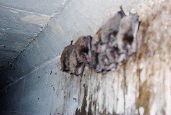
Photo 1: Bats hanging from cracks along support beams

Photo 2: Visible bats within an expansion joint
Photo 3: Example of open concrete joint used by bats
Photo 4: Guano deposits visible from bridge deck, on top of pier

Photo 5: Guano deposit on pier, obscuring structural features
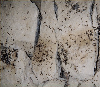
Photo 6: Bat guano on riprap
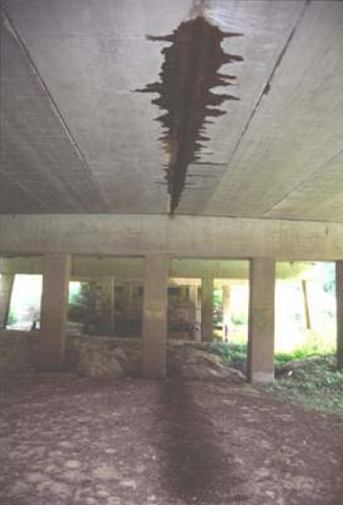
Photo 7: Staining along longitudinal joint. Note guano deposits on the ground.
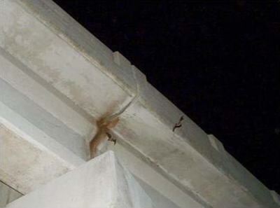
Photo 8: Staining on underside of expansion joint from bat use.
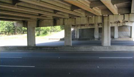
Photo 9: Staining on sides of pier caps
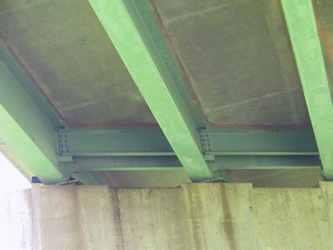
Photo 10: Guano staining on side of pier
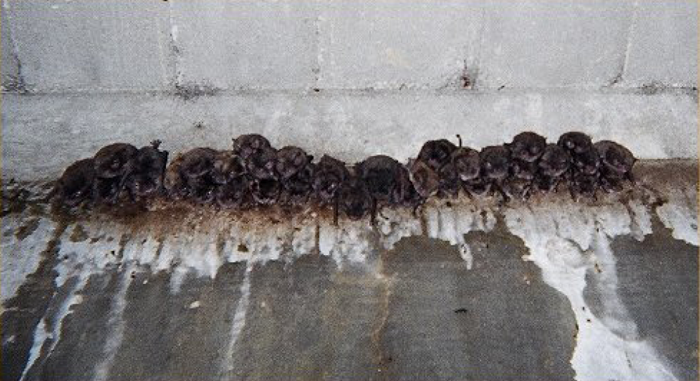
Photo 11: Bats roosting and associated staining

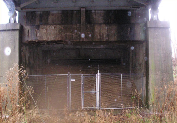
Photo 12 and 13: Bridge design mimicking “cave-like” atmosphere
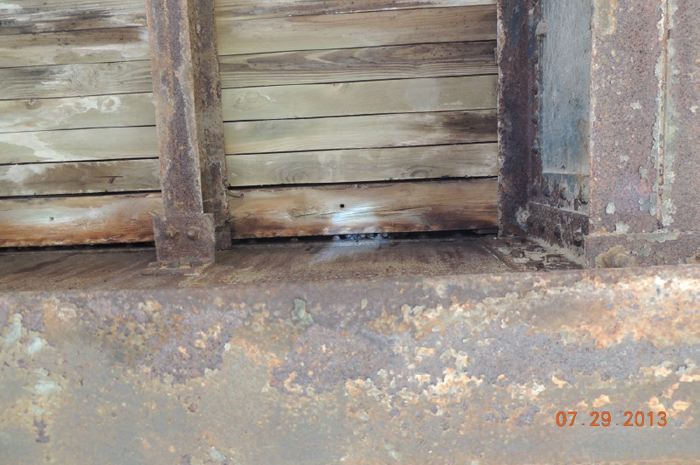
Photo 14: NLEBs roosting under a timber-decked bridge
Back to top
APPENDIX C: BRIDGE/STRUCTURE INSPECTION FORM
Bridge Inspection Form
This form will be completed and submitted to the District Environmental Manager by the Contractor prior to conducting any work below the deck surface either from the underside, from activities above that bore down to the underside, or that could impact expansion joints, from deck removal on bridges, or from structure demolish. Each bridge/structure to be worked on must have a current bridge inspection. Any bridge/structure suspected of providing habitat for any species of bat will be removed from work schedules until such time that the DOT has obtained clearance from the US Fish and Wildlife Service, if required. Additional studies may be undertaken by the DOT to determine what species may be utilizing structures prior to allowing any work to proceed.
| Route: |
County: |
Federal
Structure ID: |
Bat Indicators
Check all that apply. Presence of one or more indicators is sufficient evidence that bats may be using the structure. |
| |
|
|
Visual |
Sound |
Droppings |
Staining |
Notes: (e.g.,number & species of bats, if known) |
| |
|
|
|
|
|
|
|
| |
|
|
|
|
|
|
|
Areas Inspected (Check all that apply)
Inspection Conducted By: _________________________________________
_________________________________________
|
Signature(s): |
|
Date Received by District Environmental Manager: __________
District Environmental Use Only: |
DOT Bat Inspection Form Instructions
Back to top
Footnotes
Back to top

